Tag Archives: camino de santiago

STAGE 9: FROM LEÓN TO ASTORGA – FRENCH WAY BY BIKE

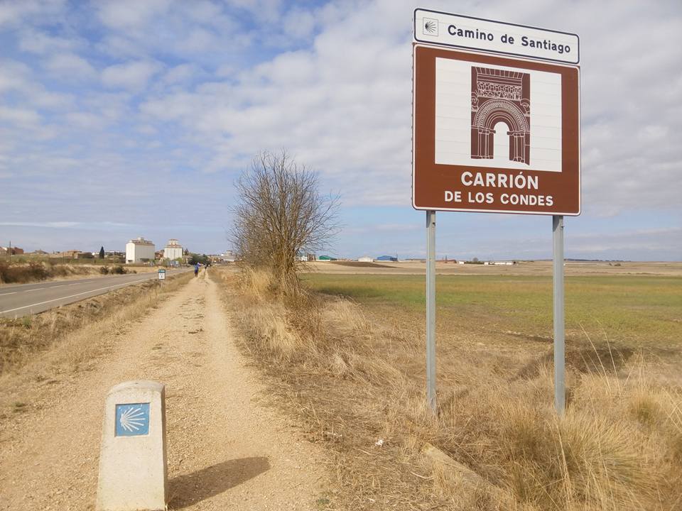
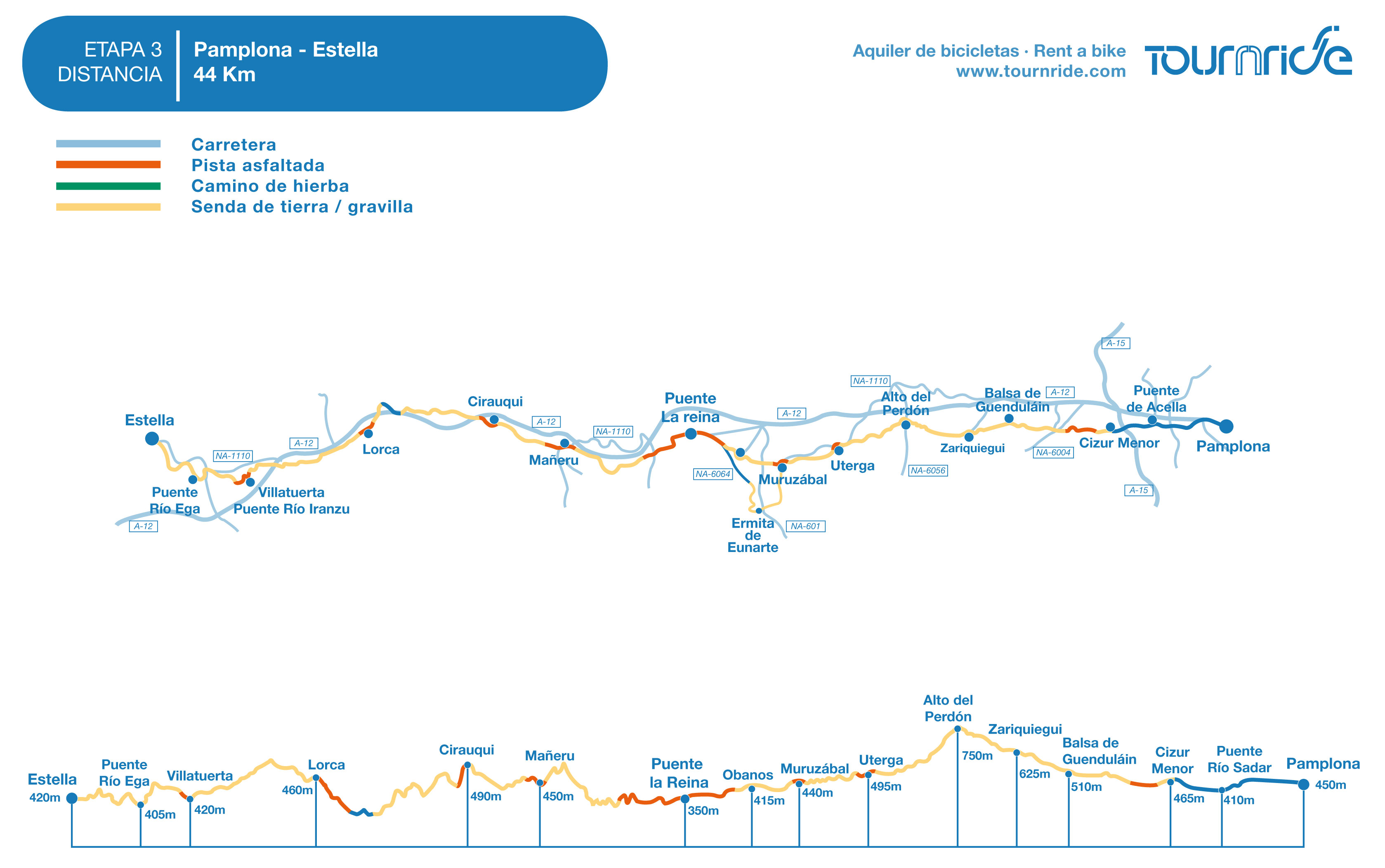
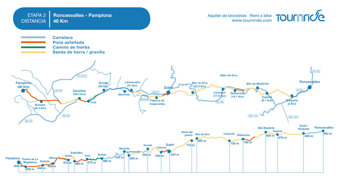
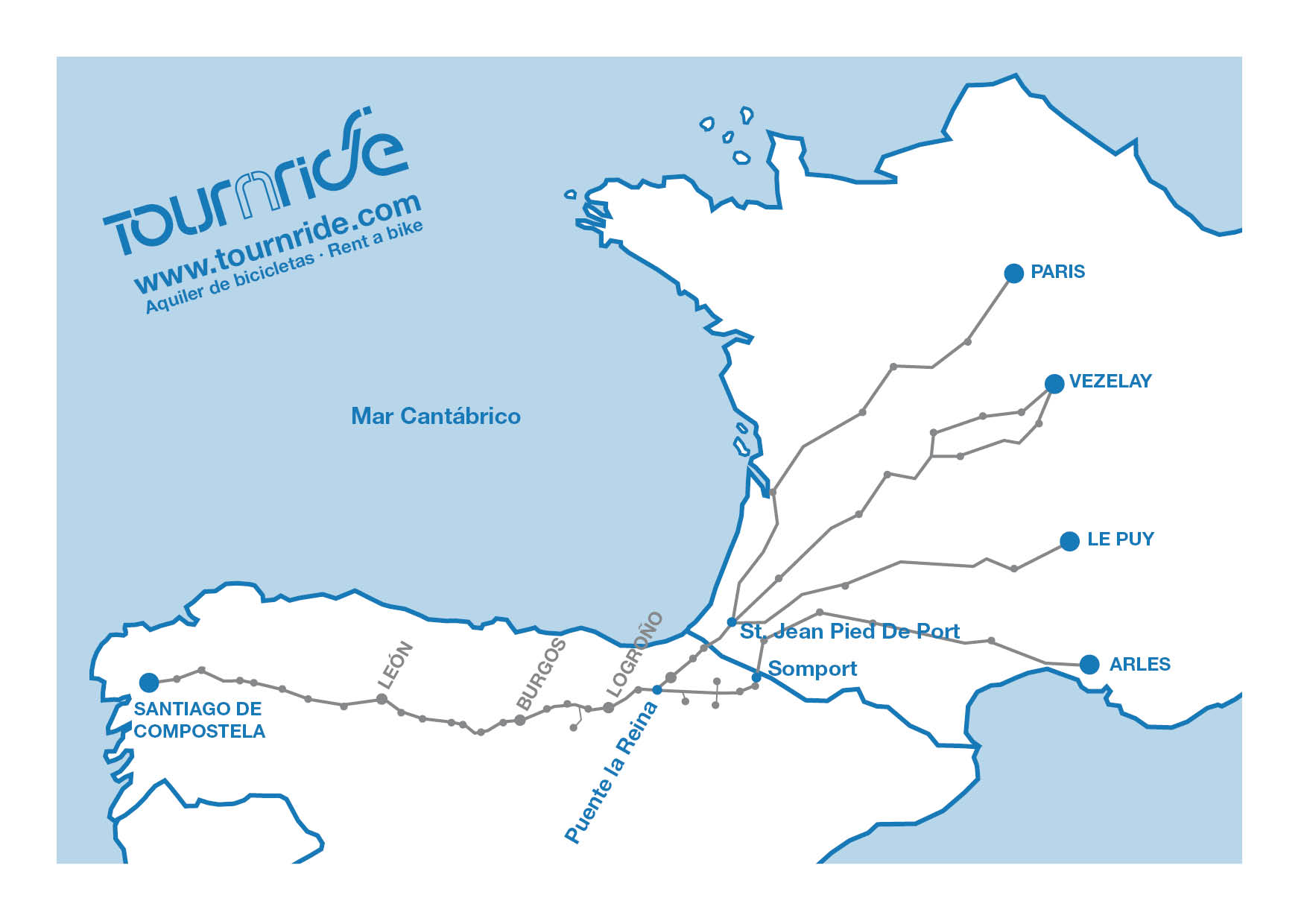
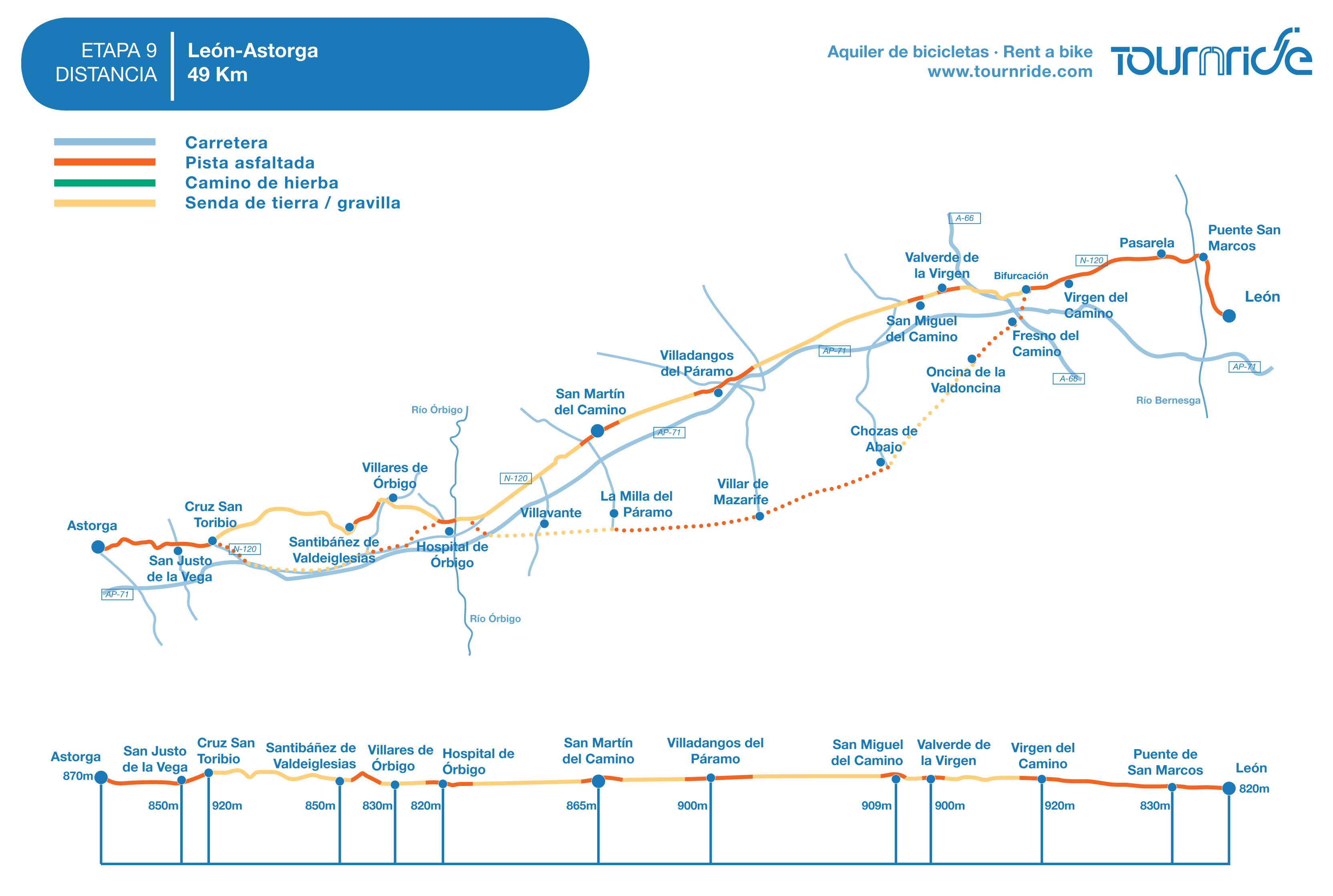
Distance to Santiago: 305 km

Stage distance: 49 km

Estimated time: 4-5 hours

Minimum height: 800 m

Maximum height: 950 m

Route difficulty:  Low

Places of public interest: Santuario de la Virgen del Camino, Hospital de Órbigo, Astorga

Itinerary map: To see the journey on Google Maps clik here 

Stage 9 of the Saint James Way by bike, from León to Astorga

Click to enlarge

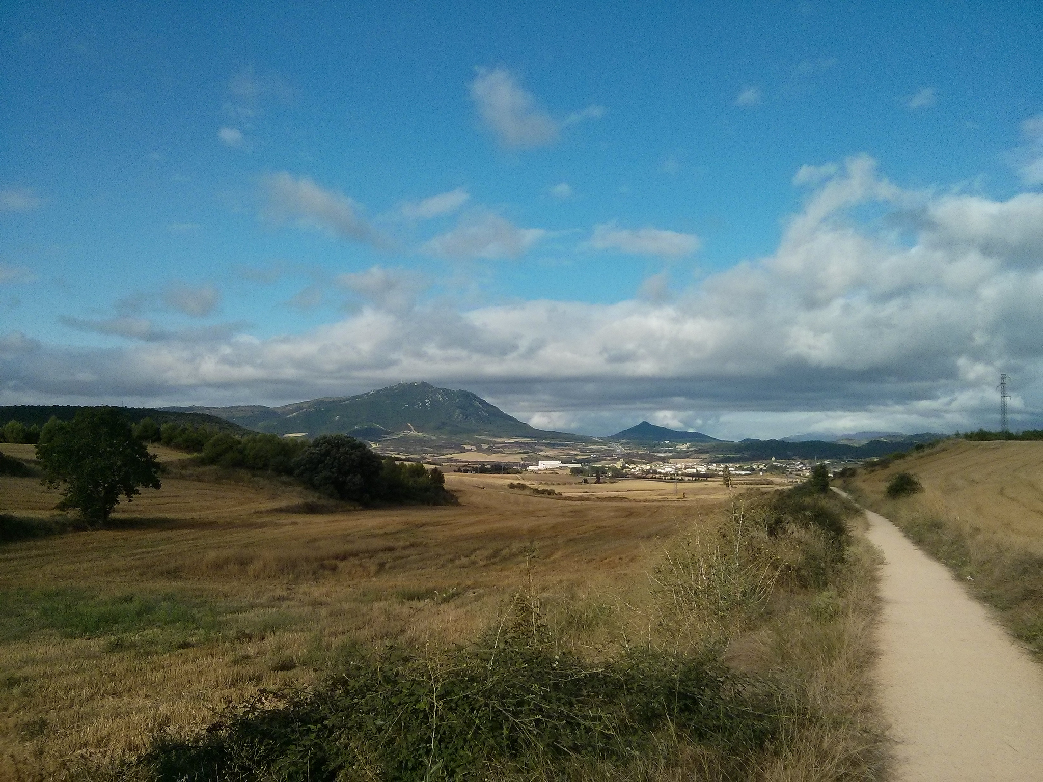
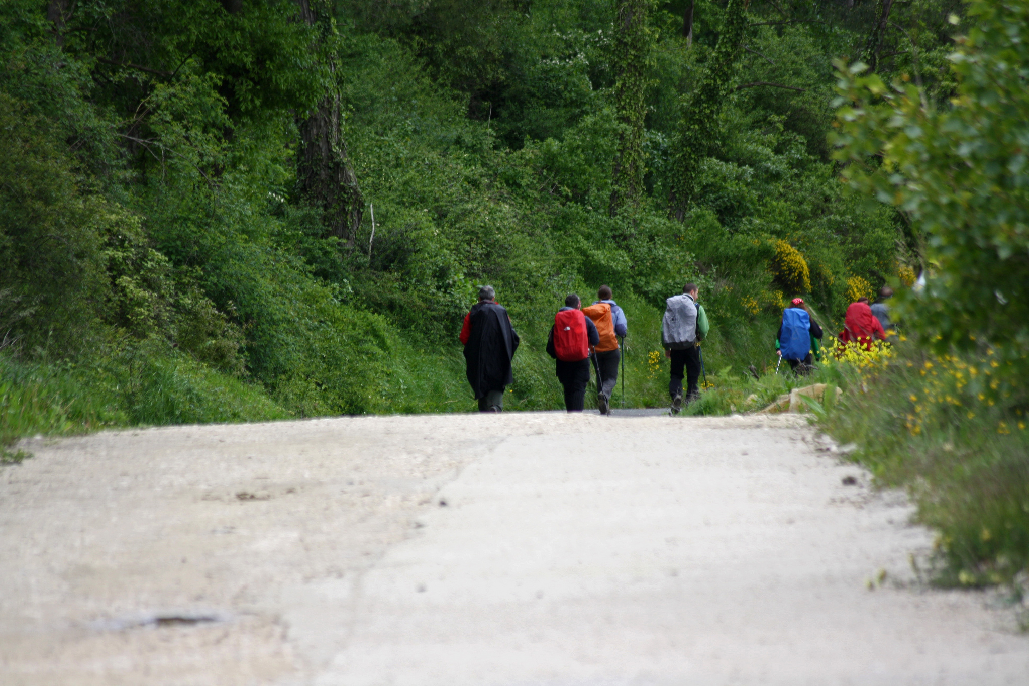
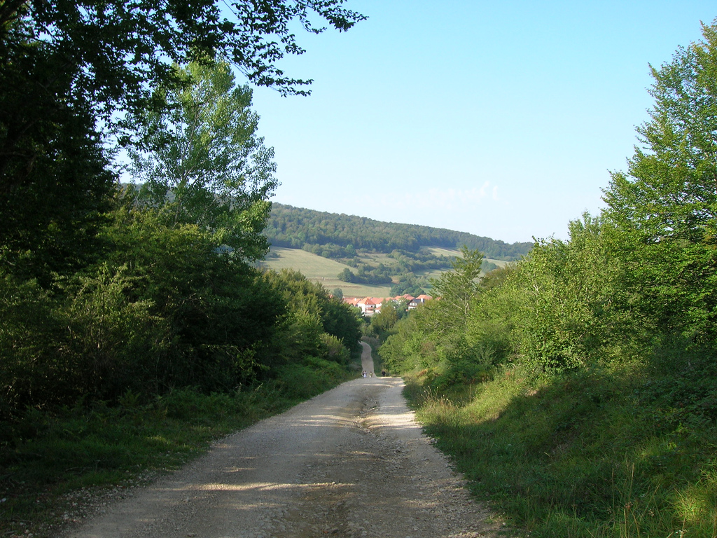
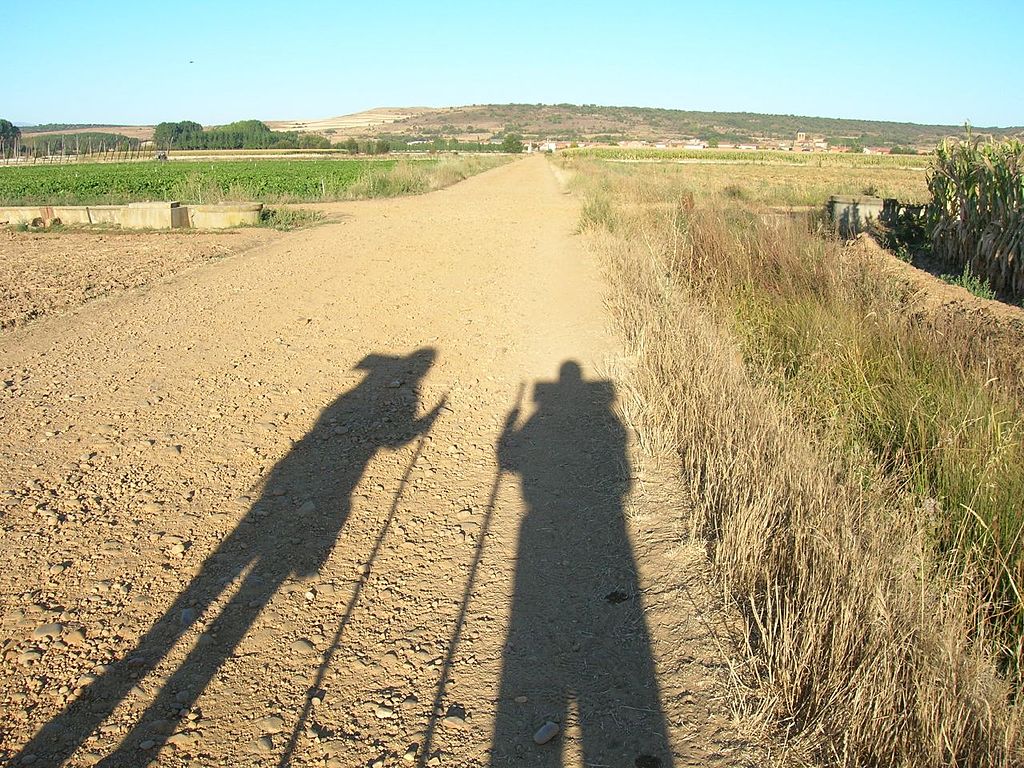
The exit from León can turn a little bit chaotic and also quite long, since Trobajo del Camino and the Virgen del Camino seem to be an urban external extension. After passing by this residential and industrial area, we come to two options to get to Hospital de Órbigo, which it’s the middle point of this area. The traditional way follows the course of the N-120. The alternative one is a bit longer, but gets away from traffic by some lands and second highways.

After crossing the amazing bridge of Hospital de Órbigo, the way becomes a fork again, making us choose one more time between highways or lands in order to get to the top of Toribio Cross, where we will have a panoramic view of Astorga. The entrance of Astorga is much simpler than the one from León, the only difficulty is the height change we have to surpass.

In general, the industrial character of these populations in which the traditional itinerary passes by, can make this stage a little bit heavy. If we prefer going by lands we will travel in a longer distance.

The only really hard-time we can have could be the weather conditions. If it has been raining, we recommend you to go through the N-120, because the agricultural tracks tend to get muddy. If it’s windy, the way’s height by Villares de Órbigo can turn a little harder.

¡Buen camino!

Astorga’s surroundings in a sunny day with some clouds in the sky

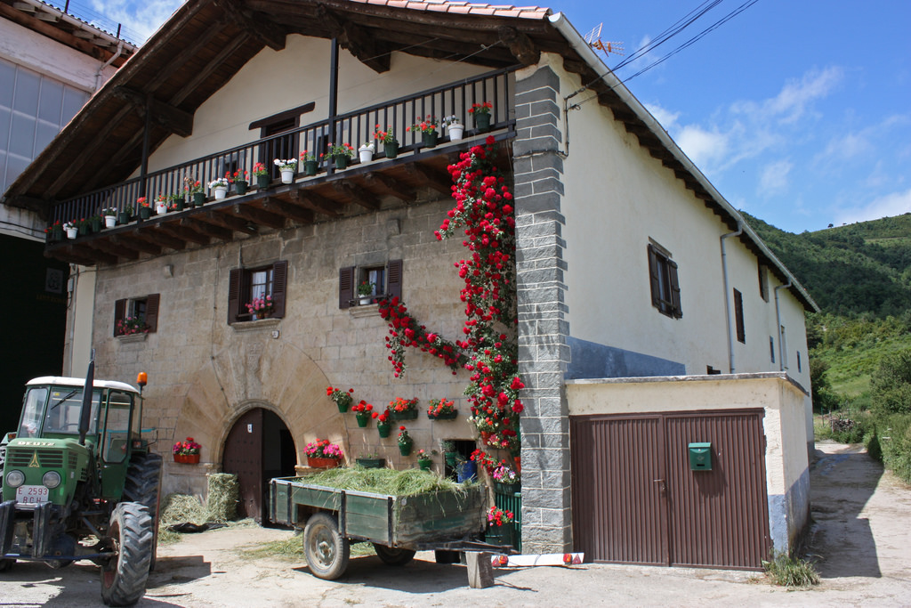
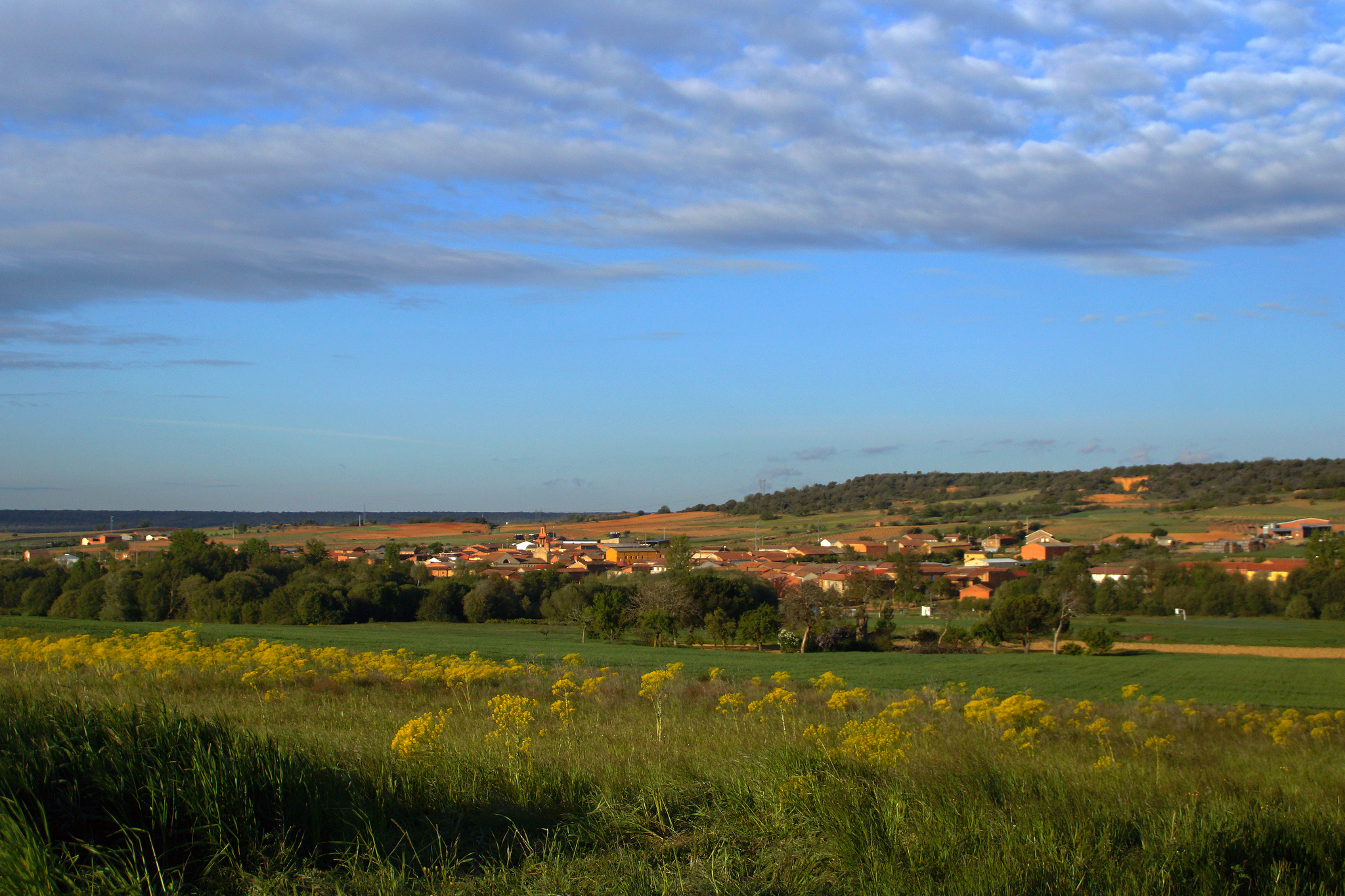
Astorga’s surroundings, picture given by Fernando Álvarez

PROFILE AND STAGE’S MAIN ROUTES

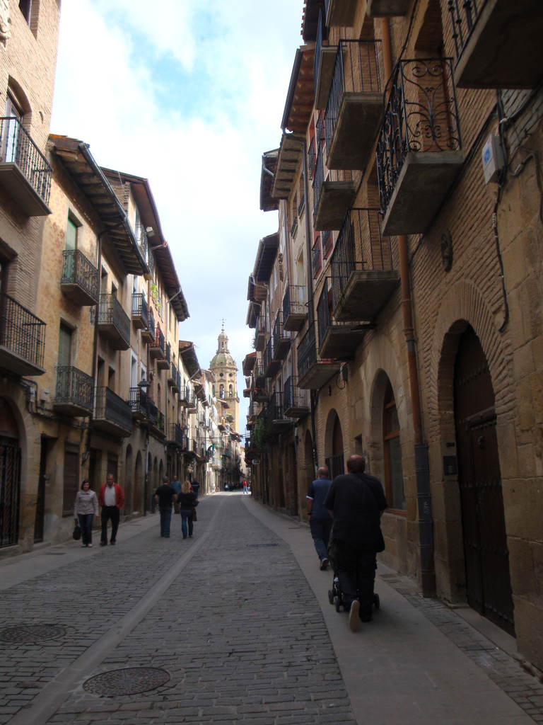
Because of how confusing is the León’s exit, we will try to make the instructions simpler to the maximum. We have to leave the city by the San Marcos Bridge, right next to the parador. Once we get to the cathedral, the easiest thing to do is going down the Ancha Street and turning to Casa Botines, keeping up forward until we border San Isidoro. Turning obliquely to the left we will get to Renueva Street and Suero de Quiñones Avenue that will lead us directly to the bridge.

After crossing the San Marcos Bridge we must keep on moving forward through the Quevedo Avenue, going across a roundabout. Once we travel a kilometer or more, we will see how the avenue turns into a curve to the right, while at the front a metal walkway shows up. Both ways cross the train tracks and that’s why for cyclists, it is better to keep on going by the avenue.

Once we arrive to Trobajo del Camino, we continue going through the avenue until we get to the curve to the left. After passing that curve, we need to pay attention because we must take the first street to the right. It is a perpendicular slope that will take us to the Virgen del Camino. This vertical gradient will become soft little by little.

Going parallel to the N-120, we arrive to the Virgen del Camino (7,5 km of route). After passing it, we take the Paz Street, a left fork of the N-120. In about 500 meters away, we see how it begins to appear contradictory arrows on the ground. This is the moment when we have to decide which way we want to take in order to get to Hospital de Órbigo:

1. Traditional way: Follows the course of the N-120, so we have to go through the pedestrian paths or by the highway. It is about 24 km that go by San Martín del Camino. This profile, in general, is in a light negative slope.

Moving forward through the detour, we must cross the A-66 by a tunnel and then keep on moving parallel to the N-120 to get to Valverde de la Virgen (Km 12), San Miguel del Camino (Km 13,5), Villadangos del Páramo (Km 21) and San Martin del Camino (Km 25,5).

2. Alternative way: This doesn’t have a historical justification indeed, but it allows us to avoid the traffic on the highway. It’s around 28 Km by track and, after some initial leaps, the profile is in a light negative slope.

Turning to the right, we take the LE-5522 to get to Fresno del Camino in about 5 minutes and to Oncina de la Valdoncina in 10. Once we get to the land tracks we will go to Chozas de Abajo and, by secondary road again, we will get to La Milla del Páramo and by good firmed tracks to Villavante, there we will be in about 4 Km to get to the traditional way and entering Hospital de Órbigo.

Paso Honroso Bridge and Hospital de Órbigo

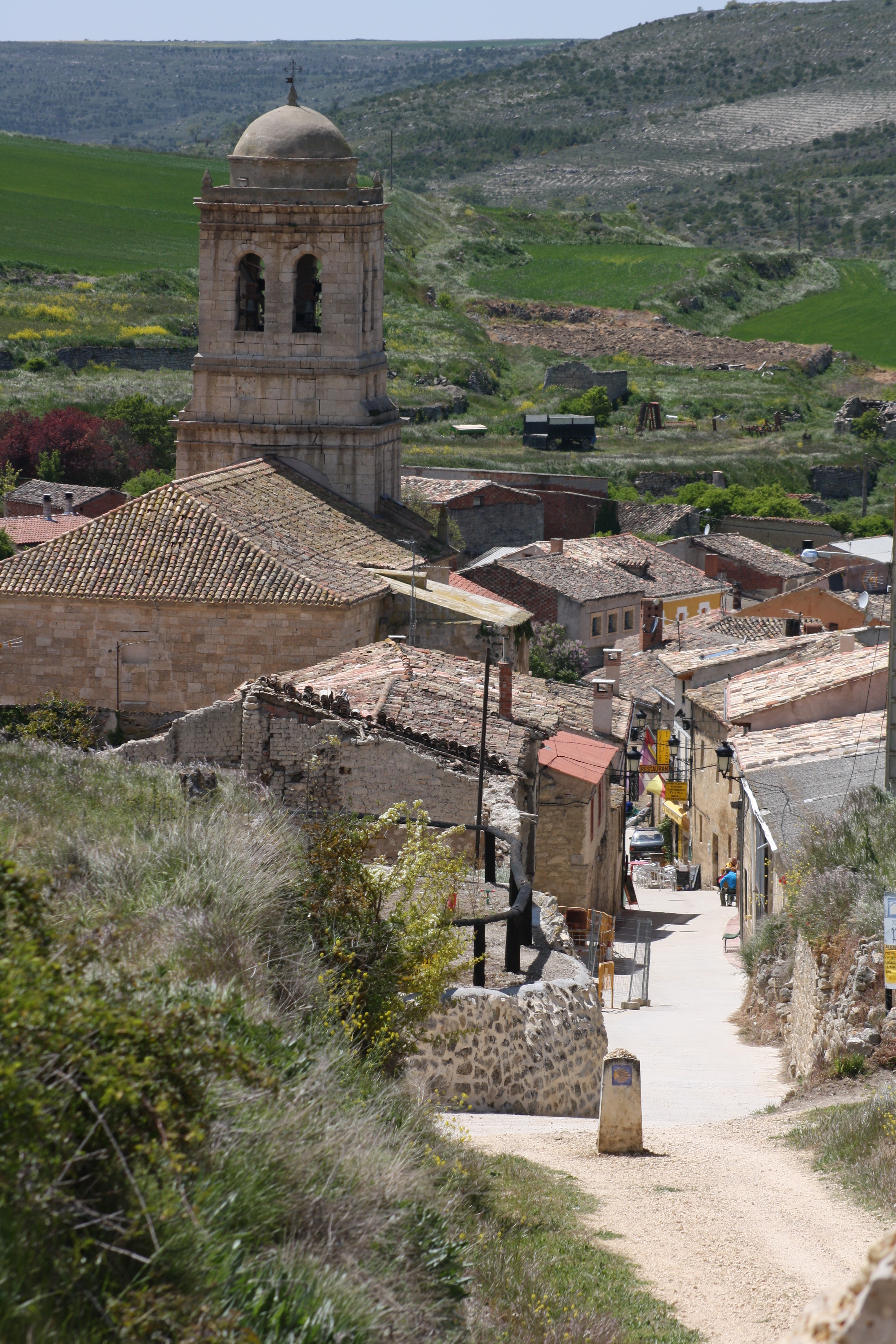
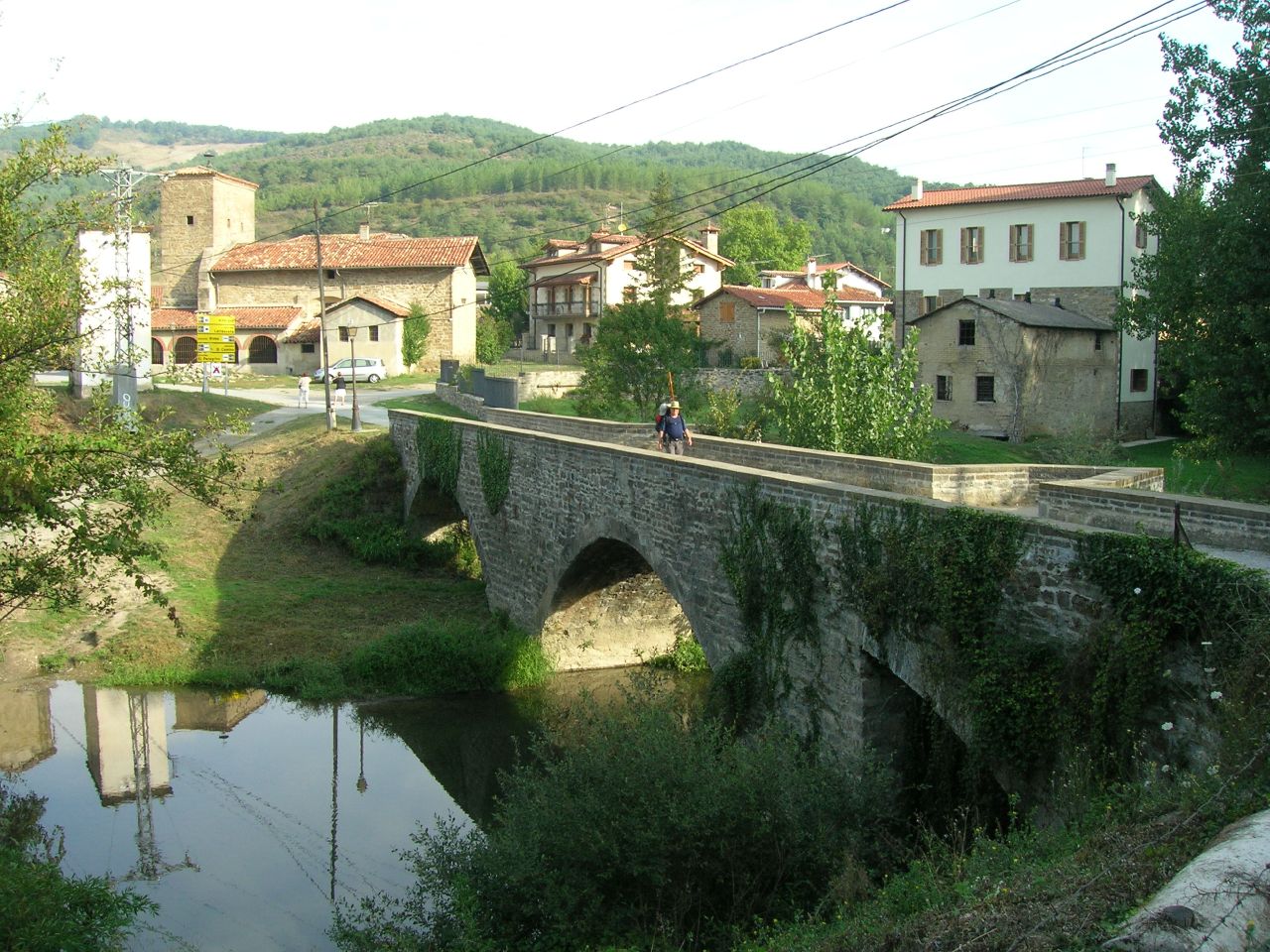
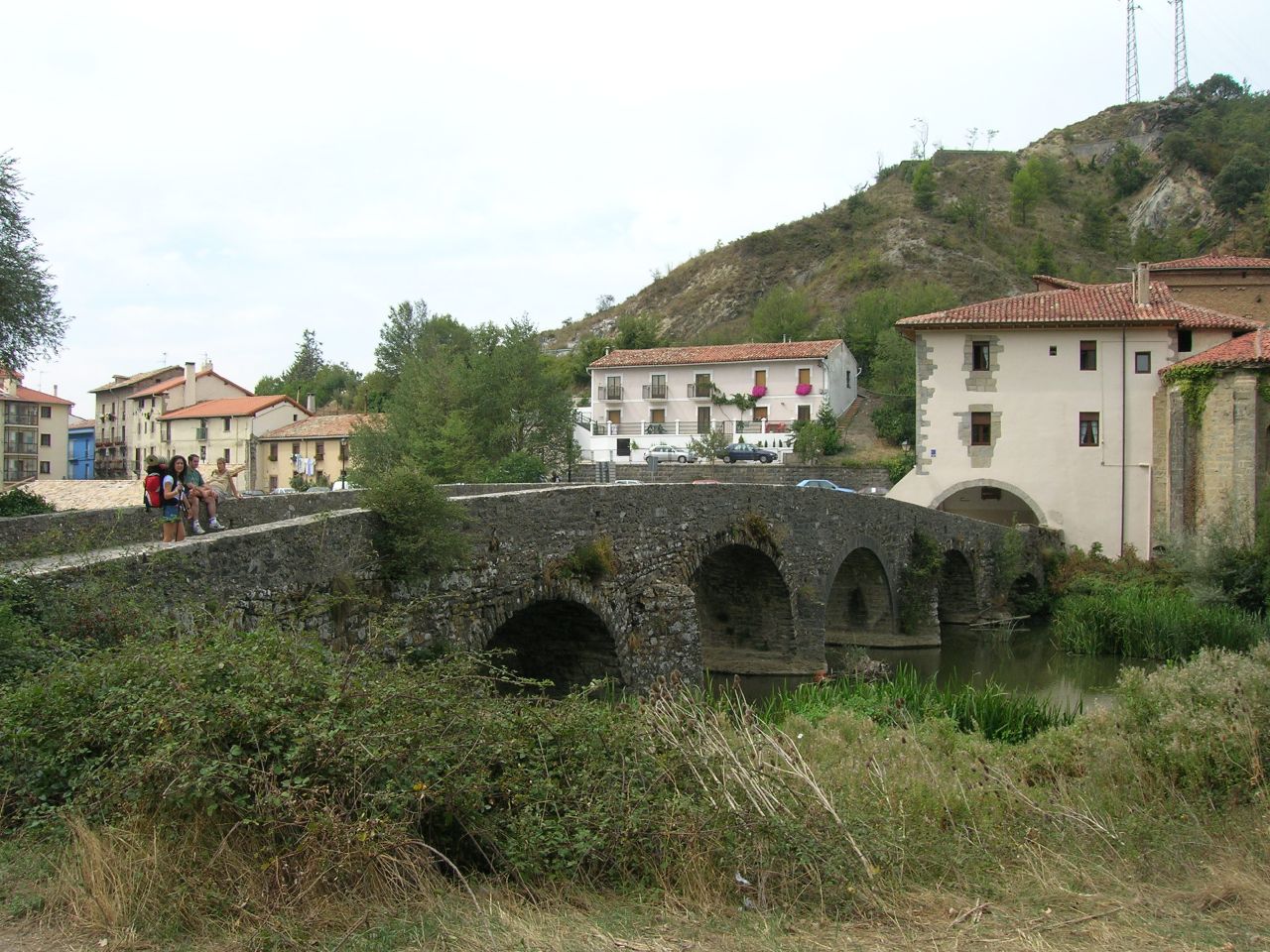
Paso Honroso Bridge and Hospital de Órbigo, picture given by Javier Diez Barrera

Once we are in Hospital de Órbigo (Km 33) we cross its amazing medieval bridge and we go back on deciding which way we’re going to take next. We have two options:

1. Traditional way: It goes parallel to the N-120 until just before arriving in San Justo de la Vega, where changes course to the right in order to get to the Cruz de Toribio. It’s about 9 Km changing course and one more to get to the cross. It is a flat profile during the first 5 Km and later, it becomes a light positive slope.

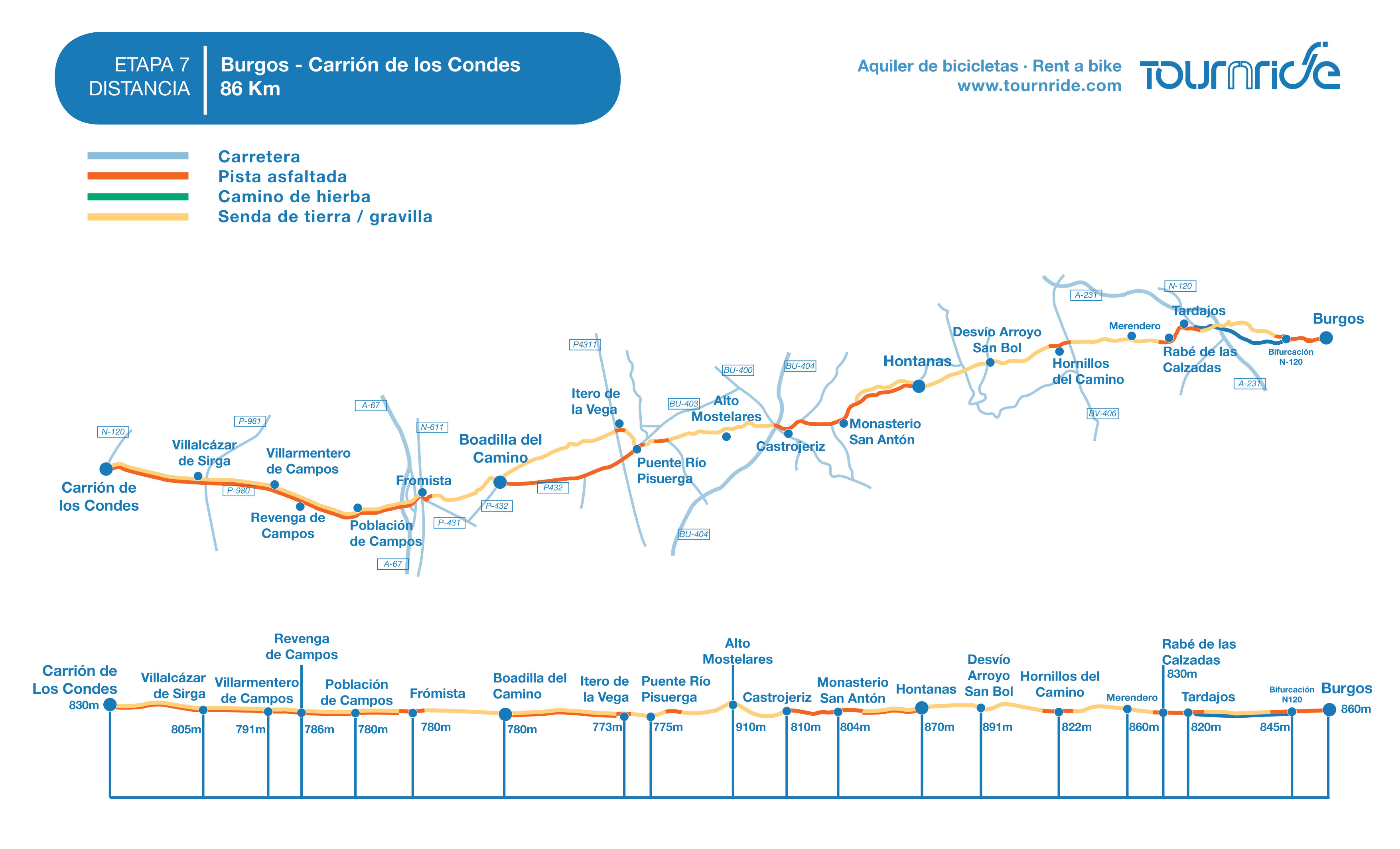
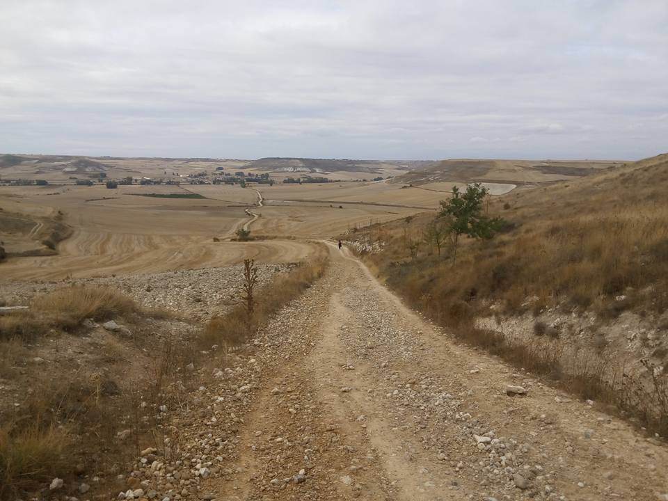
2. Alternative way: It changes course to the right after passing by Hospital de Órbigo to get to Villares de Órbigo and to Santibáñez de Valdeiglesias. In total, it’s about 3 Km more to cover, but the land tracks can be muddy due to rain. The profile alternates positive and negative slopes a little bit harder than the traditional way, but they are reasonable.

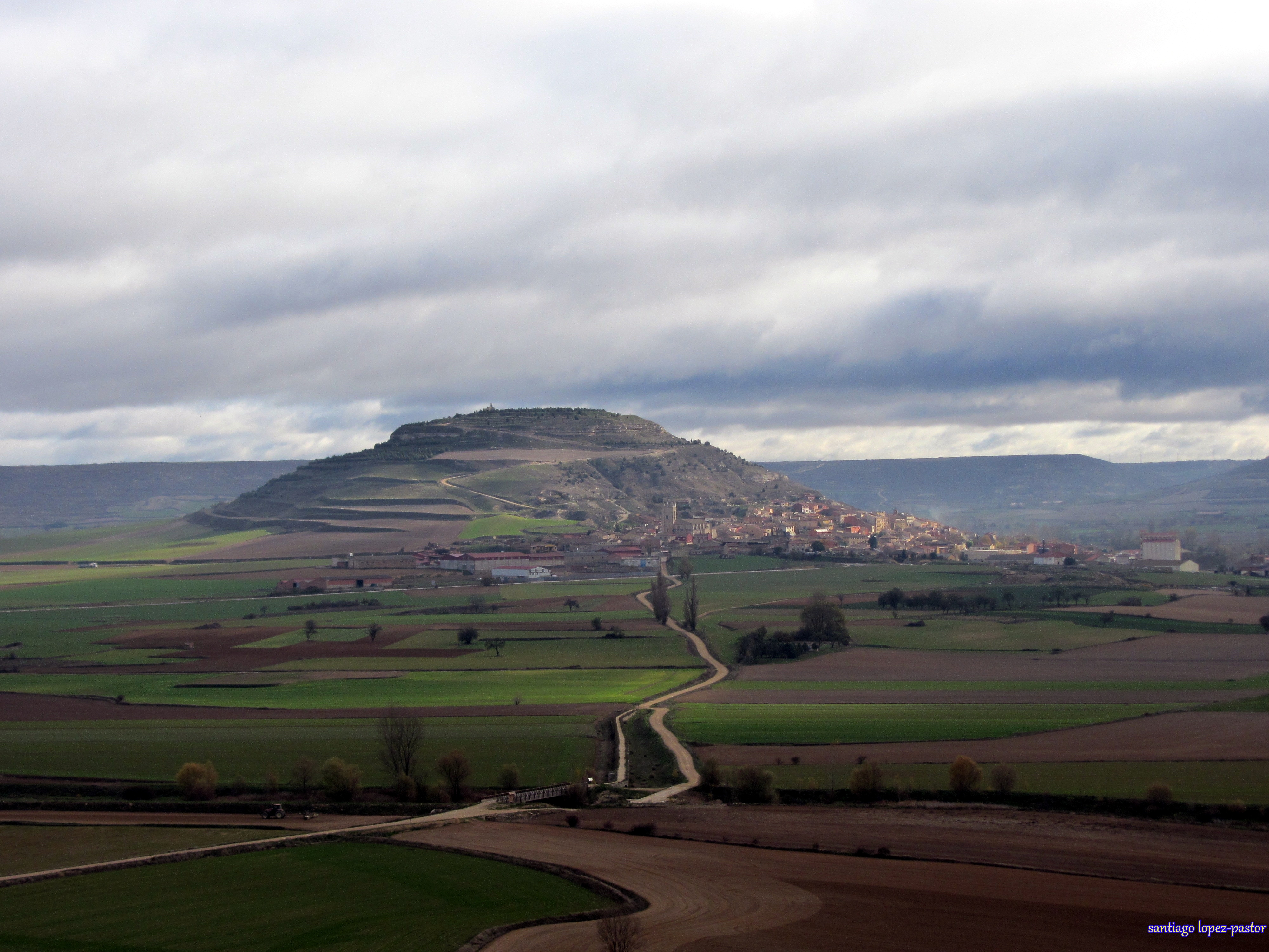
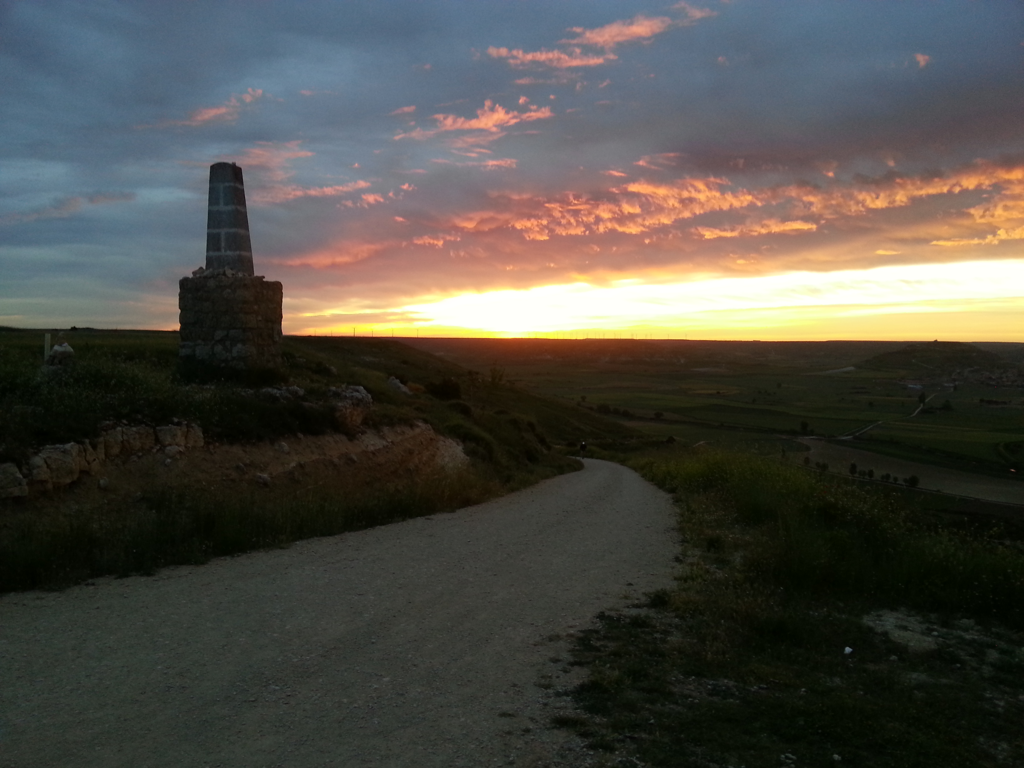
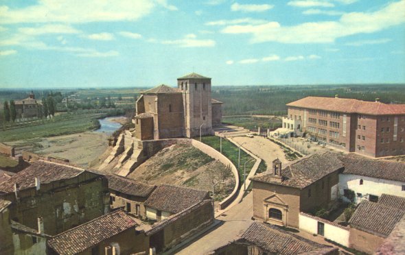
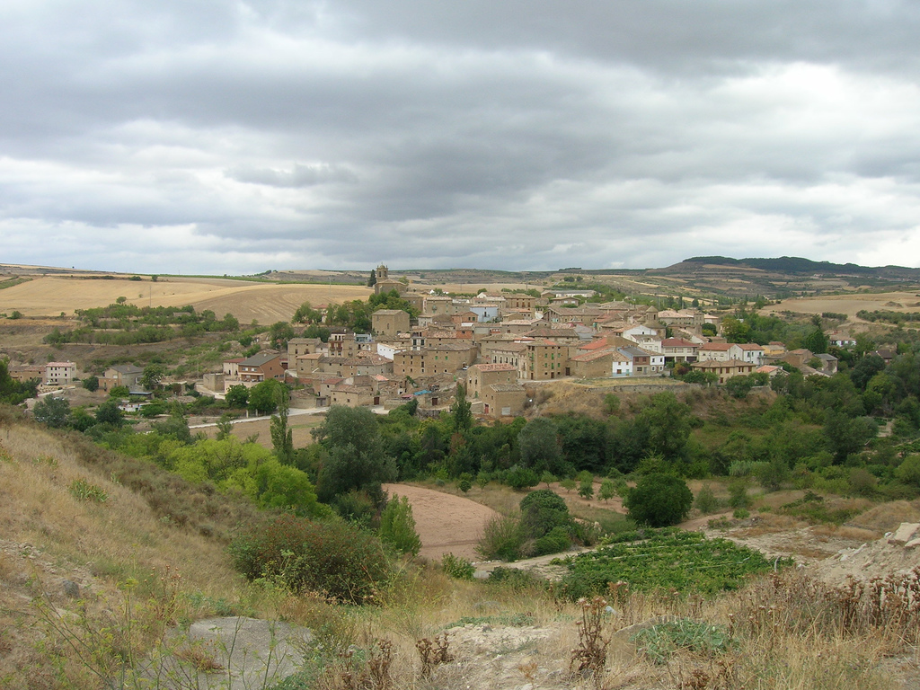
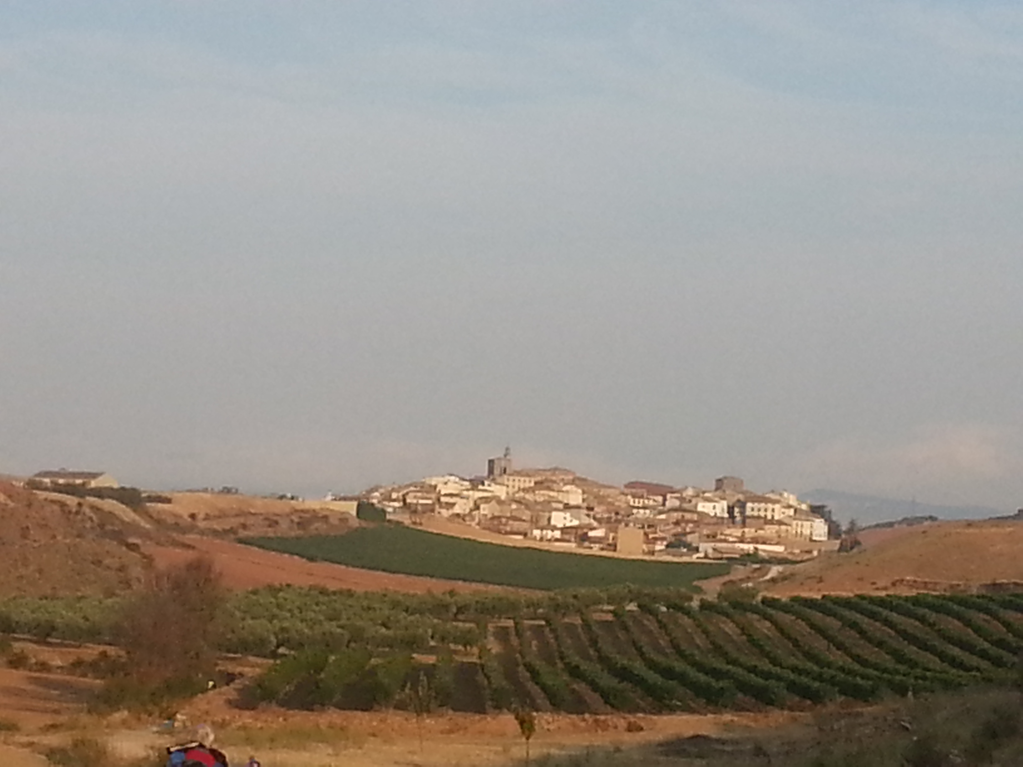
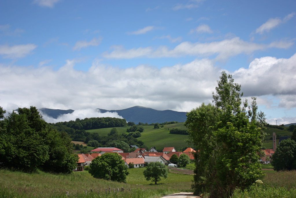
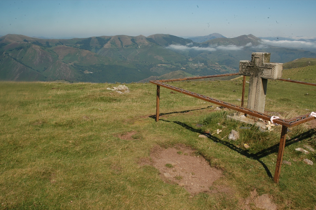
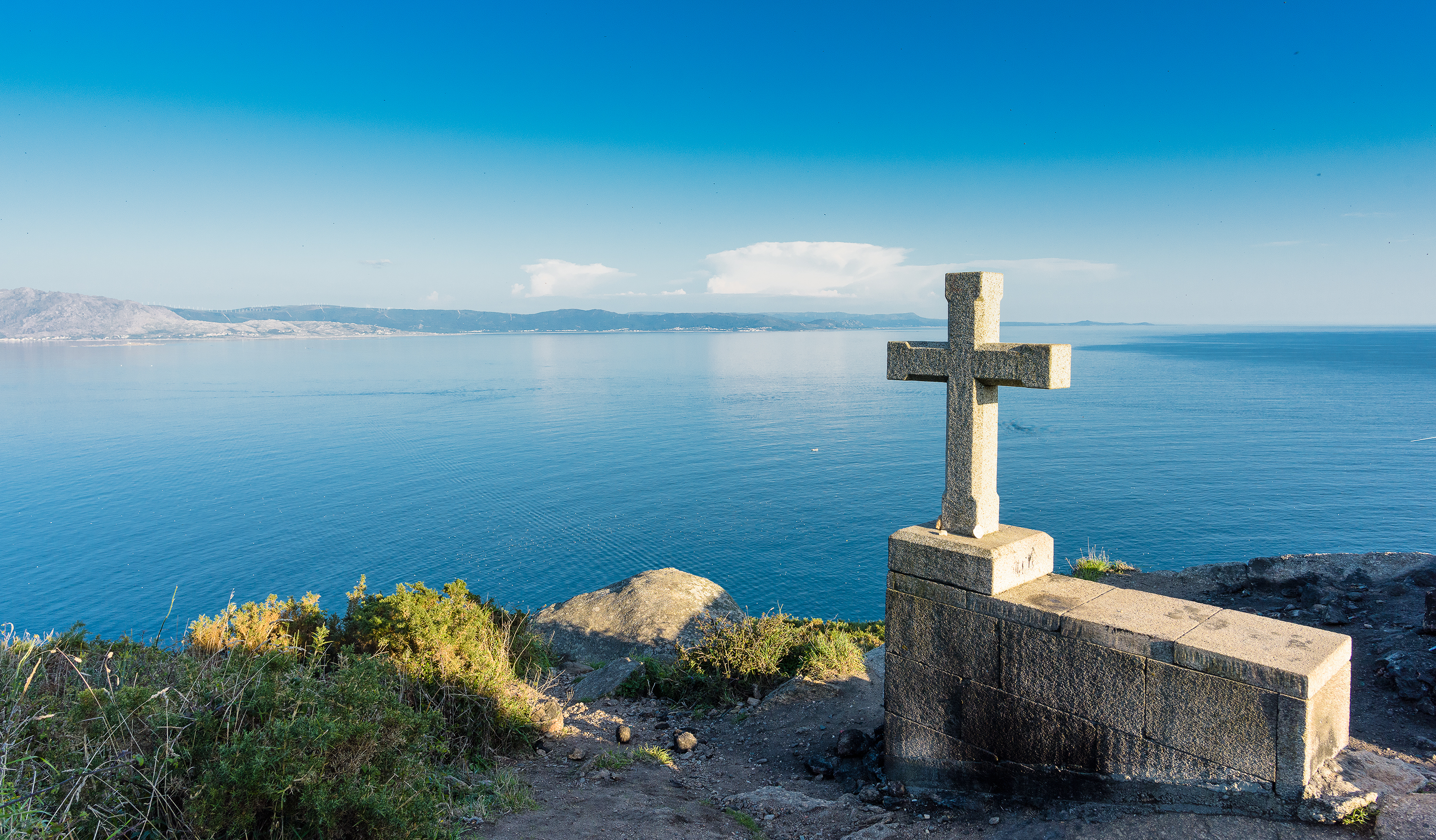
Whatever the case may be, we arrive to the Cruz de Santo Toribio (Km 45), a structure located at the top that offers us magnificent views of Justo de la Vega and Astorga.

Cruz de Santo Toribio

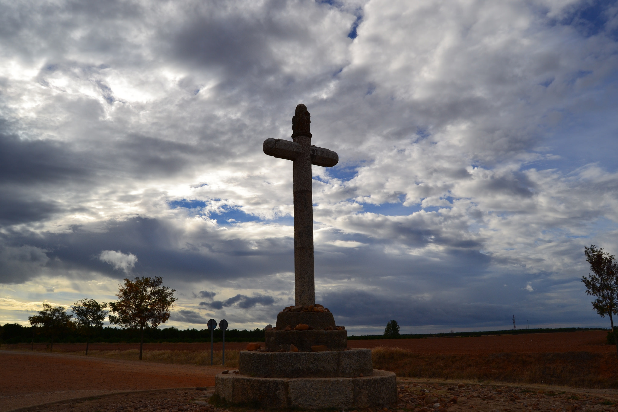
Cruz de Santo Toribio, picture given by RFMyFL

From this point, we go down through a slope of 1,5 Km with a difference in height of 73 meters, that will take us to San Justo de la Vega, where we will hook up the N-120 one more time.

In order to enter to Astorga we have to cross the train tracks. The pedestrians do it by a high walkway (with slope and without stairs), although we can also continue through the N-120 from San Justo and avoiding the walkway. After we cross straight the roundabout located at the entrance of the city and deal with another short slope that leads us to Astorga, right next to the Mayor Square.

Episcopal Palace of Astorga and the Roman Wall in Astorga

Episcopal Palace of Astorga and the Roman Wall, picture given by FONENDEZ

PRACTICAL ADVICES

If you start your journey in León, we help you getting there.

  1. En autobús. The station is located in the Ingeniero Saenz de Miera Avenue. The company that runs the most is Alsa, because it is connected with almost the entire North of Spain. From Salamanca you can also come with Vivas and from smaller towns such as Burgos or Palencia with Abel.
  2. By train. León is a very important railway center. To check schedules and prices, go see the Renfe website.
  3. By airplane. The only permanent connection flight that the León Airport has is run by Air Nostrum.

Remember that in Tournride we leave the bikes in your lodging back in León if that’s your starting point   and we can take your extra baggage so it can wait for you at the end of your Camino.

The distances between towns are short and full with services, you won’t find any problem with the supplies.

If you take this route at summer do not forget to take good sun protection and water with you. The straight lines between lands without trees are left behind already, but we’re still in León and hence the sun is still intense.

When it comes to choose the ways,it’s a matter of taste. Direct but with traffic or longer by agricultural tracks, even though the distance on bike don’t mark any difference. As an advice, if it has been raining we recommend going through the traditional way of N-120 to avoid mud.

DETAILED ITINERARY AND HISTORICAL-ARTISTIC PATRIMONY

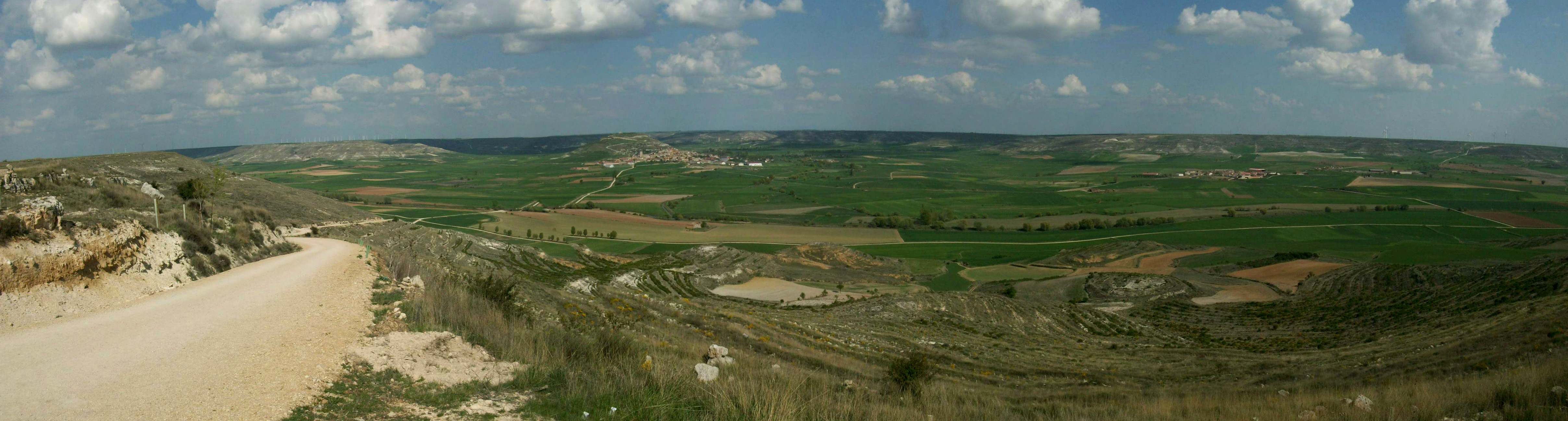
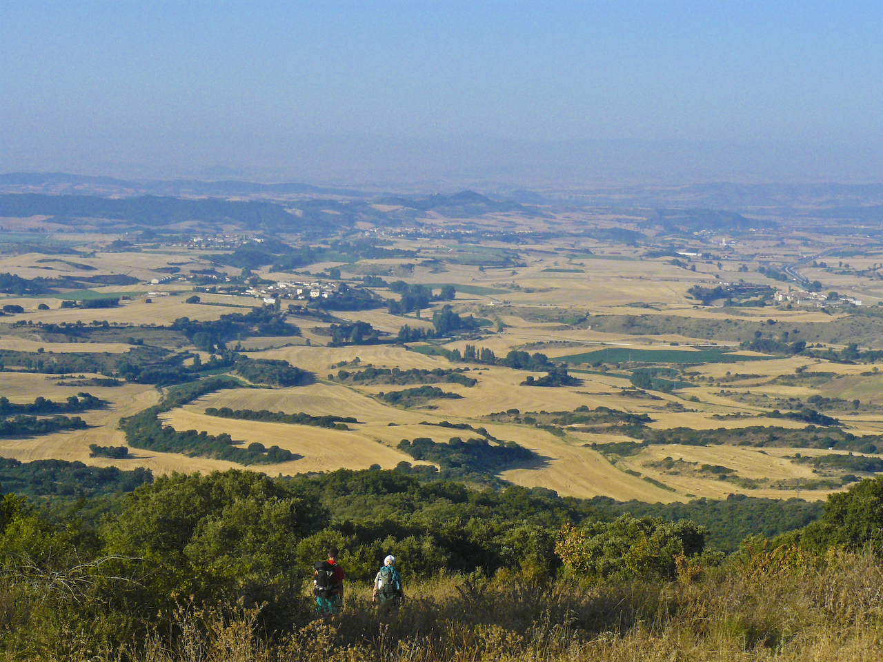
This stage has as starting and ending points two cities charged with history and cultural patrimony. In between, we will say goodbye to the wasteland plains from León, because tomorrow the profile will get broken again in the Cruz de Ferro ascent going to Ponferrada.

The N-120 has become the spinal column of a lot of populations which name reflects the Jacobean past they carry on.. So many places of “El Camino” remind us how historical these paths are. Today, less historical alternatives have appeared but that run away from the noise and traffic created by the highway.

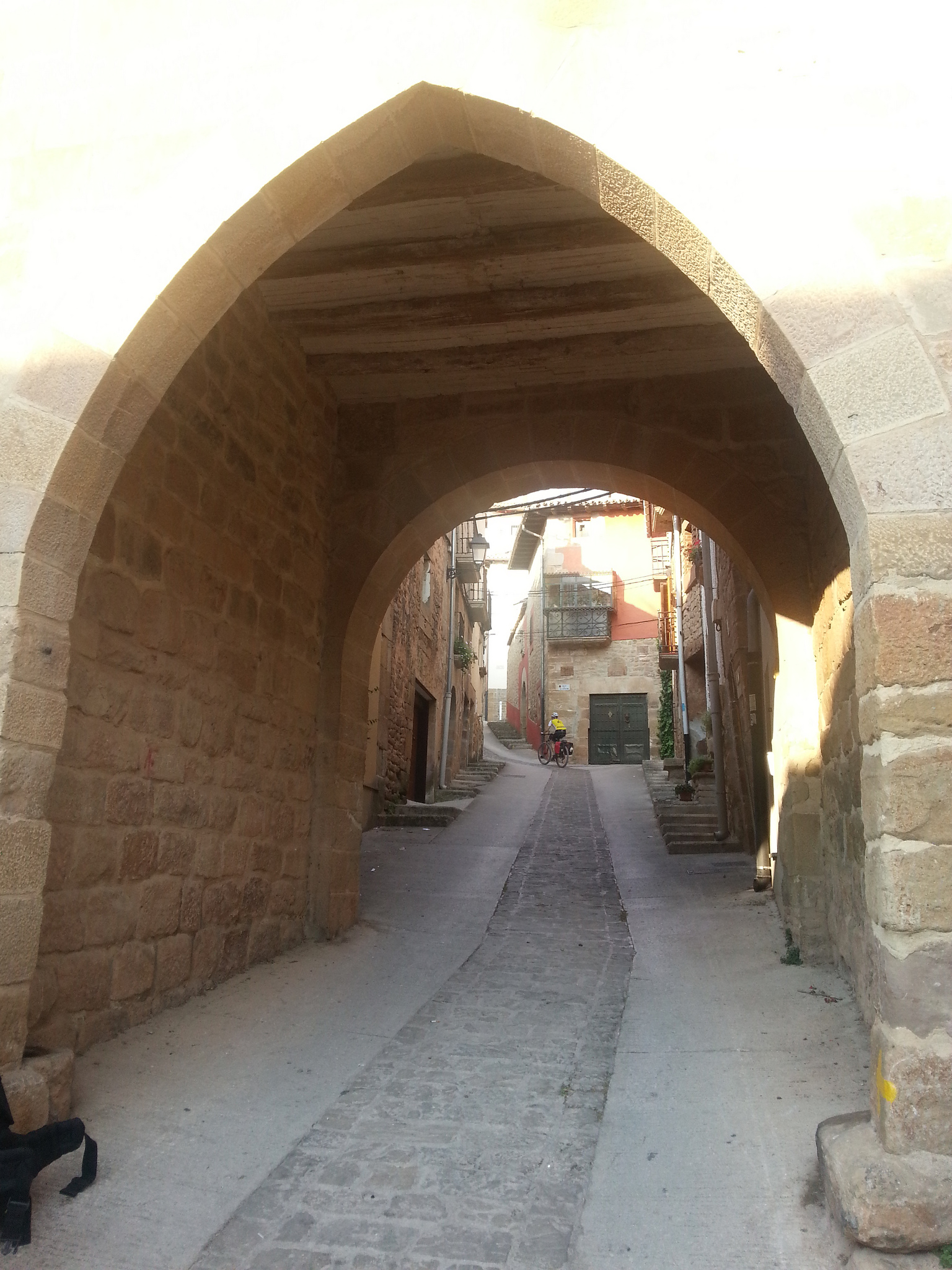
Even though the whole itinerary can be done more to the North or South,  the only must-see point of the stage still is Hodpital de Órbigo, which we have to be thankful for. This stop gives us the chance of knowing love medieval stories and crossing its historical “Paso Honroso (Honorable Pass).”.

WE EXIT LEÓN BY INACCESSIBLE STREETS AND VISIT THE MODERN SANCTUARY OF LA VIRGEN DEL CAMINO

At León’s exit we pass by some of the places we recommended visiting on the final term of the stage through León, so if on the previous day we didn’t have the chance to admire them, we recommend you seeing them now.

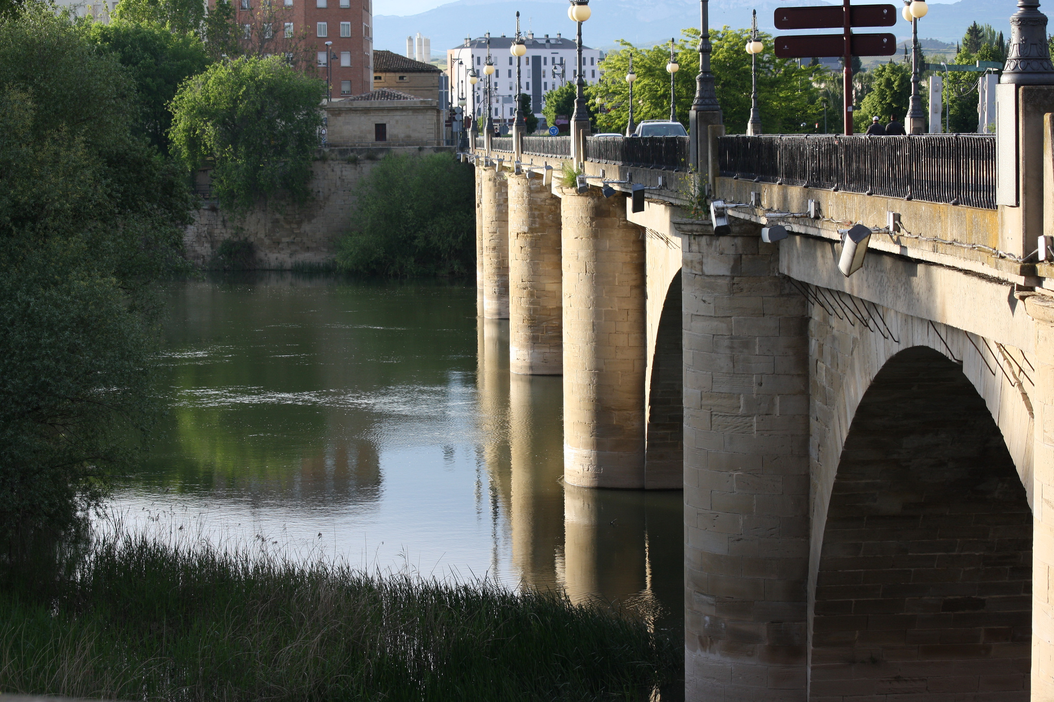
Bordering the basilica of San Isidoro we get to the Parador, where we must cross the Bernesga through the gorgeous San Marcos Bridge from the XVI century. It is made of ashlars, with big starling piles that support cannon vaults. In the XX century it was necessary to expand it but they did it respecting its original form.

San Marcos Bridge in León

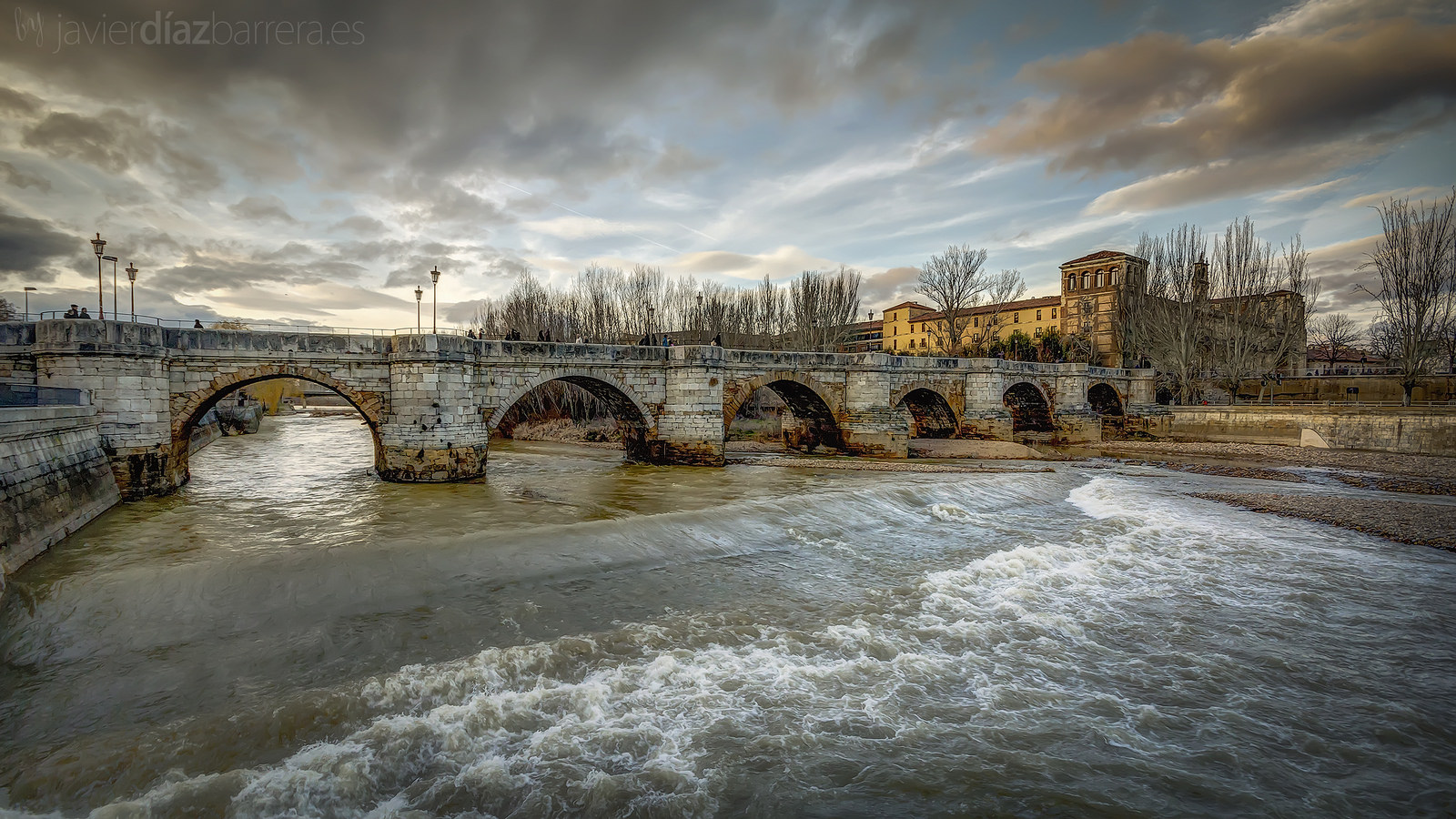
San Marcos Bridge in León, picture given by Javier Diez Barrera

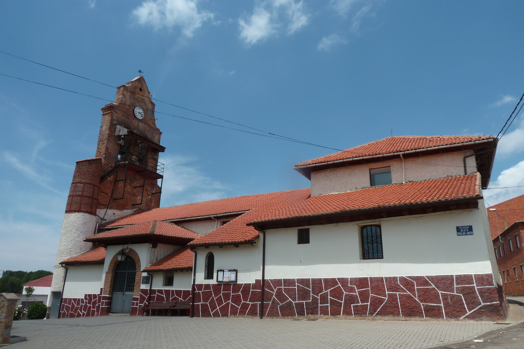
After crossing the bridge we will go through some streets from the residential neighborhood. To enter in Trobajo del Camino we have to cross the train tracks, whether it’s through highway or walkway. From its Jacobean past, the only things left are its name and one chapel out of four that existed before that are still standing unemotionally between concrete giants. It is dedicated to the apostle and its origins go back to the Middle Age, although what we see today is a renovation of a construction from the XVIII century.

Once we leave Trobajo del Camino behind we go into the western industrial estate of León. After crossing it, we go back to the N-120 until the Virgen del Camino, a commuter town where the highway passes by.

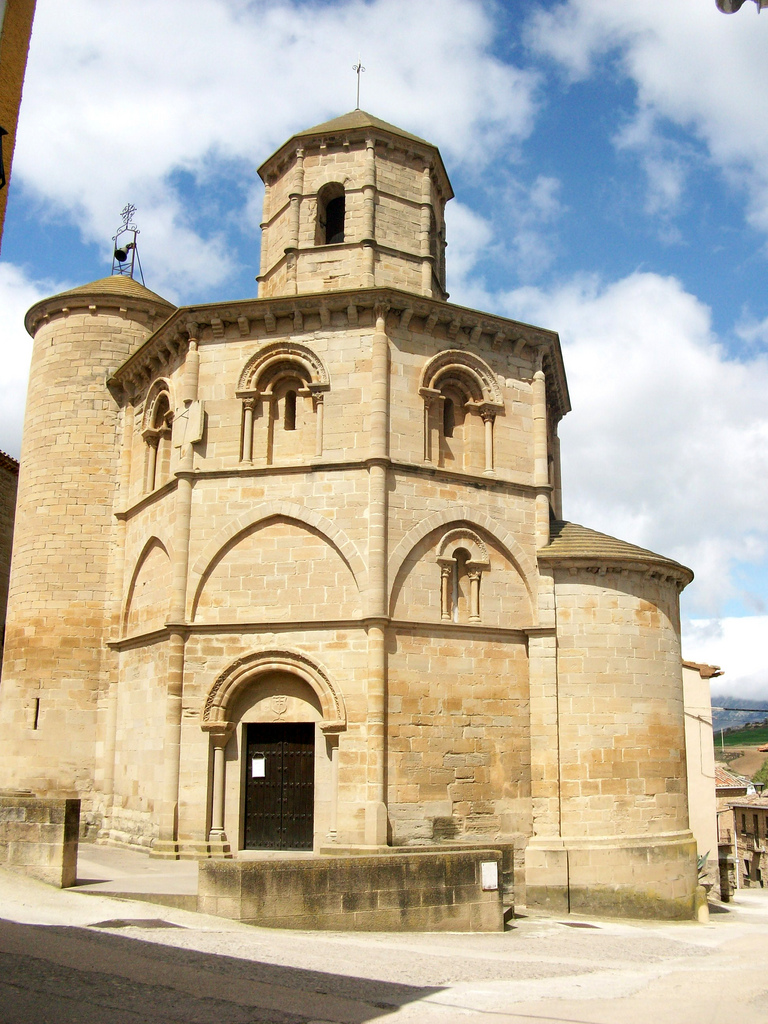
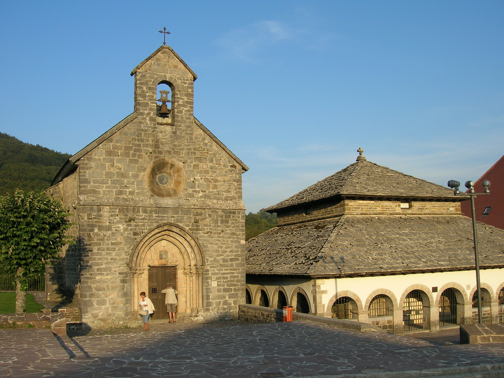
Despite the fact that everything in this locality screams modernity, even its unmistakable main sanctuary, the town’s name indicates it has been a pilgrim’s pass for centuries. There’s a legend that says that in the C.XVI the Virgin showed up to a pastor named Alvar, asking him to notify the bishop so he can build a church in this place. Doubting on the bishop’s word, the pastor asked the Virgin for help in his task. Mary took a slingshot and used it to throw a big stone so the bishop could see it and testify the miracle. They built a chapel right in the place where the miracle stone was located and around it they created the town, that became bigger and bigger thanks to the pilgrims’ pass.

In 1957 they began to build a new temple that it won’t be hard to recognize thanks to its marked modern character. It mixes a variety of materials such as concrete, glass, stone, or wood in a building which its horizontal marked nature breaks by a really high vertical cross as a tower. The facade sculptures are by the artist José María Subirachs and the stained glass windows were made in Chartres (France).

Basilica of Virgen del Camino in León

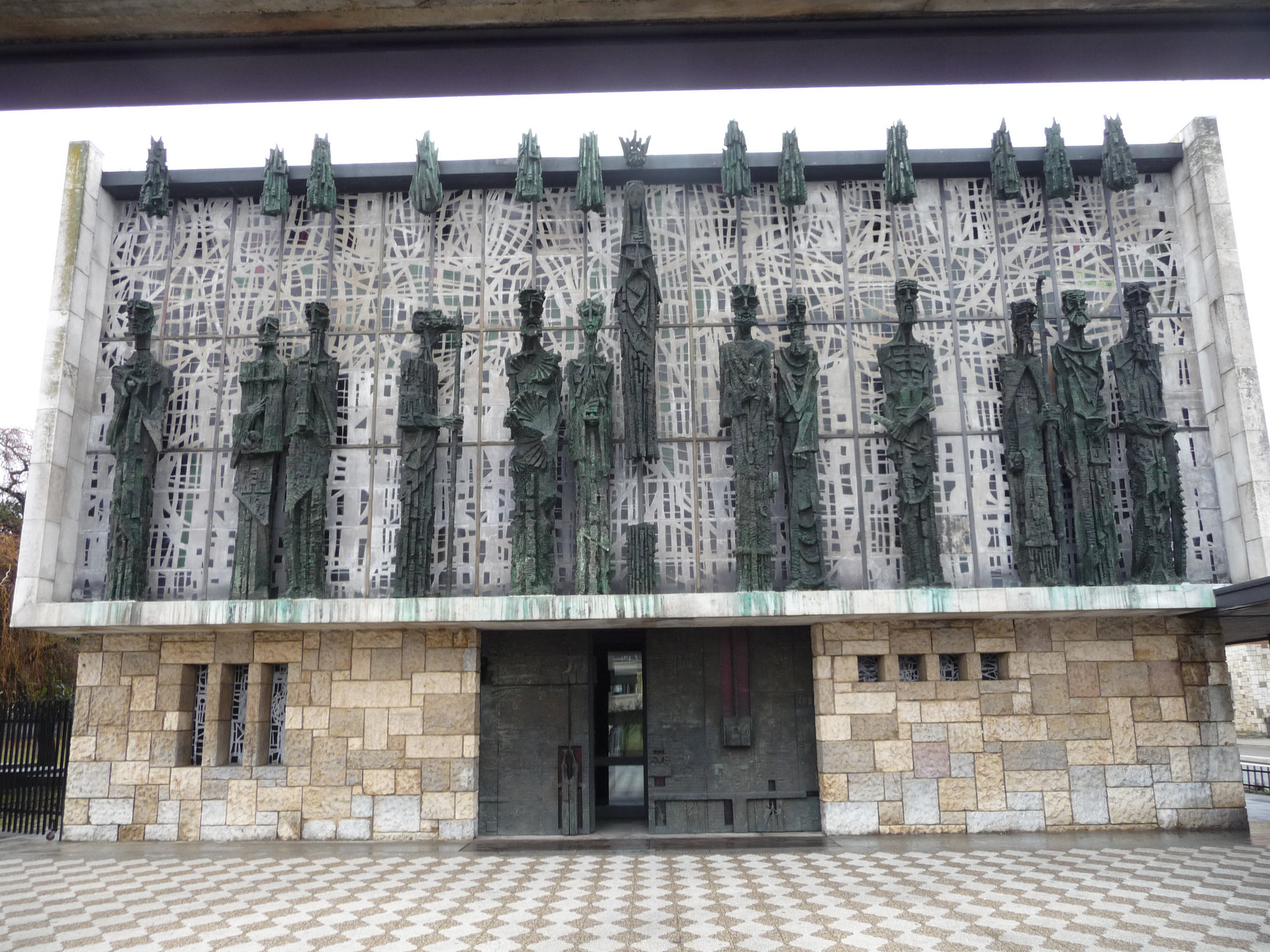
Basilica of Virgen del Camino in León, picture given by cmramirezl

Passing by the temple we have to take the left position of the N-120 in order to exit town. Taking the Paz Street we have to choose, after 500 meters, which way we want to take so we can get to Hospital de Órbigo.

WE CHOOSE OUR WAY FROM THE VIRGEN DEL CAMINO TO HOSPITAL DE ÓRBIGO

As the several contradictories painted art son the ground, there is a little rivalry between both towns that are the favorite ways of pilgrims. Actually the traditional way was invade of traffic noise due to the N-120 construction, so that’s why some close populations started taking advantage to offer more peaceful alternative.

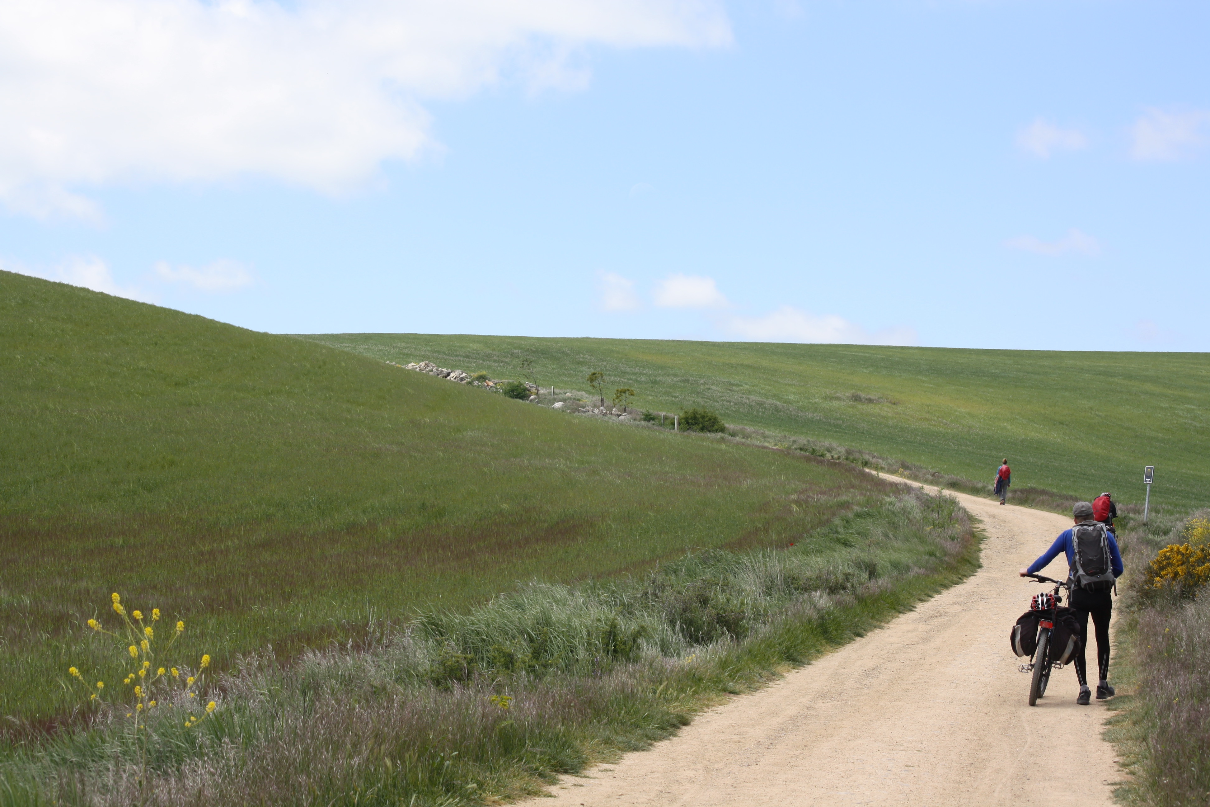
It takes 4 Km more going through the alternative way to Villar de Mazarife, which it’s practically an insignificant distance on bike, so choosing between itineraries is a matter of taste.

If you go through the traditional way you will follow the course of the N-120, having to avoid a junction of roads. By the highway shoulder we can go across without any problem, but going by the pedestrian way we have to change course a little to pass through an underground tunnel underneath the highway.  

By land and concrete paths, the view allows us one more time to see the León’s wasteland with some scattered trees alternate with some industrial ships. In less than 2 Km we will get to Valverde la Virgen and in 1, 5 Km more to San Miguel del Camino, both locations have the N-120 as backbone.In San Miguel there was a pilgrim’s hospital since the C. XII and today is actually home of the most important golf club of the León providence.

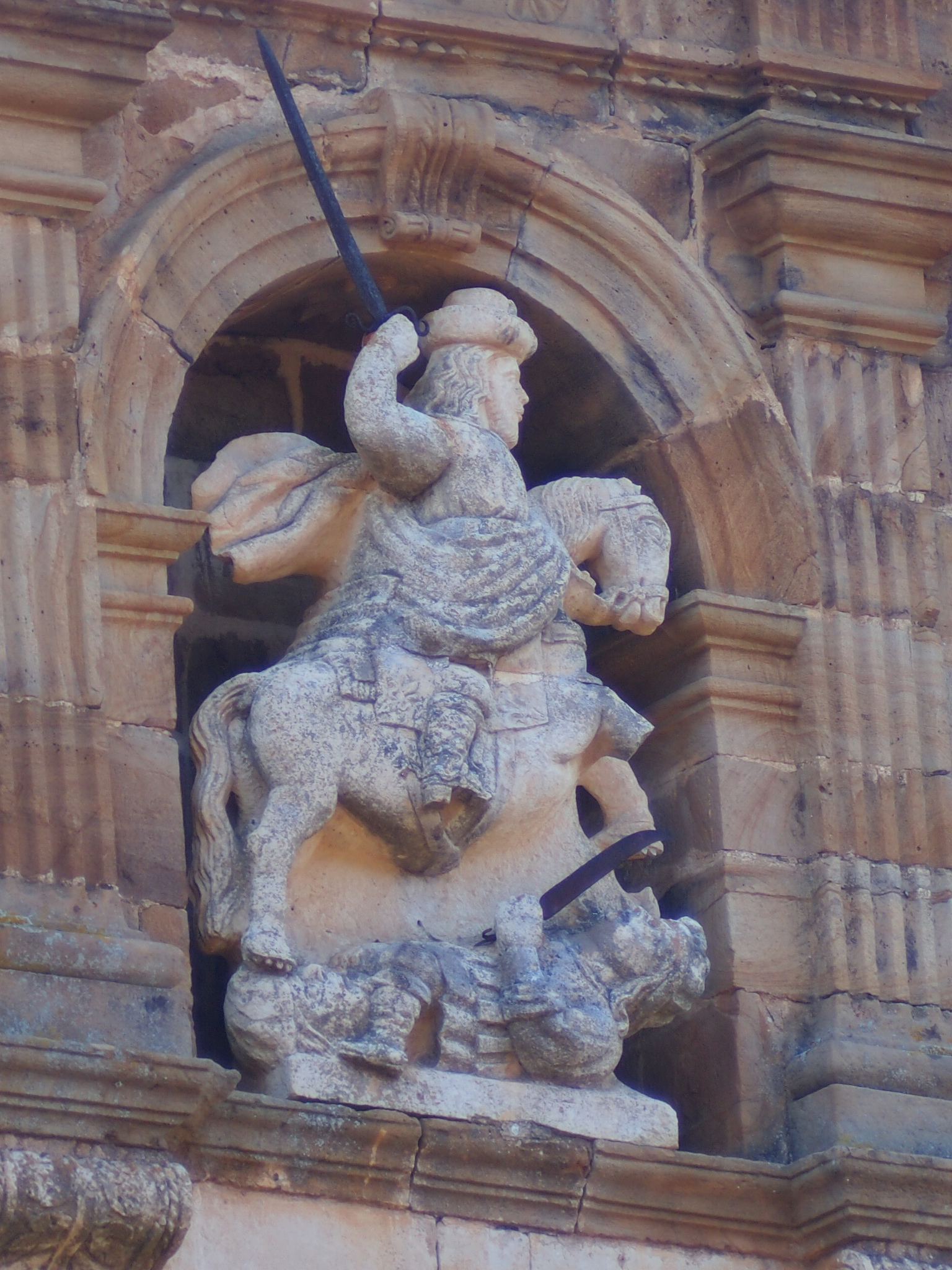
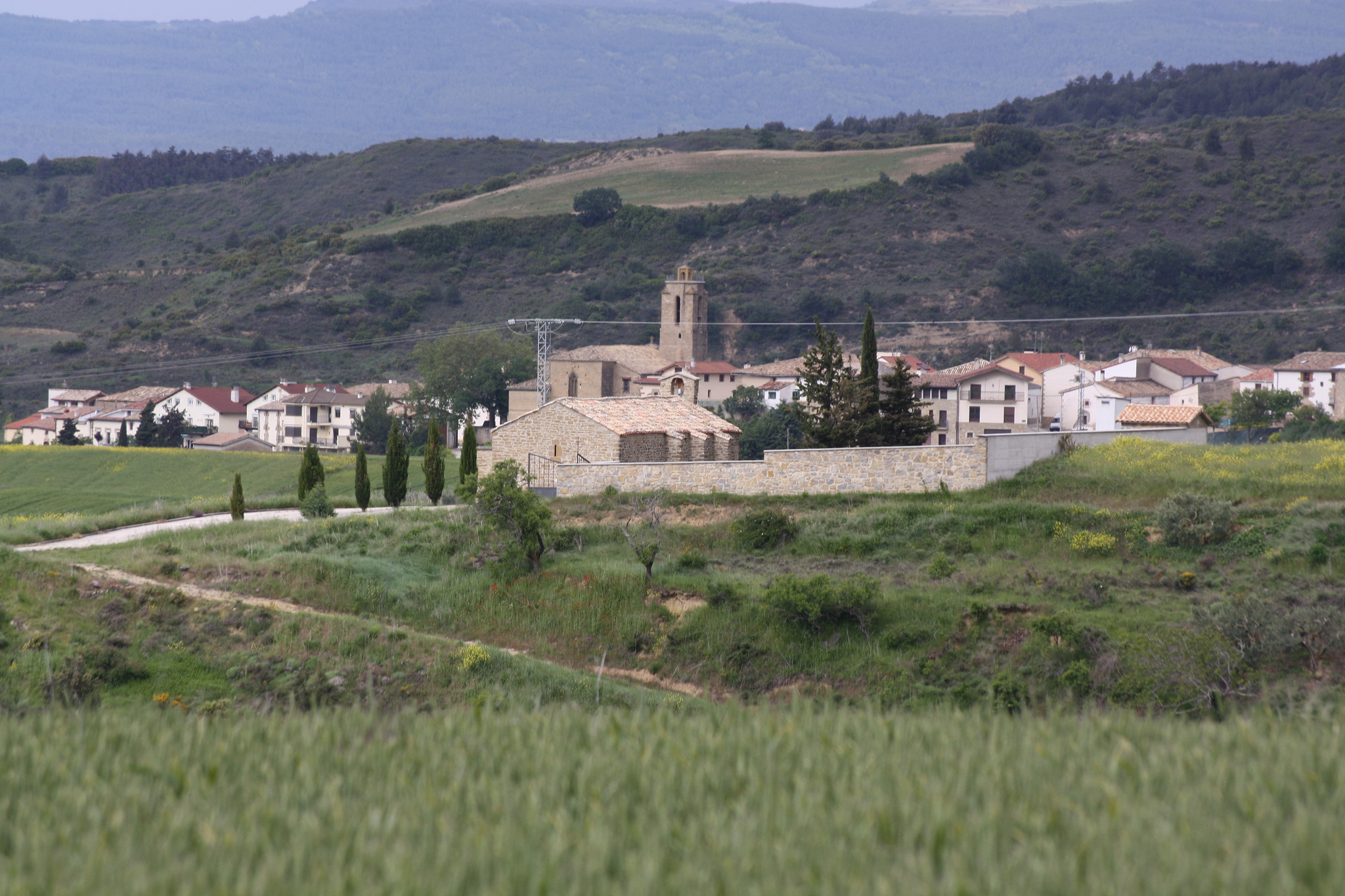
Following the highway course we leave behind to the right an industrial estate and a big urbanization, and due to how close it is to the French Way it has been baptized as the one of “Camino Santiago”. That’s how we arrive to Villadangos del Páramo, which by the way the name is not that original considering how wasteland the environment is.  The Jacobean tradition of this resurrect town during the Reconquest denounces the abdication of its parish church to Santiago Apóstol (C. XVII-XVIII). By its door, miracle episodes are being told, like the one about the appearance in the Batalla de Clavijo (Clavijo Battle). In order to remember this fact each July 25th a resident from town dresses himself up as Santiago Matamoros and enters to Villadangos brandishing his sword on top of a snow colored horse.

The Church of Villadangos del Páramo

The Church of Villadangos del Páramo, picture given by antonio 69290

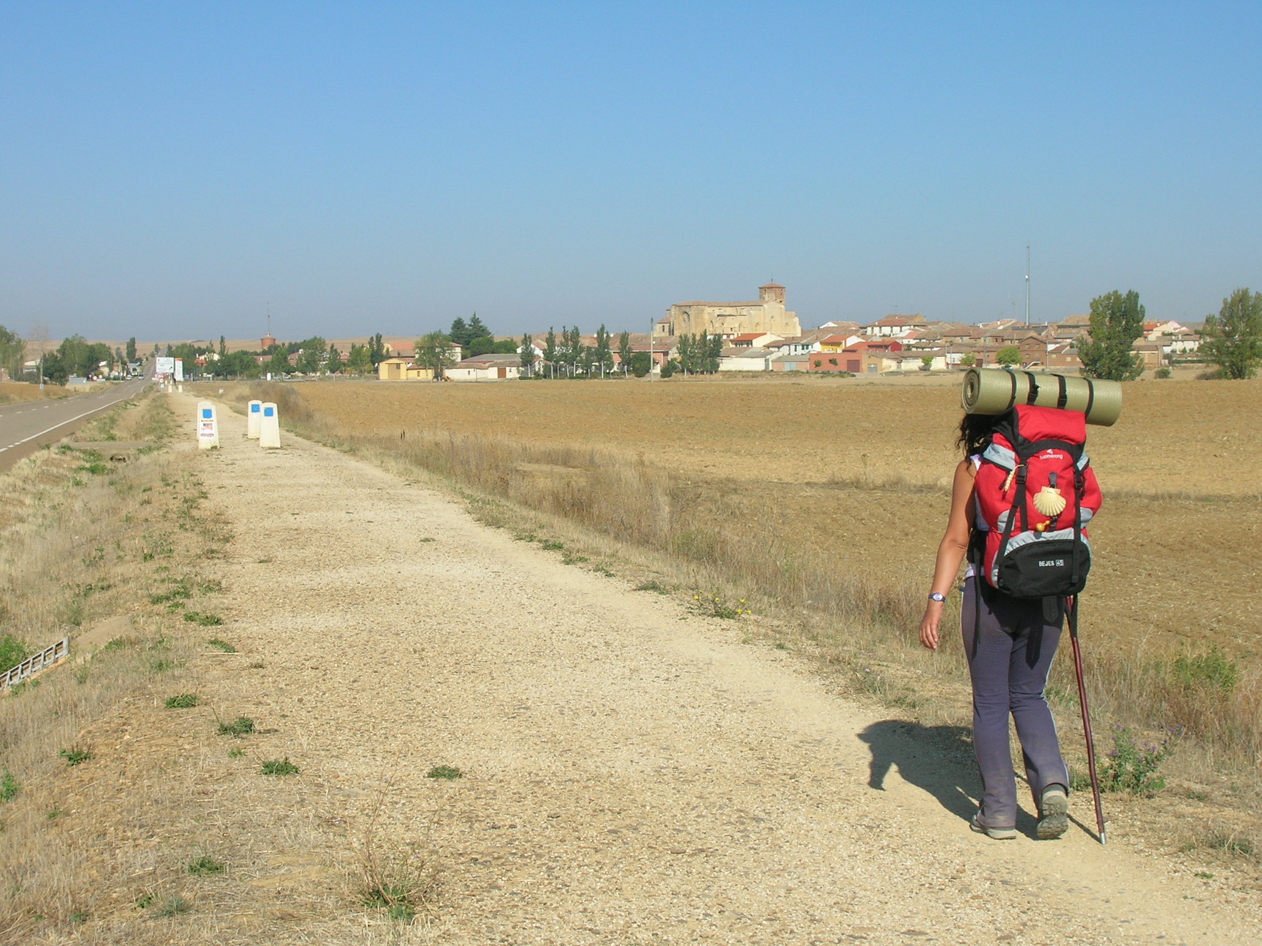
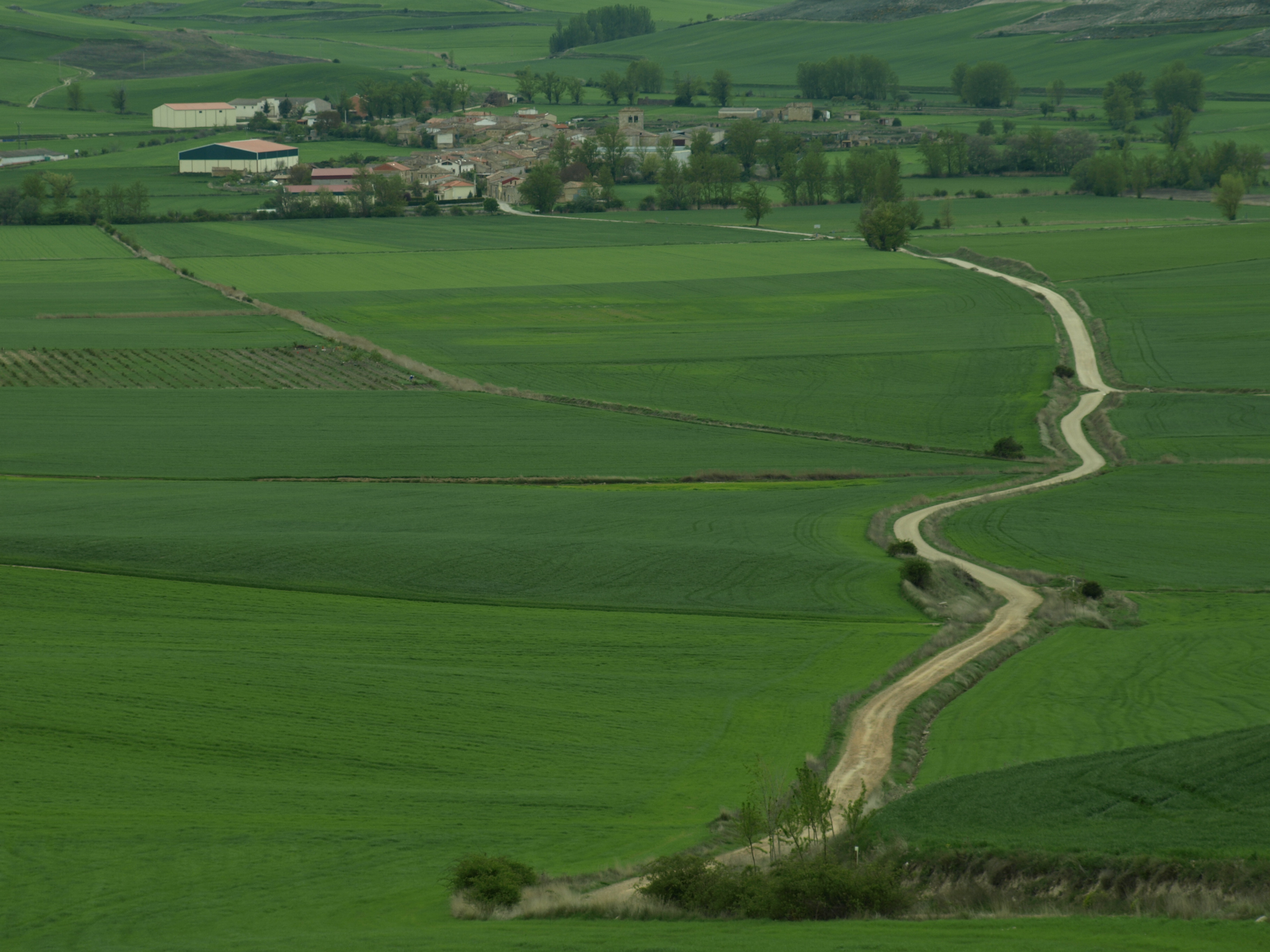
Following through the N-120 or by land path parallel to its left shoulder, we get to San Martín del Camino in a soft negative slope. In spite of not counting with excessive services or outstanding patrimony, its almost equidistant position between León and Astorga has made of it an important point of the French Way, also due to its several overnight visits.

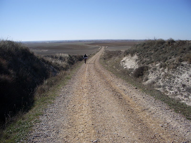
In a continuous but light slope, we cover 7 Km separating us from Hospital de Órbigo, passing by cereal and corn fields. In a parallel land path to the right shoulder of the N-120, a Jacobean sign with the yellow scallop Shell shows us where to turn to right so we can enter into town. If we go by highway we need to be careful of not missing it.

In case you chose the alternative way from the Virgen del Camino, you had passed by land paths and secondary roads between small towns until arriving to Villar de Mazarife. Some of these paths match with some old roman streets. We recommend precaution in the N-120 cross by the roundabout just before hooking up again with the traditional way.

WITH “PASO HONROSO” WE CAN KNOW MEDEVIAL LEGENDS AND CHOOSE OUR WAY TO LA CRUZ DE SANTO TORIBIO

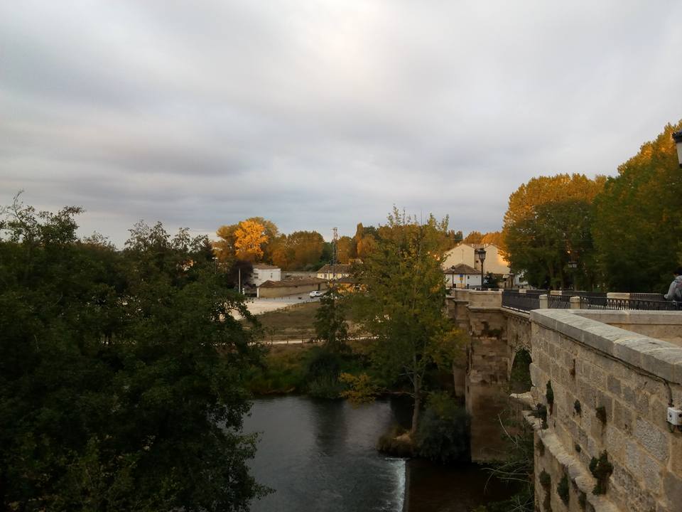
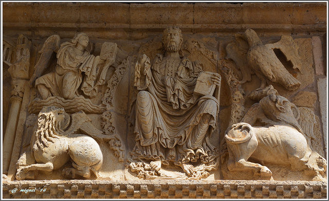
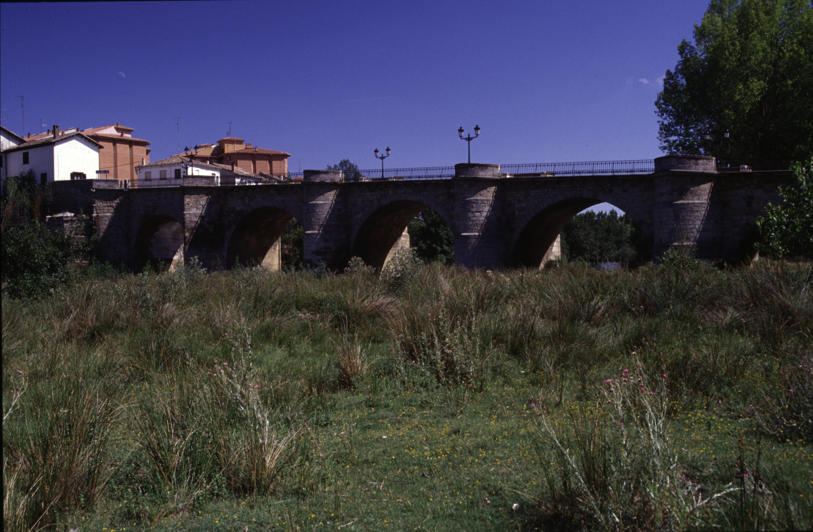
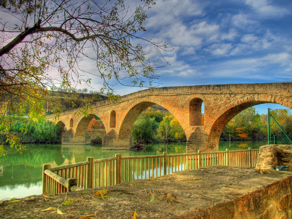
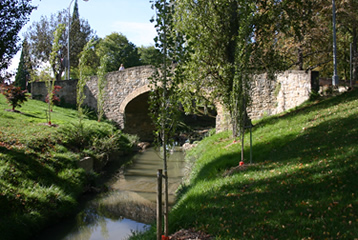
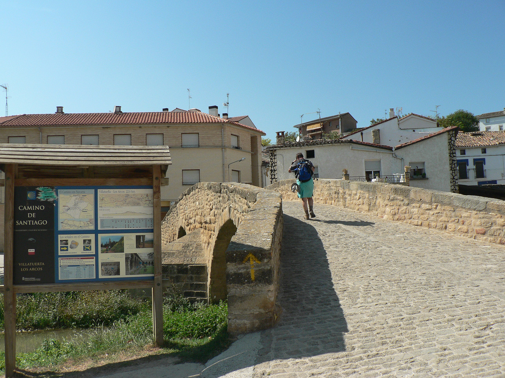
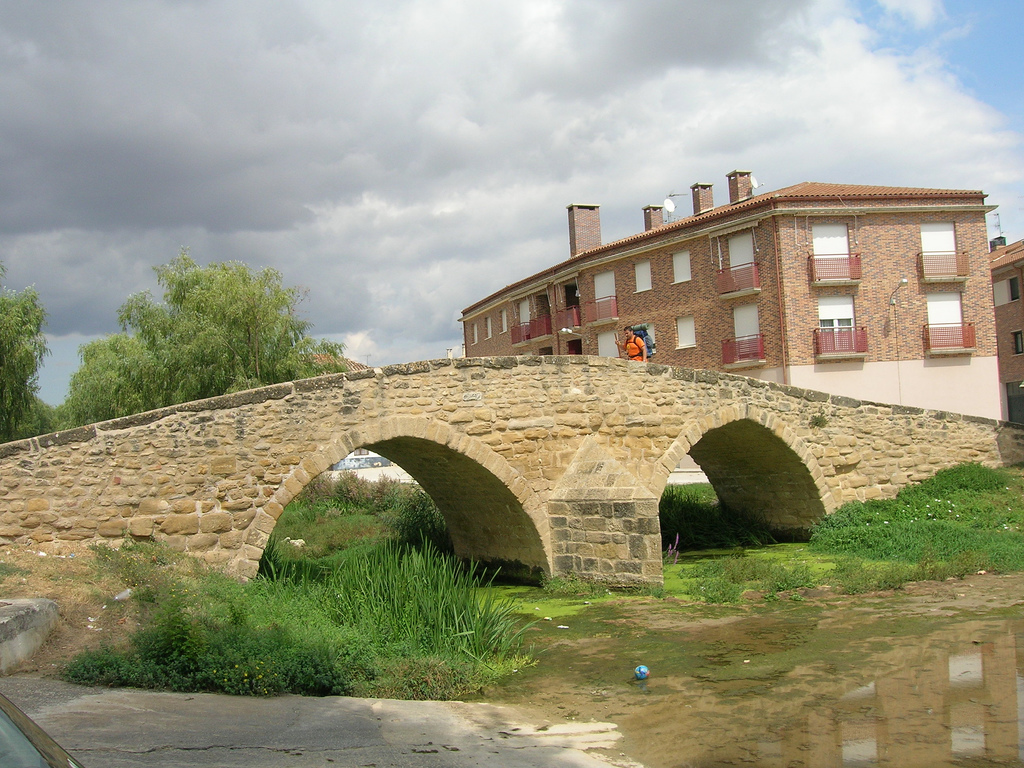
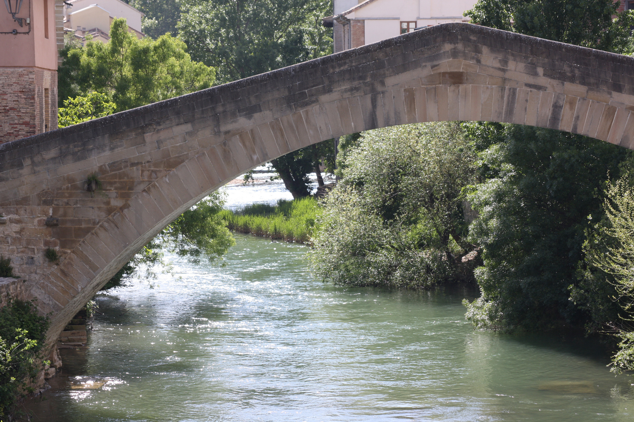
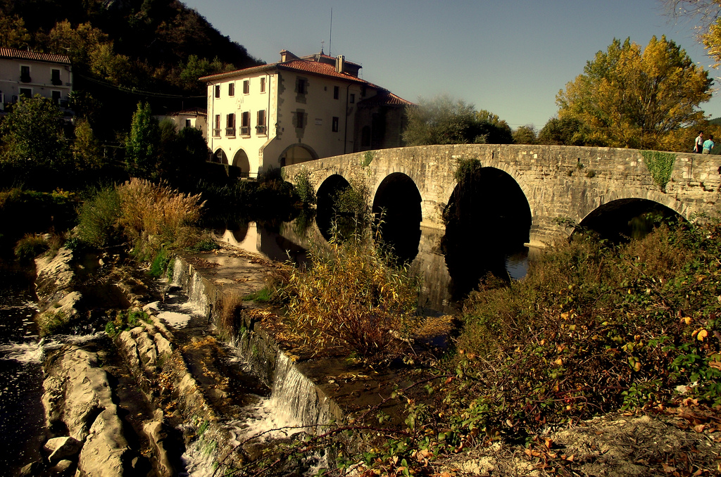
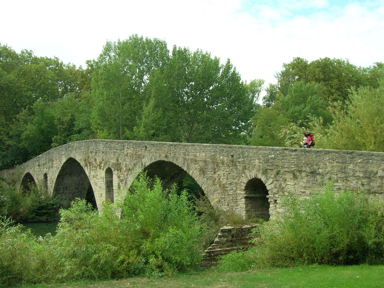
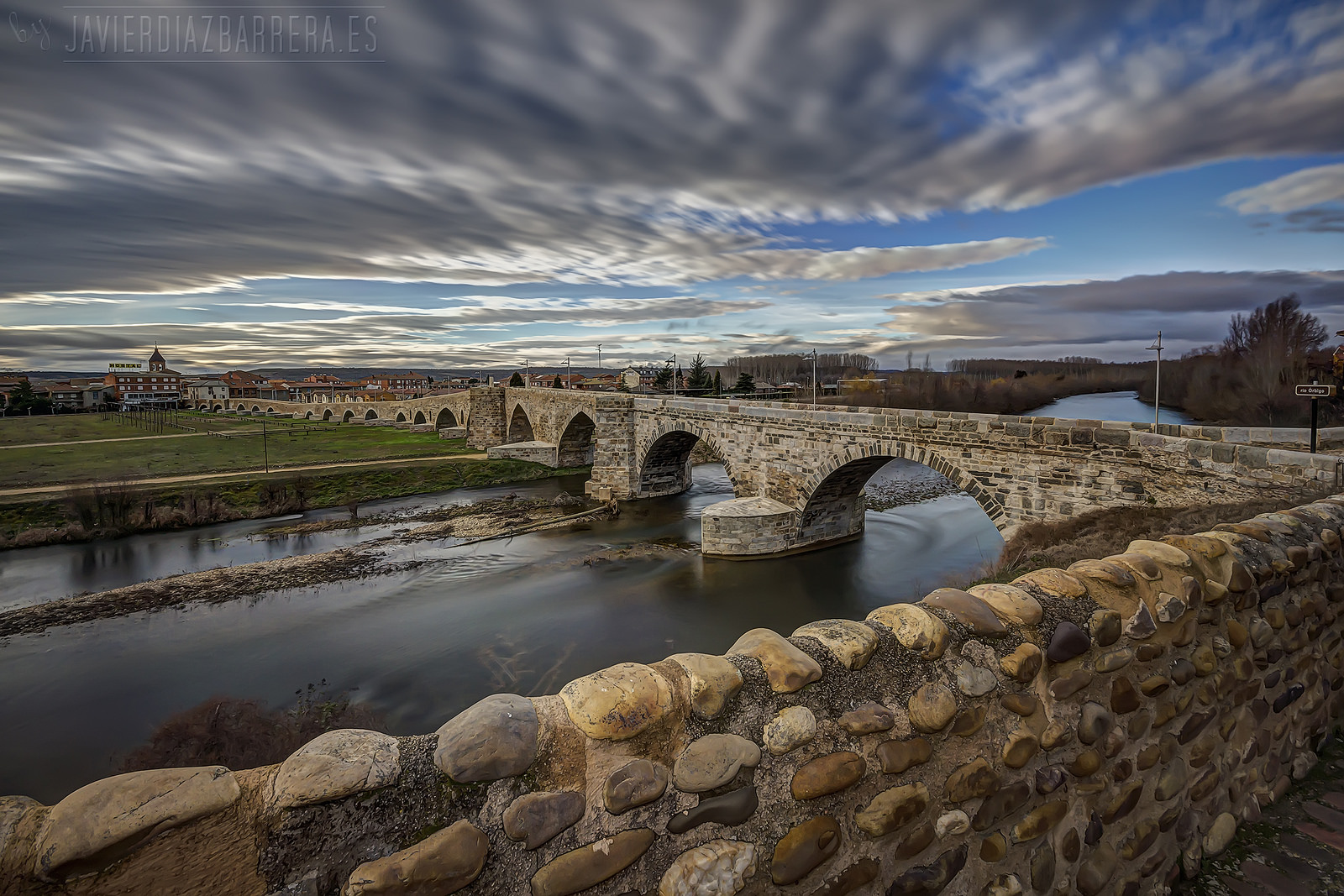
Hospital de Órbigo is divided by the homonymous river, over it is located the bridge that has made the whole city famous. El Puente de Órbigo (Órbigo Bridge) is one of the most important monuments of the entire stage, so we recommend pilgrims who go on bike through the highway, to change course in order to visit this bridge.

Bridge of the Paso Honroso in Hospital de Órbigo

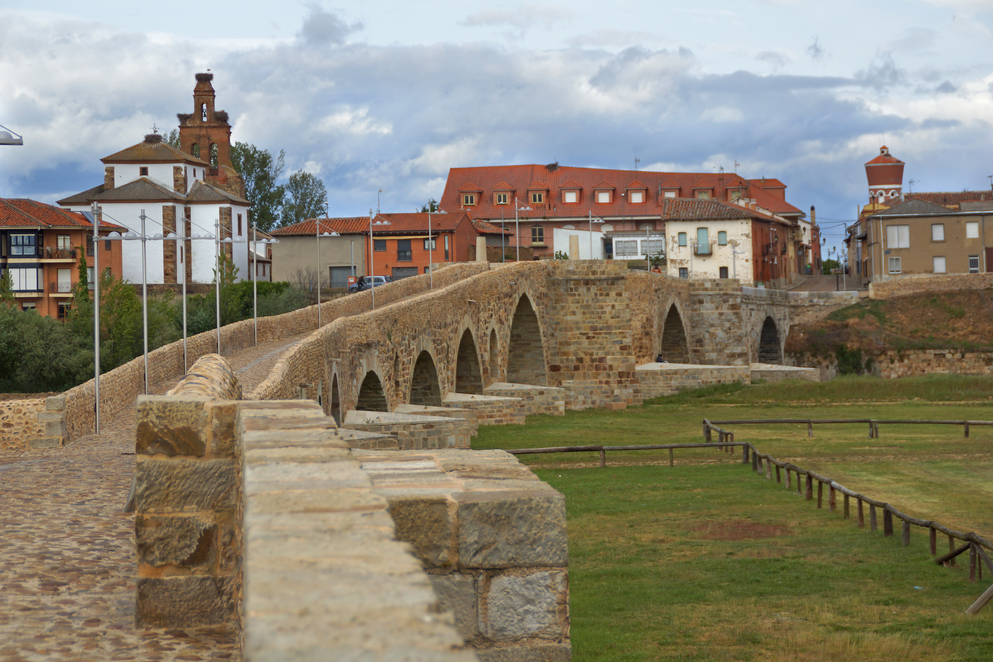
Bridge of the Paso Honroso in Hospital de Órbigo, picture given by Miguel Cortés

The bridge’s surface is made of cobblestone, quite uncomfortable for cyclists. The construction seems out of proportion for how the river’s flow is today, but before the Barrios de Luna reservoir was built, the torrent was a lot higher. Historically, there is proof of some structures that were built with the intention of navigating the river since roman times, because the road between León and Astorga was located there.. Besides, so many battles took place in that location, like the one of Swabians against Alans in the V century, or the one that took place against the French people during the Independence War in the XIX century.

Anyway, this place is known especially for being the setting of the “Paso Honroso” (Honorable Pass) according to some chronicle stories. An informative sign located in the middle of the bridge relates this achievement for all the visitors and that we sum up today in Tournride.

Although in the XV century, the horses jousts were practically obsolete, rumors has it that in this location a knight named Suero de Quiñones was so in love of a girl named Leonor that he asked the king to call up a tournament so he could win the lady’s admiration. The king allowed him to do it and the tournament was celebrated during July of the Jacobean year 1434. Its historical name, the “Paso Honroso”, comes from the fact that every person willing to cross over the river, must first battle in a joust, or otherwise, must swim the entire Órbigo and gain the fame of a coward. This included everyone but pilgrims.

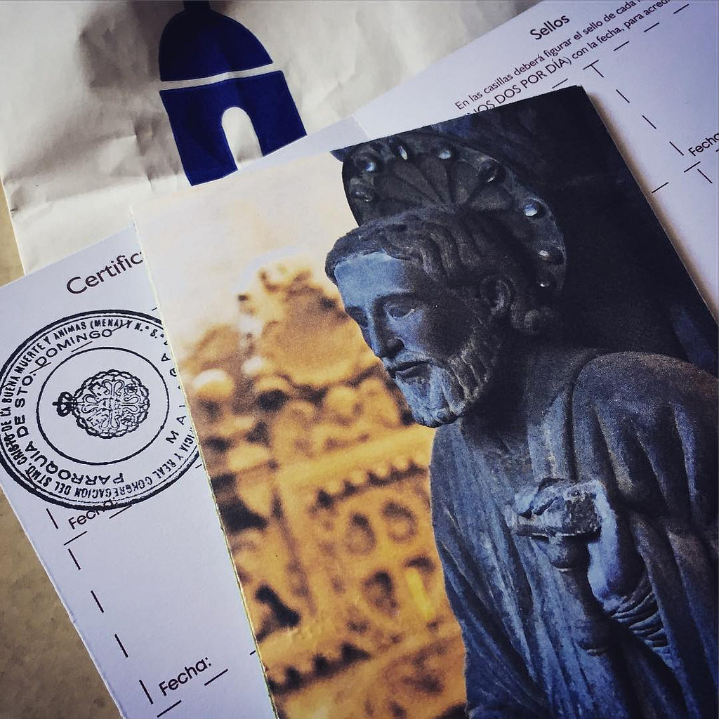
In order to praise his participation on the tournament, Mr. Suero promised to break more than 300 spears during the whole month and carrying a huge metal ring around his neck. Once he fulfilled all of his promises, he went on a pilgrimage to Compostela and asked the apostle for Leonor’s love, telling him: “If you are not willing to take my love, there is no joy for me really”.  It is said that in the actuality, the ring belongs to the gold short necklace hanging on the apostle’s reliquary in the cathedral.

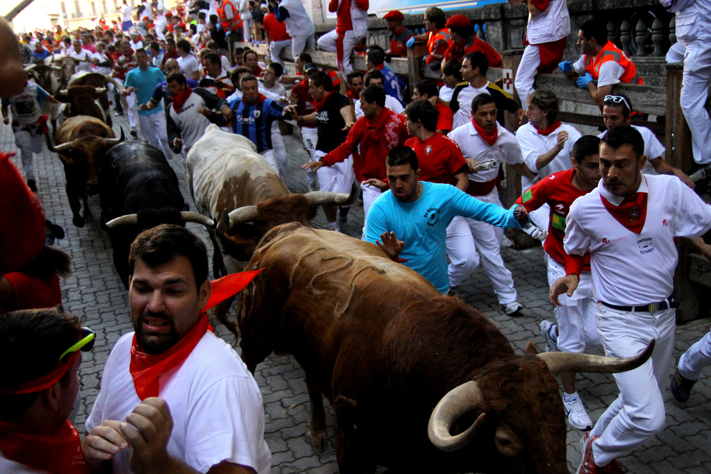
The jousts of the Paso Honroso were written by many poets and put in many different chronicles. They were so famous back then that even Miguel de Cervantes talks about Suero de Quiñones on Don Quixote! El Quijote! Today, on his honor, the first day of June is the celebration of medieval jousts at Hospital de Órbigo in the Paso Honroso. It is a big medieval festival where people put on some costumes from the period, pretend to have spear fights, sell crafts, and eat in big marquees.

Medieval Festival in Hospital de Órbigo. People with the typical costumes

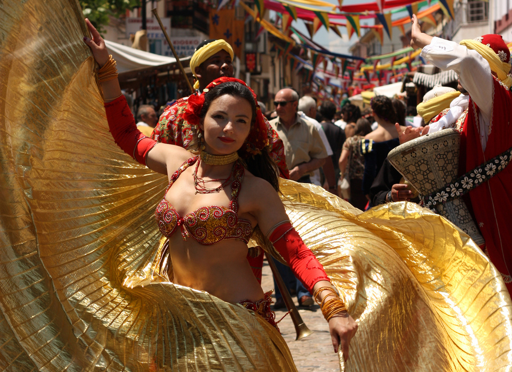
Medieval Festival in Hospital de Órbigo, picture given by Isa San Martín

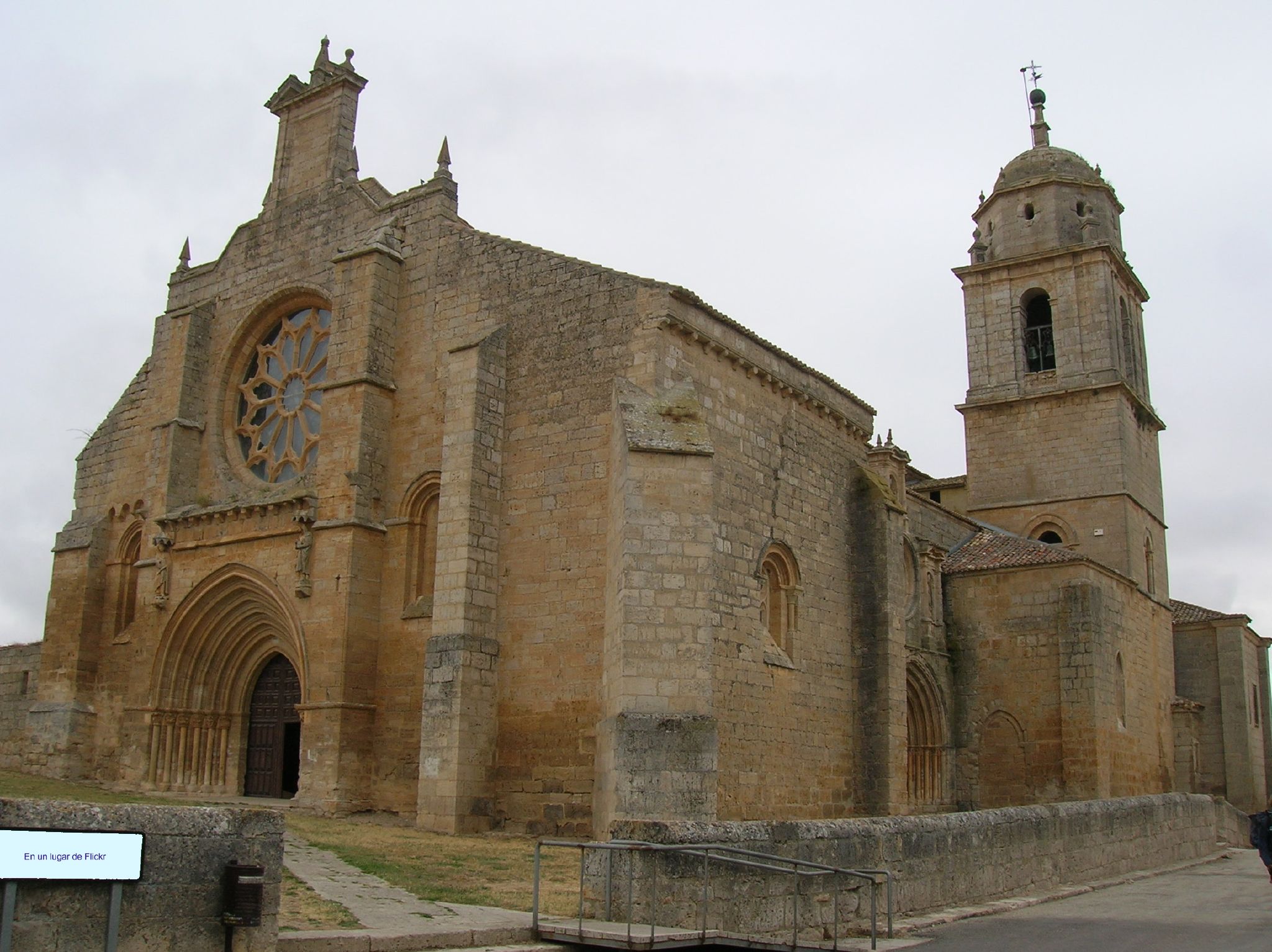
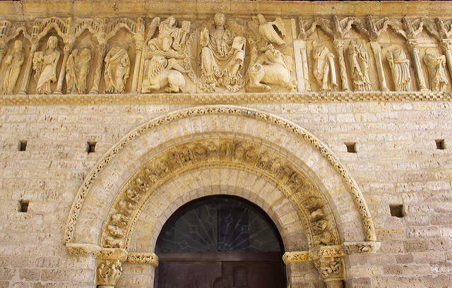
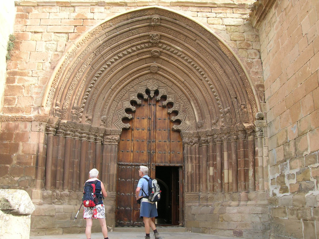
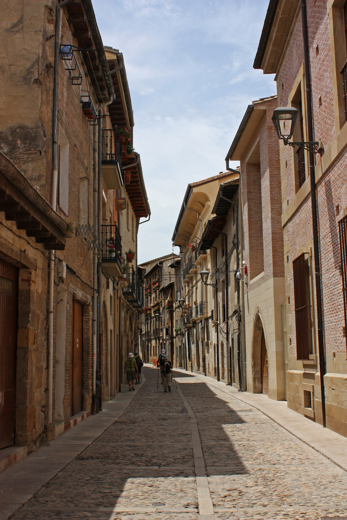
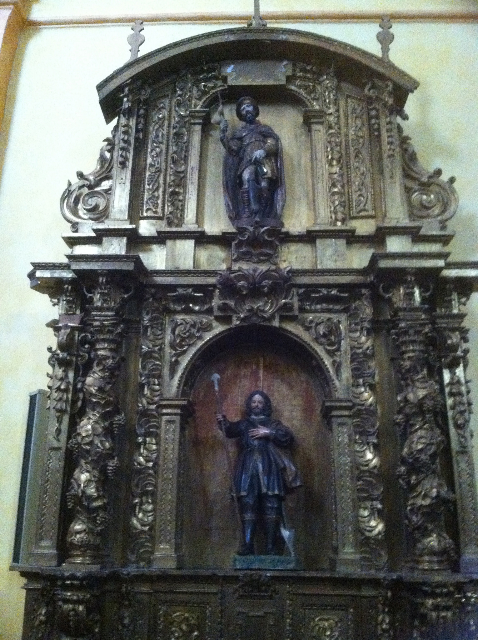
After crossing over the bridge, we keep on moving forward through Santiago Street. A few meters away we will see to our right the Church of San Juan Bautista from middle of the XVIII century. In the beginning it belonged to San Juan’s order, the Jerusalem knights. Inside there’s a plateresque altarpiece quite attractive.

Altarpiece at the Church of San Juan Bautista

Altarpiece at the Church of San Juan Bautista, picture given by Thom Ryng.

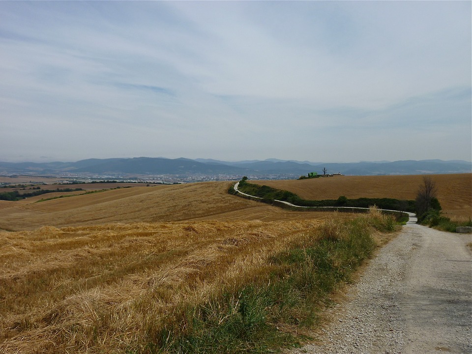
Once we reach the end of Mayor Street from Hospital de Órbigo, we find again some double Jacobean signs, right on the second road fork of this stage. Moving straight forward, we’ll go by the N-120 until Cruz de Toribio, nearby Astorga, without passing by any locality. If we take the wide track that makes way at the right, we will get lost among fields and agricultural vegetation, visiting two more towns in about 3 Km of route.

Path to Villares from Hospital de Órbigo

Path to Villares from Hospital de Órbigo with José Antonio Gil Martínez

The traditional way is the one that follows the same course of the N-120. The profile is quite simple, just by the end the slope turns into a light positive one. As an advice, we recommend you to be careful in two of the crossroads of the N-120 that we have to take so we can take the Jacobean paths that can easily go from the right to the left shoulder. If we do this by highway, we must be careful after taking the second curve to the right, because that’s where we change course to go the Crucero de Toribio (Toribio’s Cross).

The alternative way can be more recommendable, except if the weather conditions are unfavorable, especially with rain because the surface can get very muddy easily. This has way more services than the previous alternative way, the one from Villar de Mazarife.. The profile is more complicated, especially because at the end there are a couple of slopes between leaps, but it’s reasonable.

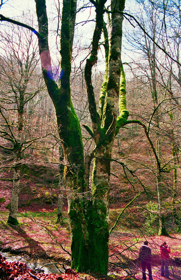
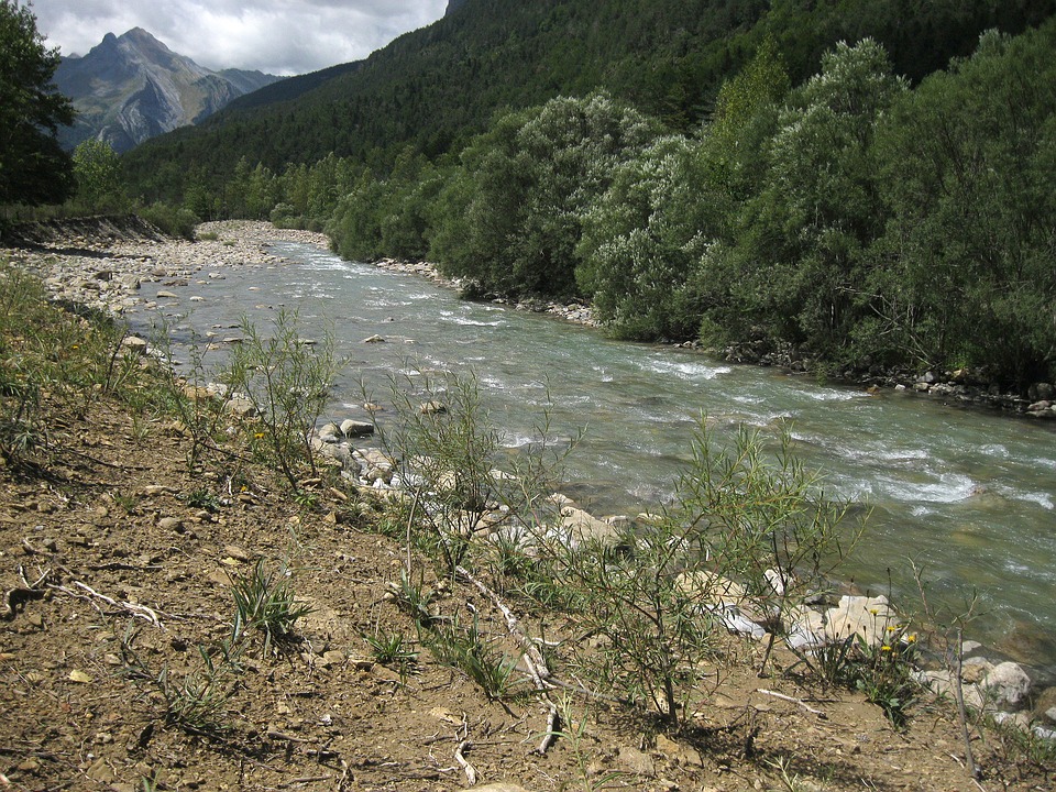
The landscape is not that wasteland, farmlands full of vegetables and reduced forest, with the Órbigo River showing up its big poplar groves in both meadows.

Star-filled night in Orbigo River

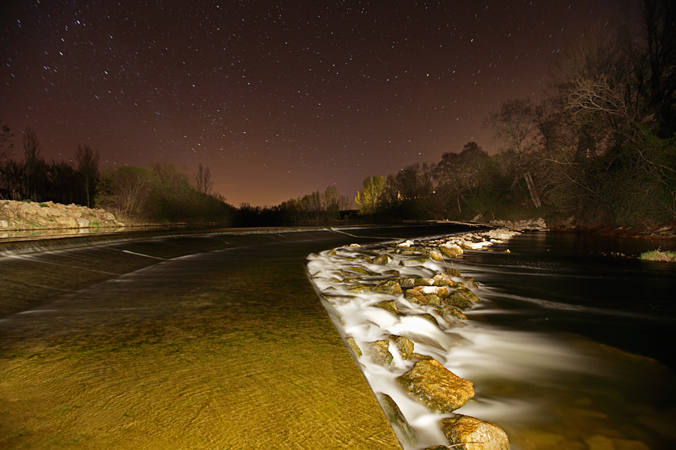
Star-filled night in Orbigo River, picture given by Miguel Ángel

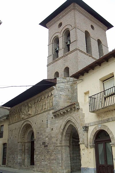
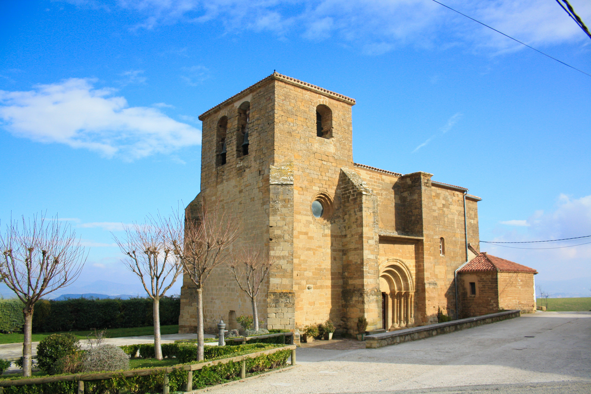
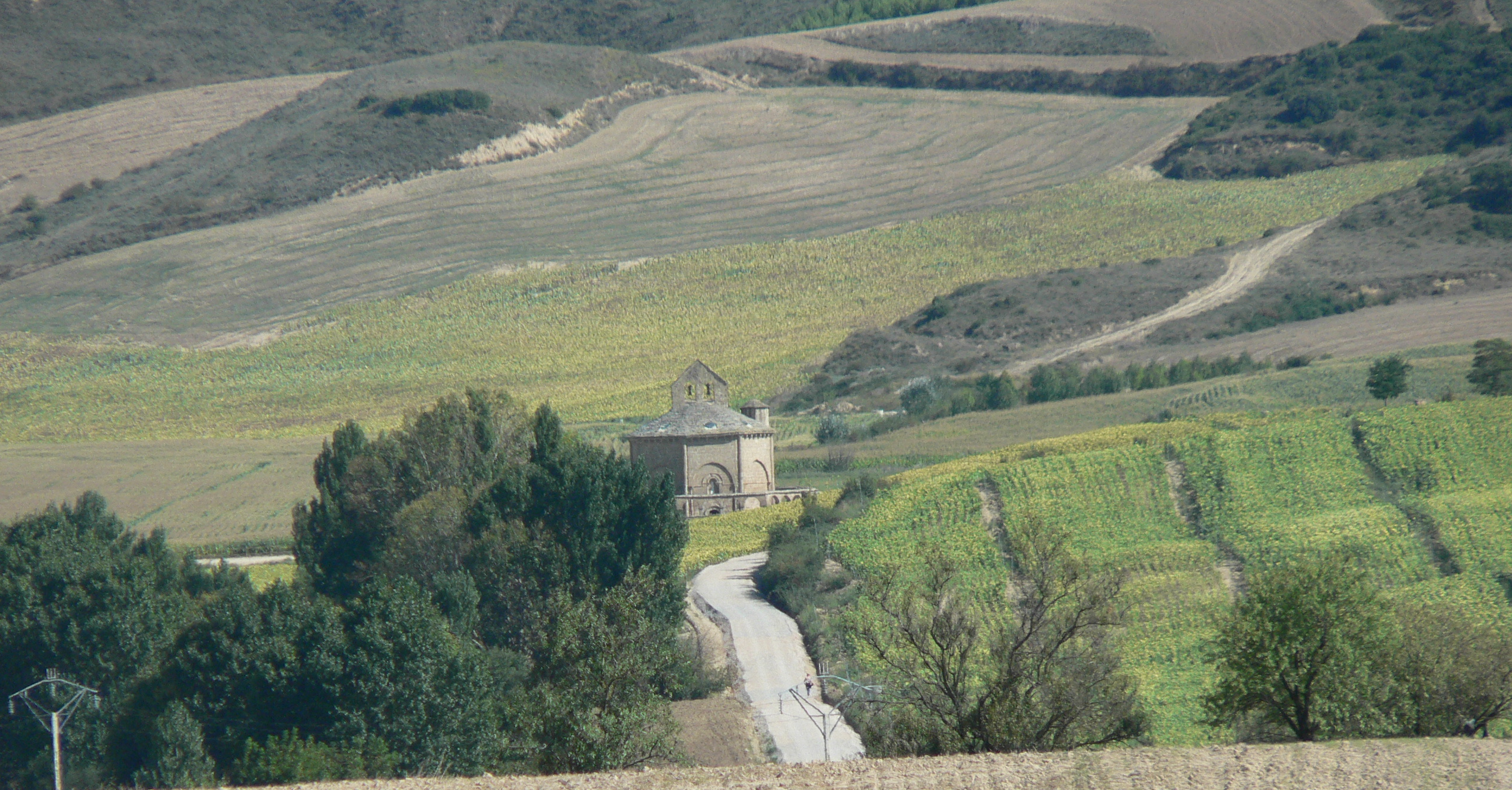
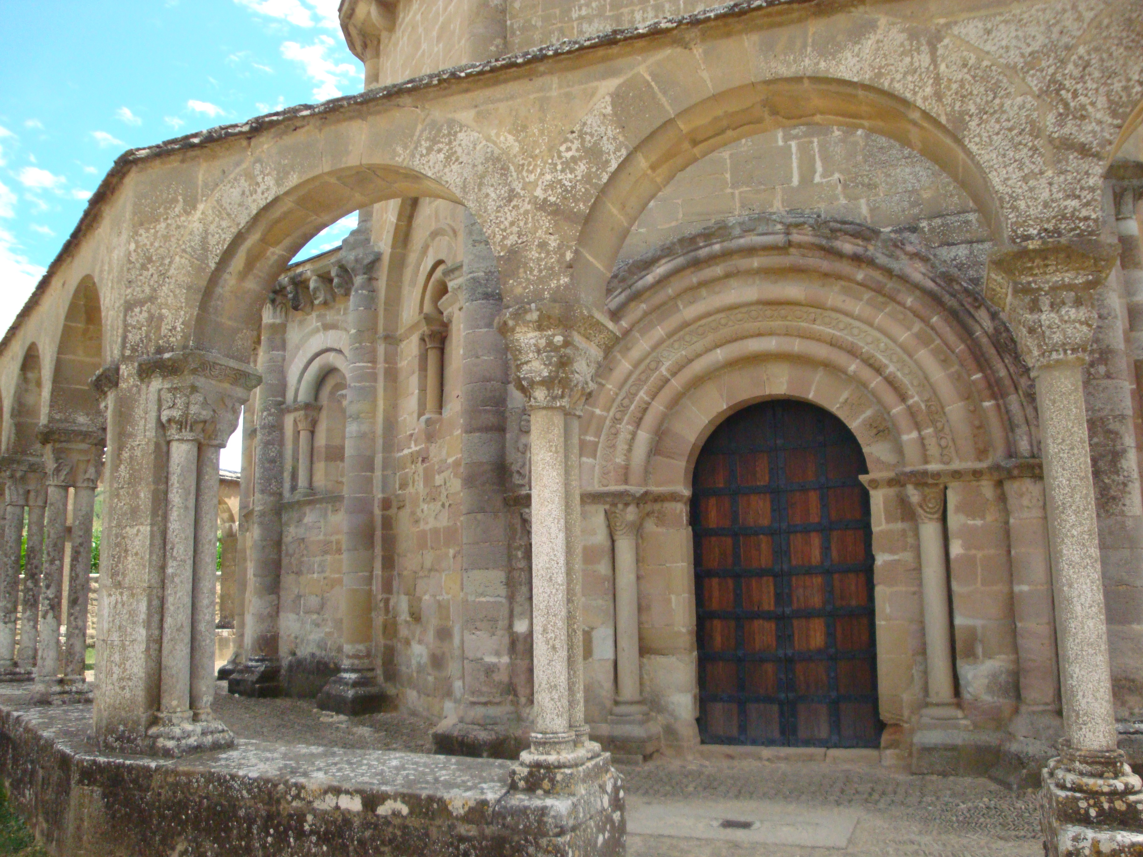
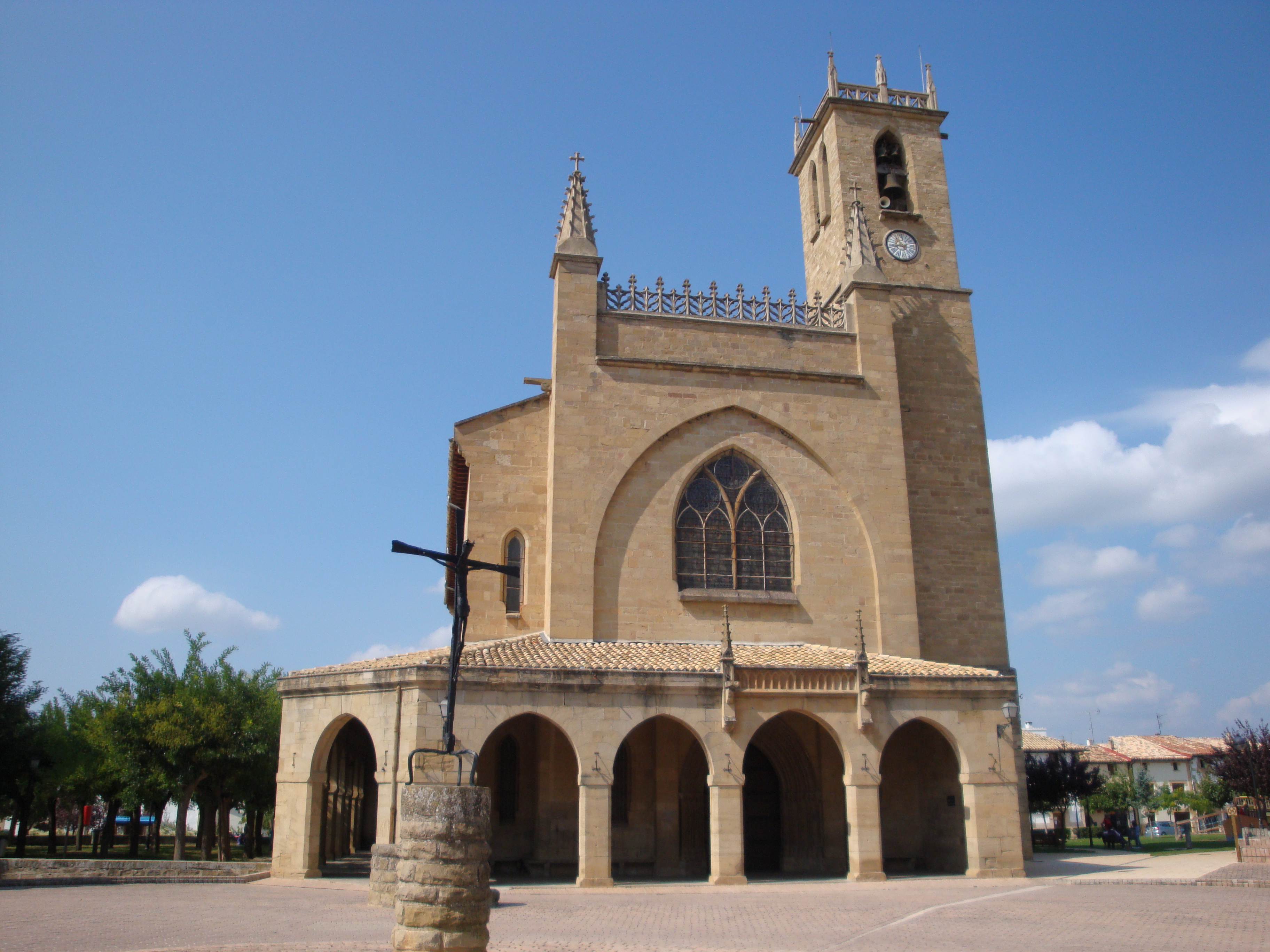
In less than 2 Km we reach Villares de Órbigo, this town has the same name as the municipality where less than 700 people live, who have as a job, mostly, field work. In Villares there is a church with romance origin and baroque remodeling, dedicated to the apostle but with a beautiful sculpture of the Virgen del Carmen. The town connects with Santibáñez de Valdeiglesias through a way and a local highway that we will actually pass by in a few minutes.

Santibáñez also counts with a parish church, dedicated to the Holy Trinity representing the nucleus’s center. Inside, there is a spectacular famous sculpture of San Roque and its Jacobean tradition is reflected in its iconography that appears to be dressed as a pilgrim.

Even so, this Santibáñez town is even more famous thanks to a really fun hobby that people tend to do each summer: one of the biggest corn labyrinths of the world.The tour changes each year and it’s a great attraction for pilgrims who stay the night at the town’s lodging.

Santibáñez de Valdeiglesias, surrounded by green fields

Santibáñez de Valdeiglesias, picture given by Miguel Cortés

Actually, the fact that in this case they choose just one labyrinth has a very symbolic meaning. In the Logroño road, of our fourth stage, in Tournride we tell you how we believe that the Game of the Goose could have been designed by the Templars, being an accurate representation of the Santiago Way. As we told you about bridges in Navarra“entre los que nos llevaba la corriente”, here the labyrinth represents the 42th square from the Game of the Goose, that would lock us up or would take us from “Labyrinth to the 30th”.

Game of the Goose

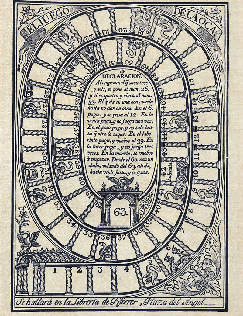
Game of the Goose, picture given by Juan Francisco Piferrer

At the exit of Santibáñez the surface turns a little more complicated, with dozens of little stones. Besides, there appear the slope changes. We must avoid a couple of slopes between leaps, we almost forget about it after all the flat tracks!

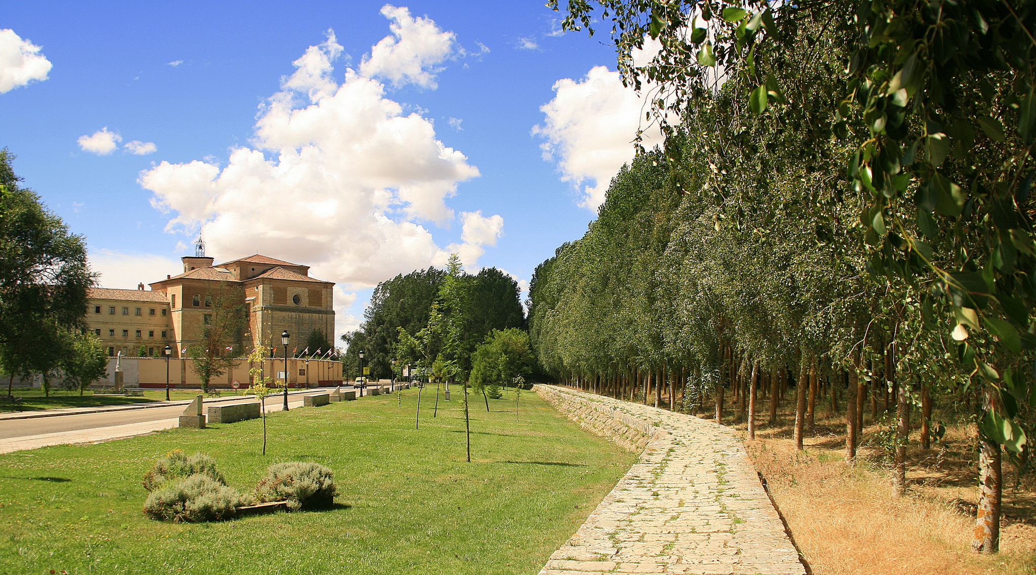
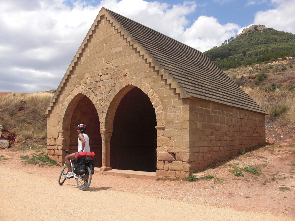
Before arriving to the Cruz de Toribio we pass by the “Casa de los Dioses” (House of Gods). This project, created by the Catalan David Vidal in 2009, involved the restoration of an old industrial ship to build up a reception place and help pilgrims. They offer juice and food for free in exchange of goodwill that must stay exactly like that so future pilgrims could enjoy the place and pay in some way all they take, as David announced. At the end of 2016, they informed about the closure of this curious point of the French Way, but even though the place’s future is not certain, it’s still publically open today.

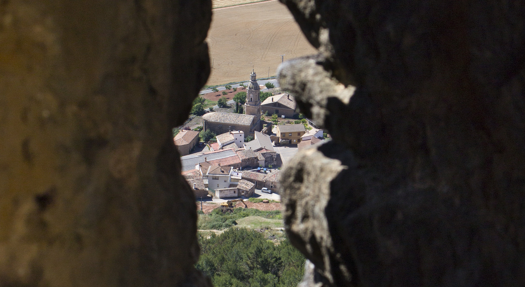
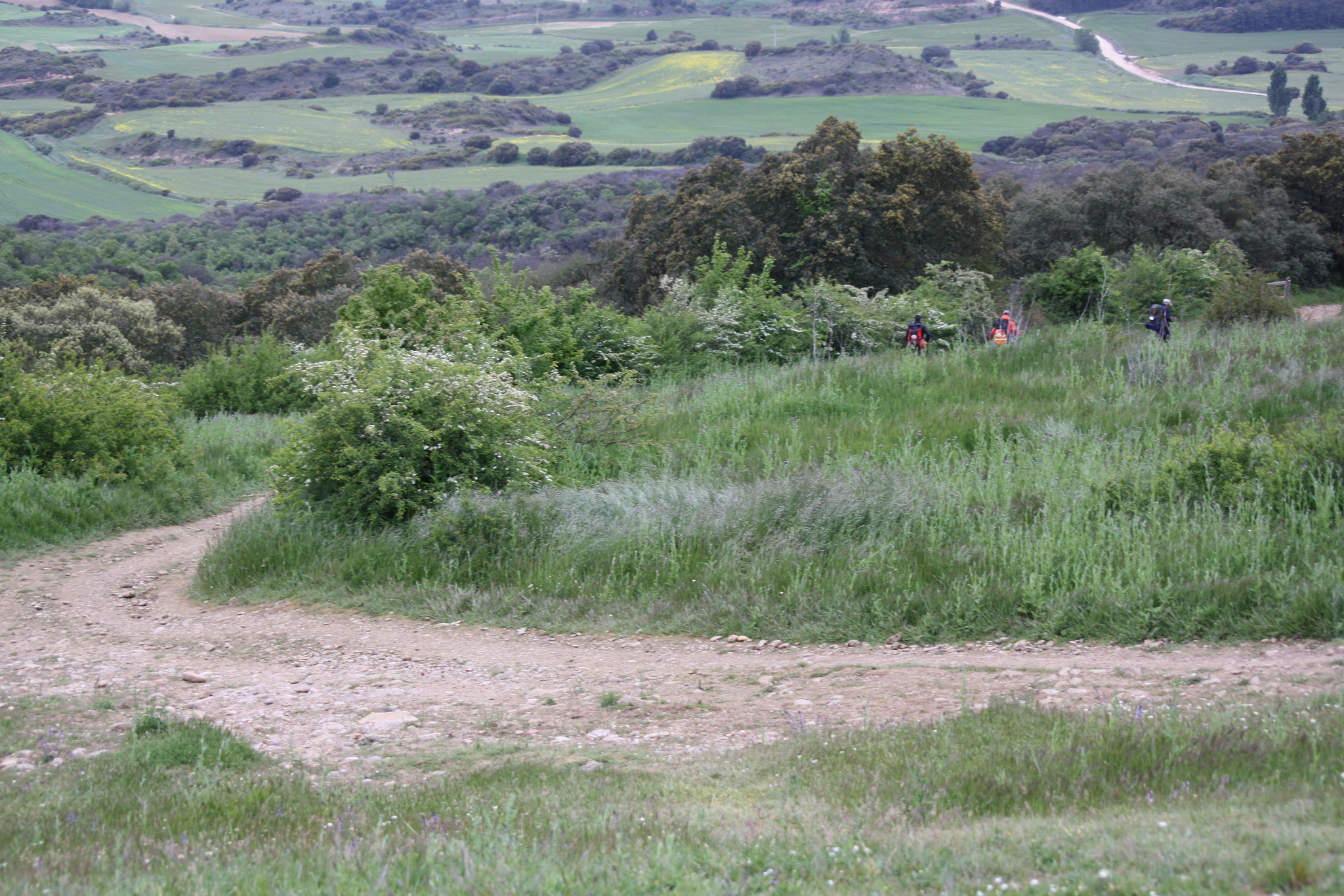
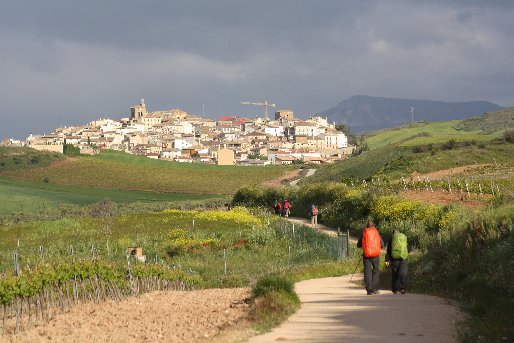
From the Casa de los Dioses, we continue moving forward by the land path and, after turning left, we arrive in about 1, 5 km to the Cruz de Toribio. Before us, a panoramic view of Astorga will open, for the first time.

WE ADMIRE ASTORGA FROM THE CRUZ DE SANTO TORIBIO AND BY SHORT SLIDES WE COME TO THE END OF THE STAGE

The cross that rules this Astorga’s views was built up in honor to Toribio, a religious man from the V century.. His saint life began when he sold everything he had so he could go on pilgrimage to Jerusalem. And later, he was named bishop of Tui and Astorga.

The chronicles say that when he was the Astorga’s bishop we wrote a letter to the Pope, showing his concern about a doctrine that was becoming popular in town. That was actually the Priscillianism, that years later would be condemned as heresy. The Pope, worried about the situation, asked Toribio to plan a meeting and gave him the power to excommunicate everyone who wouldn’t condemn Priscillianism during convention. Apparently, everyone who was excommunicated confronted Toribio and he ended up being expelled from Astorga.

Years later, Toribio was persecuted by Visigoths and, when he arrived to Astorga he asked for shelter, but they denied him the entrance. Upset, he climbed up to where the cross is and pronounced his most famous words:De Astorga, ni el polvo”(meaning he didn’t want anything from Astorga). Today, the city actually pays tribute with this cross to one of the most historical characters of town.

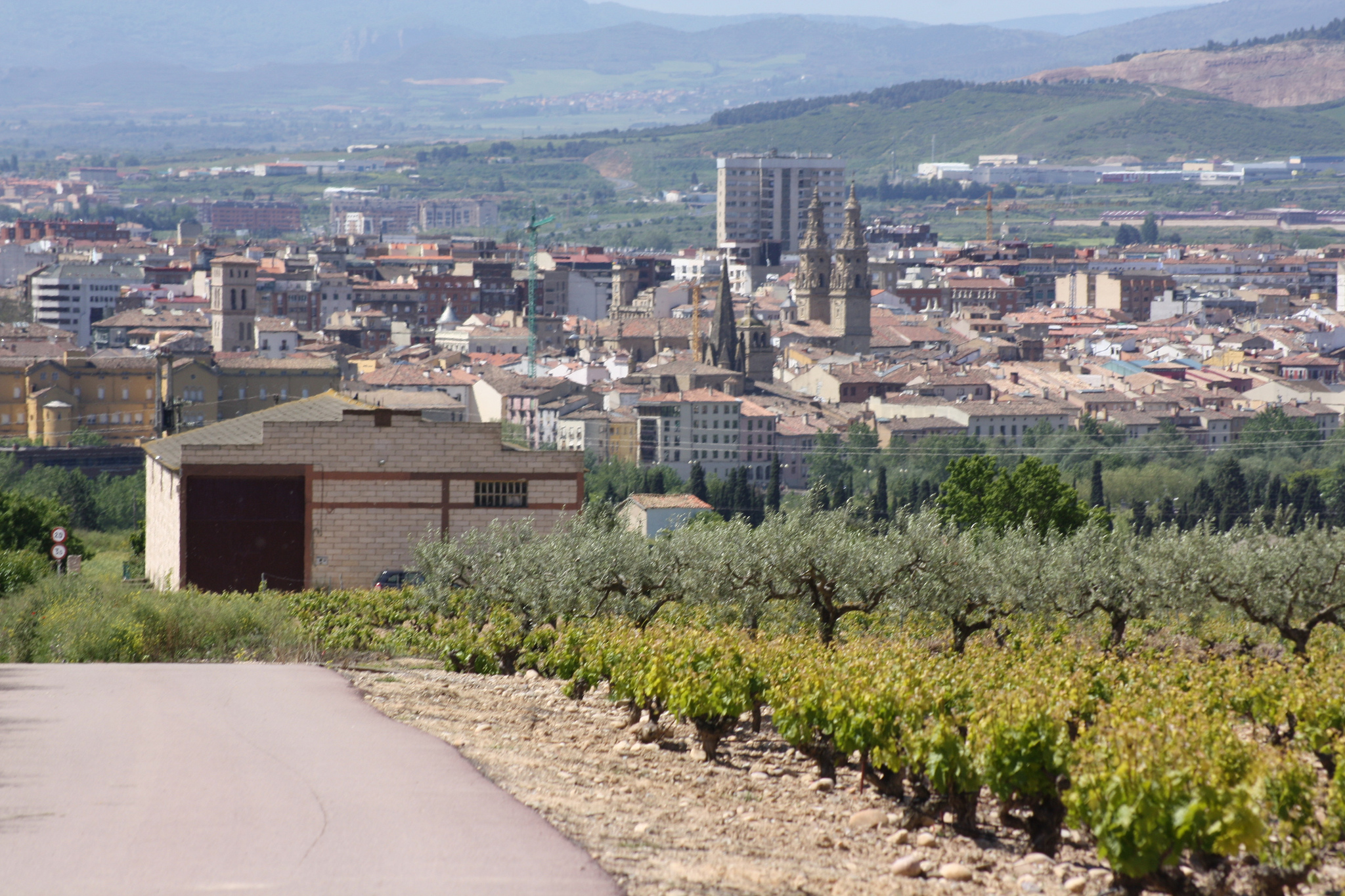
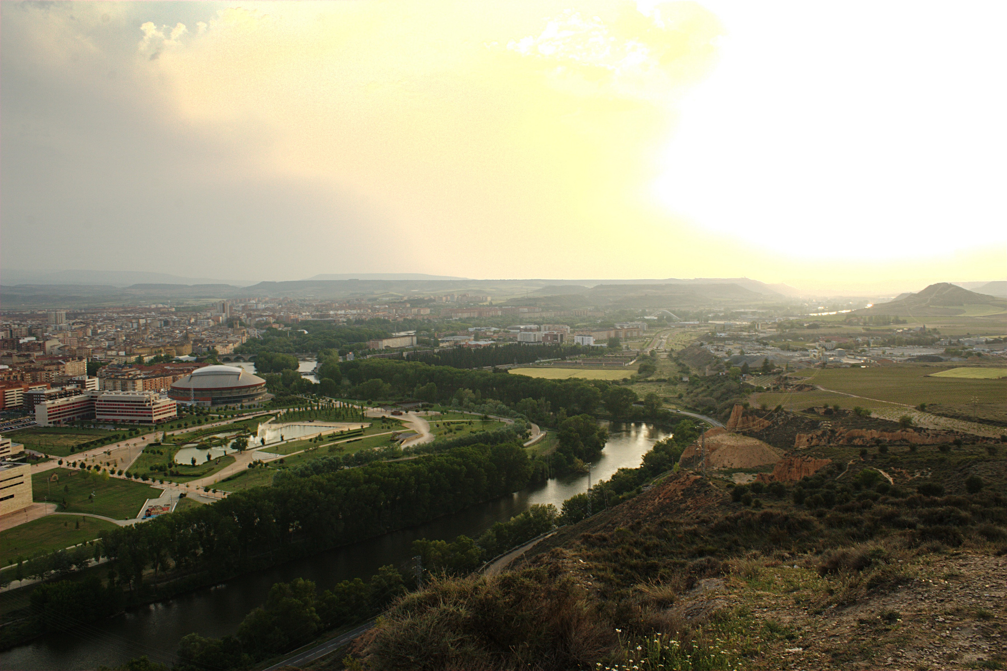
After enjoying all the views offered by this cross, we go down the slide that connects with the N-120 and it takes us to San Justo de la Vega, satellite population of Astorga. To get to the end of the stage, we can continue through the N-120 or going through pedestrian paths. You must know that if you’re not going by highway, you have to pass over the train tracks using a high inclined walkway that will make you get off your bike.

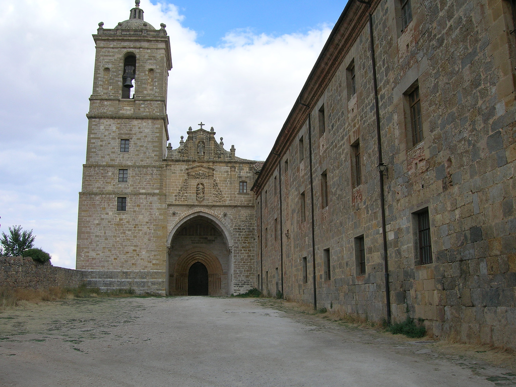
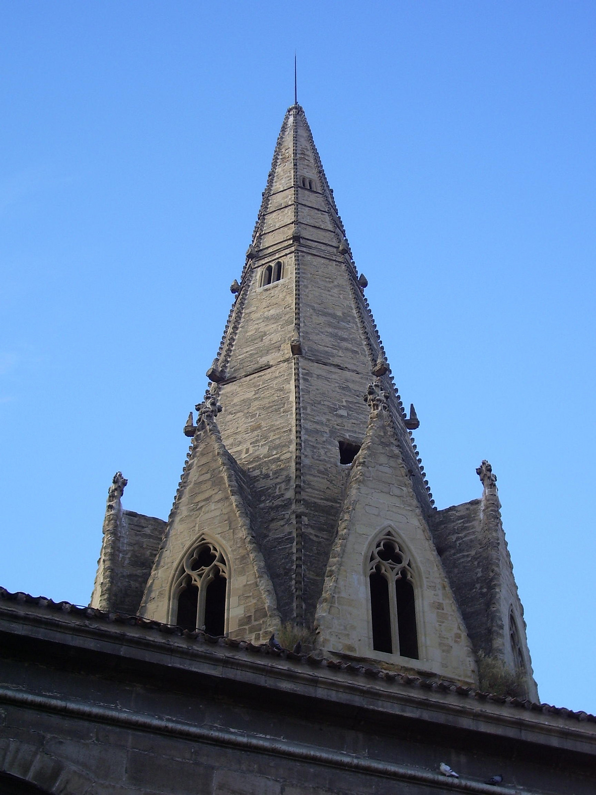
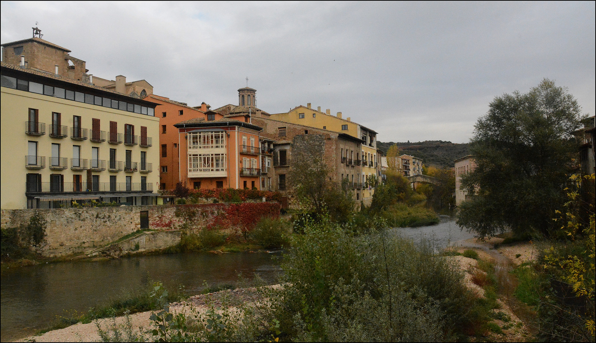
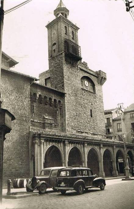
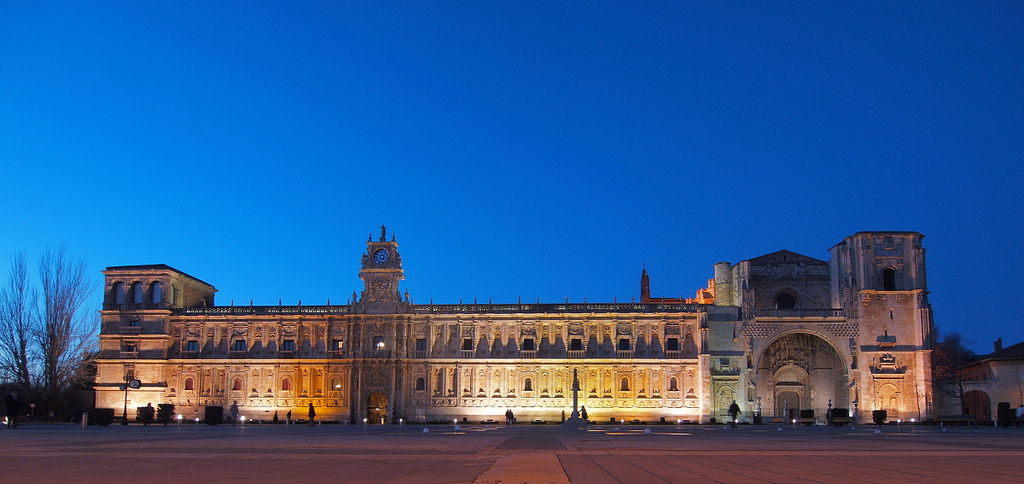
After two roundabouts and a heavy slope, we enter into Astorga, the old Asturica Augusta of romans.

Cathedral of Astorga

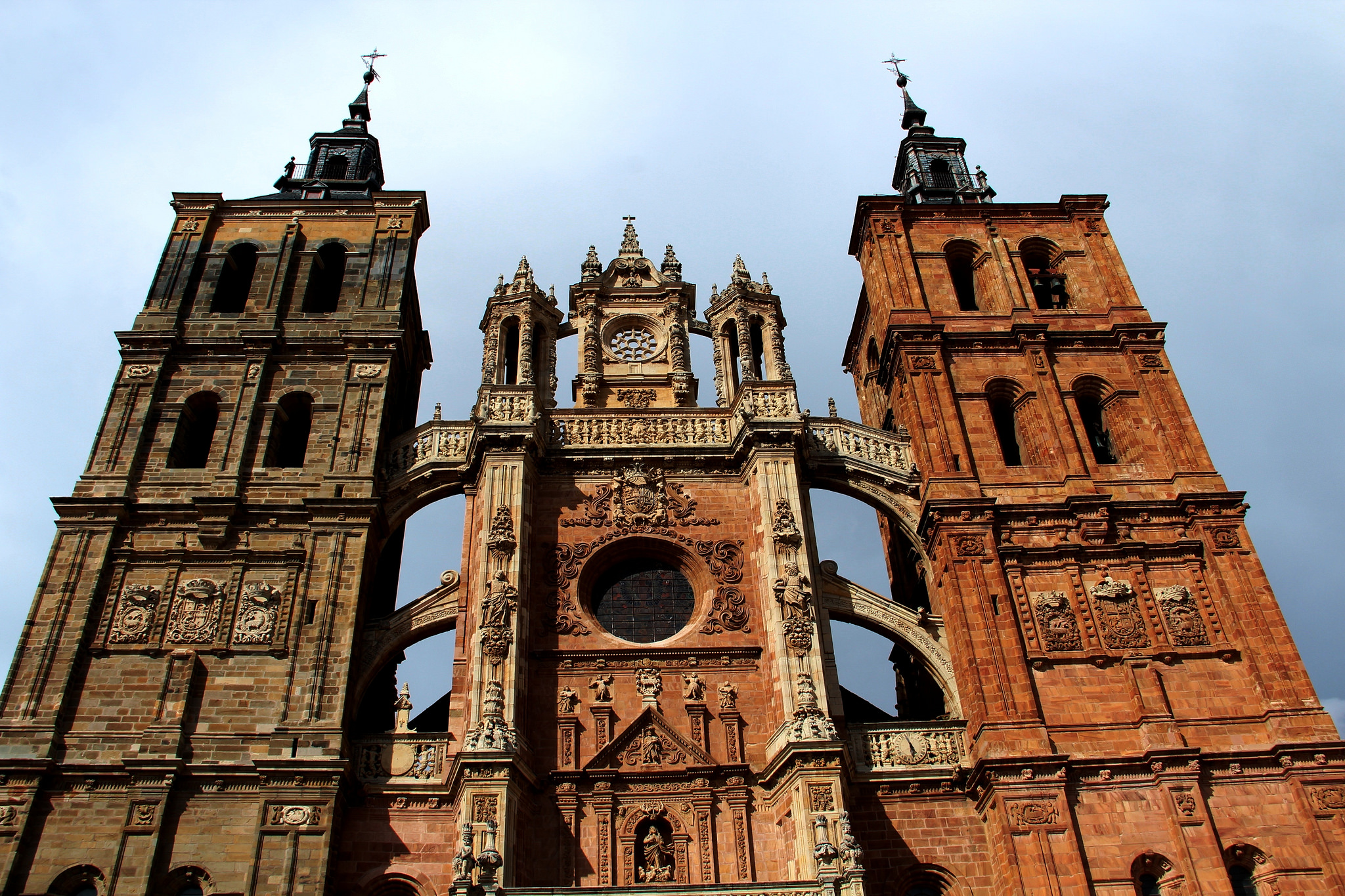
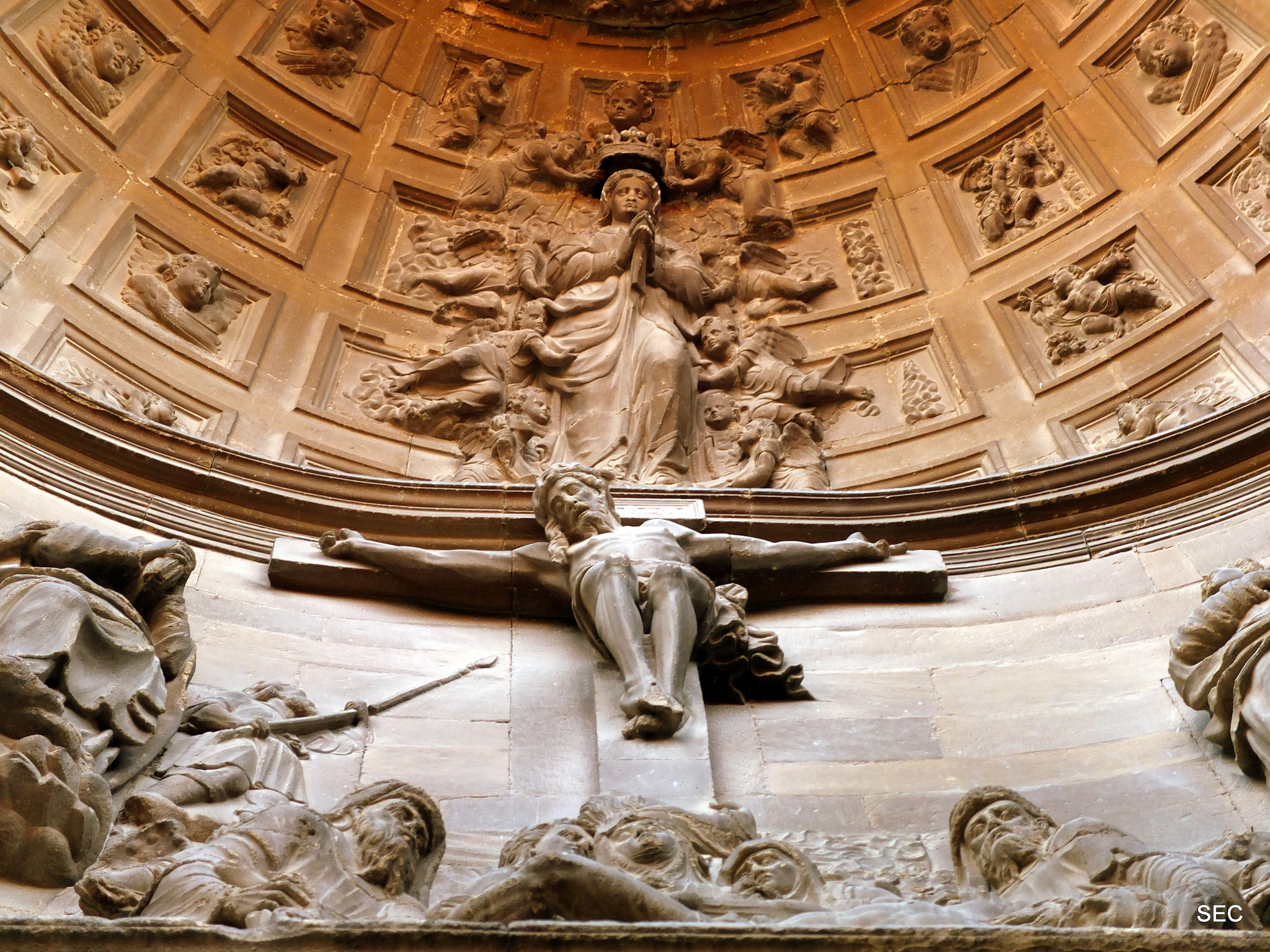
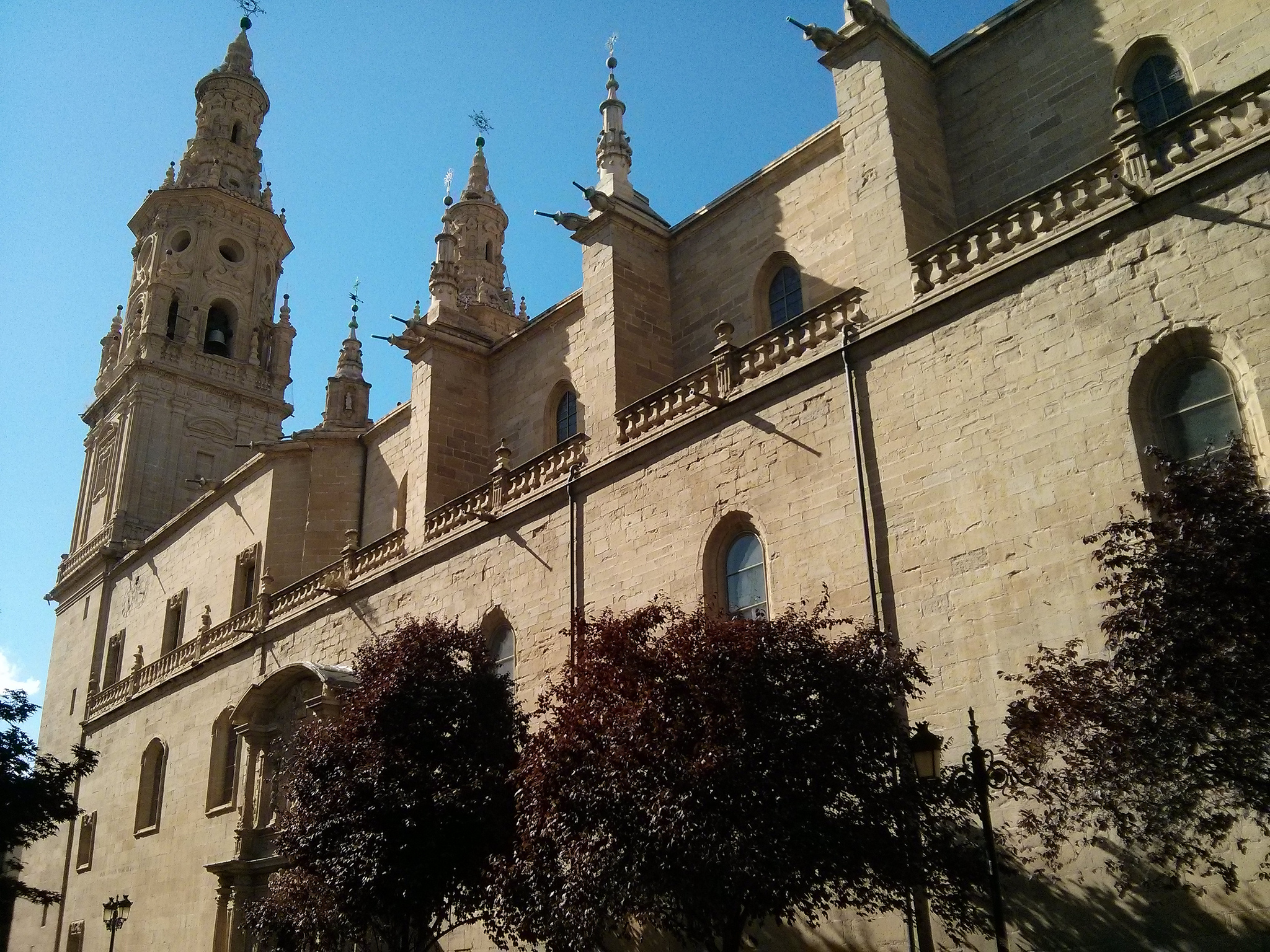
Cathedral of Astorga, picture given by Constantino Barreiro

AN AFTERNOON PROMENADE THROUGH ASTORGA

Astorga is a simple city to go all over and with so much to offer, which make of it a perfect end for the stage. In this case, it only takes 7 minutes of walking to see the main monuments of the city. In this map that we have created you can see the location of the main monuments and museums, as well as the promenade itinerary that we propose.

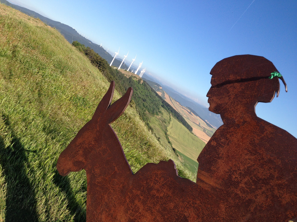
Astorga is the capital of Maragatería, a region from the central part of the León province. When we visit it, the most outstanding impression of this culture is the meeting point with all the several stores that offer the famous cocido maragato(a traditional dish). In addition to gastronomy, this entire area shares other folklore elements and traditions. This unit’s origin is actually argued, people say that it may derive from a Latin expression that means “moros cautivos” (mauri capti) thanks to having some type of Berber origin. Also, as we told you in the historical summary of the city, it could also refer itself to the mule drivers’ work, as the name says it they were traders who carried merchandise on a mule through this entire area. The mule drivers went from Galicia (sea) to Madrid (where los Gatos are), that’s where the name really come from, they were going from mar-a-gatos (from sea to cats).

We encourage you to taste the delicacies from Maragatería, but also to visit a city with a glorious roman and medieval past. In order to organize yourself better, we give you the schedules and prices of the visits. 

Take a good rest, pilgrims!

To begin, here’s a little bit of history…

We know most certainly that the current city of Astorga was an important roman center. What it’s not clear is what exactly was in the mountain where the city is located before they arrived. The wise roman Ptolomeo says on one of his books that there, it was located the capital of the Asturia’s tribes, so it contradicts the fact that its most important center was not located in the place where Asturias is today.

There’s not clear archeological proofs that there was something in that place before the Romans came, we only have chronicles and old texts of other populations talking about it. It seems a little strange because of the privileged position of the settlement, on a mountain and with great views of the environment.

What it is certain is that in the year 19 B.C the Legio X Gemina arrives to Astorga. In the previous stage we found out how another legio, one of those entities that divided the Roman Army, have founded León. In Astorga, they were also installed with the purpose of controlling the conquered territory and the benefits of the gold mines of las Médulas.

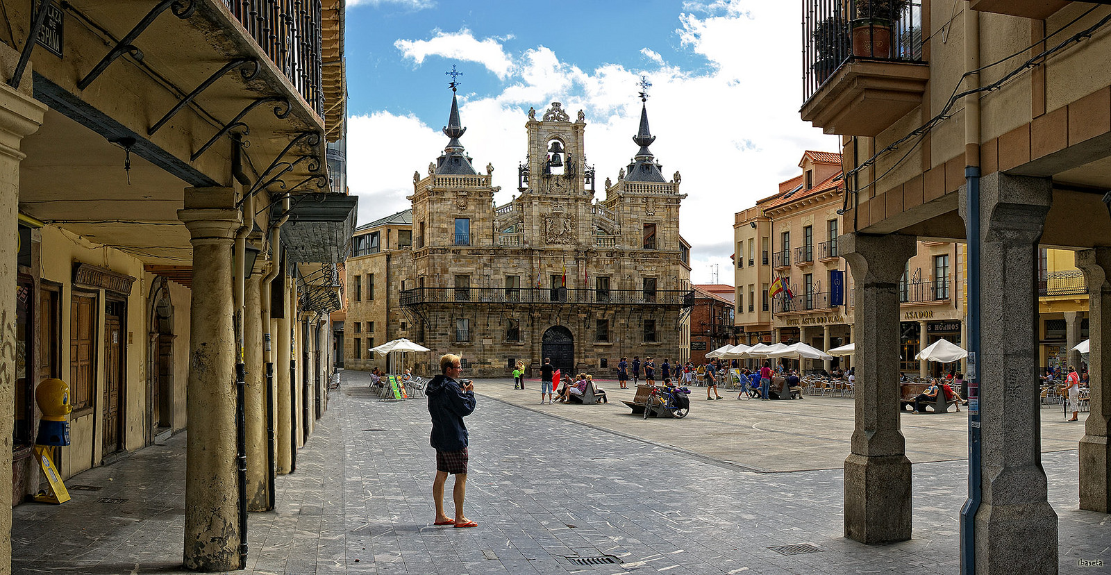
The huge importance that this center was gaining made it into a capital of one of the roman “conventus”, which today would be the same as province. Thanks to its political and administrative function there is a legacy of a great forum, underneath the Mayor Square.

Mayor Square in Astorga

Mayor Square in Astorga, picture given by FONENDEZ

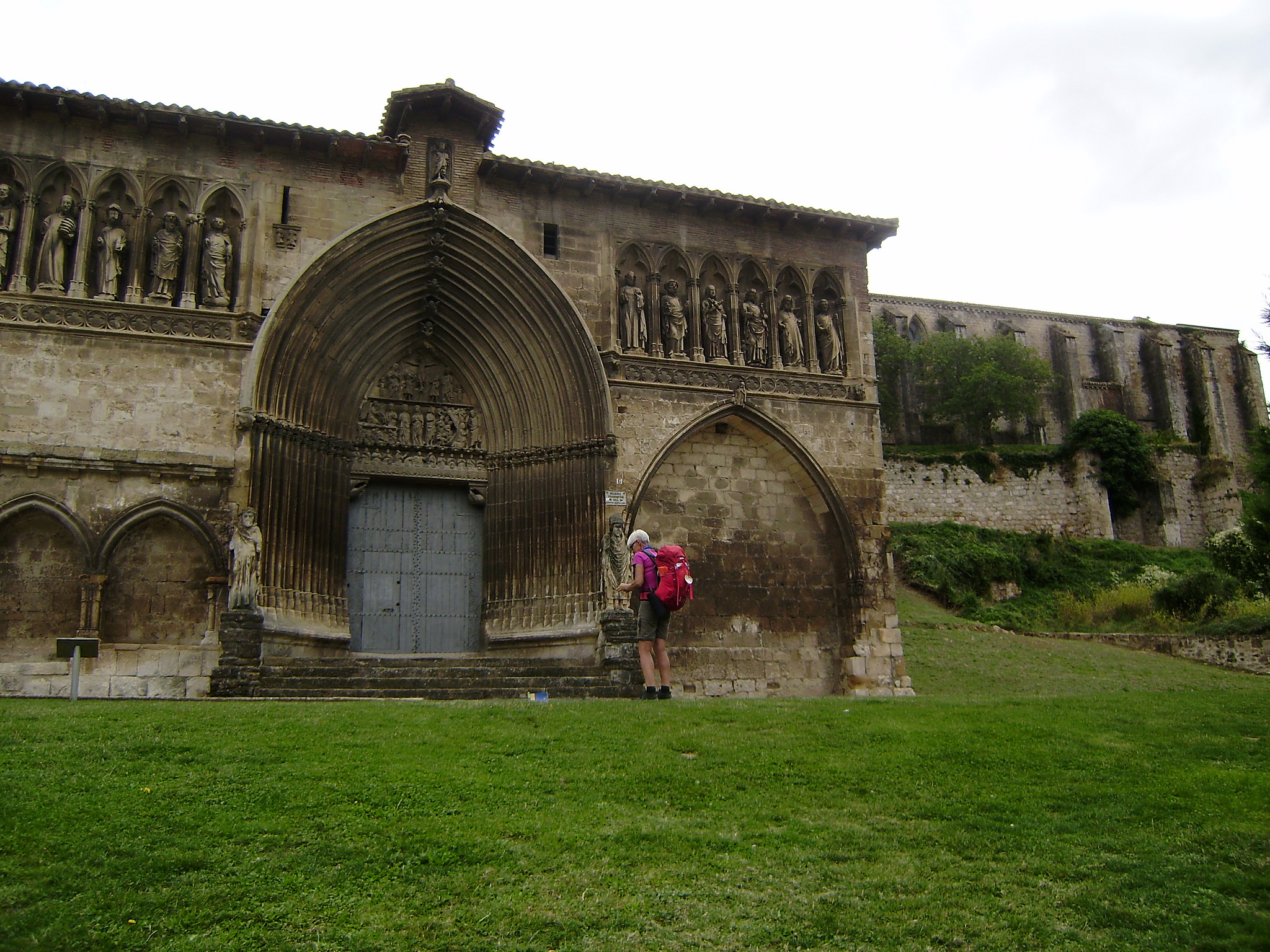
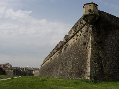
With the arrival of Christianity and the Barbarian invasions that caused the defeat of the Empire, the city finds a way to improve its defensive system building up some huge walls. These big walls from the IV century were restored in the Middle Age and even today there are still some remains in good estate of preservation. /span>

After a tumultuous period of Arabic attacks, since the year 1000 the city becomes again a permanent settlement. That’s how its medieval evolution starts, and that’s when it starts to lose the reticulated designs originated from the Roman beginnings, and appearing its big cathedral among small intersected alleys.

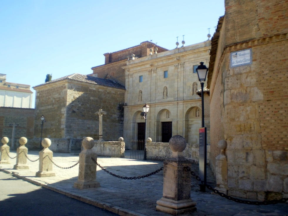
During the Middle Age, Astorga had different government periods and methods; most of them concentrated all the power in one person from an important family asked by the king’s cession. During the XIII century it belonged to an echelon and in the XV century, when Henry IV took control over the throne, a marquis from Osorio’s family took over the power. That’s how the city became a marquis place where the Osorio promoted a lot the commercial sector and the urban growth. The former roman cathedral disappeared in pro of the big construction we see today and other important religious organizations, like the Poor Clare Sisters or the Franciscans settled themselves down in Astorga.

In the XVII century the commercial sector of the city starts to grow. Principally, because the main cause of this was the importance that has been growing since XVI century for mule drivers, a method of transportation for food using a donkey or a mule. They took many items to Galicia and that’s how some important commercial relations were established. With all the cocoa seeds brought by mule drivers from the commercial ports connected to America, appeared different companies that elaborated hand-made chocolate that we still can savor today.

The city continues growing until XIX century, when a variety of epidemic diseases and the Independence War against Napoleon forced the population to go down. Also, some emblematic buildings were demolished, like the medieval castle and a big part of the wall

Besides, at the end of XIX century the train was built in the city. This affected a lot the commercial organization of Astorga, because the mule drivers disappeared and the handicraft production of the companies increased a lot, so they had to use other industrial methods. The city really grew extending territories outside the old medieval fence’s walls.

In the actuality Astorga is a modern city that has kept its traditional facts that have left a mark on its culture. We will find there all the services that we need, and at the same time we can taste the same chocolate they used to eat in the XVII century and go for a walk through the medieval streets or some parts of its glorious past.

Catedral de Santa María de Astorga

Astorga, picture given by Javier Gallego

First it was Asturica Augusta: from the forum to the current Mayor Square

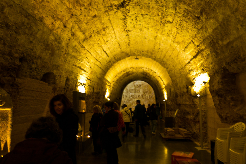
In Astorga there still are some roman ruins, for example the roman sewers and baths.  It’s very interesting to know the place that was the old roman forum, better known as “la plaza” (the square) a political center where the government used to have their meetings, it’s now the same place where the Mayor Square and the City Council are located.

The Forum of Astorga was a squared space, surrounded by a columned portico. In one of the sides a big apse opens up with a marble pavement, which it’s preserved today. It’s named Aedes Augusti and this place is so special that has made people believe this was a temple dedicated to the roman emperor.

There is a street located right on the same spot where the City Council was before; today is the location of the Roman Museum. It takes up the building of the “Ergástula”, a construction which belonged to the old forum. People think that it would surely be part of a u-shaped portico, where a high temple was located on the center. Regarding to its function, we don’t really know what it was. There are some researchers who believe it served as a slave prison who were exploited on the gold mines from las Médulas and Monte Teleno.

Roman Museum of Astorga

Roman Museum of Astorga, picture given by Roteiros Galegos

In 1999, the City Council got to recover the property and created a superior structure in order to transform it into the Roman Museum of the city. Inside of it we can find a lot of archeological ruins that make the visitors understand how life was during the last moments of the Roman Empire. The Museum’s webpage is also very didactic. We can not only find the schedules and prices for each visit but also we can learn a little bit more about Romans.

If we’re interested of knowing more about the roman past of Astorga, we can visit the roman sewers and baths called “Domus del Mosaico del Oso y los Pájaros”, an old Patrician house where a mosaic on the ground is preserved. The best part is, having to make the “Roman Route”, a promoted initiative by the City Council since 2005. The Roman baths, the sewers and the Aedes Augusti can only be visited doing that route. All the things left can be visited for free or pay separately. On this page you can find all the information..

Domus del Mosaico del Oso

Domus del Mosaico del Oso, picture given by Alberto

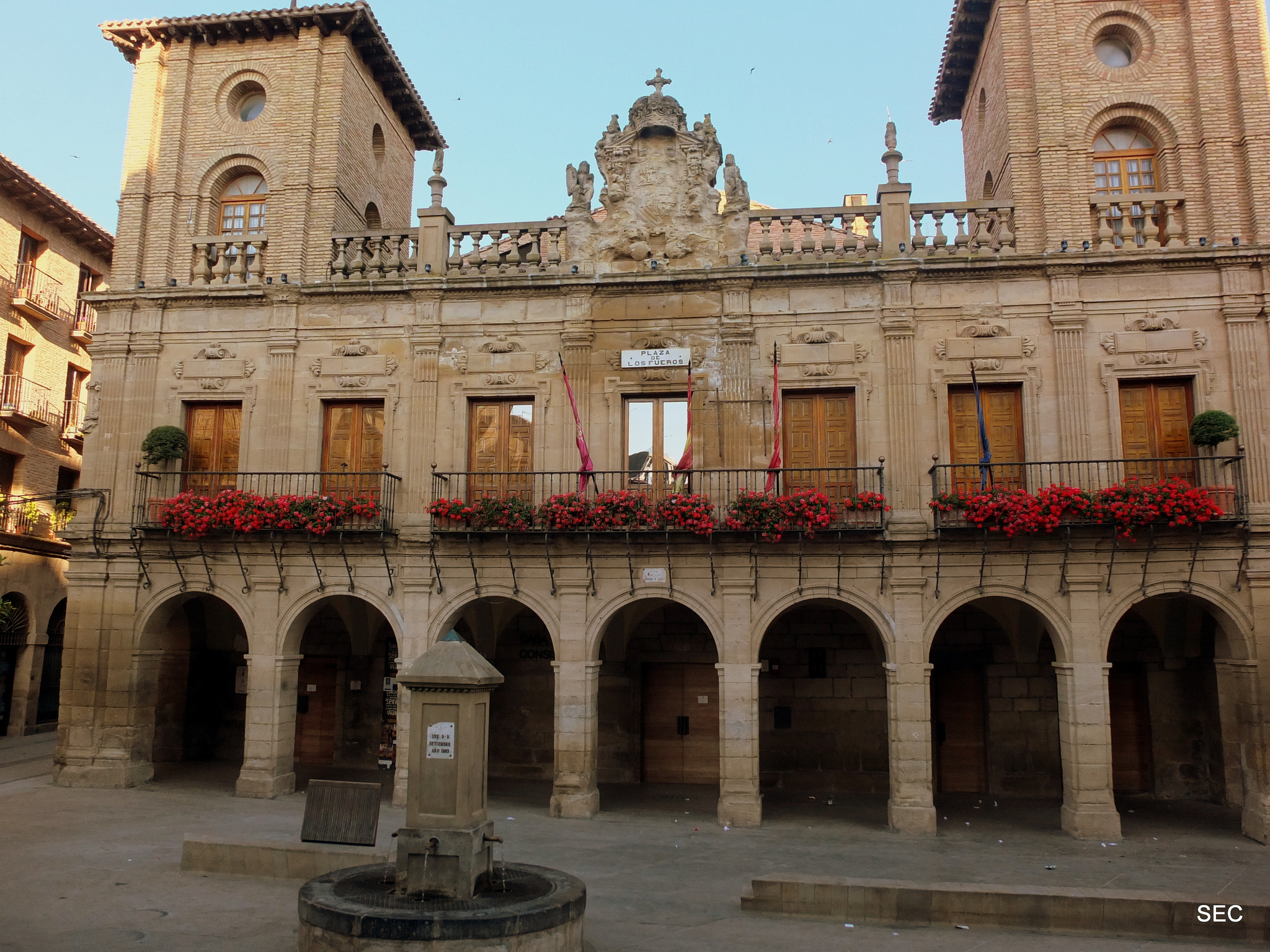
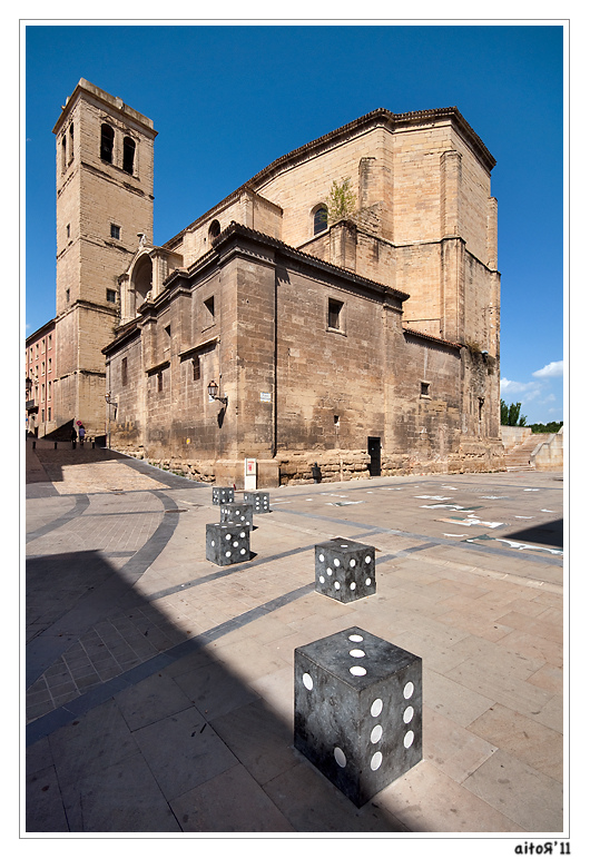
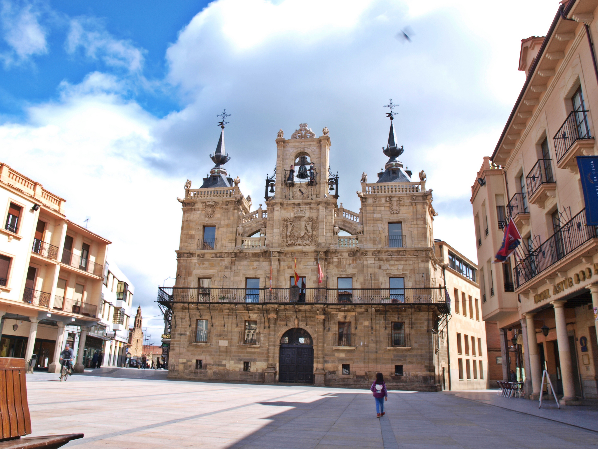
In the actuality, the Mayor Square still is the life’s center of Astorga’s government. The City Council building is one of the biggest examples of civil baroque from the León providence. During the “Siglo de las Luces” (The Lights Century), they promoted the construction of a lot civil buildings, because this illustration gave room to a political debate and the civil government. That’s why many civil buildings from Spain are baroques, mainly because at the end of XVII century and during the XVII that was the most popular style.

The building is completely symmetrical, it’s organized with two stages, the upper one has a forging balustrade. The two big sided-towers are connected to the central bell gable by some kind of balustrade sculpture that resembles as a flying buttress. From the upper part of its clock we can appreciate Colás and Zancuda, two sculptures from Maragatería that ring the bells with a mallet right on each hour from the XVIII.

City Council of Astorga with a lot of pilgrims

City Council of Astorga, picture given by Alberto Feijoo Ibaseta

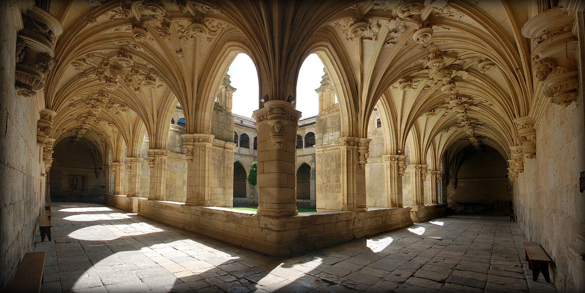
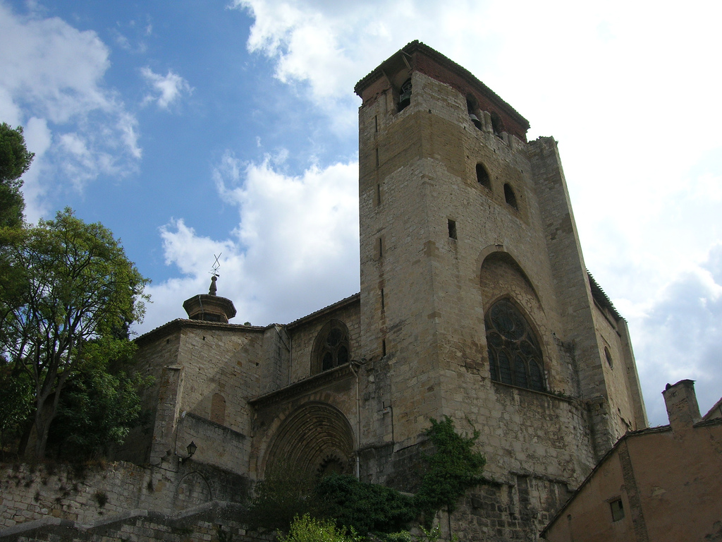
We are heading to the big medieval monument of Astorga… The Cathedral of Santa María

We go out from the Mayor Square by a pedestrian Street called Pío Gullón, on the opposite side of the City Council. After two crossroads, we must go across a pedestrian crossing and, by taking the obliquely street to our right, we will get to Los Sitios Street, which it’s wider and will lead us to the cathedral in few meters, but before passing by the Palace of Gaudí.

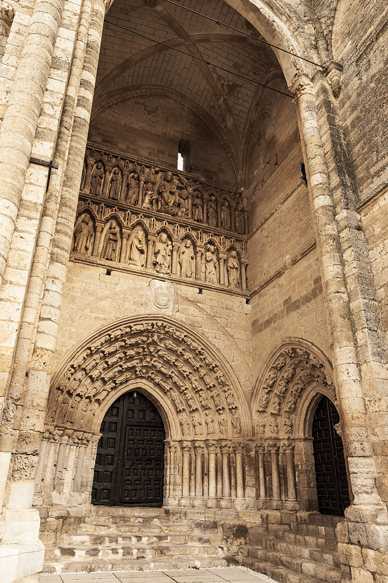
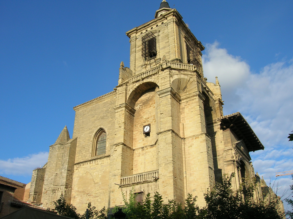
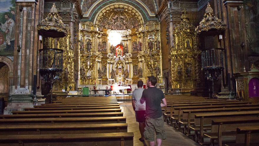
CAs we said previously, before this monumental cathedral was opened back in the XV century, there was another one but smaller with a roman style. It was demolished with the purpose of building a new one that actually lasted about 3 centuries to be finished. This delay on the construction made the architecture’s evolution to be captured through the cathedral during those three centuries, as if it were a time line sculptured on stone. The building’s construction always began with the apse, considered as the most sacred part and they always finished with the western facade. That’s why the inside of the building and its apse are in a late Gothic style (C. XV), its South cover is from the Renaissance (C. XVI) and its western facade is baroque (C. XVIII)).

Cathedral of Astorga and Palace of Gaudí in Astorga

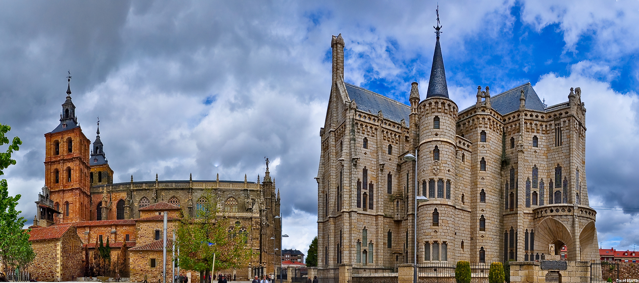
Cathedral of Astorga and Palace of Gaudí, picture given by David Martín

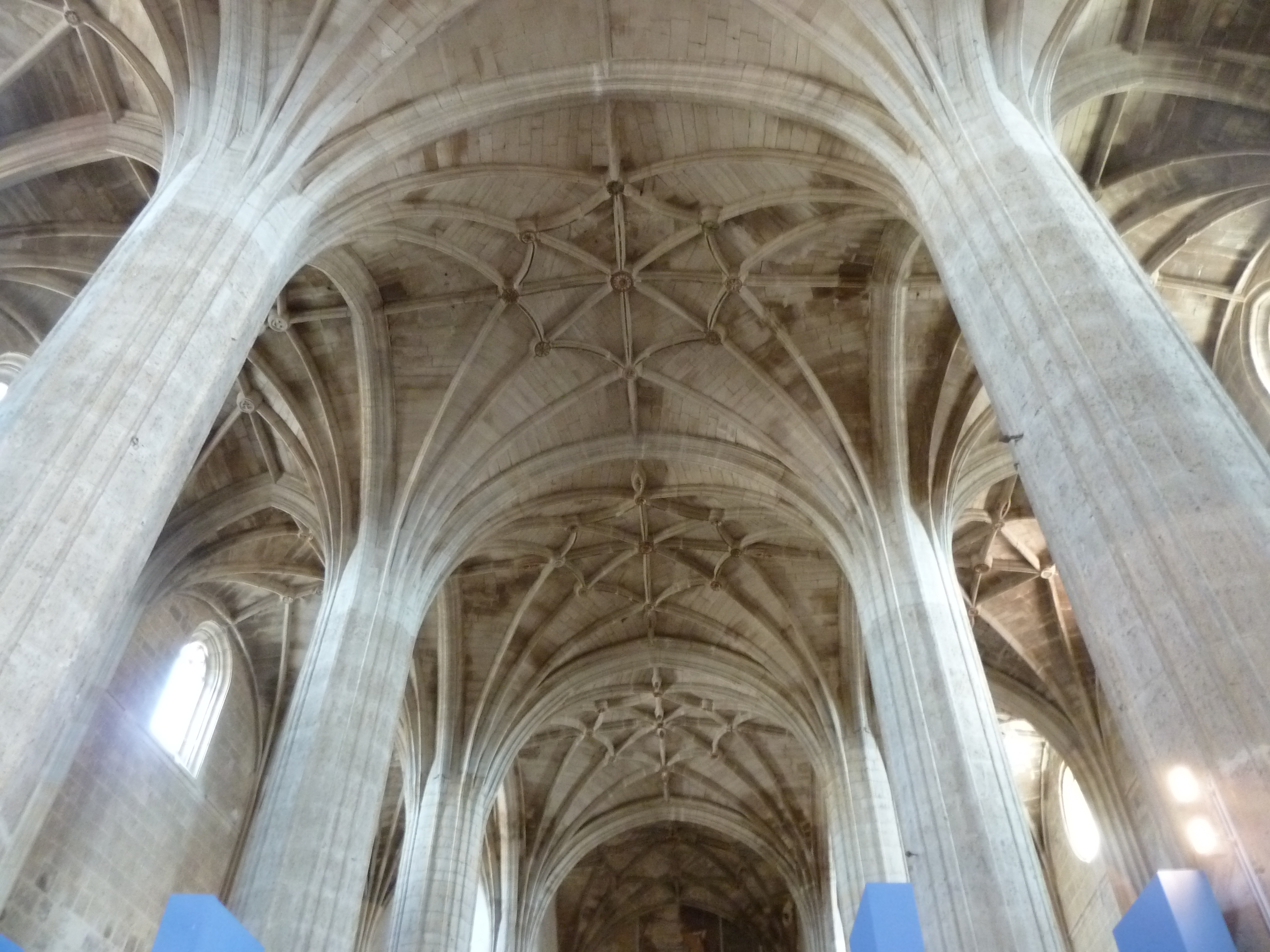
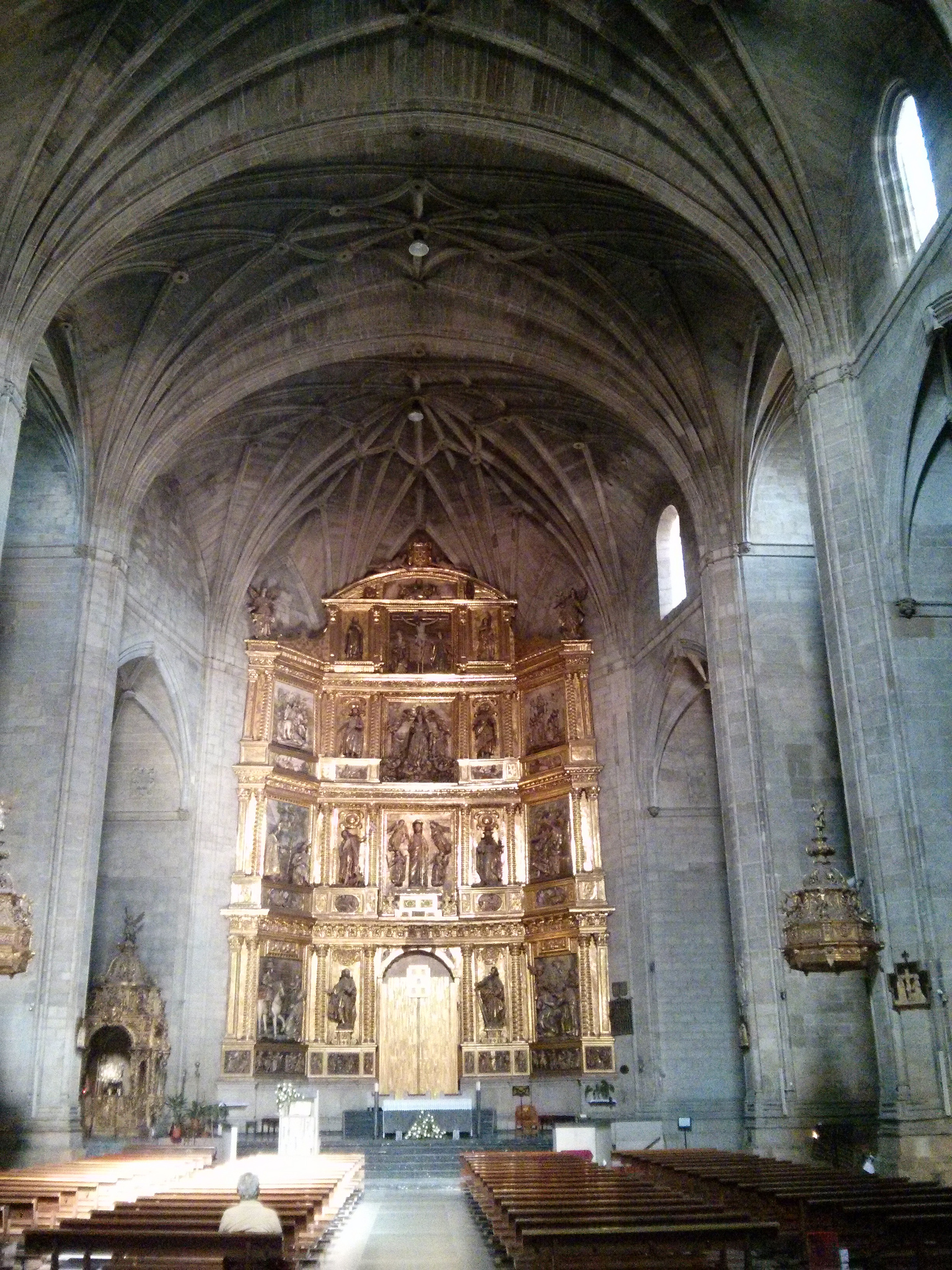
The inside is divided in three ships, which the main one is the highest and the widest, with big pointy arches as separators. Above them, it’s located the elevation’s second level, an arches’ clerestory also pointed. In these windows we don’t find colorful stained windows, like the ones back in León, but we see the natural light coming through the temple in abundance, a little bit broken by the thin decorative traceries of the windows.

The Cathedral’s vaults of Astroga are a delight. On them, the pillars tend to intertwine themselves creating complicated stars forms, that we can actually admire without getting interrupted: the clean light of the clerestory lights up the pillars, lacking of decoration, standing out all these beautiful symmetrical drawings.

Inside of the Cathedral of Astorga

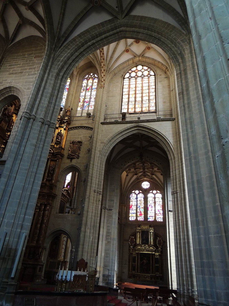
Inside of the Cathedral of Astorga, picture given by Xudros)

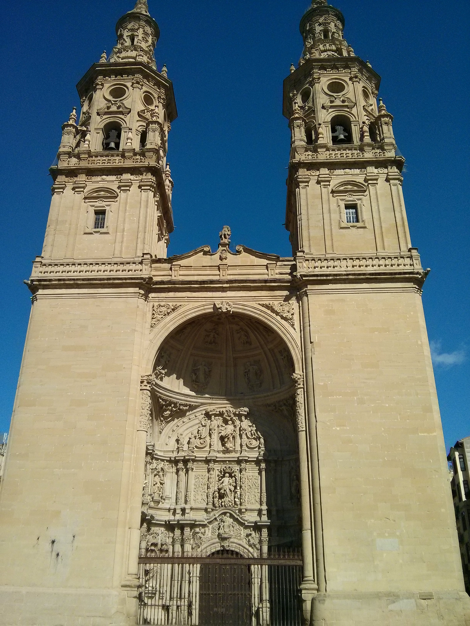
In the outside, the most outstanding part is the western facade, profusely decorated. A high level piece of the baroque from León, it resembles some kind of altarpiece, like the one we will find at the inside of the building – with the exception that that one is gold and from the C.XVI-. In the down part there are three splayed covers, maybe being an imitation of the one in León, because the central one is much bigger. Next to them, at not above them, two huge towers are built up connected to the central body by some flying buttress in the upper part.

Regarding the decoration, there are scenes sculpted about Christ’s life and Santiago also appears dressed as a pilgrim, being proof of the mark left by the Jacobean pass on Astorga’s history.

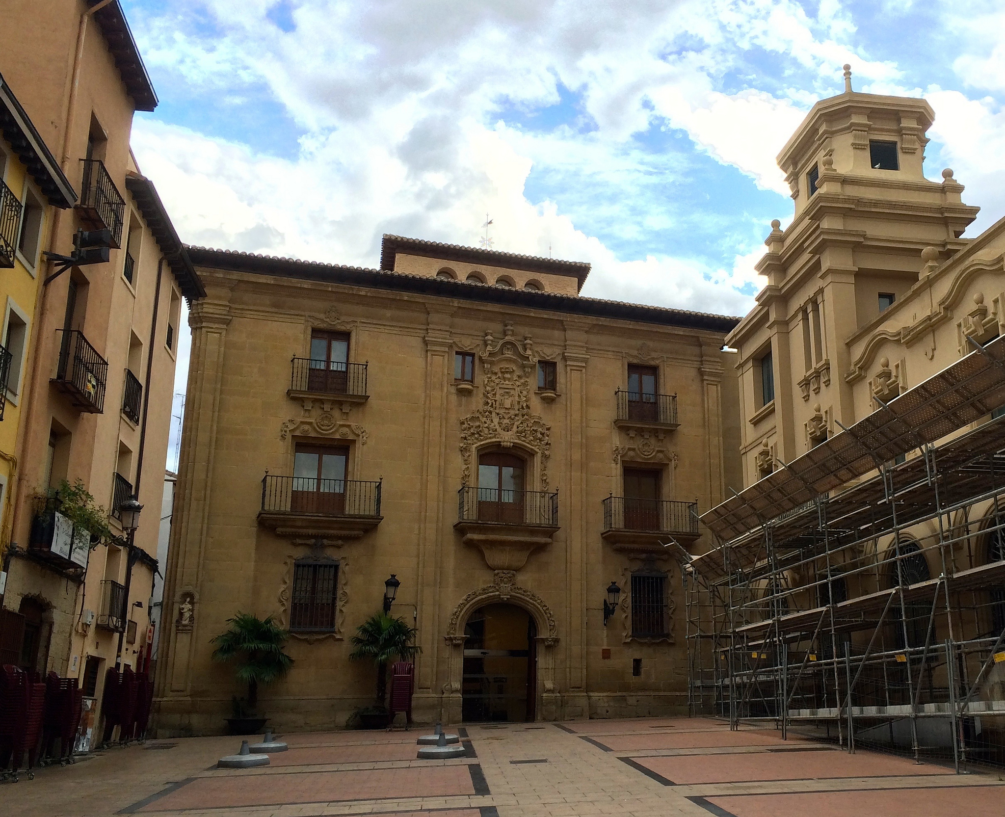
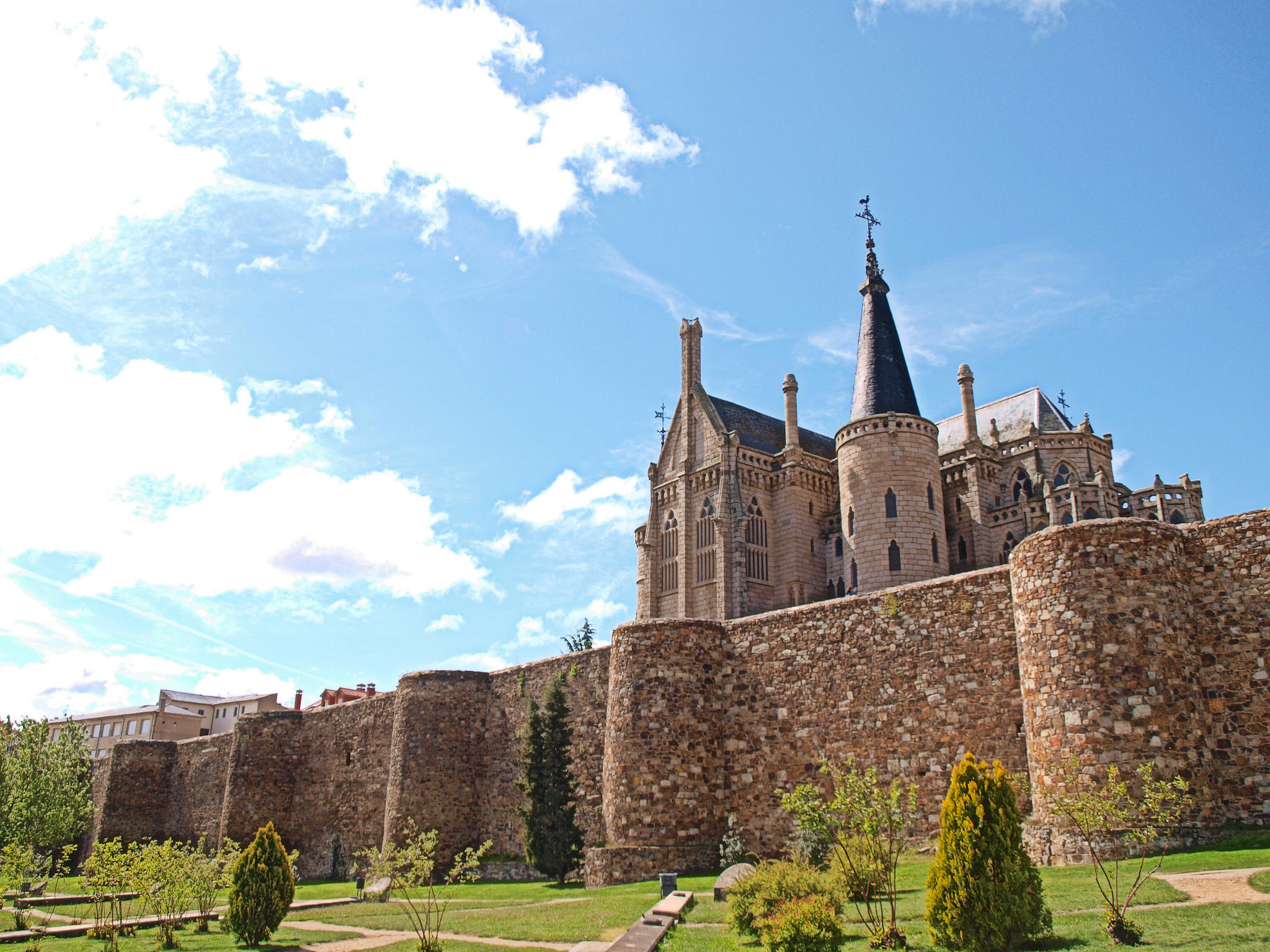
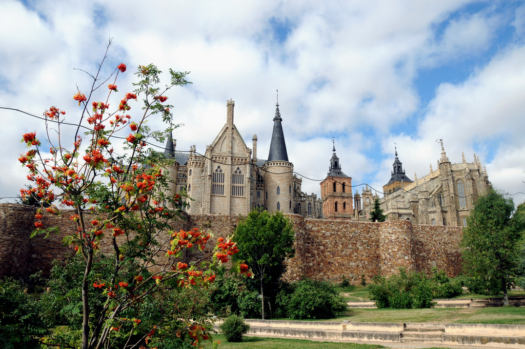
Exiting the cathedral we only have to go back a few steps to find right in our front the Episcopal Palace of Astorga, the so-called Palacio Gaudí. As we mentioned before in the previous stage when we visit the casa Botines of León, the great modern architect only made a few projects outside Cataluña, including this one. The assignment appears when the former episcopal palace of the city gets burned up in 1886 and the bishop asks Gaudí to design and create a new residency.

Episcopal Palace

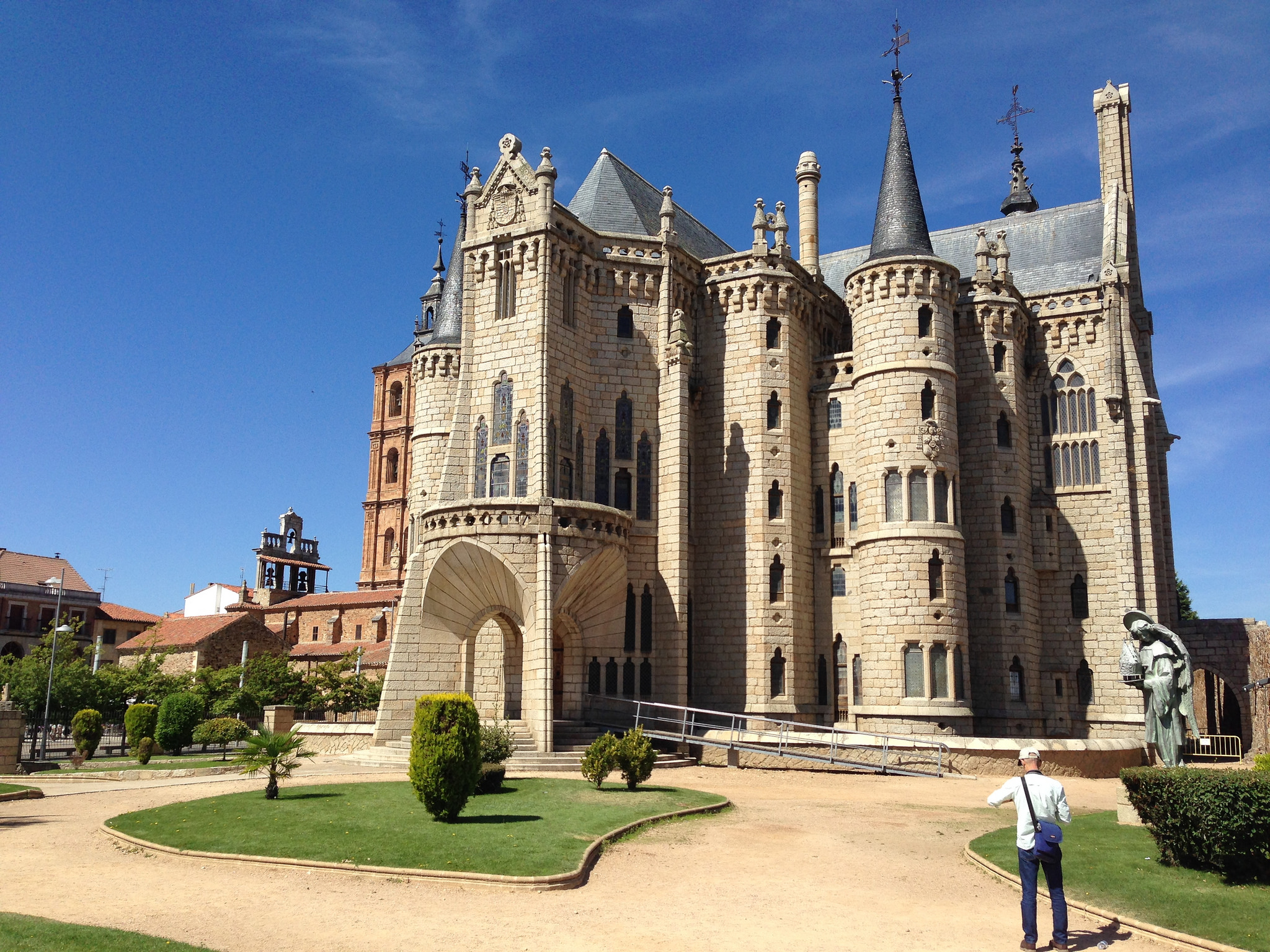
Episcopal Palace, picture given by PROtxbearmr

As we see the construction a lot of references come up to our heads, from Disney to Gothic Cathedrals. Gaudí made this palace as a reinterpretation of several historical elements, using different elements and styles. We must keep on mind that in the original design there wasn’t the external fence that we can see today, made of granite and iron and that doesn’t allow us to come close to the palace if it’s closed.

From the main facade, quite ahead, without doubt the lower portico stands up. Four big splayed arches where big keystones leave a mark, they support a cupola over pendentive. In addition, each lateral facade of the building is put in frame with big fortified towers. Three of them are similar and just one is higher. The head of the building, at the opposite part of the façade, resembles a Gothic apse, like a big ambulatory.

Although it has the appearance of a cathedral, the building’s shape isn’t a regular one, because it’s actually a Greek cross. The roof is made of slate and gable. The palace has four floors, including the basement which it is shown on the moat that surrounds the building, exactly like the medieval castles.

There are many influences on this architecture’s original masterpiece, but that one that stands out the most and calls people’s attention is the Cathedral of León: all the stained church windows are full with stained glass ones, elaborated by some prestigious studios. The drawings’ designs shown resemble the ones from the Saint Chapelle of París.

Stained glass Windows of the Palace of Astorga

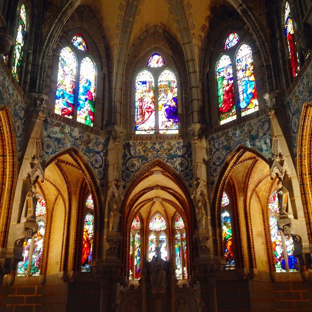
Stained glass Windows of the Palace of Astorga, picture given by Manuel Sánchez Cantón

The Gaudí Palace operates in the actuality as the Museo de los Caminos. Inside of it we can see art pieces related to pilgrimage, while we walk through the different rooms that were supposed to be a residency, but it never really functioned like that.

We choose if we want to keep on visiting Astorga and taste its popular gastronomy

In Tournride we understand that after an intense day of pilgrimage, extending the touristic visits can be tiring. That’s why we end up here our journey, but we leave you with some notes about other things you can appreciate in Astorga.

As we mentioned before, it is possible to get to know profusely the roman past of Astorga making the Roman Route: roman baths, sewers, old temples, houses, museums, etc. If we’re interested more in medieval art, at the Church of San Bartolomé (C. XI) we will see a superposition of styles that can be very interesting.

For the ones who enjoy food the most, we recommend the visit to the Chocolate Museum of the city. We will learn everything about the chocolate tradition of Astorga, due to its location with cold weather it allowed an excellent preservation of this subtle material. It only takes four rooms to go all over the museum.

Chocolate Museum in Astorga

Chocolate Museum in Astorga, picture given by Chayo

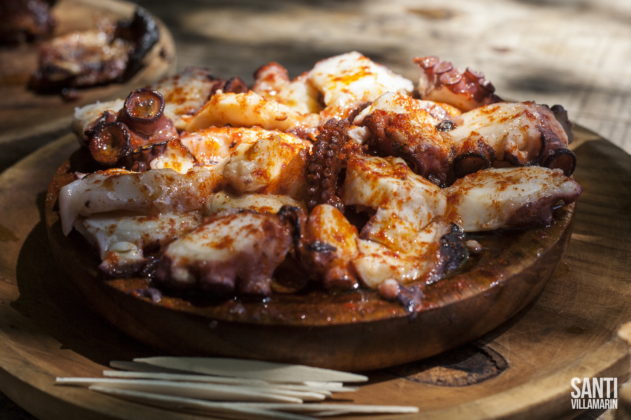
Whether we visit these monuments or not, we can’t leave Astorga without tasting its emblematic dish: el cocido maragato (The Maragato stew). Thanks to the difficult weather that Maragatería had there appeared a strong and satiating popular gastronomy. Thanks to the difficult weather that Maragatería had there appeared a strong and satiating popular gastronomy. The popular legend says that we have to eat el cocido maragato backwards, first the meat, then the vegetables and last the soup, because of the saying “de sobrar, que sobre sopa” (If something has to be the leftover, let it be the soup).. Astorga is full with restaurants that offer you the typical dish, so you won’t have any trouble finding the place to taste it.

Besides the stew, la cecina is also typical, just like in León. And, for deserts, this city is a Paradise: besides chocolates, milkshakes and sweet breads are hand-made. This is a treat for your palate.

You will have to recover energy because tomorrow we have the climb of the Cruz de Ferro. We get closer to Galicia already…

¡Buen camino, pilgrims!

Chocolate Museum in Astorga while doing the Camino de Santiago

A Sunset in Astorga, picture given by Alfredo Miguel Romero

STAGE 7: FROM BURGOS TO CARRIÓN DE LOS CONDES – FRENCH WAY IN BICYCLE

Distance to Santiago: 487 km

Stage distance: 86 km

Estimated time: 6 – 6,5 hours

Minimal height: 773 m

Maximum height: 930 m

Route Difficulty: Media

Places of interest: Castrojeriz, Frómista, Villalcázar de Sirga, Carrión de los Condes

Route Map: To see the route in Google Maps click here

Itinerary map of the stage 7 of the Saint James Way from Burgos to Carrión de los Condes

Click on the image to zoom

At this stage we will cross completely the Burgos countryside to enter Palencia, part of the so-called “Tierra de Campos”. Our body and mind will have to become familiar to circulating between a much more homogeneous landscape than the previous one in which the relief, deeply leveled, will be broken by hills that will rise like statues in the horizon and that sometimes we’ll have to cross.

There are those who despise this French Way part and focus on crossing it as quickly as possible, dismissing what is seen as monotony without inducements. It is true that this part is hard – especially in summer – but it is also an essential of the pilgrimage part: The image of its fields is one of the most recognizable of the Way. Our eyes will follow for miles this print, a route in a straight line, flanked by golden fields among which stoic oaks will sometimes rise. Which is very possible that we seal in our retina and there will be a source of peace and tranquility for the future, reminding us the serenity of the pilgrimage, and the great opportunity it offers us to focus on ourselves?

Let us now forget the world in which the pre-eminence is immediacy, innovation and permanent changes. On the opposite, let the harmony and environment stillness encourage our introspection. Pilgrimage gives us time to think and not simplify what is complex, so remember Machado, Unamuno or Fernán González and find in Castile a world full of nuances, rich landscapes and humanity.

PROFILE AND STAGE’S MAIN ROUTES

This stage runs mostly through tracks of good ground between fields and, at the end, by asphalted county roads. Normally, the profile is much leveled and the height differences will be exceeded over long distances, so that the descents will be smooth and pleasant. The climbs will not be extremely hard.

There are only three points where we can have more complications with the profile:

  • When arriving at Hornillos and Hontanas there are two toboggans descending to the town that are remarkable but also do not have much technical difficulty. It is necessary to keep on count that, especially in Hontanas, the elevation difference is such that the town is not seen until you almost have it ahead, which makes it psychologically hard because it seems that you pedal and don’t move forward.
  • El Alto de Mostelares es otro punto de complicación, justo a la salida de Castrojeriz. is another point of complication, just outside of Castrojeriz. Here we must to go through a 140 m rise in just over 1 km, with an average relative slope of 11%. The descent is also vertiginous, in firm ground with loose small stones.
Slope down to Hornillos Del Camino, called "Matamulos"

Slope down to Hornillos Del Camino, called “Matamulos” (Photo by Jorge Gañán)

Actually, the greatest difficulties that this stage supposes are the mileage, and especially if we travel in summer, the wide distances without shade between populations and services. It is true that it is longer than the previous stages but also the plain helps to gain speed and the terrain is favorable.

To leave Burgos you have to cross the university campus of San Amaro where, after crossing the bridge over the Arlanzón, we can use the bike lane until the N-120 which turns left and the signal tells us to cross the pedestrian’s passage to Benito Pérez Galdós Street. At that point we have two options: cross and go the original way or skip it and go on the N-120 until Tardajos.

If we go by the traditional we will take the street Benito Perez Galdós. Turning on a dirt road until reaching the municipal area of ​​Villalbilla de Burgos, where we will first cross the railroad tracks, then the BU600 for an overpass and then the A-231. The road then runs parallel to the N-120 until Tardajos.

In Tardajos, we already lose the N-120 and we will not find it again until Carrión de los Condes. Therefore, to visit the localities in this stage is necessary to go along the traditional way. Most of the time the firm will be land, although in some stretches the Camino de Santiago coincides with asphalted tracks or county roads.

Tardajos and Rabé de las Calzadas are joined by a tarmac track of 1.5 km. After crossing the village, it is necessary to cross 8 km to Hornillos Del Camino by a path between fields. It begins with a gentle but permanent ascent of 4 km until reaching a high (917 m of altitude) from which we can comfortably descend to Hornillos.

Rabé Trail of the Causeway to Hornillos Del Camino, surrounded by desert fields

Rabé Trail of the Causeway to Hornillos Del Camino (Photo by Jorge Gañán)

When arriving, we are 11 km ahead to Hontanas by another path in which the only place with services that is there is the hostel of San Bol, in a detour to the left to the 6 km. During this section we reached the maximum level of the stage (930 m).
The trail terminates on a 200 m slide where 50 m of difference of altitude is lowered to the Hontanas town center (kilometer 31 of stage).

Pilgrims on the road to Hontanas doing the Saint James Way by bike

Road to Hontanas (Photo by Hans-Jakob Weinz)

From Hontanas it is about 10 km to Castrojeriz.. Los primeros 5 km requieren más dificultad técnica, ya que el sendero se encuentra en la ladera de una colina y hay piedras sueltas. Después, el camino de Santiago en este tramo coincide con una carretera comarcal que pasa por las ruinas del monasterio de San Antón y termina en Castrojeriz. Debido a la dificultad del primer tramo,The first 5 km require more technical difficulty, since the trail is on the side of a hill and there are loose stones. Afterwards, the Santiago road in this section coincides with a regional road that passes through the ruins of the San Antón Monastery and ends in Castrojeriz. Due to the first section difficulty, in Tournride we recommend – especially in times of influx of pilgrims – go by the regional road from Hontanas, when crossing the exit village.

After crossing Castrojeriz we head towards Itero de la Vega, from which we are separated 11 km. In the middle, stands the aforementioned Alto de Mostoles, in which we recommend compensating the climb hardness with the enjoyment of beautiful views offered and extreme caution in the descent.

Cerro de Castrojeriz seen from the top of Mostoles in a cloudy day

Cerro de Castrojeriz seen from the top of Mostoles (photo by Santiago López-Pastor)

Before arriving at Itero de la Vega, we crossed the Pisuerga River by a large stone bridge that marks the border between Burgos and Palencia. The original road immediately turns right by a dirt track to go to Itero and from there to Boadilla Del Camino but, if you prefer, you can continue straight on the P432 road to Boadilla (1 km less than the trail).

If you take the traditional way out of Itero de la Vega you will travel 8 km between fields to Boadilla Del Camino (kilometer 60 of stage): the first half in slight rise and the second in soft descent.

Two pilgrims doing the Saint James Way by bike on the road to Frómista

Road to Frómista (Photo by instant10)

From Boadilla Del Camino there are only 5 km to Frómista, in a flat profile and along a path that runs along the Canal de Castilla southern bank. We cross the canal just before entering the town by a manual lock of S. XVIII and we arrive at the town center.

Canal de Castilla Locks

Canal de Castilla Locks

The road between Frómista and Carrión de los Condes is permanently parallel to the P-980 in the form of a gravel path, so we can choose to use it or go along the road. They are 20 km in which every 3,5 or 6 km there is a town: Population of Campos, Revenga de Campos, Villarmentero de Campos and Villalcázar de Sirga. The profile is slightly uphill the first 17 km and soft down at the end, although it is not very noticeable.

In Población de Campos, before crossing the river Ucieza Bridge, there is a detour that marks an alternative way until Villarmentero. It goes along the river north bank. If you are not going to go on the P-980 because you prefer the trails, this may be a good option for you. It is quieter and there are fewer pilgrims on foot.

A pilgrim doing the Way, passing through the trail to Villalcázar de Sirga

Trail to Villalcázar de Sirga (Photo by José Antonio Gil Martínez)

In general, stage 7 from Burgos to Carrión de los Condes is long and characterized by tracks between cereal fields, joining populations separated by distances of between 5 and 11 km. The exception is the final part, between Frómista and Carrión de los Condes, more populated and by county road. The stage profile of the Camino de Santiago on bicycle has no complications except in the ascent and descent to Alto de Mostelares, where we must exercise extreme caution.

PRACTICAL TIPS

  • Burgos is the center of a good number of communication routes, so if you start here your way you will have no problem getting there. We give you options:
  1. Bus: The station is here  and every day there are connections with the Peninsula main cities. Some of the companies that have direct routes with the city are Alsa and Autobuses Jiménez.
  2. 2. Train: The station is here and directly or indirectly connects with the main Spanish cities. For more information you can consult the Renfe’s website.
  3. 3. Car: Burgos has very good connection with all the surrounding capitals and, from there, with the rest of the peninsula. If no acquaintance is encouraged to take you, you can always use platforms like Blablacar.

Although there is an airport in Burgos, in fact the Camino de Santiago border on its entrance into the city, as we saw in the previous stage, currently has no commercial flights.

Remember that in Tournride we leave the bikes for the Camino de Santiago in your lodging in Burgos if you start there  and we can take your spare luggage so that it is waiting for you in your way end.

  • Always be aware of the distances between populations, especially in summer. Eleven kilometers can be very long if we do not get enough water or food.
  • Avoid pedaling during the summer in the central hours of the day as there are miles where there is no shade where you can get away from the sun. Always wear glasses, cap and sun cream.

DETAILED ITINERARY AND HISTORICAL-ARTISTIC HERITAGE/b>

At this stage we will enter fully into the fields of Castilla. Its golden color will dye the way between visits to different towns that, many times, will have a heritage that will amaze us. We will discover small and friendly towns among others such as Castrojeriz, Frómista and Carrión de los Condes, who culturally have much to offer.

But in addition to these stops, we will find places on the road as impressive as the convent of San Anton ruins or the views that will offer us the peak of Alto de Mostelares.

Panoramic view of the green fields from the Mostelares top

Panoramic view from the Mostelares top (Photo by total 13)

SALIMOS DE BURGOS AND WE GO THROUGH FIELDS UNTIL “FALL” IN HONTANAS

In Tournride we know that the big cities outings can be a bit confusing for the pilgrims in bike, since sometimes the signals are a little hidden. In the itinerary map you have marked the route, but here we detail it better.

Putting as an exit point the municipal hostel, you have to follow Fernán González Street leaving the cathedral on your left. We arrived at the Arch of San Martin. This arch is shaped like a horseshoe and uses brick because it was built in the 14th century by Mudejar architects, that is, Christians who lived in Muslim territory.

Arch of San Martín made of stone

Arco de San Martín (photo by Salvador G. de Miguel)

AWhen crossing the Arch of San Martin, the arrows indicate that we go down the stairs to the left, but for us it is much better to go straight and turn 60 m later, avoiding the stairs. Take the Emperador street, which turns left into Villalón street and leads us to cross the Arlanzón. The stone bridge that allows us to get around the river is called “de malatos” (sick) because in the past there was a hospital for lepers.

After passing it we enter the area of ​​the Parral Park and the University campus.. Although the arrows indicate the park central path, for us it is much more comfortable to go by the bike path that runs alongside the N-120.We can follow it for 1.5 km, drawing in three roundabouts in a straight line.

When the N120 turns to the left, we are shown the crossing of the zebra crossing to the right to continue along Benito Pérez Galdós street. Although it is not to follow the traditional route, know that the N-120 will take you direct to Tardajos,, the first stage population. The distance to travel is the same (7.5 km), but without crosses or detours.

If you prefer to go along the original route, follow Galdós street until it becomes a path that alternates with dirt and asphalt and leads you to cross the railroad tracks, the BU600 road and the dual carriageway. The final stretch coincides with the N-120 and leaves you in Tardajos.

Tardajos and Rabé de las Calzadas are joined by a paved track of only 1.5 km long. Both places have Roman past and, in fact, were located in a strategic point in which different roads converged, including the “Fifth Way” that united Clunia – in the south of Burgos – with Sahagún. The name of Rabé “de los Calzadas” comes from there.

The river Urbel runs vertically between the two towns and in the Middle Ages used to flood constantly. This was very unimportant all the way between both localities, which affected the communication and ended up establishing the following saying: “From Rabé to Tardajos, you will not lack works; From Tardajos to Rabé, free Dómine.”. Do not worry; nowadays the road is much easier!

Rabé de los Calzadas reached a greater splendor than Tardajos in the Middle Ages, although Tardajos also had a hospital for pilgrims. Of the castle and the three churches that were there, today is very little and the place most remarkable is the palace of Villariezo, which we see at the town entrance, of S. XVII.

Rabé de las Calzadas village

Rabé de las Calzadas (Photo by total 13)

From Rabé to Hornillos there are 8 km that we must walk along a dirt path between fields.. The first half is in permanent climb and, when arriving at the top, we will see a slope of descent until Hornillos, which is in a valley. For the pilgrims on foot the descent is hard, since loading with weight becomes long – in fact this section is called “Matamulos” -, but in bicycle this Santiago road section has no difficulty.

Road down to Hornillos surrounded by green fields

Down to Hornillos (Photo by A. Herrero)

We arrived at our 21 kilometer stage, Hornillos del Camino, with a prototypical Jacobean urbanism. Its main street coincides with the French Way and runs exactly from east to west. Today it has all the services and, as is usual in this type of localities, its church stands out in height and size among the small houses of two floors. Formerly it had a hospital for pilgrims that was founded in the S. XII by the king. Subsequently, the monarch gave the whole town to a French Benedictine monastery.

Leaving Hornillos we have to drive for 11 km along a path between fields, on a slight vertical slope for the first 4 km and then practically flat when arriving at the valley of San Bol. At 6 km, there is a detour signposted to the left to Go to the shelter and hostel of San Bol. Given the desert of this moor, this is an important place for pilgrims on foot, who often leave from Burgos and are already exhausted at this point so they need a place where take refuge.

Hontanas is at a lower level, so from afar you cannot see on the horizon. When we arrive, a 200 meter slide will leave us in the village center. The locality top toponymy comes from the old springs (“fontanas”) that there was in the place and that became an oasis of peace for the medieval pilgrims, after crossing the previous paramo without shadow. Today it has all the services that modern walkers may need.

Down street in Hontanas (Photo by Hans-Jakob Weinz)

Down to Hontanas (Photo by Hans-Jakob Weinz)

Before going down to the village, to our right we will see a picnic area next to a small hermitage. The place keeps an image of Santa Brígida, a Swedish woman born in a family of high birth at the beginning of S. XIV that had religious visions from small and that peregrinated to Santiago de Compostela, in addition to other destinations like Holy Lands.

Already in the village, we will be struck by the church that is in the center,, with a tower that surpasses in height to the rest of constructions. The temple is dedicated to the Immaculate Conception and has Gothic origin (S. XIV), although it was later rehabilitated in the S. XVIII, reason why it has neoclassical appearance. This can be seen, for example, in the use of classic elements to decorate the tower: semicircular arches and pediments (triangle shaped trimmings).

WE PERCEIVE THE SAN ANTÓN MAGIC CONVENT AND ARRIVE TO CASTROJERIZ, LAST BURGALES

At the exit of Hontanas the arrows indicate the road crossing to take a path that follows by the slope of a hill and that in 4 km returns us back to the road. Since the trail is narrow and does not have any type of safety wall to avoid the fall by the hill, we recommend obviating the arrows to the exit of Hontanas and instead of crossing the road continuing by her directly until Castrojeriz. Of course, caution because it is a narrow road and double meaning that, in the end, we should also share with the pilgrims on foot.

Six and a half kilometers after leaving Hontanas we will see the impressive San Anton monastery ruins. In Tournride we recommend you stop to enter the monastery, as it is one of those enigmatic and the French way spiritual places.

The first thing that strikes you is that the road itself passes under an imposing portico formed by two large arched ogival arches that frame the old church north portal. The flaring cover has 6 archivolts full of sculptures, which are surprising because of their good state of preservation. To the right, in cover front, there are two niches on the wall. These holes were actually cupboards and were used by the monks to leave bread and wine to the pilgrims, since this place was focused from its foundation to the walker’s attention.

Portico of the old monastery of San Anton, with the road through which the road underneath

Portico of the old monastery of San Anton, with the road through which the road underneath (photo by Werner)

The convent was founded in the 12th century, although the remains we see today are Gothic (S. XIV), hence the pointed arch use.. In the Peninsula was a very important center of San Antonio Order until in the S. XVIII the king Carlos III delegated its management to the private scope. Since the confiscation of Mendizábal in the 19th century, the place was abandoned and since then began its decline, although the good ashlarry with which it was made allowed it not to collapse at all. In 2002 began a rehabilitation project for the attention of pilgrims and today it is possible to sleep there, being the pilgrim’s fundamental principles the same as the Antonines followed a thousand years ago: gratuity and austerity.

If you skirt the building you can enter the church, today without a roof, on the south side. Looking at the structure we can distinguish the organization that had in three ships. The apse wall is quite well preserved, with large buttresses attached to the windows.

Ruins of the San Antón Convent

San Antón Convent (Photo by José Antonio Gil Martínez)

In this church, besides the attention to the pilgrim, one of the practices that gave reason to be to the Antonines’s order was carried out: the illness cure “Ignis Sacer. This evil was also known as “sacred fire” and was a widespread disease in the Middle Ages: it caused the loss of extremities after suffering very strong pains. Today it is known that the disease was caused by a fungus that parasitized rye, hence it was so common, since it was one of the population’s main foods. Curiously, the Antonine monks were able to discover the origin and cure of this disease centuries before science succeeded, using wheat and plants.. They secretly kept this information and, therefore, were the only ones who were able to cure it. So much so that Ignis Sacer came to be known as the “St. Anthony fire” and, in fact, many sick of this evil pilgrims to Santiago just to pass through this monastery and heal itself.  

After this visit we continue along the road to Castrojeriz, which we will see in the distance occupying the hillside lower part, on the top of which there is an old castle. This is a good place to stop: it is almost in the middle of the stage (41 km), has all the services and is one of the most beautiful places we will visit today.

Castrojeriz village in the background

Castrojeriz

This town is, after Burgos, the second largest Burgundian town on the French Way and the last one we will spend in this province.. Historically has had much importance and the hill top where it is has archaeological remains that date from the 1500 a. C as well as Romans and Visigoths – these last inhabitants already made a castle there.

Anyway, when really began to gain transcendence was after the Repoblation.. After two Arab attacks in the 8th and 9th centuries that destroyed the Christian fortresses there, this place is conquered and becomes a strategic place to control the entire territory to the Douro. Therefore, it was vital to repopulate the area.

For this reason, Castrojeriz was given one of the Castile’s most important charters, which today constitutes an interesting sociological document. In the previous stage we saw how in Burgos a privilege was given by which the person who broke the land first was left in property – which gave the category of free peasant. Here the peasants were given the opportunity to become a kind of “second nobility”. All they had to do was get a horse and go to war with him, becoming gentlemen. They were called “caballeria villana” or “infanzonía”, and this meant access to a series of legal and fiscal privileges.

Monument to the Fuero of Castrojeriz concession

Monument to the Fuero concession (Photo by Lancastermerrin88)

In a society as hierarchical as the medieval one, the fact that these privileges were promulgated is a tension sign that must have taken place centuries of struggle between Christians and Arabs. It also makes one think of the level of violence that should have been established socially if any peasant who took a horse was considered valid to fight.

Nowadays, Castrojeriz is a town with much to offer. The first thing that we find on arriving, before the hill, is a splendid church with a large rosette on its western facade.

It is the former collegiate church of Santa María del Manzano. It began to be built in the 13th century, Romanesque, but in the XV its roofs were changed by other Gothic and in the XVII the temple was expanded. Inside, there is a Gothic carving of the Virgin and legend says it was found inside the trunk of a large apple tree in Castrojeriz.. There was a hermitage that was enlarged to become the temple we see today, where the sculpture became famous for performing miracles. He was so well known that Alfonso X “the Wise”, narrated some of them in his “cantigas” (poems) dedicated to the Virgin.

Collegiate Church of Santa María del Manzano in a cloudy day

Collegiate Church of Santa María del Manzano (Photo by José Antonio Gil Martínez)

The streets in Castrojeriz are arranged parallel, in the hillside of the hill and are united perpendicularly by stairs. For this reason, we recommend that cyclists follow the large pedestrian thoroughfare that will pass through most of the relevant buildings.

You will first see the church of Santo Domingo -the temple is Gothic, although it does not look like it by its Plateresque tower of S. XVI -, later by the long and porticada Plaza Mayor and, at the end, the church of San Juan.

Main Square of Castrojeriz

Plaza Mayor de Castrojeriz (Photo by Lancastermerrin88)

The church of San Juan deserves a stop to see the interior. This temple was designed by one of the most important architects of the 16th century German Gothic, named Rodrigo Gil de Hontañón. He also participated in the design, for example, the Salamanca Cathedral Segovia or Plasencia. If you can, we recommend that you enter the church to take a look at the impressive ribbed vaults that cover the space at the same height in the three naves. The columns do not have capital and of their columns they leave nerves that extend by the roof like branches of trees in perfect symmetry. All a work of art!

Interior of the Church of San Juan

Church of San Juan (Photo by Carlos Palacios)

A BOADILLA DEL CAMINO: WE CROSSED THE TOP OF MOSTELARES AND ENTERED PALENCIA

With this precious image we leave Castrojeriz and, on the way out, we are faced with the vision of Alto de Mostelares. From the town exit until we almost reach the river Pisuerga, the firm will be of land plagued by small stones in some moments.

Dawn in the Alto de Mosterales

Dawn in the Alto de Mosterales (Photo by malditofriki)

After crossing the Odrilla River by a wooden bridge, we began the ascent. On average the slope is 12%, to which can be added the wind action and the intense sun heat. Intense but short.

We cross the plain at the top and, almost immediately, begins the descent. We advise caution since in a little more than 1,5 km are lowered about 115 m; Although it is facilitated because part of it was recently paved.

We continue along the trail for 3 km, completely flanked by the Burgos countryside. The road ends in a regional road and in about 900 meters we see a detour to our left to take the path that takes us to Puente de Itero.

Before arriving at the bridge we will see a construction on our right: it is one of the French Way most special shelters.It is the old hermitage of San Nicolás de Puente Fitero, which was abandoned for more than two centuries until an Italian professor decided to promote his rehabilitation as a hostel. Here the dinner is communal and every night there is a ritual washing of feet to the pilgrims who stay there. This tradition was common among monks in the Middle Ages. Mystical and spiritual place that will provide an experience not to forget.

The bridge of Itero (or Puente Fitero) is one of the longest in the French Way and under its 11 arcades runs the Pisuerga, natural border between Burgos and Palencia.. It was built in the 11th century and in the 17th century it was restored respecting its original shape, with high quality ashlar masonry.

After passing the bridge the road marks to the right, towards Itero de la Vega. “Itero” comes from the Latin “petra ficta” that evolved to “milestone” or landmark (road delimiter). This expresses its border position on the Pisuerga riverside (“vega”) and is that, when leaving the town, we will fully enter Palencia and its natural region called “Tierra de Campos”..

Cereal on the road during the Saint James Way

Cereal on the Road (Photo by Instant2010)

This natural area Palencia also shares it with Valladolid, Zamora and León. Together, they produce a volume of cereals so high that they are called the “Barn of Spain”. Of this we will give good account ourselves, since up to Leon we have in front of miles of pedaled by trails of earth between hectares plagued of golden cereal.

A pilgrim walking through the road from Itero de la Vega to Boadilla del Camino

From Itero de la Vega to Boadilla del Camino (Photo by Santi García)

After crossing 8 km we arrive at Boadilla (kilometer 60 of stage). In this small town we will find all the services that we need. In the town center there is a kind of stone column that is, in fact, a jurisdictional roll.

These columns were placed in the villages to indicate the administrative category that had the population and to differentiate it from the rest. They could only be placed where there was a mayor and, therefore, where he had the power to condemn to death. In fact, on the roll the convicts were tied with chains to expose them publicly before judging them. In this case, this scroll is from the 16th century and indicates the neighbor Castrojeriz people independence.

The jurisdictional roll of Boadilla Del Camino stands out for its height and decoration, being one of the most important in Spain.. Although there were many, few of them are conserved, because the Constitution of Cadiz (1812) had ordered to destroy them all. These columns were political symbols and judicial power of a lord in a territory and the new law abolished these powers.. For that reason, only rolls remain in the places that they refused to demolish them.

Jurisdictional Roll Boadilla

Jurisdictional Roll Boadilla (Photo by José Antonio Gil Martínez)

Behind the scroll we see the Our Lady of the Assumption church. Although the temple origin is Romanesque what we see today is S. XV and XVI – this century stands out its main altarpiece. Of its beginnings yes a large baptismal font is stored and profusely decorated.

Baptismal font in the Church of Our Lady of the Assumption

Baptismal font in the Church of Our Lady of the Assumption (Photo by Davidh820)

THE CASTILLA CHANNEL TAKES US TO FRÓMISTA

After leaving Boadilla del Camino on the main street, an arrow indicates that we turn left. In a little more than 1 km, we arrive to the Channel of Castile bank, by which we will travel 3.2 km in plane until a lock by which we must cross the channel and to enter in Frómista.

This channel was one of the most important engineering projects carried out in Spain during the Enlightenment.. It was promoted by Ferdinand VI (1713-1759), a king influenced by this cultural and intellectual current and carried out along with his minister the Marquis de la Ensenada. The idea was to give way to all the surplus of cereal that was produced in Castile, since the communications of this area with the peninsula rest were harmful and one wanted to revitalize its economy.

Channel of Castile bank

Canal de Castilla (Photo by Jorge Gañán)

It was intended to unite Segovia with the Cantabrian Sea in Santander, but this was an enlightened dream. Despite this, 207 km of canal were made in which barges with products circulated by horses. It became a very important engine for the Castilian economy, its first sign of industrialization; although with the railroad appearance lost this use. Today it is obtained from it hydraulic energy, is used for irrigation and also has recreational use (fishing, tourism, etc.)

The road will become a pleasant walk that, after crossing the lock that allowed saving 14 meters of unevenness of land, will leave us in Frómista. In the lock there are stairs, so you can cross the bridge of the road that is a little further on.

The “Camino” way crosses Frómista on the lower side, so if you want to visit some of its monuments we will have to turn right when you get to its great central avenue (Ingeniero Rivera Avenue)..

Frómista is one of the best-known Jacobean locales. Despite having less than 1000 inhabitants, it has a great cultural, historical and gastronomic heritage. The place is also known as “villa del miracle”, referring to a legend of a man who was excommunicated for not returning a loan to a Jew. It turned out that, even though he had returned the money, when years later he died and tried to receive extreme unction, the priest could not do so because the metal cylinder with which he was to anoint him remained stuck to the paten. Until the misunderstanding was clear, he could not receive the last sacrament.

But … what does Frómista offer to visit it today? First is the important monument, the church of San Martín.. The temple image always comes to mind when speaking of the Romanesque style, as it is one of the exponents of this style. It is dated between the end of the C.XI and the beginning of the C.XII. In the XIX century it was object of a great restoration  

Photo of San Martin Church in a sunny day

San Martin Church (Photo by Miguel Cortés)

This church transmits a lot of beauty for the simplicity and cleanness of its forms, which play with the volumes in a very balanced way.. It is of three naves with semicircular apse and vault of cannon – the most common medieval form – but it surprises with its octagonal dome with lantern and with the two western facade circular towers. It is normal that the towers were quadrangular, so this is reminiscent of Carolingian or German art.

In addition, the San Martin temple conserves a great amount of decorative sculpture, very rich in details. In each “canecillo” – in the eaves of the roofs – there is a small sculpture and outside moldings check marks all the buildings heights. Inside, the decoration of its capitals is surprising.

Capital of the Orestiada in San Martin de Frómista. In the restoration of S. XIX the original was taken to a museum and this copy was placed here

Capital of the Orestiada in San Martin de Frómista. In the restoration of S. XIX the original was taken to a museum and this copy was placed here (Photo by Ángel M. Felicísimo)

In addition to the church of San Martin, in Frómista also is the temple of San Pedro, in the place of Tuy.. This is not Romanesque, but Gothic, which can be seen in its vaulted vaults. Its cover is Renaissance and part of the temple is occupied by the local parish museum.

In the same great avenue of the town, is the sculpture of the Patron Saint of Frómista: San Telmo. This saint was born here in the 12th century and toured Asturias and Galicia preaching, especially with fishermen – that is why in this sculpture in the middle of the Castilian plateau is represented in a boat.-

The Patron Saint of Frómista: San Telmo

San Telmo (Photo by Arte Historia)

FROM FROMISTA TO VILLALCÁZAR DE SIRGA AND LAST KILOMETERS UP TO CARRIÓN

At the exit of Frómista we have to cross two roundabouts on the P-980 and then the indications are simple: continue straight along the road to Carrion de los Condes. The path for pilgrims on foot is permanently parallel to the asphalt, with two cairns in the middle each, hundreds of meters.

Even though the trail is quite wide, it will be more comfortable for us to go down the road. They are about 20 km in profile of very high elevation, although the feeling will be almost to go flat.

A Camino de Santiago sign Road between Frómista and Carrión de los Condes

Road between Frómista and Carrión de los Condes (Photo by Jorge Gañán)

. As in Tournride we know that after all the effort made today you will already be tired, we are going to give you some slight notes of things that can be interesting in case you want to stop.

The first population is, worth the redundancy, Población de Campos. In it we can find all the services that we need. Although in the past it was closely related to the Order of St. John today the most remarkable are its two hermitages and its parish church dedicated to St. Magdalene.

Before crossing the river Ucieza by a bridge, at the exit of Población de Campos, there is a marked detour to the right. It is an alternative route that we can take if we want to go between fields to Villovieco.. There we will cross the river again to take the P-980. The distance is practically the same for the two roads.

If we go by the P-980 instead of by the alternative road we will pass by Revenga de Campos. In the tower of the church of this population they usually nest the storks, bird that in Castile finds one of its better habitats in the Peninsula.

Wherever we go, the road will pass through Villarmentero de Campos. The church of San Martín de Tours stands out. Although it does not attract much attention on the outside, it has a beautiful Mudejar coffered ceiling: the Muslims who lived in this Christian territory created a beautiful wooden deck here.

Finally, the road passes through Villalcázar de Sirga before arriving at Carrion de los Condes. Of the four towns of this last section, Villalcázar de Sirga is the one that has a more remarkable patrimony, largely because it houses the church of Santa Maria la Blanca.

South view of the church of Santa María la Blanca in Villalcázar de Sirga

South view of the church of Santa María la Blanca in Villalcázar de Sirga (Photo by José Luis Filpo Cabana)

As soon as it is seen from afar the temple surprises its size and robustness while, on the inside, it marvels at its delicacy. The church began to be built in the 12th century and was closely linked to the Order of the Templars and the Crown. In fact, to the Virgin White that adores there dedicated Alfonso X the Sage twelve of his “cantigas”.

When the Order of the Temple was dissolved in 1312, the temple was ceded to a family of high birth. The dissolution of this organization has passed into history full of legends, given the abruptness of its eradication. The truth is that since its birth in 1118 the Templars had accumulated so much power that even Philip IV, king of France, owed them an immense amount of money. For this reason, he imprisoned some of these knights and killed them after torturing them, also pressing the Pope to dissolve the order, which he achieved in 1312.

Entrance of the Church of Santa María La Blanca

Church of Santa María La Blanca (Photo by Ochoyres)

If you can enter the interior of the church, take a look at its main altarpiece and the polychrome sepulchers full of reliefs, you will not regret it!

Sepulcros de la Iglesia Santa Maria la Blanca

Sepulchers of the Church Santa Maria la Blanca (Photo by Guu)

After this last visit, we walked the last 7 km of stage along the P-980 and we entered Carrión de los Condes by the Pilgrims. You just have to enjoy a well-deserved rest!

A LATE RIDE BY CARRION DE LOS CONDES

Carrion de los Condes is one of those places that, although it is not of great size nor it concentrates a great number of inhabitants – it counts on near 2000 -, yes it has a long historical trajectory carved in monumental patrimony. It lost much of its monuments during the War of Independence, but still keeps a lot of treasures that are worth discovering.
In Tournride we encourage you to enjoy a walk around this locality. Its size and the concentration of places to visit allow, in just 30 minutes, you can make a general picture. To facilitate the experience, we have prepared this itinerary map and give you some small notes on what to see in Carrión de los Condes.

Encourage you to walk, you will not regret it!

Departure from Carrión de los Condes by the Puente Mayor

Departure from Carrión de los Condes by the Puente Mayor

Carrion de los Condes, from legends of Trojan horses to a modern cultural city

In Tournride we think that in order to appreciate what we visit today it is necessary to understand how it came to be generated. Therefore, we begin this walk giving a few brushstrokes about where Carrión de los Condes is and what has been his historical development.

Carrión de los Condes is in the center of the province of Palencia. Its privileged position on the banks of the river Carrión, in the arid plateau of Castile, has made it inhabited since prehistoric times. Even so, the first urbanized settlement is believed to have been Celtiberian.

In the S. I a. C. the Romans arrived at the place and destroyed with what there was, creating a new settlement that, when it fell the empire in the West in S. V, the visigodos took under their control. In the northwest part of the right bank of the river Carrión they constructed a castle, of which today there are no remains.

The Arabs are made in the S.VIII with that fortress, denominating Monte Algiers. From the attempt of an Asturian knight from the time of Alfonso II “El Casto” to recover the citadel of Arab hands arises one of the most famous legends of the town that, despite being very ingenious, was not precisely “innovative” historically speaking.

In the “Iliad” Homer tells how the Achaean army managed to penetrate Troy after years of siege. It is said that the Greeks simulated leaving in retreat, leaving a hollow horse at the gates of the city, which the Trojans took for an offering from Athena and into Troy. At night, the Greek warriors hiding inside the horse opened the gates of the wall and their army devastated the city.

In this case, Christians are said to have used chariots instead of a horse as in Troy to recover the castle of Mount Argel. They put arms in the coal and disguised themselves as coalmen, pretending to the Arabs who only wanted to enter the castle to sell their merchandise. When they entered, they opened fire, and when they fled the castle they fell into the ambush of the Christian army, waiting for them at the gates.

Church of Our Lady of Bethlehem beside the Carrion River, former site of the medieval castle Mount Argel

Church of Our Lady of Bethlehem beside the Carrion River, former site of the medieval castle Mount Argel

Thanks to this ingenious tactic, the castle returned to Christian hands and, around this point began to develop the population nucleus, which came to have great importance in the Middle Ages. It was established as a “county”, that is to say, a territory governed by a count dependent on the royal family. The royal visits gave great importance to the town and many families of high lineage were concentrated there.

In fact, the name of “the Counts” comes because there were different power struggles between families to control the place and, in the S. XV, three families of different counts signed a pact not to lose the power before another county family. Carrión will be a county until it changes the territorial organization and it becomes a municipality, already in the Modern Age.

The splendor of the Middle Ages was reflected in the construction of a large number of buildings of great artistic value, both civil and religious. There many religious orders were concentrated in monasteries – a large part of the lineage of the families of Carrión happened to direct them – and the upper class constructed houses of stone emblazoned. In addition, Carrión had great commercial importance and was a mandatory stop on the French Way, so there was a great flow of goods and people there. So much so that there were 15 hospitals of sick and pilgrims and by the end of S. XV had 6000 inhabitants..

In addition to all this, from the S. XI Carrión also had gained fame because a family of infants took to a monastery of the locality relics of important Roman saints. Among them, San Zoilo, who was a martyr decapitated in Cordoba for preaching in the S. IV, when Christianity was still persecuted.

In the sixteenth century the plan of the city was already similar to what we see now, but a recession caused by the plague and the excessive taxes qthat were applied in the locality, which reduced trade, began to break through. In addition, the pilgrimage no longer had the flow of previous centuries. Some 600 inhabitants were reached, but thanks to the establishment of a “free” weekly market (free of taxes) by royal order the commerce began to re-emerge and, with it, the life in Carrión. In the S. XVII was even to trade with Flanders or France and in the following century the situation remained stable.

In the S. XIX takes place one of the most tragic episodes of the town. With the Napoleonic occupation in Spain the War of Independence is unleashed and Carrión de los Condes becomes the scene of the confrontation. The leader of the Castilian resistance decides to burn all the important buildings of Carrión o avoid that the French could get to take his power and to take shelter in them. Convents and churches were burned and, very importantly, all the archives that kept historical documents of Carrión de los Condes..

This fire, added to the confiscation – which emptied all the masculine convents of the city -, much changed the urbanism. Some of the buildings burned or abandoned were used to build new ones, such as the Town Hall or the Market Square. “Carrión de los Condes” was modernized during that century and the next, finally becoming the attractive locality that it is today.

We start walking and, for a change … we do it from east to west! From the convent of Santa Clara to the interesting cover of the church of Santiago

We leave the southeast part of Carrión, near where we enter from the P-980. There is the Real Monasterio de Santa Clara (Royal monastery of Santa Clara), our first stop.

Santa Clara was Italian and was the first woman to write a monastic rule for women in the 13th century. Two direct disciples of Santa Clara founded this convent in the year 1231, which makes it one of the oldest in Spain.. In addition, it occupies a great extension of land and its operation has been almost uninterrupted.

Royal Monastery of Santa Clara

Royal Monastery of Santa Clara (Photo by Lala)

Architecturally, little remains of the original building of S. XIII. What we see today is the overlap of reforms, the most important of the S. XVII, which was when the monastery reached its moment of splendor during the management of Sor Luisa de la Ascensión. This abbess was able to accumulate a great influence. In fact, it was the one that got the king to create a tax-free fair to re-circulate goods after the recession of the sixteenth century.

It is said that the monastery survived in good condition to the War of Independence thanks to the cunning of the nuns, who made a pact with the French for which they invited them every afternoon to a chocolate if they respected the place. Whether it is true or not, the monastery spent the war intact and, in fact, the nuns who live there today continue to prepare typical sweets.

The convent today houses a museum, highlighting among its assets the impressive collection of nativity scenes of the world: figures representing the birth of Jesus brought from all over the globe. It is also worth visiting the church, with its altarpiece presided over by a sculpture of Santa Clara.

At the north gate there is a well. As many Jacobean walkers drank of it, it is called the well “of the Pilgrims” or “of Health”. It was considered that this spring was exactly in the middle of the Way of Santiago from France, although today it is thought that this point is a little later, passed Sahagún.

Following the street of Santa Clara and crossing the road, we passed the tourist information booth and arrived at the church of Santa María del Camino.. In this 12th century temple, of great dimensions to be Romanesque, a pilgrim’s Blessing Mass is celebrated every day in the afternoon.

Following the pedestrian street, dotted with hospitality and shops – many of them specialized in the needs of pilgrims – we reach the Plaza Mayor. This will be the place where we will finish our walk, but first, we will continue the visit to the church-museum of Santiago, which is in the same pedestrian and is part of the most important heritage of Carrion de los Condes. We will stop, mainly, in its magnificent main front.

Iglesia de Santiago

Iglesia de Santiago (Fotografía cedida por Zarateman)

What today is the church of Santiago was previously part of a monastic complex built in the 12th century, which also had a hospital for pilgrims. Although it was one of the buildings that suffered the most from the fire of 1811, part of the church survived, and in 1931 it was declared Historic Historical Monument and, in 2000, Cultural Interest. Its reconstruction after the fire was carried out in 1849, moment in which also the Plaza Mayor and the city council in front were created -all this with material of old convents-.

In addition to the museum collection housed inside, the building’s main entrance, which is medieval, attracts attention. In it we see a door in the form of an arch half point with an upper horizontal frieze that runs through the entire facade. The arch to the right and giving access to the alley that borders the church is part of the old monastery.

Cover of the Santiago Church in the Saint James way

Cover of the Santiago Church (Photo by José Luis Filpo)

The door of the church of Santiago is decorated with an impressive archivolt full of figures that, in this case, do not represent biblical characters, but the medieval trades that existed in Carrion during the Middle Ages. There are 22 human figures and each is a different trade: blacksmith (represented by the Jewish cap), alchemist, cobbler, minstrel, scribe, monk, harpist, judge, warrior, mourner, tailor … It is striking, as a curiosity, Appears to the right, which represents a ballet-contortionist, in an almost impossible posture and with insinuating clothes.

Under the arch, two columns with carved capitals frame the door. In the one on the left we see the Good,, in the form of two protectors that prevent a lion (the demon) from taking the soul of a person while they take it to heaven. In the one on the right, on the other hand, the opposite is represented: Evil as the torture of a naked man whom some dogs bite permanently without ever killing him.

Capitel "Del Bien" on the Cover of the church of Santiago

Capitel “Del Bien” on the Cover of the church of Santiago (Photo by Zarateman)

On the door we see a frieze that can remind us of what we saw previously in Villalcázar de Sirga, with a Pantócrator Christ in the middle. He is surrounded by the four apostles represented as his symbols: Matthew is an angel, Mark a lion, Luke a bull and John an eagle. To the sides the apostles are represented, in groups of six.

Pantócrator made of stone in Carrión de los Condes

Pantócrator in Carrión de los Condes (Photo by Miguel Ángel García)

In fact, the whole wall of the church has a global significance.. Above is Christ as judge and surrounded by his closest friends, who by their merits in life have already gained a place with Him in Paradise. The book of laws is closed because the Final Judgment has not yet come. Below we are, society – in that medieval moment -, developing our mundane life activities. If we “do it right” we will go to God’s right (Good) and, if we “do it right”, to his left.

Although to us today this seems very difficult to decipher, medieval people understood at the time. It was a symbolism to which they were accustomed and this was used to warn and guide the people level. They would be, in a contemporary analogy, our current traffic signals -which we understand but which a medieval would never understand-.

We continue to the church of San Andrés and cross the bridge to San Zoilo

We follow the pedestrian street until there is traffic again and, in the street Hortaleza, we turn to the right to visit the church of San Andrés, denominated “Cathedral of Carrion de los Condes”..Although there was a Romanesque church there, in the sixteenth century it was replaced by the one we see today, according to a project by R. Gil de Hontañón – a master of which we speak today for his design of San Juan in Castrojeriz. The interior is bright and large.

Leaving the church we follow the whole street Hortaleza to the Puente Mayor. This bridge is a reconstruction of the S. XVI. The first bridge there was that of S. XI, which was made to unite the monastery of San Zoilo with the town of Carrión – although at that time both territories worked independently-. The primitive bridge had doors to the ends and in them it was charged to pass, as much to the merchants as to the pilgrims.. Therefore, some people left in their will money to pay that toll to a certain number of poor or pilgrims, as a charity.

Bridge over the Río Carrión at night, in Carrión de los Condes

Bridge over the Río Carrión, in Carrión de los Condes (Photo by Diario de un Caminante)

After crossing the bridge we will see in front of us, at only about 200 meters, the baroque façade of the Monastery of San Zoilo, which now functions as a hotel.. This monastery was known among the medieval pilgrims because, just as today in Iratxe they give us wine, here they were given all the bread and wine they wanted. In addition to pilgrims came kings and, in fact, here married Fernando III the Saint in the S. XIII.

San Zoilo Monastery in the background during a sunny day surrounded by green trees

San Zoilo Monastery (Photo by Miguel Ángel García)

Of the original building is little and, of its set, it emphasizes especially the cloister of S. XVI. The sculptors who participated decorated columns and capitals profusely. As well as the vault that runs the entire portico.

Cloister of the San Zoilo Monastery

Cloister of the San Zoilo Monastery (Photo by Valdavia)

We end up returning to the Río Carrión east side: visit to civil buildings and well-deserved feast in the vicinity of the Plaza Mayor

After this visit we cross the bridge again and then turn right following the river bank. In Ruiz Girón street, which crosses a few meters, we can have a look at one of the few houses of great aristocratic families that is preserved today, since most were destroyed in the fire of 1811. La Casa Girón is Of the XVIII and in his facade we can see the shields of the family, as well as the beautiful bars of the windows.

We return to Adolfo Suárez street and turn left, arriving in less than 100 meters to the Plaza Mayor. There we can see the Town Hall, built in 1868 after the previous one fire. It is a building of great solidity, with a base of stone coming from abbeys and convents disappeared..

Carrion de los Condes “Plaza Mayor”

Carrión de los Condes “Plaza Mayor” (Photo by Santiago Abella)

Near the square, the Carrion de los Condes heart, a large number of restaurants are located in which we can enjoy the best of the Palencia gastronomy: roasts, lamb, Pisuerga crabs, etc. If you like the sweet, know that the place counts on a great tradition of sweets by its monastic inheritance. In Carrion de los Condes are especially known the “garrapiñadas” and puff pastry.

Having put the brooch to this long stage with a visit as complete as this, only rest to face the stage tomorrow in the best mental and physical. Tomorrow we will enter León, which will be the stage with more mileage, although the profile will be favorable. Passing Sahagun, we will have already crossed half the itinerary to Santiago.

Prepared to pass the Ecuador of your road?

STAGE 4: FROM ESTELLA TO LOGROÑO-FRENCH WAY BY BICYCLE

Distance to Santiago: 661 km

Stage distance: 49 km

Estimated time: 4 hours

Minimal height: 420 m

Max height: 590 m

Difficulty of the route: middle – low

Places of interest: Los Arcos, Torres del Río, Viana, Logroño

Itinerary in Google Maps: To see the tour in Google Maps click here

Saint James Way by bike stage four: from Estella to Logroño

Click on the image to enlarge

At this stage we will leave Navarra to enter La Rioja, the smallest community in Spain but internationally known for its wines. To get to Logroño and be able to taste them, we will have to cross 49 km that will combine quiet stretches of agricultural track with simple profile with two more complicated ones, especially the one of the about 11 km that separate Towers of the River of Viana.

From Tournride we tell you everything about the profile, services and heritage; to help you enjoy your Camino to the fullest and to make the best itinerary decision. Even so, if you have any doubts, you can always contact us.

Good way!

PROFILE AND STAGE’S MAIN ROUTES

We leave from Estella and we cross the about 2.5 km that separate us from Ayegui by a stony route in permanent rise, although with some jumps of abrupt slopes. A kick-start a bit break-legs, but nothing that cannot be carried.

After leaving Ayegui and making the obligatory stop at the Fuente de Bodegas Iratxe, there are two possible routes: follow Azqueta and Monjardín or go south and save the Montejurra to pass later for Luquín. Both options take us to Los Arcos, but from Tournride we choose (and recommend you) the traditional route through Azqueta and Villamayor de Monjardín.

When leaving Azqueta the land path begins to take slope and becomes narrower as it advances. At some point the route can become quite uncomfortable, so if you need to get off the bike, do not hesitate. This ramp lasts only 1.5 km and will reward us with the visit to another of the most emblematic sources of the Camino, the Fountain of the Moors.

Arrival at Villamayor de Monjardín on a wild path during a cloudy day

Arrival at Villamayor de Monjardín (photo provided on Flickr by Antonio Periago Miñarro under the following conditions)

We will leave Los Arcos we will have to leave by the cemetery, in the east side of the town, to take another agricultural track of good firm that in 7 km will cause us to end in Sansol (kilometer 26 of route).

In Sansol we leave by the NA 1110 and from there we will be able to see Towers of the River to our left, in a lower quota. The road turns and takes us straight to the village. We enter Torres del Rio in the north and we go through the streets of the Race and the Sepulcher to find the yellow arrow on our right, which leads us to face the most complicated stretch of this stage.

The 10.5 km that separates Towers of the Viana River compose a true section “rompe-piernas” (break-legs), with permanent rises and falls and continuous changes of terrain. The most complicated part is the crossing of the ravine of Cornava, on horseback between both localities. Most of this part of the itinerary passes almost to the NA 1110 and does not cross any notable town or monument, except for the hermitage of the Poyo, at the edge of the road NA 1110. In addition, the road crosses several times the road of double meaning, which also makes this stretch dangerous.

For all this, despite trying to follow the traditional itinerary when making the Camino, in this case from Tournride we recommend that from Torres del Rio to Viana you go on the road NA 1110. When you reach Viana there are still 11 Km of road and it does not make sense to exhaust unnecessarily.

Once in Viana, the rest of the stage to Logroño is a steep slope, except for a small ramp that we will use to return to the road crossing the border between Navarra and La Rioja.
We leave from Viana on the N 111 (also we can follow the pedestrian path exiting the polygon and crossing the road by an underground passage) and after traveling less than 1 km we see a path of land with a military with the symbol of the shell and the Arrow on our left. We must take that asphalted track, which will take us direct to the hermitage of the Virgin of the Caves (kilometer 41 of stage).

From the hermitage we follow the asphalt sloped track and head west to return to the N 1111 by a slight ramp. When you get to the road and join it, we will see the green sign indicating that we enter the Rioja and, almost afterwards, the blue and yellow road sign that points us to the asphalt road that we must follow.

After crossing three underground steps, with the N 1111 to our right, in a little more than 2 km we will arrive at the Stone Bridge, entrance to our end of stage: Logroño.

Logroño stone bridge over a river and during the sunset

Logroño stone bridge (photo provided on Flickr by Roberto Latxaga under the following conditions)

In summary…

In short, although this stage is the longest we have done since Saint Jean Pied de Port, the simple profile and the large number of paved tracks will make a large part of the kilometers to be traveled become a pleasant farewell Of the Navarrese fields.

We only remember here the two sections in which we have to be cautious and the possible variants of them:

  1. Azqueta – Monjardín. Rise of 1.5 km along a ramp sometimes quite uncomfortable. Variant: go through Montejurra and Luquín, although it is not a path of roses either (climb the mountain to a height of 970 m and lower it again).
  1. Torres del Río – Viana. 10.5 km stretch with variation of land type and permanent ups and downs, a full “rompepiernas” (break-legs). Variant: Do this part for the NA 1110, which we recommend from Tournride.


PRACTICAL TIPS


  • If you start your way in Estella, the best way to get there is by bus, since there is no train station. Estellesa is a bus company with connections to Estella from Irún, Logroño, Pamplona, Puente la Reina and San Sebastian (in addition to many other smaller towns).

Another option is to take a taxi from Pamplona to Estella, if you contact Fermín on +34 609 44 70 58, you will get 55 euros on weekdays and 68 on holidays. Your taxi can accommodate up to 8 people, so you can organize groups of pilgrims to reduce the cost.

Remember that in Tournride we take the bikes to the place where you start and we can transport your surplus luggage at your end of the road.

  • At this stage there are two stretches of kilometers where there is no place to buy water or food: 9.3 km from Urbiola to Los Arcos and 10.6 km from Torres del Rio to Viana. Therefore, we recommend provisioning in Villamayor de Monjardín or Urbiola and in Sansol or Torres Del Río.
  • Much of the stage runs through tracks between open, shadowed fields. If you are going to travel this itinerary in summer, keep in mind the need to be well protected from the sun and with water to spare.
  • Less in Azqueta and Urbiola, in the rest of towns that are passed in this stage there are shelters with closed places to store the bicycles: one in Ayegui, two in Villamayor de Monjardín, two in Los Arcos, one in Sansol, two In Torres del Rio, three in Viana and six in Logroño. The Logroño parish hostel  does not have a closed place for bicycles.


DETAILED ITINERARY AND HISTORICAL-ARTISTIC HERITAGE

Today we have a lot to see: from medieval civil engineering in the form of fountains and bridges to large temples in Logroño and other smaller ones in Torres del Rio. We will visit the great Viana, historical and monumental nucleus and we will cross fields between vineyards. Start the geological experience in La Rioja!

La Rioja vineyard with the village of Briones in the background

La Rioja vineyard with the village of Briones in the background (photo courtesy of Flickr by Juantigues under the following conditions)

Ayegui is practically an extension of Estella, reason why in this principle of stage we must face the route by these municipal terms populated and with heavy traffic.

We must leave Estella in the southwest. Both the street of San Nicolás (already visited in our walk of end of previous stage) and Fray Diego Street in Estella, which leaves of the bridge that crosses the Ega and connects with the center of the locality, they end in a roundabout that takes us to the street Carlos VII. On this street we leave for Ayegui, taking the second exit Calle de Estella towards at the next roundabout.

In less than 1 km we are in Ayegui, through which center passes the NA 1110 that we must pick up again after passing the Plaza de los Fueros. In about 200 meters we will see the sign of the pilgrim with the arrow that indicates that we take the street of the left that in less than half a kilometer will take us to our first obligatory stop of the day: the monastery of Santa Maria de Iratxe and the famous source of The wineries of the same name that, instead of water came.

First we will see to our right the source of Bodegas Irache, the call “source of the wine”. Of stone, it has a metal plaque with the Santiago Cross embossed with two pipes at its sides; one emanates water and the other leaves wine. This fantastic invention was built in 1991, with the idea that all the pilgrims could approach the source and corroborate what Aymeric said in his codex of the 12th century, that Estella was “a land of good bread and great wine.”

Source of Bodegas Irache which has a Compostela cross of stone

Source of Bodegas Irache (photo provided on Flickr by Jose Antonio Gil Martínez under the following conditions)

In fact, bread and wine used to be a substantial and important part of the diet of pilgrims, since products such as meat or eggs were not available to the majority of society.

In addition, the source combines that reference to the antiquity of the wine and the Camino in the area with the clearest modernity: there is a webcam installed in the fountain, which allows live viewing of pilgrims. Do not hesitate to advise your family and friends to keep an eye on you when you are there, it is always good to give healthy envy!

Pilgrim drinking a glass of wine at the fountain of Bodegas Irache doing the Saint James Way

Pilgrim drinking a glass of wine at the fountain of Bodegas Irache

If we want, in the office near the source and in the Wine Museum of the winery can seal the credentials of pilgrims.

We continue along the road and a few meters further on we reach the square where the Monastery of Santa Maria de Iratxe is. This monumental construction that combines different styles began to be built in the S. XI on an earlier one of S. VIII. Since then it has been adding extensions and improvements and has been inhabited continuously since its birth until 1985. Today it occupies almost 7000 m2, of which more than 1000 correspond with its church.
It was the first hospital of pilgrims of Navarre, since the one of Roncesvalles did not begin until near 100 years later. In addition to hospital pilgrims has also functioned as a university and training place for clergymen.

Monastery of Irache in the forest

Monastery of Irache

From its initial construction, it is striking how the church, from the 12th century, has been preserved. The Romanesque temple is clearly influenced by Cistercian architecture. The Cister came as an opposition to the Order of Cluny, with the idea of restoring monasteries to asceticism and poverty. That’s why its architecture is not plagued by decoration, but is clean and elegant, like this temple.

In relation to this approach towards poverty, the legend says that the abbot of this monastery used to hide food from the monastery under his habit to give it to the poor and that, when the rest of monks reprimanded him for hiding it, when the habit Roses and flowers came out.

Cover of the Monastery of Irache

Cover of the Monastery of Irache (photo provided on Flickr by José Antonio Gil Martínez under the following conditions)

Besides the church, it is very worth the visit to the two cloisters of the whole, being one late gothic and the other Herrerian style.
We continue along the asphalt road until we reach a half-kilometer crossing. If we follow the yellow arrows painted on a stone that point us to the right, we will go towards Azqueta and Monjardín. On the other hand, if we continue along the dirt path that we have in front, we will see in a few meters a military road that will indicate that we continue straight, to make the route through Montejurra and Luquín. Both routes are well signposted.

FROM SOURCE TO SOURCE, PLEASE BE CAREFUL BY THE CURRENT: ROUTE BY AZQUETA AND MONJARDÍN

After this festive and cultural stop, we must follow our path, which will lead us to visit another of the emblematic sources of the Camino: the source of the Moors. For that we must reach Villamayor de Monjardín.

We follow the dirt road until we reach the road NA 1110 and then we cross it to take the Prado de Irache Avenue that goes a little to our right. This street will make us pass by the Camping Iratxe and then it will become a dirt path that crosses a road by a lower step. Following this narrow path of land between the populated vegetation, we will cross the road again and taking the NA 1110 to our left all the time, we will arrive at Azqueta.

From Tournride, we recommend that this small stretch between Ayegui and Azqueta be made by the NA 1110. The path is narrow and full of jumps. It is not technically complicated, but it is cumbersome and nothing is gained by going there, even if it is the traditional route.

Mention that Azqueta is natural one of the best known characters of the French Way, called Pablito. For pilgrims on a bicycle, it is a myth because he was one of the first people (if not the first) to ride the bike in the 60’s. He always waits for the pilgrims at the entrance of the village to give advice on how to walk correctly or tell stories in relation to the pilgrimage.

On Carrera Street we leave Azqueta, turning left after passing an industrial warehouse. On the front we have a ramp in the form of a path not too wide ground of about 1.5 km that ends directly in Monjardín. After climbing it, we’ll be able to refresh ourselves in a clear water source and we’ll have a quiet walk ahead to Los Arcos!

When arriving at Monjardín the land path becomes an asphalted track and to our left the medieval source of the Moors is pointed out. Although its roof was recently rebuilt, giving it the same shape it had when it was built in S. XIII; the rest of the fountain is a very special example of well-preserved medieval civil engineering and no additions.

Medieval Fountain of the Moors in Villamayor de Monjardín

Medieval Fountain of the Moors in Villamayor de Monjardín (photo courtesy Flickr by Dani Latorre under the following conditions)

The source of the Moors is actually a cistern, a word from Arabic meaning “well” or “deposit”. By the influences of Al-Ándalus in the Iberian Peninsula we can find this type of construction in different places. The Arabs always put them in the courtyard of their houses, in the form of a central pool to which they channeled rainwater. Therefore, more than a traditional Western source with pipes, this cistern looks like a shed with two large arches leading to stairs leading down to the water tank. If it is hot, this place will be perfect to cool off a little after the ramp you have touched up from Azqueta.

Says the municipality of Villamayor de Monjardin own this people is that of the four lies, because “it is neither Villa nor greater, nor has nuns nor garden. In fact, in ancient times the name of the town was simply Villamayor but as in Spain there are many localities with that name they added the one of the mountain in which it is. Before that mountain was called Deyo that is why to the castle that is in its summit is denominated San Esteban de Deyo.

View of Villamayor de Monjardín from the castle

Villamayor de Monjardín from the castle (photo courtesy Flickr by Mikel Culla under the following conditions)

The castle is said to have been “built by the Romans, made strong by the Moors and conquered by the Navarrese. The archaeological evidences date the castle in S. VIII so that the Romans could not build it and at the end of S. IX the town was conquered by the Arabs, although at the beginning of S. X the king Sancho Garcés recovers it. They say that this monarch was buried in the castle of the town, which was very important because his position at a high point on the adjoining land made it a strategic fort.

NICE WALK BY THE NAVARRO FIELD UNTIL ARCOS

From Monjardín to Los Arcos, we have just over 13 km of dirt track in the form of agricultural land. When leaving Villamayor by the Romaje Road we will see the militaries that tell us to continue towards the south, crossing later the A-12 by a lower passage and climbing a very light ramp to Urbiola.

In Urbiola (or even before in Monjardín) it is not enough to provide food and water, since there is no other town to Los Arcos.

We leave Urbiola on Calle Mayor, we cross the NA 7400 and we see how the asphalt turns into an agricultural track that in about 600 m makes us cross the A 12 again through another underground passage. From that moment, we have more than 10 km of road well signposted in slight slope. Although it is not paved for most of the way the trail is quite wide, so we will have no problem.

We entered the Arches in the north. This town owes its historical development to its position of “knot of roads”, among them the Camino de Santiago or the Roman trade routes. Due to the importance it has as a pilgrimage, it follows the village-street structure, with its main street coinciding with the itinerary of the French Way.

Today it is the end of the stage for many pilgrims, especially those who go on foot, and therefore has many services. In the old days it was like that and it had three hospitals of different pilgrims. One of them, that of St. Lazarus, catered to many sick pilgrims in longer stays (a great epidemic of leprosy is remembered).

After passing the poorly preserved hermitage of San Vicente, only vestige of a splendid past in which there was a large palace and a church, we headed down the main street to the center of town.

This main road is flanked by large stone houses with shields on the facades; I also remember the historical importance of the town, where important Navarrese families lived.

In the square of the fruit we must turn to the right to reach the square of Santa Maria, where we will automatically see the solemn construction of the same name, due to its magnificent stonework and wingspan. It is one of the most important churches in Navarre.

Again, the Camino de Santiago is again the cause that in medieval times it was decided to promote the construction of a temple. It began at the end of the 12th century, when the itinerary was a mass phenomenon of the time and was reformed until the S. XVIII.

From the outside, the 16th-century northern doorway is noteworthy, a great Renaissance example full of carvings of angels and cherubs. In the exterior there is also a large portico of later construction (S. XVIII), neoclassical and lacking of iconic decoration.

From the tower of this church used to ring the bell to guide the pilgrims who, since the road from Monjardín was not as well signposted as it is today (the signs that guide us today are the result of a collective effort initiated In the 80s), they lost and despaired to not see Los Arcos.

In Tournride we recommend you without hesitation to get off the bike to visit what may be the best of the church of Santa Maria: it’s interior. Filled with smaller altarpieces in rococo style, it also has a large main altarpiece in the Baroque style apse of the 17th century. The amount of colors and sizes everywhere marvel the visitor, full of small details that attract attention. It is also worth noting the Mannerist carving (between the Renaissance and the Baroque) of the choir chairs and, above all, in its organ of the S. XVIII, the most ostentatious of Navarre.

Outside the church is also worth visiting the cloister, from the 16th century and late-Gothic style.

FROM ARCOS TO TORRES DEL RÍO, MORE KILOMETERS FROM AGRICULTURAL TRACKS WITH SIMPLE PROFILE

We leave Los Arcos by the Plaza de Santa María, crossing the zebra crossing that is in the square itself and which ends at the Jacobean route. A paved road once again becomes a dirt road when leaving the town and, following a little more than 3 km in slight slope, we will arrive at a point where a military tells us that we take the track to the right.

Continuing straight on a slight ramp, we come to the road NA 7205 where another sign makes us turn left and continue on asphalt until reaching Sansol..

Sansol and Torres del Rio are practically glued, separated by a ravine. Therefore, when following the road we arrive at the NA 1110 and continue through it, we will see to our left Torres Del Río at a lower level.

Sansol and Torres Del Río separated by a ravine in a cloudy day

Sansol and Torres Del Río (photo provided on Flickr by Jose Antonio Gil Martínez under the following conditions)

The NA 1110 will take us directly to the north of Torres del Rio, down a very steep slope. We enter Carrer de la Carrera and head to the town center to visit the Holy Sepulcher church, a strange jewel of the Romanesque.

To the pilgrims who before getting to Puente la Reina were curious and approached to visit the church of Santa Maria de Eunate, this temple sure reminds them of that previous visit. Like the other church, it is from the 12th century and is also related to the Order of the Temple (although there is no historical evidence of it) and in its form closely resembles the Holy Sepulcher of Jerusalem. The two also coincide in their octagonal form, although in this case their geometric shape is perfect.

Church of the Holy Sepulcher in Torres Del Río

Church of the Holy Sepulcher in Torres Del Río (photo provided on Flickr by Total 13 under the following conditions)

Inside, the imposing vault attracts attention, with interspersed nerves reminiscent of the influence of Arabic architecture in this area. In fact, it is thought that it could be built by Christian artisans who lived for years under Muslim rule in the Iberian Peninsula and who then saw their work influenced by it.

Outside, it is curious how in spite of being Romanesque and therefore part of a style that tends to tend to robustness and horizontality; this temple has three floors with open spans illuminating the upper dome and a large cylindrical tower that provides much Verticality. Like other towers already seen, this was used as a beacon for the pilgrims at night, guiding their way.

COMPLICATED LINE BETWEEN TORRES DEL RÍO AND VIANA

The stretch of Torres del Rio to Viana is uncomfortable, with continuous ascents and descents, with a firm change according to the necessities, surrounded by vegetation and crossing several times the NA 1110 near curves. As we mentioned at the beginning, we recommend doing this part of the stage directly on the road NA 1110, in this case it does not make sense for cyclists to follow the original path.

In any case, if you decide to take the traditional path of the road, you will see that it is well signposted. Leaving Torres del Rio along the asphalted road Camino de Santiago, it ends at a path that crosses the national road by a lower pass. In just over 2.5 km from Torres del Rio, we will arrive at the hermitage of Poyo.

The hermitage of the Virgen Del Poyo is on the north bank of NA 1110, so if you make the route by road you will pass here as well. Formerly in this place there was a hospital of pilgrims and a church dedicated to the Virgin, but all that is left is this hermitage, which is in a bad state of conservation. The initial work probably began in the sixteenth century but in the nineteenth century it was highly recommended and in that same century the temple suffered a great fire that burned its image of the virgin of the XVI. The sculpture that can be seen today is a copy of the original.

Road to Viana on a path surrounded by nature with a lot of green trees

Road to Viana (photo provided on Flickr by Hans-Jacob Weinz under the following conditions)

After following for a few meters along the road, we cross them and take a road from the land that leads to another road, NA 7206. After less than 80 meters along that road we cross the sign on a path on the right and continue a strong hanging down the ravine of Valdecornava. With the road to our left, we crossed a small bridge over the Cornava River and we followed the path of the earth, crossing by a lower passage of the highway and continuing until arriving at the NA 1110 again. The last 2 km we make the road to enter Viana by its area of polygon (kilometer 38 of route).

When you reach Cristo Street, at the entrance of Viana on the NA 1110, you will see the sign of the pilgrim on the right that tells us to follow that street. Following practically straight all the time they arrived at the center of the locality, to the Place of the Forces.

Fueros square in Viana with a fontain in the center

Plaza de los Fueros in Viana (photo courtesy Flickr by Instant 2010 under the following conditions)

Viana is the last Navarre town we will visit on the French Way and the great number of monuments, remnants of ramparts and emblazoned houses testify to the importance of this town historically. Part of this importance is due to its strategic location, on a high near the border with Castile. It came to have six hospitals of pilgrims and nowadays it has all the services that a pilgrim may need. If you do not see the strength to get to Logroño (there are 11 km) is the other option you have to spend the night.

At our stop in Viana we cannot miss the visit to the Gothic church of Santa María, in the Plaza de los Fueros itself. Built between the 13th and 14th centuries in one of the most splendid moments of the town, it is a wonderful example of Gothic, with later additions. One of them is next to the south, Renaissance cover, where a tombstone reminds visitors that there is buried César Borgia, prince, warrior and cardinal.

Church of Santa María in Viana

Church of Santa María in Viana (photo ceded in Flickr by Jose Antonio Gil Martínez under the following conditions)

Son of Pope Alexander VI, of the Borgia family (known for his intrigues in the Vatican and for the succession of popes and powerful characters that were part of the Italian renaissance panorama), this character went down in history for his reputation of doing everything Necessary to achieve its objectives. This is summed up in his motto of “o Caesar or nothing”. In fact, it is said that it was he who inspired the work of Machiavelli’s “The Prince”, with his philosophy so influential in the politics of the Modern Age of “the end justifies the means.”

The name of the Borgia family is actually an Italianization of the house of Borja, of Navarrese origin. César Borgia was bishop of Pamplona with only 16 years and cardinal a year later. Like others of his lineage, it was wanted that it arrived at Pope, but the appointment of Julio II, staunch enemy of his family, led to his imprisonment. In the end he manages to return to Spain as a military man and ends up dying in a battle in Viana at the beginning of the 16th century.

Renaissance dome on the tomb of César Borgia

Renaissance dome on the tomb of César Borgia (photo courtesy Flickr by Instant 2010 under the following conditions)

The front page of his tomb is one of the best examples of the Spanish Renaissance, with many Biblical and mythological passages carved in stone.

The interior of the church almost makes us feel like in a great cathedral, with three large naves and different chapels very decorated, with frescoes in the vaults. You can go around the temple by the triforium, that is, the aisle above the side aisles on an upper level and facing the central nave. From there we will have a good view of the impressive baroque altarpiece that is in the apse of the church.

If you want to spend more time in Viana it is also interesting to go to see the town hall, the House of Culture (former pilgrim’s hospital), the convent of San Francisco and the church of San Pedro.

FROM VIANA TO LOGROÑO, LAST 11 KM FOR THE HERMIT OF THE VIRGIN OF THE CAVES

We leave Viana on the NA 1111 and after a kilometer we will see on the left a paved track marked with a military that in a little over another thousand meters will take us to the hermitage of the Virgin of the Caves, which will appear on our right.

The hermitage of the Virgen de las Cuevas does not impress artistically, since in the XVIII it was completely restored in a very simple way, with masonry and without much decoration. What attracts the most attention is the lowered arch that gives entrance to its portico.

But we still recommend the visit for several reasons. First, because that, is part of the traditional French road. Second, because it is located in a place where there was a village already since before the arrival of the Romans (town of Covas) that later in the S. XIII joined Viana. And finally, because the already mentioned Aymeric Picaud, this place is in his guide of the 12th century. Next to the chapel is a small picnic area with tables and stone benches. A good place to relax.

After the visit, we face the last 8 km of stage, continue along that track and in about 200 meters a military will point us a path of dirt and gravel to the right. Continuing on a slight slope (as from leaving Logroño) we find a tarmac track that leads to a roundabout of the NA 1111.

Road at the entrace to Logroño with the city in the background

Road to Logroño (photo provided on Flickr by Hans-Jakob Weinz under the following conditions)

Continuing to the left, we see the sign that tells us that we enter La Rioja. We pass and we take the exit to the right, well signposted, that takes us to an underground passage and a paved track through which we entered Logroño. On the banks of the Ebro we reach a roundabout that connects with the Stone Bridge. Welcome to Logroño!

A RIDE BY LOGROÑO

As always, in Tournride we propose you a tour in the afternoon through the city end of stage, so that you can enjoy everything that Logroño can offer. In this case, in just 24 minutes walking in total you will be able to see much of the city’s impressive sacred and civil heritage, while diving in the atmosphere of a city where to go from pinchos and wines is a delight.

To start, a little bit of history…

Logroño is since 1982 the capital of the Autonomous Community of Rioja, the autonomy with less territory of Spain. Its territory has been occupied since before the arrival of the Romans in I a. C. and its historical development have been marked, above all, by three factors:

  • Its localization next to the Ebro. In fact, the name of the city is believed to be derived from the root word celtíbera “gronio”, que significa “vado” o “paso”. which means “ford” or “step.” The celtiberians occupying area would refer to the continuous wading of the Ebro.
  • To be point of passage of the Way of Santiago. Since in the 11th century the king decided that the Jacobean route passed through the city, the city did not stop taking on importance.
  • Its border position with the kingdoms of Castile, Navarre and Aragon. Its strategic location surrounded by the river and near borders facilitated the construction of military infrastructures and also increased commerce. It was a crossroads place.


Ribera Park next to the Ebro, Logroño in the background. On the way to Santiago de Compostela

Ribera Park next to the Ebro, in Logroño in the background (photo courtesy Flickr by Marc Kjerland under the following conditions)


In the S. I a. C. was founded “Vareia”, the old Roman city, which gained much importance because like Ebro is a navigable river allowed connecting the commercial routes from Italy with the interior of the peninsula. It continued to gain importance in the following centuries but but in 1092 is destroyed by the Cid Campeador, but since its position was strategic, for the king of Castile it was important that it was populated and for that reason three years later it gives a jurisdiction to him to be restored. It grants citizenship to the Franks (foreigners) and allows them to appropriate land, among other things. Soon afterwards, it was decided that the Way pass by and the city grows, walks and infrastructures are created.

Today half the population of La Rioja lives in Logroño and is a city accustomed to receive pilgrims and visitors, with much history and heritage to know.

As it could not be otherwise, we start in the Ebro and go to the old town

We start the visit on the stone bridge, which we have already passed on entering the city. Just cross it is the park of Pozo Cubillas to the right, and from there there is a viewpoint that allows us to see the Stone Bridge and the river.

The bridge is called this because there is also another one of iron and there was formerly one of wood. This one was inaugurated in 1884 and has seven arches and measures 198 meters. It was built by the poor state in which was the old stone bridge that had there, that had 17 arcs and two fortified towers and was the great symbol of the city (in fact appears in the shield of Logroño). It ended deteriorating by the continuous floods of the Ebro, today with the flow much more stabilized by the construction of dams and subsidiary channels.

Stone bridge in the city of Logroño

Stone bridge (photo provided on Flickr by Hans-Jakob Weinz under the following conditions)

We go to the roundabout and we go in the old town by the street Ruavieja, one of the oldest of the city. Turning in the first street on the left we reach the Santa Maria de Palacio church.

This church was built between the 12th and 13th centuries, with new contributions up to the 18th century. The most characteristic of it is its lantern tower, known as “la aguja”, (the needle), another of the symbols of the city. Its construction is related to the Order of the Holy Sepulcher, one of the religious and military organizations that protected the pilgrim’s also striking the Renaissance altarpiece of the temple.

Tower called the "needle" in the city of Logroño

Tower called the “needle” (photo provided on Flickr by Jynus under the following conditions)

Plaza de Santiago, from Templar mysteries to miracles of the apostle

We return to Calle Ruavieja and Sagasta Street who cross it to get to Santiago Square, where there are three things that we cannot miss since they are all related to the Camino: The pilgrim’s fountain, the curious game of the “Oca” of human size and the Santiago’s church.

In the square we can see to our right some drawings in the ground, with enormous dice included, that represent a board of the Oca game. There is a theory that says that this game was invented by the Templars in the S. XI, as a representation of the Camino de Santiago with its bridges (“from bridge to bridge and shot because it takes me the current”) and with the goose as representation Of the protective role that the order exercised, since these animals make a lot of noise before strangers (“from goose to goose and shot because it touches me”). That is why in the ground each stop is represented as a city of the road, starting in Logroño, with important monuments marked.

Game of the Goose and church of Santiago the Real in the background, in the square of Santiago

Game of the Goose and church of Santiago the Real in the background, in the square of Santiago (photo ceded in Flickr by Aitor Escauriza under the following conditions)

Opposite is the pilgrim’s fountain, built believed to be in 1675 but completely restored in 1986. This fountain is also called the fountain of Santiago, as it is next to the church of the same name.

The church of Santiago el Real is the oldest in the city, it is said that it was founded by a disciple of Santiago himself. When the apostle came to preach to the peninsula, a group of people followed him to Jerusalem, among them his disciple Arcadius, who is said to have founded this church (for more information see Santiago’s history).Obviously, the building we see today is not that, but a later one.

In 884, this primitive temple was rebuilt after the Battle of Clavijo, but later that church was burned and what we see today, in the 16th century. The Battle of Clavijo is one of the most mythical of the war of the Christians to expel to the Arabs of the peninsula. On the facade of the church we can see a sculpture at the top, which represents Santiago as Matamoros.

We had already seen Santiago dressed as a pilgrim in other representations, which rationally makes no sense because he would pilgrimage to his own tomb, but it is a very powerful symbology.

The apostle’s as a warrior on horseback is another of his most representative iconographies. During the middle Ages the stories of miracles of saints were current, and the apostle’s appearances in battles were one of the most widespread. During the recon quest was said that the apostle appeared and helped to “kill Moors” and in the Battle of Clavijo made one of his most stellar appearances. In fact what is known today of that battle is a historiographical revision of the XVIII that surely is quite “adorned”.

Stone iconography of Santiago Matamoros in León

Iconography of Santiago Matamoros in León (photo courtesy Flickr by Francisco González under the following conditions)

The appearance of Santiago in battles continued being a frequent miracle with the passage of the centuries. When it was conquered America was created the iconography of Santiago Mataindios that helped to the Spanish conquerors against the natives. And, centuries later, the sons of these conquerors fought for independence, Santiago Mataespañoles was born. As we see, ¡The different military iconographies of Santiago tell much of history!

Visit to parliament and replenish forces in the market of supplies

We continue along Calle Barriocepo to reach one of the most representative buildings of the city, this time civil: the parliament of La Rioja.

The building that occupies was an old convent, the one of the Merced, constructed between S. XIV and S. XVI. Since 1998, parliament has used what was once the church and the cloister which, covered with a glass dome, is where the hemicycle is. The east part of the building is the Library of La Rioja.

In addition to these two uses, the enclosure was also used as a military barracks and, from 1889 to 1978, it was a tobacco factory. In fact, in the street Portales remains today the most characteristic feature of this ancient use: a large red brick fireplace, which was left as a souvenir.

La Rioja Museum in the city of Logroño

La Rioja Museum (photo provided on Flickr by Kris Arnold under the following conditions)

We continue walking along Calle de la Merced until Museo de la Rioja, and there we turn left to go to the market of Abastos, dating from the beginning of S. XX. Among its red brick walls, irons and large windows we can enjoy the best gastronomy of La Rioja, since in addition to selling the products there are also places where they cook them. If you want to lower your budget for food, it is a great place to buy something rich and eat it in a park later. Schedules can be viewed on your web site.

We finish at the Santa María Cathedral and learn about wine

We leave the market by Sagasta Street and turning on the street Portales to the right and we arrive at the concatedral of Santa María la Redonda. Although today the name draws attention because we see nothing circular in the temple, it is given because before there was another church that was octagonal, similar to the view in Torres del Rio. When in the XV century it is declared to Logroño “city” it is decided to create a great temple, throwing the small Romanesque and beginning in 1516 what we see today.

South facade of the Cathedral of Santa María la Redonda in Logroño

South facade of the Cathedral of Santa María la Redonda (photo courtesy of Flickr by Antonio Periago Miñarro under the following conditions)

The interior is in Elizabethan Gothic style, so named because during the end of the reign of Catholic kings were many works that are between the end of Gothic and the beginning of the Renaissance, so they have characteristics of both styles. And also it takes decorative elements Muslim and of Flanders, by the political situation of the moment. An example of eclecticism.

That is why, although the columns and arches are of Gothic style, we see how in rib vaults ribs are marked forming a kind of palm grove, with filigree, of Arab influence. In the main façade, on the other hand, we see how it is already a fully baroque style, since the whole exterior of the church was reformed in the XVIII. The two huge twin towers of the temple are another of the great symbols of the city and the door looks almost like a stone altarpiece.

Interior of the Cathedral of Santa María la Redonda in Logroño


Interior of the Cathedral of Santa María la Redonda (photo courtesy Flickr by Antonio Periago Miñarro under the following conditions)

A curiosity of this church is that, being so close to the river, the land on which it sits is marshy. For this reason, it was used to cement parts of branches of vine that do not rot with the humidity and help to distribute the weight.

Facade of the Cathedral in Logroño

Facade of the Cathedral (photo courtesy Flickr by Antonio Periago Miñarro under the following conditions)

But the vine not only plays a crucial role in this temple, but as it is known in this community everything related to the world of wine is very important. La Rioja is one of the best known nationally and internationally. Since the Romans introduced their cultivation, wine has not been stopped in this area.

Proof of this are the different wineries that we can find near the core of Logroño. If you are interested in this topic, the ones that are closer to the city are the Bodegas Franco-Spanish, Ontañón and Ijalba although in this page and in this other you can find all kinds of activities related to wine in Logroño.

Interior of a winery in Logroño with a lot of barrels inside

Interior of a winery in Logroño (photo provided on Flickr by Kris Arnold under the following conditions)

We rebuild forces by dining something in one of the parks or we go of pinchos

To end the day, from Tournride we give you a couple of options to have something to eat, relax and be able to face the next day. If you prefer to relax in a park snacking on something to eat, you can go to a park on the banks of the Ebro, such as the Ebro Park that we have already marked on our map.

If you prefer to taste the gastronomy of Rioja, goes de “pinchos” will be a very good option. In the southern part of the food market, on Laurel Street, you will find more than 50 shops in a lively, quiet and relaxed atmosphere. The other area that is also typical of pinchos is the area near San Juan Street, parallel to Portales Street to the south. Even so, in this page you will find all the necessary information about places of pinchos and gastronomic and oenological activities in Logroño.

In the next stage we will travel a similar distance but will demand more effort for your profile and itinerary, so enjoy before everything that Logroño can offer us!

STAGE 3: FROM PAMPLONA TO ESTELLA – FRENCH ROUTE BY BIKE

Distance to Santiago: 705 km

Stage distance: 44 km

Estimated time: 4 hours – 4 and a half hour

Minimal height: 397 m

Maximum quota: 780 m

Difficulty of the route: mid

Places of interest: Alto del Perdón, Church of Santa María de Eunate, Puente la Reina, Cirauqui, Estella.

Itinerary in Google Maps: To see the tour in Google Maps click here

Stage 3 of the French way by bike: from Pamplona to Estella doing the Saint James Way

Click on the map to zoom it

This stage of 44 km is characterized by a continuous ascent from Pamplona during the first 12 km until reaching the Alto del Perdón (780 m), maximum route quota. From there we will descend for about 4 km on a steep slope until we reach Uterga. We recommend caution to avoid injuries. But, as always, “after the storm, calm always comes.” Therefore, a much smoother terrain profile will lead us to our end of stage: Estella.

In addition, today the pilgrims, who started in Somport and have toured the so-called Aragonese Road, will be joining us. Near Puente la Reina, in the middle of the stage, we will meet them and will be together until arriving at Santiago de Compostela.
Along the road, today we can see a curious monument to the pilgrims in Alto del Perdón. We will also pass by one of the most emblematic localities of the Camino Francés: Puente la Reina, urban prototype of population born around the pilgrimage route. Near Muruzábal we can turn aside to visit the church of Santa Maria de Eunate, one of the most magical temples of the road.
Medieval and picturesque villages will splatter our route, which we travel through agricultural paths or ancient Roman roads between large tracts of cereal fields and vineyards.

Welcome to the Navarran countryside, a haven of peace!

The outbound trail from Pamplona on the way to Santiago de Compostela

Pamplona Outbound Trail (photo by Flickr provided by Hans-Jakob Weinz under the following conditions)

GENERAL PROFILE STAGE AND ROUTE

As we have already noted, the profile of this stage is much less brittle, but requires an initial effort to climb to the Alto del Perdón, where we can see the road from Pamplona at our left, and on our right, the valley that we still have to go. From Puente la Reina there is only one ramp that will really make us sweat. It is 1.5 km and takes us from the edge of the Arga leaving from Puente la Reina until Mañeru. The rest of the road to Estella runs along paths between cereal fields and vineyards, crossing several times with the A-12 in underground steps.

Leaving Pamplona by the university we will take a quiet road that crosses a fluvial park and, in a slight ramp, we arrive to Cizur Menor. We left the residential nucleus and started to climb towards Alto del Perdón by a first dirt track and a grass road later, with an average slope of 2%. At the end of the grass road, a little before the eighth kilometer of our stage, left to the left Guenduláin, now uninhabited.
Here the slope will become higher and higher From Guenduláin to Zariquiegui the average climb inclination will be about 5%. Arriving at Zariquiegui we will be at the foot of the Monte del Perdón peak (1034 m) and we will see in front of us the ramp that will take us to the high that we will reach in this route, with a quota of 780 m.

Cyclist reaching the top of Alto del Perdón

Climb to Alto del Perdón (photo courtesy Paul Quayle)

To reach the Alto del Perdón from Zariquiegui we saved a difference in altitude of 125 m in less than 2.5 km, following a ramp that can reach 15% incline several times. This rise can sometimes be made harder if there is a lot of wind, a circumstance that is not unusual. In fact, the sound of windmills moving with the air will be with us through the road.

When arriving at Alto del Perdón we can stop to rest, admiring the views. To our right, we will see the valley that we will cross to Estella, a whole picture of cereal fields dotted with small towns.

Views on the top of Alto del Perdón

Views from the Alto del Perdón (photo provided on Flickr by Hans-Jakob Weinz under the following conditions)

With the descent from Alto del Perdón you have to be very careful, especially if it rains. It is difficult because it can have a slope of up to 12.5% (although the average will be 7%) and the ground is unstable. There are enough loose stones and it can wind up, which does not help the balance. If you do not have much experience in complicated slopes and you see that the wheel begins to slide, do not hesitate to get off and take the bike to your side helping you with the brakes. The descent is about 3.5 km so you will not lose much time. If you want to abolish this whole stretch, take before the Alto del Perdon the N-111 and border the mountain.

Trail down from the Alto del Perdón on the way to Estella

Trail down from the Alto del Perdón (photo provided on Flickr by Hans-Jakob Weinz under the following conditions)

The descent takes us straight to Uterga. After crossing the village we go to Muruzábal, where we will arrive after the 18 km route. There you have to take a dirt track that runs to the right from the village. Just 2 km after walking that flat path, we will arrive at Obanos.

Kind of between Muruzábal and Obanos there is a stop that we cannot miss: the church of Santa Maria de Eunate. It is a very unique Romanesque temple in an uninhabited place, for which it is well worth adding a few kilometers to the stage. To get to it we have to detour in Muruzábal, taking a different road from the center of the village and traveling for 2 km. It is not very well marked, so it is recommended to ask the villagers. They will be more than accustomed to seeing doubting pilgrims!

Temple of Santa María de Eunate in the night

Temple of Santa Maria de Eunate (photo provided on Flickr by Xabi M. Lezea under the following conditions)

After about two kilometers we arrive to the church. Near this point we will see how the pilgrims who have traveled the Aragonese Way, which begins in Somport, also arrive.

From the church we must take the path towards the west, to reach Obanos, where we will retrace the path with those who have gone directly from Muruzábal without visiting the church of Santa Maria de Eunate. To get out of Obanos you have to go through a stone arch, and there is little to get to Puente la Reina, by a dirt track with a slight slope. It is a very pleasant walk.

We arrive to the Ecuador of our route in Puente la Reina (22 km), , one of the most emblematic localities of the road. We cross it and we leave town by its famous medieval bridge, passing on the same river that we crossed at the beginning of the stage: the Arga River.

Medieval bridge over a river in Puente la Reina

Medieval bridge in Puente la Reina (photo courtesy Flickr by Aherrero under the following conditions)

From Puente la Reina to Estella, the profile is so much flatter. We will only find two moments of quite a ramp: when leaving Puente la Reina to go to Mañeru and when we cross the town of Cirauqui, of steep medieval streets.

After leaving Puente la Reina we climb the ramp of 1.5 km between pine trees through a dirt track and we arrive to Mañeru. We cross the village and from there, we see a path of about 2.5 km in almost flat profile to Cirauqui. This path is very beautiful, runs between agricultural fields in a very quiet environment.

Arriving at Cirauqui we will have already passed 29 km traveling through this stage. This population of medieval origin has very steep streets. After crossing it, going up to the town hall and then going back down, we must walk 5.5 km until we reach Lorca.

Three pilgrims at the entrance of Cirauqui with the village on the background

Entrance to Cirauqui (photo courtesy Paul Quayle)

The Cirauqui-Lorca route is very quiet: a profile with gentle inclinations by dirt tracks and asphalt crossing the A-12 through different steps.Already in Lorca we are only 8.7 km to reach Estella.
The landscape will remain similar, with large cereal plantations and vineyards delimited by agricultural tracks and national highways. We must first pass through Villatuerta, 4.5 km from Lorca. We can go by road (NA 1110, before part of the N-111) or take it to leave Lorca, and then follow a dirt path that leads us to cross a bridge and an underground passage to end at Villatuerta.

From Villatuerta we face the last 4 km, which we will walk on a slight slope, so it will be a pleasant stage end. With the same dynamic, we will follow agricultural tracks and we will have to pass through a last bridge and an underground passage. And at last, Estella.

Narrow path that lead to Estella from Puente la Reina

From Puente la Reina to Estella (photo provided on Flickr by Antonio Periago Miñarro under the following conditions)

Resuming, although this stage can be done completely by local road, the original path is quite affordable and therefore Tournride recommends you to follow it. We only have to take precaution between kilometers 10 and 16 of our route, when the Alto del Perdón goes up and down. If you do not feel safe, you can skirt the mountain by road or get off the bike and push in some moments.

PRACTICAL TIPS

  • Pamplona and Puente la Reina are places where many people start the journey. If this is your case, we give you options to get there:
  1. How to get Pamplona:

This modern city has a bus station, train stations and airport. Among all these safe transport modes you will find some that will bring you to the city.

2. How to get to Puente la Reina:

The best transportation option is the bus. The company that has most connections is La Estellesa with departures from Irún (2h 45min), Pamplona (30min), Logroño (1h 30min) and San Sebastián (1h15min). Conda and Avanza leave from Pamplona.

You can also go by taxi; there are special services for pilgrims. A 7-seater taxi from Pamplona costs around € 30.

** Remember that at Tournride we have luggage transfer service from start to finish on the way. Tell us where you begin to pedal and where you finish: we will leave the bicycle in your accommodation and take the excess luggage, which will wait for you in the place that you choose. If you have any questions you can consult our FAQ section or contact us.

  • Many of the stage populations have shelters, in case you are tired and do not arrive until Estella. There are hostels in Muruzábal, Mañeru, Cirauqui and Lorca and, of course, in Puente la Reina.As in that locality joins our way with the Aragonese, there may be many pilgrims. Hikers have preference over cyclists in hostels. So, if you see that all are full but you want to stop, know that there is a camping-hostel past the bridge. You can also continue to Mañeru (5, 2 km), although you have to save a ramp of 1.5 km.
  • In this stage we go through many towns and is a very traveled by pilgrims area, so it has many services. You will not have problems to obtain provisions and in the way you will be able to accede to enough doctors’ offices if it were necessary.

DETAILED ITINERARY AND HISTORICAL-ARTISTIC HERITAGE

Today we say goodbye to one of the great cities that we will cross in our cycling adventure, but we do it to discover wonderful things: medieval towns as emblematic as Puente la Reina, or the special Romanesque church of Santa Maria de Eunate. Our path will continue to be dotted with bridges from different eras and will run between large cereal fields and vineyards.

FROM PAMPLONA TO ZARIQUIEGUI: WE GET THROUGH THE NAVARRO FIELD

To leave Pamplona we must cross the university campus of the city. We leave by the Calle Mayor that takes us to the Park of the Taconera, the miniature zoo of the “pamplonicos”.We leave it to our right and we continue by the Pío XII Avenue until the Sancho el Fuerte Avenue, where we turn left and then in the first one to the right, by the street Fuente de Hierro. Going down this street we go now to the university campus of Pamplona.
We continue straight and go down University Street, along the campus bike path. When we reach the roundabout where the cars cross the Arga River, we follow the bike path that diverts right at the first exit of the roundabout. We cross the zebra crossing a little further and, now, we pass over the Arga River.

To cross the Arga River we pass on the stone bridge of Acella Landa. This bridge, three meters wide, has a single arch of about eight meters height. It is part of the Pamplona river park.

Stone bridge of Acella Landa over the river Arga

Acella Landa Bridge (photo courtesy of the Pamplona City Council)

When crossing it, we enter directly in the municipality of Cizur Menor.After following the road for less than 2 km, passing over the motorway, we reach the population nucleus. Due to its proximity to Pamplona, this town is very urbanized and serves as a residential area adjacent to the city. In spite of this also it has heritage of great antiquity, like the Romanesque church of San Miguel Arcángel.

We cross from northeast to southwest, by a large urbanization. Afterwards, yellow arrows painted on pivots and a milestone with the shell on Zelaia Street indicates the path of the French Way.

Old road at the exit of Pamplona surrounded by cereal fields

Road to the exit of Pamplona, surrounded by cereal fields

We continue along the road, seeing to our left large extensions of cereal fields and, to our right, the urbanized area of Cizur Mayor.Almost 5 km of ramp that is hardening progressively takes us between agricultural fields and makes us leave behind Guenduláin to arrive at Zariquiegui.

When entering Zariquiegui, we find in our left the church of San Andrés. Of Romanesque style, it emphasizes its great cover with several archivolts and the vegetal decoration of its capitals. In the tympanum, as we saw in the church of Santiago de Roncesvalles, there is a carving of a crismón. Like there, it is a pictogram that representing Christ as the beginning and end of all things, through the first and last letter of the Greek alphabet.

Church of San Andres in Zariquiegui on the way to Estella doing the French Way

Church of San Andres in Zariquiegui (photo courtesy Flickr by Lucas Martínez Farrapeira under the following conditions)

WITH THE WIND PUSHING UP TO THE HIGH OF FORGIVENESS, EMBLEMATIC PLACE OF THE FRENCH ROAD

The sturdiness of this temple, which has been welcoming pilgrims since the 13th century, gives us the strength to face the ascent to the Alto del Perdón. It is a ramp of little more than 2 km that is not especially fatiguing, but it can harden if it is very windy and, as already said, it is not unusual that that happens.
In fact, on reaching the summit of Alto del Perdón (780 m) we will see how one of the figures of the sculpture that is there can be read: “where the road of the wind crosses with that of the stars”. This sculpture was designed by the artist Vicente Galbete in 1996. The fact that it refers to the Camino de Santiago as the “one of the stars”, it’s related to the legend of the discovery of the remains of the apostle. It is said that the hermit who discovered them, did so because he saw stars raining over a valley. Hence the name of the city and the road: Santiago de Compostela would be Santiago of the campus stellae. Meaning stars field.

Sculpture in the Alto del Perdón with mills in the background

Detail of the sculpture in the Alto del Perdón, with the mills in the background

In this case, the allusion to the “path of the stars” also refers to what the sculpture itself represents. Formed by different forms of plaque, you can see a group of pilgrims from different times heading towards Santiago guided by the Milky Way.

In Alto del Perdón we can also see a marker with distances to different world capitals and a wall with an empty niche. The remains of stone remind us that formerly there was a complex formed by a hermitage and a hospital of pilgrims, abdicated to the Virgin of Forgiveness. The sculpture of the Virgin today is found in Astrain church. It was carried there in the 19th century, when Napoleon’s army desecrated the hermitage during the Independence War.

But the thing that makes the Alto del Perdón really special is the views it offers from the Navarrese landscape. Behind us lies the basin of Pamplona and, ahead, we see Valdizarbe Valley and its hills, behind which is the Puente la Reina.

This is one of the most emblematic points of the French Way. Its name remembers the integral forgiveness of sins obtained by the pilgrimage, which has been an incentive for the realization of the Way from the Middle Ages. Surely also in reference to this sense of the fight against the sins arose a legend that is situated in this place.

Two pilgrims on the Alto del Perdón watching the fields and trees in the background

Views from the Alto del Perdón (photo courtesy of Flickr by Giovanni Ricardi under the following conditions)

It is said that the devil tried to buy the will of a thirsty pilgrim by offering water from a source of this mountain range. He asked that, in return for water, renounce God, the Virgin and Santiago. But the walker did not fall into the trap, and finally the apostle himself appeared miraculously to cast Satan.

GOING DOWN WITH CARE TO VALDIZARBE VALLEY. FIRST STOPS: UTERGA AND MURUZABAL

If we continue along the path from Alto del Perdón, we will descend from the sierra by a steep slope. It’s a tricky descent. Alternative: go by road, not a big detour. 

To go by road we take the NA 6056 that passes through Alto del Perdón and we make the final curve to join the NA 1110. In less than two kilometers we turn left to link with the NA 6016 that leads directly to Uterga.

However, all the roads lead us to Uterga! We enter the Asuncion street, where is the church that bears the same name.Its solidity resembles that of Zariquiegui, but this temple is later, from the 16th century. The tower and the portico, the two elements that most characterize it, are of the XVII and XIX respectively. The portico is reddish brick and in front of it there is a precious olive tree and benches to sit on. Another good place to do a little break.

Views of Uterga village at the entrance


Views of Uterga from the driveway (photo provided on Flickr by Hans-Jakob Weinz under the following conditions)

We leave the village by the street of the Eras and in less than 2.5 km by an agricultural path in profile on a slight slope we descend to Muruzábal. From this point we are going to see how the cereal fields leave space also to the vineyards.
In tune with the introduction of the vineyard in the landscape, we find in Muruzábal a winery that can be visited. It is located in the Muruzábal Palace, a large baroque building that was erected as a residence of an important Navarrese family. Nowadays it is bottled in its own wine and, together with the church of San Esteban, is one of the great attractions of the town.

LET’S TAKE A DEVIATION…. EVERYTHING FOR THE PEACE THAT TRANSMITS SANTA MARÍA DE EUNATE

Whether or not you are great lovers of Romanesque art, from Tournride we recommend you visit the church of Santa Maria de Eunate. It is one of those magical places of the French Way, a special and wonderful construction in the middle of acres of agricultural field.

Church of Santa Maria de Eunate surrounded by fields of cereal and vineyards

Church of Santa Maria de Eunate surrounded by fields of cereal and vineyards (photo courtesy Flickr by P1040058 under the following conditions)

In fact, the detour does not increase the distance so much. If you go direct from Muruzábal to Obanos, you will cross a path of 2 km. If, instead, you leave Muruzábal in a southeasterly direction to get to the church and then you go to Obanos, you only add a kilometer to your route. Worth it!

Detail of the church of Santa María de Eunate

Detail of the church of Santa María de Eunate(photo provided on Flickr by Zubitarra under the following conditions)

There are many beliefs and legends that surround this temple in such a characteristic way. Santa Maria de Eunate is special, above all, for three reasons:

  • Its location. Plus being even today “in the middle of nowhere”, it is located exactly in what, according to our current political map, is the center of Navarra. They say the experts in the subject that is erected in a place in which different flows of energies come together.
  • The lack of documentation about the church. Although the majority of experts date it in the S. XII and that forms part of the Way of Santiago, almost is not mentioned in almost any historical text. Strange, do not you think?
  • Its way. The church is Romanesque and octagonal, which by itself is rare. But, besides, it is not a perfect octagon and it is known that given the constructive quality of the building they could have done it well if they had wanted to. In addition, a portico exempt of 33 arcs repeats that same form around it, and there was never a cover that unites it to the building, since there are no marks of fastenings in the stone. Why then build those arches? Why not give a perfect shape to the temple?
Church of Santa Maria de Eunate on a sunny day

Church of Santa Maria de Eunate (photo ceded on Flickr by Gianfranco Petrella under the following conditions)

Many questions and few answers. Since the church resembles in its form the Holy Sepulcher, it was said that it could have relation with the Templars Order. But historically speaking, this does not make much sense. What is believed is that it could be of the Order of the Knights of San Juan, who attended and protected the pilgrims. This is thought because it is known that this area had influence and have been found remains of ancient burials with scallop shells around the church. That is why one hypothesis is that in this place this order had a hospital for pilgrims.

If so, it could also be that the central tower of the church serves as a lighthouse. By lighting a fire in it would be seen from afar and so the pilgrims would not be lost on the road.

AFTER A MAGIC STOP, WE REMEMBER JACOBEAN LEGENDS IN OBANOS AND GO TO PUENTE LA REINA

From the church of Santa Maria, we take a path of earth in a westerly direction that in few meters ends in the road that takes to Puente la Reina. But, before arriving, we will leave Obanos to our right.

For those who decide not to go to see the church of Eunate and therefore pass through this town or, also, for the curious who decide to stop there to meet her, we leave here a little information about this place.

Obanos is a town with a great Jacobean tradition. In fact, the most important party of the town is every two years and consists of a theatrical performance in which more than 600 people participate and in which a legend of the Camino de Santiago is staged. According to the so-called “Misterio de Obanos”, a duke pilgrimed with his wife when they passed through the town and she decided to stay there to help in the hospital of pilgrims. Her husband was so angry for his decision that he ended up killing her and crying about it for the rest of his life. Later, he returned to the village and retired until he died in the hermitage of Arnotegui, which still exists today and is in the vicinity of the village.

Western facade of the church of San Juan Bautista in Obanos

Western facade of the church of San Juan Bautista in Obanos (photo courtesy of Flickr by Zubitarra under the following conditions)

Architecturally, Obanos is characterized by its cobbled streets and the beauty of some of its houses and civil buildings, with large arches of stone.. The best known are Casa Muzqui, Tximonco or Cildoz.
the two variants of the French road (the one that begins in Somport and the one of Roncesvalles) converge. Sometimes it is said that the two roads meet in Puente la Reina, as many pilgrims pass through Obanos bordering it and therefore join with the rest in the next stop.

The church of San Juan Bautista is of 1912, of neo-gothic style. Their asymmetry is because they reused some of the parts of the previous Gothic church, so it only has a tower. The cover is also from S. XIV. Inside, a large nave covered with white tiles welcomes visitors, with an altarpiece in the apse, S. XVII.
When leaving the town, we won’t be lost thanks to the low originality of the street names: both taking the street Pilgrims of Compostela and the Way of Santiago will end at NA-6064, which after turning to the left to take the NA -1110 will take us direct to Puente la Reina.

ROUTE ECUADOR… THE EMBLEMATIC PUENTE LA REINA!

At the entrance of Puente la Reina we receive a monument to the pilgrim way.. Since 1965 welcomes all visitors on a basis in which you can read: ““And from here all the roads to Santiago become one””. Although we already know that, being strict, it is not where they converge but in our already visited population of Obanos.

Base of the monument to the pilgrim at the entrance of Puente la Reina

Base of the monument to the pilgrim at the entrance of Puente la Reina

We have already passed through other towns with much of their history linked to the Camino de Santiago. But, never better, we can say that this is the “queen” of all: born by and for the pilgrims. Other towns that we passed risen due to its proximity to a hospital of pilgrims or a monastery, but Puente la Reina is a town whose main vertebrae is its own road and that, in addition, preserves that original urban plot of “town-street”.

Therefore, it reflects in its urban design its own history. Its main streets are parallel to the Calle Mayor, the road to Santiago. In the middle of this is the Playa Mayor. And the streets which are today the “new enclosure” and “old enclosure” that close the old area, which formerly were the wall itself. Everything closes in, creating an almost perfect rectangle.

Image of the medieval bridge over a river at the exit of Puente la Reina

Image of the medieval bridge of exit of Puente la Reina (photo ceded in Flickr by Victor Rivera under the following conditions)

In fact, its original inhabitants were the “francs”, those foreigners who entered through France on the peninsula of which we have already spoken previously. King Alfonso I gave them a “carta puebla” to promote the founding of the city, that is, he gave them a series of trade deals and taxes in exchange for being settled in that place.
The reason for this is that in the 12th century the Arabs were losing territory, and one way of securing it was to create settlements in territories that were once again of the Crown. where Puente la Reina is today, a few years before Queen Doña Magna had built a large stone bridge so that the pilgrims could save the Arga River. On the edges of the Camino, next to that bridge and in the quiet valley of Valdizarbe; King Alfonso I found a good place for a new settlement.
The town was created having as axis the Road and during the following two centuries the pilgrimage to Santiago was a great medieval “phenomenon of masses” and this locality grew around that main street: churches, hospitals of pilgrims and trades for the walkers. Even the monk Aymeric Picaud, the creator of the first “guide” of the western world, mentions the place in the Codex Calixtino as a point of convergence of the Aragonese Way with the three that came through Saint Jean Pied de Port.

Today, all this overlap of stone history is in an exceptional state of preservation for the pilgrims who, almost a thousand years later, continue to visit it..

Just after entering the town, following the Jacobean sign that from the road points to the left, we find a stony memory of the antiquity of the place: the Romanesque church of the Crucifix. From the end of the 12th century, it was born as part of the complex of the old hospital of pilgrims (now a school) and owes its name to the old Cofradía del Crucifijo which from the S. XV managed the hospital.

 Image of Christ in the church of the Crucifix

Image of Christ in the church of the Crucifix (photo courtesy Flickr by Antonio Periago Miñarro)

In addition, inside the church, there is a large Gothic crucifix from the beginning of the fourteenth century, which marvels at both its size and its originality. Instead of having a “T” shape, Christ stands on a large “Y” carved so that the cross seems to be formed by large, natural trunks. The sculpture of Jesus gives a good account of the changes experienced from the Romanesque to the Gothic: it is a realistic and naturalistic Christ, who gives an impression of pregnancy and covered by large cloths that give a lot of dynamism. In spite of its large size there is correction in proportion and, in addition, the fineness in the size of each trait transmits to us sensation of pain and sorrow. One of the great works of Gothic imagery.
There are different speculations about the origin of this crucified Christ. Some relate it to the Templar Order and others say it was a gift from some Germans who carried the size throughout their pilgrimage and who ended up giving it as a gift to the hospital of pilgrims.

The street of the Crucifix takes us direct to the Main Street. In it we will see a whole life revolve around the pilgrims, in the form of shops in low stone big houses, with balconies forged in iron and large arched doors. When you go there you will find three points worth visiting: the church of Santiago, the Playa Mayor and the church of San Pedro.

Puente la Reina Main Street with the Church at the end

Calle mayor in Puente la Reina (photo provided on Flickr by Zubitarra under the following conditions)

The church of Santiago was built almost contemporaneously with the one of the Crucifix, but today it is much larger due to the successive reforms it was undergoing. Also for this reason we can find a mixture of different styles in it: from Romanesque to Late Gothic and Renaissance.
Inside, the vaults of the main nave create complicated starry shapes with their nerves. They are held by huge Renaissance pillars. In addition, inside this temple we will be able to see one of the most famous carvings on the Camino, from which we already had an aperitif in the form of a copy in our visit to Roncesvalles: la escultura de Santiago “Beltza” o Santiago “Negro”. Although in all the French Way you can see more than 300 sizes of the apostle, this is one of the most known and admired. It is called the “black” (beltza in euskera) because before it was restored its complexion was that color.

Leaving the church, we continue along the main street and we arrive at the main square of the village. A good place to make a stop if we need it, sheltering us under its portico gallery. They adorn the place the beautiful buildings that give shape to it, especially the so-called “Flatware House”.

We continue along the Calle Mayor and, before leaving the village, we pass by the church of San Pedro. This one is way modern than the other two, of the S. XVI, although it has a chapel of gothic origin along with other three Baroque. The highlight of this temple is an altarpiece and a carving of the Virgin. The sculpture used to be a hollow of the medieval bridge that gives out to the town, and it is called the Virgin of the Txori (“little bird” in Euskera) because supposedly a small bird washed the face to him every day with water that caught of the river with its peak.

After leaving the Calle Mayor behind us we arrive at the great medieval bridge that bids us from Puente la Reina and gives the start signal to the second half of our stage.

This marvelous medieval construction was commissioned in the 11th century by Queen Doña Mayor, wife of the Navarra King. Although most scholars argue that the name of the town is due to this fact, there are others who believe that since the Arga River was called “rune” in Basque, could be derived from “pons rune” (bridge over the Arga).

Bridge to the exit of Puente la Reina over a river in a sunny day

Bridge to the exit of Puente la Reina

The stone bridge has 5 large pillars with mole that hold 6 round arches. The central arch is larger and the eastern one is not visible today because it has been buried. Formerly the bridge had three towers and in one of them was where the hole was where the Virgin of the txori, was, who according to legend washed a little bird with water from its beak.

TO MAÑERU AND CIRAUQUI BY AGRICULTURAL TRAILS: “POSTAL PHOTOS” FOR OUR ROAD

We leave Puente la Reina crossing its medieval bridge and then turn left.We cross a zebra crossing that introduces us to the neighborhood of Zubiurrutia, the so-called “barrio de las monjas” (Nuns´s Neighborhood), because it has a convent of Augustinians since the 13th century. The Arga River follows us parallel to our leftand so we continue straight until passing the purifier. A large pine grove on steep terrain occupies the space between the river and the A-12 motorway, the Auto via del Camino.

View of Mañeru surrounded by wineyards and green fields

View of Mañeru (photo courtesy of Flickr by Malditofriki under the following conditions)

To get to Mañeru, which is next to the freeway, we will have to climb that ramp between pines. It is not a very long slope and it is also the last great effort of this stage but they are still more than 20 km ahead so, if you are tired; do not hesitate to raise it by pushing the bike.

We arrive to Mañeru, delimited by the A-12 by the north. We cross the village on its side and, leaving the villa, one of the most endearing views of the road we open before us. A whole path of land, between cereal fields and vineyards and, in the background, is Cirauqui.

Mañeru is a picturesque medieval village of less than 500 inhabitants.. Like our next stop, Cirauqui, it also retains its medieval layout set on a hill. This village has a great wine tradition, although nowadays the cultivation destined to vineyards has lost ground in favor of the cereal. Even so, a wine called “Belardi” is still produced and produced in a cooperative way.

A pilgrim doing thw Saint James Way by bike in a narrow street in Mañeru

Narrow street in Mañeru (photo provided on Flickr by Malditofriki under the following conditions)

During the middle Age the town was under the control of the San Juan Order, and soon happened to depend on Puente la Reina linked to the monastery of the Crucifix. It was also the scene of the first Carlist War. Today we can find in Mañeru all the services that we need.

After crossing the town through its narrow streets and passing through the great square of the Fueros, we went through the cemetery area towards Cirauqui. To get there, we cross 2.5 km of agricultural path between large fields.

When arriving at Cirauqui we have to face the last great ramp of the day, since to cross the town means to cross its steep streets, entering by what is left of the old wall until reaching the city council. Before arriving to the town hall, from Tournride we recommend that you get off the bike for a few minutes to visit the Church of San Román.

Two pilgrims doing the Saint James Way arriving at Cirauqui

Arrival path to Cirauqui (photo provided on Flickr by Hans-Jakob Weinz under the following conditions)

This church was built in the 12th century and belonged to the monastery of San Millán de la Cogolla (like the whole village). Although it has undergone many additions and reforms, it preserves its southern door intact. This cover is very interesting because it is a sample of the mixture of three different influences that could be found at the end of the XII century in the Iberian Peninsula: it has elements of the Romanesque sculpture, the way to make covers of the Cistercian order and, also, decorations reminiscent of the Arab world. All of it a conjunction of currents.

Stone cover of the church of San Román

Cover of the church of San Román (photo ceded on Flickr by Jose Antonio Gil Martínez under the following conditions)

Also there is a possibility of itinerary signalized at the entrance of Cirauqui that borders the town instead of crossing it. Precisely, it is designed for cyclists who want to avoid the ramps of the locality.

FROM CIRAUQUI TO LORCA IT’S ALL ABOUT ENGINEERING: FROM ROMAN FOOTWEAR TO MEDIEVAL AND MODERN AQUEDUCT BRIDGES

The path we take when leaving Cirauqui is part of an ancient Roman road and takes us straight to a bridge of the S. XVIII, built on another previous that was also Roman. Rolling on this road so old we arrive in a few meters to an overpass on one of the most modern roadway of Navarra, the A-12 or “Del Camino”.
We crossed the pass and followed the road for almost three kilometers, always with the freeway to our left. Then we must cross the highway again through an underpass. We arrive at a roundabout where we turn right to take the NA-7171, which crosses the A-12 below. After pedaling for about 500 meters we will see a great structure that crosses the NA-7171 above us: it is the viaduct of Alloz.

Viaduct of Alloz on the way from Pamplona to Estella

Viaduct of Alloz

El viaducto de Alloz fue diseñado por Eduardo Torroja en 1939. Alloz viaduct was designed by Eduardo Torroja in 1939. Surely many do not sound their name, but that of their granddaughter: Ana Torroja, the singer of the missing group Mecano. Even so, we must not forget this great Spanish engineer, considered one of the great masters and artists of the reinforced concrete of S. XX. Designed this great structure to carry the water from the reservoir of Mañeru and today it is still standing, fulfilling its function and has already become an incentive for the realization of the Way of Santiago by Navarra.

A few meters later after passing the viaduct, a dirt road leaves from the road. When we take it we will arrive direct to another work of engineering, this time instead medieval, which is the bridge that crosses the Salado River.

This bridge is supported above two arches and is mentioned in the Codex Calixtino. Monica Picaud warns all pilgrims in his book to be careful, because he says that here they used the bandits to assault the walkers. Standing on the bank of the river and sharpening their knives, they told the pilgrims to give their horses to drink from the water of the river, which, because of the saltiness it was, killed them. Afterwards, they slaughtered the horses and took away the belongings of their owners.

LAST 10 KM … LITTLE MISSING TO ACHIEVE ESTELLA! We pass through Lorca and Villatuerta

After crossing the bridge, we turn left and continue along a dirt track until we pass through a tunnel that crosses, again, the A-12. When leaving the underground passage we will see an asphalted track that will take us direct to Lorca (kilometer 36 of route), that we will cross from east to west by the Calle Mayor.

Like many of the towns in the area, this locality in which today less than 100 people live has its history closely linked to the Camino de Santiago. More than 900 years ago it had a hospital for pilgrims and today it has two private shelters.

A pilgrim passing through a stone bridge in Lorca

Lorca exit bridge (photo provided on Flickr by Elcaminodesantiago0920 under the following conditions)

We leave the main street of Lorca to undertake the last 9.5 km of route to Estella. But first we must travel about 4.5 km to Villatuerta. We have two itinerary options:

  • Go through the NA-1110 road.
  • Take a dirt path that appears at our left when leaving Lorca and continue between paths of crops and vineyards. After crossing another underpass under the motorway, we will arrive at Villatuerta.

If you take the second option, you will see that there is a rest area just before passing the tunnel that crosses the freeway. There has been installed a monument in honor of a Canadian who died in 2002 when she was doing pilgrimage to Santiago.

WE ARRIVE TO VILLATUERTA AND WE UNDERSTAND THE LAST STEPS TO ESTELLA

Villatuerta is divided in two by the Irantzu River and to cross it we must follow the streets until arriving at a stone bridge of medieval origin. Like that of Puente la Reina, it is higher in the center than in the extremes. This is called “dromedary-type” bridges. Although, of course, this one is much smaller.

Villatuerta bridge doing the Saint James Way by bike

Villatuerta Bridge (photo provided on Flickr by Jose Antonio Gil Martínez under the following conditions)

The other monument is the temple of the Asuncion. Formerly there was another tard-roman church in its place, but it caught fire in S. XIV and for that reason was constructed the gothic temple that we see today. It emphasizes, above all, its interior. It is very decorated, with even the remains of murals.
We leave the town by the northwest, by the “Camino de Estella”. We crossed a zebra crossing and came to a dirt path. When we see the road (NA 1110) we turn left to, for a short way, reach the hermitage of San Miguel.

This temple is almost obligatory visit for those who make the French Way. It rises like a fort, a huge stone mass surrounded by fields. It is the first pre-Romanesque temple that we will see in our route and, inside, many pilgrims leave papers with desires and rest for a while,, enjoying the peace that transmits the place and marveling with its splendid copper altarpiece with semi-precious stones. A medieval jewel.

In addition to being a traditional stop for pilgrims, the temple is also related to rites for fertility or to cure pains. Women who wanted to get pregnant would sit on a rock and hear mass. Also, in the central chapel there is a small hole and the people put in him the head to cure chronic pains.

We leave this church so special and we return to the road, and very little! To return to the route we have to step back a bit, taking back the short path that took us to the hermitage. Back on the road, we have to cross a last underground passage on the A-12 to reach Estella.
When passing, we continue and we see a bridge that crosses the Ega river and by the end, we enter following the street Curtidores we entered by the southeast to Estella.

A WALK BY ESTELLA

As always, in Tournride we propose you an afternoon walk, so that you know what to see and what to do in Estella, your end of the stage. You can see the itinerary of the walk here. They are just 35 minutes walking, and you can know many monuments of the town aquí. They are just 35 minutes walking, and you can know many monuments of the town!

First, a little history about what is known as “Toledo del Norte”

The fact that the Camino de Santiago passes through Estella is due to a decision of King Sancho Ramirez.. In the year 1090 decided that the route was diverted until the Ega river that crosses the population and gave a Jurisdiction to the francs so that they developed their activities there. With the great phenomenon in which the pilgrimage became in the following centuries, great constructions were developed in Estella.
The city development made different neighborhoods appear, being also very important the Jewish community of the place (until the Jews were expelled from Spain in 1492). In addition, it should be noted that the whole movement of the pilgrimage involved the expansion of artistic currents, which was reflected in the populations of el Camino. The monumental result of all this in Estella makes it often called “the North Toledo”.

Houses on the banks of the river Ega

Houses on the banks of the river Ega (photo courtesy Flickr by Miguel Ángel García under the following conditions)

We go for a walk, too much to admire in just half an hour!

Upon entering Estella, either by the NA-1110 or by the original path, you will end up in the Curtidores Street. In it you will find a municipal hostel where you can rest, but if you are full you can always try to find a place in the other four hostels of the village (see more about accommodation on practical advice stage).

Curtidores Street

Street Curtidores (photo courtesy Flickr by Alex Bikfalvi under the followingconditions)

In the vicinity of the Curtidores Street, we find a point with several interesting monuments:the Santo Sepulcro church, the Santo Domingo convent, the Santa Maria Jus del Castillo church and, following the street by the river, The the Navarra Kings Palace.

The Holy Sepulcher church is the first thing we will see upon entering Estella. During the Middle Age it was the main temple of some of the neighborhoods or boroughs that constituted the locality. Today we can see the different influences that left a dent in his factory since the 12th century. Only one of the ships is from that century and most of what remains is from the S. XIV (Gothic). A particular note is the main front, with 12 archivolts forming a huge flare door. It has a lot of decoration, highlighting a Santiago figure dressed as a pilgrim.

Cover of the church of the Holy Sepulcher

Cover of the church of the Holy Sepulcher (photo provided on Flickr by Magnus under the following conditions)

Side by side, are the Santo Domingo convent and the church of Santa Maria Jus Del Castillo.To go from one to another we will return to the Curtidores Street and see the Picudo bridge over the Ega river, another example of the “dromedary” type.

Weeping Bridge surrounded by trees

Weeping Bridge (photo provided on Flickr by Hans-Jakob Weinz under the following conditions)

The Santo Domingo convent reflects the importance of the relationship between the Church and the Crown in the middle Ages. It was the king of Navarra who ordered and paid for the construction, but the Dominicans, who were going to occupy it, gave benefits to the faithful and helped to maintain it. Due to the cruelty of the Independence War before Napoleon, the monks flee the convent and although it is later inhabited intermittently, with the confiscation of 1939 is abandoned and remains in disuse, until at the middle of the century only remained the Walls. In the 60’s and 70’s it was rehabilitated and now functions as a nursing home, so it cannot be visited in the interior.

Almost adjacent to the present residence is the church of Santa Maria Jus del Castillo. Formerly, in the place where it is, there was a synagogue. In the 12th century, the site is occupied and this Christian temple is built, which maintains its function as a church until the XVII C. Although initially called the Holy Mary and All Saintschurch, with the construction of the castle of Zalatambor in a nearby high, you will begin to know as the church “under the castle” (“jus” del Castillo, in euskera).Then begins a process of deterioration that stops when at the end of S. XX it is decided to use this valuable space artistically and historically as a center of Interpretation of the Romanesque and Camino de Santiago.
If we return to Curtidores Street, we will arrive at the Museum of Carlism, which is right next to the pilgrims’ hostel we already mentioned. It occupies the space of the old palace of the Governor of Navarra, of the XVII Century. If you are interested in Contemporary History you will surely find here a place to enjoy learning, since in addition to promoting research on Carlism, the museum has a clear didactic and pedagogical approach.

People at the entrance to the Carlismo Museum

Entrance to the Carlismo Museum (photo courtesy Flickr by Zumalakarregi Museoa under the following conditions)

Carlism was a political movement that appeared in the nineteenth century in opposition to liberalism. While the new liberal political current wanted to remove the Bourbons from power and change the political and economic system, the Carlists were betting on a system more similar to the Old Regime in which the Church and the Crown had a lot of presence. Basically, its essence is summarized in the motto “God, Fatherland, King”. The curious thing about this movement is that it extended and evolved a lot over time, as it even persisted until the end of the Franco dictatorship. In addition, during the S. XIX the different attempts to seize the power of his followers led to three different civil wars.

Many of the areas that today are part of the Camino de Santiago in Navarra were scenario of battles during these three Carlist wars, which is why this space has been dedicated to the study and research of this political movement.

Coming back to Curtidores street, we continue walking it towards the west and we arrive at the San Martín Square. In it there is a beautiful 16th century Renaissance fountain with trees and benches where to rest admiring the two monuments that surround us: the palace of the Kings of Navarra, in the square itself and, on the other side, the San Pedro church.

Old photograph of the Palace of the Kings of Navarre

Old photograph of the Palace of the Kings of Navarre (photo courtesy of Flickr by Batto0 under the following conditions)

The palace of the Navarra Kings is very important because it is the only rest that remains in Navarra of Romanesque style civil architecture. As we have seen so far, most of what remains of this movement of the 11th and 13th centuries is reduced to religious buildings. But, in this case, we can see how it is applied in a civil construction, although the original function of the space is not clear. There are some scholars who believe that the Franks with power were there that governed the different boroughs of the old Estella. Others believe it could be a large cellar and barn with a room for the governor of the kingdom.
Regardless of its original function, the building stands out for its conservation. Its current facade is divided into three horizontal bodies with two towers. The medium body, with large windows, rests on a large porticoed gallery. The upper part is an extension of the XVII. Nowadays it houses the artist´s Gustavo de Maetzu museum.

In front of this square you will find, on a higher level (there are stairs and a lift to get there) the largest church in the town and one of the main attractions of the place: the San Pedro de la Rua church.

Views from the church of San Pedro de la Rúa

Views from the church of San Pedro de la Rúa (photo courtesy Flickr by Ignacio Gómez Cuesta under the following conditions)

This temple occupied what was the center of the medieval city of Estella and it emphasizes especially with its cloister, very decorated. It was next to the old castle, from there its position in a high of the slope, of defensive end. In fact, the tower at the foot of the church gives the whole military aspect. Its oldest remains are of the XII Century and worked during the Average Age like pilgrims cemetery.

In addition to the remains of the cloister, stands out its entrance portico. As we have already seen in the church of San Roman de Cirauqui, the polylobulated forms of this one remind us of the influence of the Arab art that during XIII Century predominated in the south of the Iberian Peninsula.

San Pedro de la Rúa Church

San Pedro de la Rúa Church (photo courtesy Flickr by Jose Antonio Gil Martínez under the following conditions)

The climb to the church is worth not only to see the whole in itself, but also by the views offered by Estella. We recommend you to stand on the stairs down to the square and enjoy a beautiful sunset with the Navarrese landscape in the background.

We restore forces with good gastronomy and places to rest

After so much racking of stage and tourism, we are sure that you want to rest and to eat something appetizing. Estella is a good place for it, not in vain Already in S. XII warned the monk Aymeric in his guide of the Way that was a place of “good bread, excellent wine, much meat and fish and all type of happiness”.

If you are of fish, you cannot leave without trying the ajorriero codfish, with vegetables and tomato. You can also find trout cooked in different ways. The carnivores will find in the roasts their great ally, especially of suckling pig (look for the “gorrín” in the letters of the restaurants) or of all type of hunting. In addition, like all the Community of Navarra, stands out for the good quality of its vegetables.

Sweet Tooths know that there are several shops with a lot of pastry tradition in the village. They are famous, above all, the puff pastry of Estella (“alpargatas”) and the chocolates bonbons.

If you prefer a more economical option, you can buy something to eat and enjoy it by picnicking in the Llanos Park, on the banks of the Ega River. There are also pools where you can take a bath and those who say that its waters are medicinal and have healing properties.

But do not forget to rest well after this day full of discoveries … Tomorrow we change community and do wine immersion in La Rioja!

STAGE 2: FROM RONCESVALLES TO PAMPLONA – FRENCH ROUTE BY BIKE

Distance to Santiago: 753 km

Distance in stage:: 48 km

Estimated time: 4-5 hours

Minimum height: 420 m

Maximum height: 962 m

Difficulty of the route: medium – high

Places of interest: Bizkarreta, Zubiri, Villaba, Pamplona

Itinerary in Google Maps: To see the route in Google Maps click here

Stage 2 of the french way: from Roncesvalles to Pamplona

Click on the image to enlarge

After a first stage very demanding on a physical level but has allowed us to enjoy a spectacular landscape, we began our second day of pedaling in a stage of brittle but simpler profile.

From Roncesvalles to Pamplona we will cross forests of beech, oak and bojs; Cross medieval bridges such as La Rabia or Los Bandidos and enjoy the charm of picturesque towns such as Zubiri or Villaba. We will finish the day “by the big door”, as the bullfighters of the first great city that we will visit in our pilgrimage: Pamplona.

Aerial view of Pamplona during the french way by bicycle

Pamplona in aerial view, with Castle Square in the center (photo courtesy of Unai Pascual Loyarte on Flickr under the following conditions)

To go from Roncesvalles to Pamplona by bicycle you can follow practically all the route the original way that also pilgrims go on foot. Of course, to be able to do it without problems is necessary to have a mountain bike suitable for complicated terrain. This stage is not as demanding on a physical level as the previous one but it does have a rather rough profile and the terrain is sometimes not very firm.

In general, it is more complicated at the technical level, although the physical effort is smaller than in the previous one. If you do not have a good bike, you are not accustomed to go down rocky terrain or carry too much weight in the saddlebags you can always deviate in some sections and go by road.

You can even do the whole stage following the N135.This is a traditionally biked area and drivers are accustomed to sharing lanes with people on bicycles.

Although we often want to follow the original path as much as possible, if you think you will feel more comfortable leaving it at some points, we encourage you to do so from Tournride. As we have already said, it is a matter of making the Camino a rewarding experience, adjusting its demands to our specific times and circumstances.

PROFILE AND STAGE’S MAIN ROUTES

We now explain in general the profile of the stages of the Roncesvalles-Pamplona stage. It is a question of giving you an idea of what awaits you on this second day. 

We begin by crossing the 2.7 km that separate our starting point from Burguete, the nearest town. It descends by a gentle slope that crosses the forest of the Valley of the Arga and arrives to Espinal, where there is a camping that can serve us of lodging. From there we will face our first ascent: we will reach Mezquiriz Alto (960 m), surpassing an average slope of 4% for 1.7 km.

Green landscape of the path that lead from Espinal to Alto de Mezkiriz

Landscape from Espinal to Alto de Mezkiriz (photo courtesy of José Antonio Gil on Flickr under the following conditions)

When you reach Alto de Mezquiriz you cross the N135 with the original path. If we decide to continue without taking it, we will face the first descent with technical difficulty. We go down a fairly steep slope that will lead us to a small “jump” after which we will arrive at Bizkarreta. From there we expect the hardest climb of the day, towards Alto de Erro. The difference in height is 120 meters. Although the average slope is 5%, there are sections with fairly marked jumps. The ramp can be a little complicated because there are loose stones. Above crosses again the N135 and, if you have felt insecure at some point in the original path, we recommend that you take it.

The descent from the Error is the most difficult slope since it is very fast. It hasan average of 5% of slope, but the terrain is not firm and there are quite a few jumps. Going down for about 4 km you will arrive to Zubiri, where there are also accommodations.

From Zubiri we are about 20 km of stage that we will do without losing sight of the river Arga. The terrain will vary according to the time of the route. We will begin with a soft 2% down a track that will change from asphalt to gravel or dirt until we reach Larrasoaña first and then Irotz. When passing Larrasoaña, in Akerreta, we will find a short but rapid descent that requires caution.

Path on the mountain that lead to Zubiri

Road to Zubiri (photo courtesy Malditofriki on Flickr under the following conditions)

After passing Irotz we will arrive at Zabaldika, where we will find that the road unfolds in two:

– Going straight ahead we will go along the original path that, after an initial climb, will take us through Arre and Villaba to finish in Pamplona.

– Towards the left we will cross a cement track for a very beautiful river walk to Huarte and from there we will go straight to the old town of Pamplona.

The second option is more comfortable for cyclists, because the terrain is better conditioned and is a quiet stage end. But if we choose the traditional option we will pass through Villaba which, besides being the town where Miguel Induráin was born, is also a very beautiful town.

Passing through the bridge at the entrance of Villaba by bike

Bridge at the entrance of Villaba (photo courtesy Javier Mendía García on Flickr under the following conditions)

So, in summary, at this stage we have three itinerary options:

  1. Follow along the route the original path, taking into account that we will find fast descents and some steep slope. It is the path that requires us more physically and technically, especially because the terrain is not very firm.
  2. Do the stages by road following the N135, which in addition to saving 5 km of pedaling makes us follow a profile less rugged and always go by asphalt.
  3. Interleave the original path with the N135. The two itineraries are crossed in all the populations of the stage and, in addition, in the Alto de Mezquiriz and Alto de Erro.

If you want to follow the original path but want to avoid the more complicated points, we recommend that after climbing the top of Mezquiriz you take the N135 to Zubiri and there you take the traditional route again. If it rains, we recommend choosing the second or third option.

As for which route option is best to take from Zabaldika to enter Pamplona, for cyclists it is usually preferable to go by Huarte. The ride is nice and much less bumpy. Although if you are fans of Induráin perhaps you want to pay homage to him passing through the picturesque town that gave birth to him.

Paseo de Huarte at the entrance to Pamplona in the stage from Roncesvalles to Pamplona by bycicle

Paseo de Huarte at the entrance to Pamplona (photo courtesy Hans-Jakob Weinz on Flickr under the following conditions)

PRACTICAL TIPS

  • If you start the road in Roncesvalles and therefore this is your first stage, we help you get there . It is best to go to Pamplona by train, plane or bus and, once in the city, choose one of the following options
  • Go inbus. Tickets are bought at the ticket office at the station itself and cost about € 6 (plus another € 6 for each bicycle).
  • Taking a cab. If you take it in the center of Pamplona, the average price is about 60 € to Roncesvalles (on Saturdays and holidays costs 10 or 15 € more). You can also use the taxi sharing service for pilgrims
  • At the Roncesvalles hostel you can book a place before going, but you must pay in advance with a credit card or bank transfer. You will be given all the information if before you write an email to info@alberguederoncesvalles.com
  • Although we have warned that the profile of this stage is uneven, we do not want to scare you. It can be done with a good mountain bike. Just be careful in the descent from the Alto de Erro and with the fast ramp between Akerreta and Zuriáin.
  • The N135 makes it easy to take the road at any time but also creates hazards, watch out for road and road junctions that require precaution to avoid accidents.
  • During this stage we will find many towns and, with them, places of accommodation in which we can stay if we find ourselves tired. The passage through them also facilitates the provisioning, we will find enough sources to replenish water and places to buy food.

NATURAL, HISTORICAL AND CULTURAL HERITAGE AND DETAILED ITINERARY

In this second stage we will cross two valleys: the Valley of Errobetween the high Mezkiriz and Erro and the Valley of Esteribar between Zubiri and Pamplona. The configuration of the terrain and the climatology of the area have meant that this whole area has been populated since many centuries ago. In fact, some of the localities that we will pass through are of medieval foundation and its growth is due to the Camino de Santiago.

Photo of Tree in the Valley of Error

Tree in the Valley of Error (photo courtesy of Jose Maria Miñarro in Flickr under the following conditions, having been modified)

WE START IN RONCESVALLES WITH ONE

OF THE MYSTERIES OF THE ROAD…

We have already discussed what to see in Roncesvalles in the previous stage in a shortwalk. Shortly after leaving the N135 we will find our first point of interest: the “Cross of the pilgrims”.. Along with the “Iron Cross” of Leon, it is the most famous of the French Way and, although one knows why it is there, it is not known who or when it was made.

This cross is related to many legendary characters and, despite the simplicity of its forms, many pilgrims stop to give an offering. Its primitive stature is gothic (of about S. XIV) and in her it is possible to be seen Jesus crucified in the superior part and to the Virgin with the Child in the inferior one. The other two figures would be that of the monarchs Sancho “the Strong” and Clemencia, his wife.

It is known who placed the cross in that place, because there are documents that explain that in 1880 the prior of Roncesvalles, called Francisco Polit, had it placed there taking advantage of the remains of several different crosses. The origin of these remains is what creates controversy: some believe that it would have remains of the Cross of Roldán (S. XV) and others that would be part of a carving of the times of the same Charlemagne (S. VIII). The truth is that in the Codex Calixtino it is said that Charlemagne had had a cross installed in the Alto de Ibañeta, in the Pyrenees, and his remains may have been made the one we see today when leaving Roncesvalles.

FIRST RISE: FROM BURGUETE TO THE HIGH OF MEZKIRIZ

With this unresolved mystery we continue our way and we arrive until the first population: Burguete. Its name comes from its origin as “boroupgh” (village) dependent on the hospital of pilgrims of Roncesvalles. As outstanding patrimony, it is possible to emphasize the church of San Nicolás de Bari. Although most of what we see today is the S. XX, the façade is baroque (S. XVII). Inside there is an altarpiece, also Baroque, which is worth stopping to admire.

Pilgrims on the road by bicycle in Burguete

Pilgrims on bicycle in Burguete (photo courtesy of Juan Pablo Olmo on Flickr under the following conditions)

Path without pavement from Burguete to Espinal

Road from Burguete to Espinal (photo courtesy of José Antonio Gil on Flickr under the following conditions)

We leave Burguete and continue to Espinal, a small town-street. It is surrounded by a landscape so beautiful that even Ernest Hemingway referred to it in his book “Fiesta” of 1926. We walk along its main road with houses with balconies and more than eight centuries of Jacobean tradition and in it we will see the church of San Bartolomé. It emphasizes its pointy roof with attic windows. This area is generally famous for trout fishing on the Rio Irati, as well as for a cuisine focused on mushrooms and mushrooms (especially in autumn).

Village of Espinal among the green landscape in a sunny day

Village of Espinal among the green landscape (photo courtesy of Alex Bikfalvi on Flickr under the following conditions)

The green landscape of Espinal

Espinal landscape (photo courtesy of Alex Bikfalvi on Flickr under the following conditions)

Leaving Espinal we have to face the ascent to Alto de Mezkiriz. When we reach the top, we will find a stone stele. In it there is a carving of the Virgin and Child: it is called Virgen de Roncesvalles. The inscription asks to pray a salve by the “queen”, which helps to pass the difficult mountainous stage of the Pyrenees and allows to enter the “land of the Navarrese, rich in bread, milk and livestock”; as described by the Aymeric monk in his “guide” of the 12th century.

Estela de la Virgen tombstone in Alto de Mezkiriz

Estela de la Virgen in Alto de Mezkiriz (photo courtesy of José Antonio Gil on Flickr under the following conditions)

DOWN WITH CARE FROM THE HIGH OF MEZKIRIZ TO ZUBIRI

Going down from the Alto de Mezkiriz we will meet Ureta and we will arrive later to Bizkarreta. This population was founded at the beginning of S. XII with the name of “biscaretum” and was very important because it had a great hospital of pilgrims. Roncesvalles was eclipsing with the passage of time and its primitive hospital is only a few remains, which we will see next to the path.

Today, the main point of interest of Bizkarreta is the church of San Pedro. From its initial factory we only have the cover. It is Romanesque, very simple. Following the characteristics of its style, the walls are thick and the decoration very simple. In this case, the most salient are the three archivolts that mark the arch of its main door. Most of the remaining elements of the church are later, from the S. XVIII. 

Before the ascent to Alto de Erro we pass through Linzoáin. This small and picturesque village has as only one outstanding monument another church, that of San Saturnino, also Romanesque and very simple. But what makes it special is rather its peaceful environment, on the bank of the river Erro and with large cattle houses. You can breathe the tranquility of the Navarrese countryside.

Livestock house in Linzoain in the way to Pamplona

Livestock house in Linzoain (photo courtesy of Alex Bikfalvi under the following conditions)

After this respite of peace, it touches the Alto de Erro. Along the way we will find the monument to a Japanese pilgrim who died making the road. After the descent we will reach Zubiri, we will reach Zubiri, the administrative capital of the Esteribar Valley and the only industrialized nucleus, especially for its large magnesite processing plant. Its name in Euskera means “town of the bridge”, of zubi (bridge) and iri (town) and is that known as “Bridge of the Rage” is one of its great attractions.

FROM ZUBIRI TO ZABALDIKA BY LARRASOAÑA: THE THING GOES FROM BRIDGES!

If you are tired, in Zubiri there are several hostels that can serve as a stopover place for you. You can sleep in one of them and spend the next day in Pamplona, which is just over 20 km. If you do not want to stop, to follow the road you do not have to enter Zubiri. Still, from Tournride we recommend you to approach the entrance of the village to see the Bridge of Rage.

Puente de la Rabia in Zubiri over a river, surrounded by green trees

Puente de la Rabia in Zubiri (photo courtesy of José Antonio Gil on Flickr under the following conditions)

This medieval bridge crosses the River Arga. Its name derives from an ancient tradition whereby traders made their animals take a turn around the central pillar of the bridge. It was believed that this column had a supernatural power that avoided the disease of rabies. The bridge supports the passage over two large semicircular arches and its pillars have a large cutwater that relieves the pressure of the stream of water. From the bridge, we can see the great cereal fields, the most important cultivation of the valley.

ubiri, in its origins, was constituted mainly by the bridge and a street that united it with the church of San Esteban and the hospital of Santa Magdalena. Today the church is newly built because the original was used as a military barracks during the Carlist Wars of the 19th century and ended up being destroyed. The hospital was next to the bridge, but it has not been possible to preserve it either.

ZUBIRI, roncesvalles to pamplona, bicycle, french way

Zubiri (photo courtesy of José Antonio Gil on Flickr under the following conditions)

To continue with the route we return on our steps from Zubiri and, a kilometer later, we find the magnesite company in front of us. We skirt along the road until we reach the exit of the industrial area. We may have to get off the steps by getting off the bike. A stone path leads to Illaratz, Ezkirotz (which in the 10th century had a fairly important monastery) and ends at Larrasoaña.

The main attraction of Larrasoaña is the Bandidos Bridge. Like the Rabia, it is also medieval and crosses the river Arga. It is so called because in this place the thieves used to attack the pilgrims. 

Pilgrim passing through Bandidos Bridge in Larrasoaña

Bandit Bridge in Larrasoaña (photo courtesy of José Antonio Gil on Flickr under the following conditions)

To continue to Akerreta do not enter Larrasoaña, but once again we encourage you to deviate a few hundred meters to see the bridge. In addition, the town of Larrasoaña has a lot of Jacobean tradition, being an example of development thanks to the Camino de Santiago. In the 12th century it received what was called the “fuero de los Francos,” a series of tax-exempt laws to encourage foreigners who made the pilgrimage to settle on the side of the road. These types of towns always end up with the same configuration: a large central street, through which the road passes, flanked by other buildings. It must be taken into account that all foreigners who made the road were called “francs” to enter France, not because they were French.

After a short ascent, we arrive at Akerreta and from there we cross a dense forest by a narrow path that goes to the side of the river Arga. So we reached Zuriáin. At this point you have to take the road a little and then we can decide if we turn left to take a path of grass and go through Iroz or if we go straight to Zabaldika. Iroz has nothing remarkable at artistic level, but the original path goes by.

ALL ROADS LEAD TO PAMPLONA: ZABALDIKA DECISION

Zabaldika is the point at which the route is divided, near a rest area.

If we take Huarte on the left, we will have to pass a first stretch of road and track and then we will take a nice river walk through the Tejeria Park. After crossing the Puente de la Magdalena we will enter Pamplona. 

Magdalena Bridge, roncesvalles to pamplona, bicycle, french way

Puente de la Magdalena, at the entrance to Pamplona (photo courtesy of José Antonio Gil on Flickr under the following conditions)

This bridge was declared good of Cultural Interest an Artistic Historical Monument. It was built between the 12th and 15th centuries and its name is given by the neighborhood in which it is located: The Barrio de la Magdalena. On one bank there us an elaborate cruise with the image of the apostle. Following the path we reach the walls of Pamplona. The profile of the whole walk is quite flat and the itinerary is a little longer than the original path.

If, on the contrary, we choose to go head-on, we will take the historical route that passes through Arre and Villaba. We will begin by climbing a small slope that leads to an old manor, now in ruins. Continuing along the track and patch of grass, we will find a ring road. We can avoid it by going through an underground tunnel.

This way we will have reached Arre, where another bridge allows us to enter the village. It is a medieval bridge of 55 meters, bigger than the previous ones, which crosses the river Ulzama and leads towards the convent of the Trinity. The Ulzama River ends at the Arga River and has 9 medieval bridges that cross it. This leads directly to a hostel complex and basilica for pilgrims. It was all an old hospital of pilgrims of S. XI. In the interior of the church, dedicated to the Holy Trinity, there is a Neo-Roman altarpiece of the S. XIX. Everything is managed by a brotherhood and by the Order of Marists.

Trinidad de arre, roncesvalles to pamplona, bicycle, french way

Trinidad de Arre (photo courtesy of José Antonio Gil on Flickr under the following conditions)

Villaba was founded in the 12th century by royal mandate. Its proximity to Pamplona and the improvement of communications during the XXth century with the construction of an electric railway made it linked to the urban expansion of Pamplona. Its main street is the street of the Jacobean footpath. In a roundabout they installed a sculpture as honorary monument to Miguel Induráin, who was born in this town in 1964. It consists of the metallic silhouette of the cyclist, climbing up the straight line of a sloping stage profile.

AND,AT THE END… ¡PAMPLONA!

We leave Villaba and we arrive at our end of stage: Pamplona. Known internationally for its San Fermines, it is a city that has much to offer us. After stamping our credentials and getting some rest in the hostel, we cannot miss the opportunity to visit and try some of their delicious “pintxos”.

A RIDE FOR PAMPLONA

At Tournride we want you to make the most of your pilgrimage. As we are aware that sometimes it is difficult to reach the cities and get time to find out what to see there, we have decided to propose a walk for each end of the stage.

In Pamplona, one of the largest cities in which we will stop to Santiago, there is much to see and do. We have designed a 50 minute walk that we have marked on this map and in which everything relevant is visited in the city. If you think it is too long, we recommend not walking to the Citadel and staying closer to the monumental area.

Pamplona from mount Ezkaba

To begin with, a bit of History…

Pamplona has been populated for thousands of years. In fact, they have found useful and menhirs beneath their soil that date back more than 75 000 years! This territory charged with History has been conditioned, especially since the 9th century, by three main factors::

  • The different “fueros” (laws or specific ordinations) that the city has had and that gave much power to the clergy against the civil power.
  • Its status as a reception point for immigrants or “francs” who created their own neighborhoods since the 11th century
  • Its strategic position on a high near the border with France. Since Pamplona becomes part of the Crown of Castile in the XV century, will be an important defense in all wars that will remain with the neighboring country.

In reality, what we know today as Pamplona is the union of three boroughs or different cities. The first nucleus, which today would be the part of the cathedral (the highest in the city), was populated from centuries before the arrival of the Romans in 75 BC. Its inhabitants were the “vascones”. When the Romans saw the position of that nucleus, raised over a valley and surrounded by the river Arga, they conquered it and made it a strategic point of the empire. They urbanized it and used it as a knot of communication between the Peninsula and Europe.

aereal view PAMPLONA, roncesvalles to pamplona, bicycle, french way

With the fall of the empire comes the Visigoths and then the Muslims. In the war to drive the Arab conqueror, the clergy helps decisively. As a thank-you, the king decides to give special powers to the city church and gives him a condition of private self-government.The “Kingdom of Pamplona” is created, governed by a jurisdiction in which the bishop is the lord of the city and the cathedral his nerve center.

While this nucleus is still very important, in the XI century reach the territory “francs”, immigrants who create a population next to that and are engaged in trade. In the XII comes another wave of immigrants called “Navarros” and also create their own town: the “navarrería”.

old town pamplona, roncesvalles to pamplona, bicycle, french way width=

During the following centuries each borough is walled and tensions are created between them, untying fights that end when the king Carlos III unites them in a single entity in the year 1423.

At that moment Pamplona can be said to arise, as we understand it today. In the S. XVI happens to be of the Crown of Castile. As the city is very close to the French border and during that century there are different clashes between both crowns, Pamplona must be fortified. The citadel is built, one of the best examples of Renaissance military architecture in Europe. Today it is preserved very well and in it there is a large park that is worth visiting.

citadel pamplona

Citadel wall (photo courtesy of Isumelzo on Flickr under the following conditions)

Thus we arrive at the S. XVIII. The role of the Church and its strategic military and commercial situation created a curious social composition. Although it was normal that the majority of the population were farmers or artisans, in Pamplona there was a high percentage of high clergy and aristocracy; which made it a very traditional city. Therefore, in that century it was decided to “modernize” the city: it is urbanized, it provides services such as municipal sewerage and major buildings are remodeled. For example, the façade of the cathedral was reformed in that century, so it is neoclassical.

All this process is interrupted when in the XIX century Napoleon conquered the city. After the War of Independence that frees to the peninsula of the French conqueror, a struggle for the power between the liberals and the carlistas takes place. The Liberals supported the creation of a central government that controlled all Spanish territory without distinctions, whereas the Carlists were more traditional and wanted to maintain the regime of special fueros of Navarra.

pamplona monument to the regional code of law, roncesvalles to pamplona, bicycle, french way

Monument to the fueros (photo courtesy of Mario Sánchez Prada on Flickr under the following conditions)

In Pamplona the negotiation between the two sides for the constitution of a government ended up making the city in particular, and Navarre in general, have special conditions of self-government in some aspects. In fact, at the end of the nineteenth century, attempts were made to abolish these privileges, but a great social demonstration prevented it. In honor of that episode the Monument to the Fueros was erected in Paseo de Sarasate.

From that moment until today, the city has not stopped growing. Successive extensions are built and many of the walls that, like inheritance of that division in three boroughs, were continued separating the districts.
Nowadays it is a very modern city, with large extensions of green areas and a great amount of cultural life. Do you dare to meet her?

A day trip through Pamplona: as true “pamplonicos”

In Tournride we suggest a day trip through Pamplona so that you can get a general idea of the place, because we know that you will probably have to continue pedaling towards Santiago the next day. Anyway, Pamplona is one of the main stops of the French Way and if you cannot regret to extend the stop and dedicate a few days to this beautiful city. We give you additional plans below for this.

If you arrive before lunch you can recover forces by eating at one of the places that offer a menu of the day (with astonishing value for money) near the town hall. Afterwards, we start the afternoon touring some of the best known places in Pamplona as part of the tour of the San Fermines.

PAMPLONA MONUMENT, roncesvalles to pamplona, bicycle, french way

Monument to the San Fermines in Pamplona

From the Plaza Consistorial. we leave the Mercaderes Street and from there we turn to the pedestrian Estafeta. The corner of meeting of both streets is one of the most mythical points of the bulls. Once in Estafeta, we will see in the middle of the street a few stairs to the right. Upwards we will leave the route that the bulls follow and the great Plaza del Castillo will open before us.

PAMPLONA City Hall, roncesvalles to pamplona, bicycle, french way

Plaza Consistorial de Pamplona (photo courtesy of Total13 on Flickr under the following conditions)

This square is well known because it takes place two of the most important moments of the San Fermines. From it the “chupinazo” is launched, which kicks off the festivities on July 6 and, in it, the “poor me” is sung, which puts an end to the celebrations. At 12 o’clock on the 14th of July a crowd gathers in the square and sings holding a candle a song that says “poor me, poor me; That the parties of San Fermín have finished”.

pamplona, roncesvalles to pamplona, bicycle, french way

Plaza Del Castillo on Pamplona (photo courtesy of Batto on Flickr under the following conditions)

This place is the nerve Center of town. Formerly there was a Castle close, hence your name. Before the bullfighting became in this Plaza, as in many other cities of Spain that they had no bullring. Is fenced with a “Curro” Wood and was covered the floor of sand. Today has spaces landscaped and many cafes in their arcades.

One of the corners of square we can see the walk sarasate. There is the Church of St. Nicholas, one of the largest of the many adorning the city. Formerly St. Nicholas was one of the three Burgos constituting Pamplona. The Church we see today has aspect of strength in the outside because it was thinking about it as place defensive, given the multiple clashes that produced with the other two Burgos. In fact, tower is actually a Watchtower.

pamplona san nicolas, roncesvalles to pamplona, bicycle, french way

Vintage photography of the Church of St. Nicholas (assigned by Batto on Flickr under the following conditions)

This aspect of strength outside contrasts with the inside: a beautiful domes Gothic with sizes very thin and wonderful for its height. Recommend stand also to admire the body. Is Baroque and is the most important of the city.

We follow by walk sarasate where to end we turn to the right to take the taconera. There is Park the taconera, one of the places Green more special Pamplona. In the old pit the Wall we will see a lot of animals: deer, Ducks, Peacocks…. all of them live in half freedom, surrounded by a beautiful Park with different tree species. All a Haven peace. In fact, if you don’t want to eat in space hospitality, from Tournride you recommend that you sit down in one of its banks or in its fluffy grass to the shadow of a tree for picnic. Then, you can coffee in coffee Viennese, a Bohemian and quiet meeting point intellectual Pamplona.

citadel, pamplona, roncesvalles to pamplona, bicycle, french way

Photo air part of the Citadel (photography assigned by the city Council Pamplona).

Leaving the taconera we will Citadel. This old fortification military is now a Park 280 000 square meters full of attractions: sculptures, pavilions exhibition, more than 30 tree species, all amenities child … it is important to know that is prohibited the entrance with any type of vehicle (including bikes) and that only open during the day.

Designed in the time Renaissance, in which Italy lived a great time cultural and intellectual, fortification was designed by a military engineer of neighboring country: Giacomo palearo. Also had another as like in Antwerp. Have 5 defenses to give you a way similar to that of a star, but two of them are missing. Was surrounded by a pits, which today are Green areas, where there was bridges drawbridges.

Returning about our steps we left to the left the taconera and walked down the Street greater where to get we will see the Church of San Lorenzo. It is the Chapel San Fermín Amiens, pattern of the city. Party in his honor became match a “fair Franca” in medieval times, that is, a fair traders with some tax exemptions. As part of what is sold was won, became bullfighting and closures. Became party employer and since 1950 has been doing more and more famous, to get to the party international is today.

We continue down the Street greater and come back to square Hall. Taking back Street merchants, we continue straight and we directly to the Cathedral where, if not yet what you have done, you can seal the badge.

pamplona, roncesvalles to pamplona, bicycle, french way

Cover of de Santa María la Real

The Santa Maria de Real Cathedral was made, for the most part, in the S. XIV and fifteenth. Before had another Church, but are pulled to build this great and sober Temple with large Windows ojivales (Arcos targeted). But what I really can’t stop visit is your cloister. Is one of the best examples Gothic Europe and their Stone arches with drafts very thin and wonderful to all who sees him. Cathedral has schedule and have to pay for log in, but discounts are pilgrims. To see this data you can see the Cathedral’s page. 

Leaving the Cathedral we take the Street from the Navarrería, old borough of immigrants Navarre, and at the end turn right on the Street Del Carmen. At the end, in the portal France, we return to turn right and we arrived to corner of the White horse.. Here we have stunning views of the bottom of the city and is the perfect place to end a day full of discoveries. There are different bars and restaurants with terraces in which we can take some drink or eat

.

PAMPLONA White Horse, roncesvalles to pamplona, bicycle, french way

Corner of the White Horse Pamplona

If we find no site or not we want to end here, we can re-down to the Center of the core historical. In the streets post office, merchants and shoe shop, surrounding square Castle, we can try the famous “pintxos” of the city. High cuisine to quite good price. If we want to try different spikes in bars different but we don’t want to take a lot of drink, we can ask for a “zurito” in each. Would be the equivalent to ask for a “short” (a cane small) in Navarre..

This entire tour sum in total more, of course, as long as we want to devote to each place to visit only 50 minutes walking. A jaunt loaded history, Green areas and good food. ¡SO, leave the bike and walk!

FEW DAYS PAMPLONA: WHAT ELSE TO SEE AND DO?

Of course, the walk we proposed in the previous section is susceptible of divided and made more calm. But, in addition to what we have already described, listed here some of the other attractions that has the city:

  • Follow know a little more tradition Taurine visiting elsewhere mythical of the city: bullring, built in early S. twentieth and that is the fourth world’s largest or monument to closure. It’s a huge bronze sculpture representing perfectly movement and dynamics of a closure, all a work of art. We can see it in Avenue Roncesvalles with walk Carlos III.
  • See great art collections. In the city are two important museums:
  1. The Navarra’s Museum. From sculptures of the facade old Cathedral up boxes Goya all together under one roof. More information, rates and schedules here.
  2. The Navarra’s University museum. Modern building has a beautiful collection of contemporary art, formed from the legacy of a collector private met over 100 works of artists as Picasso, chillida, Rothko or Kandinsky. It is gone by adding other collections ceded or private. if you like art, you’ll find here a space in which you will feel at home.
  • To browse the walled part of the city that we lack. Pamplona is an example beautiful city fortified and care with which held can enjoy long walks. If you want to learn a little more about this topic you can visit Fortin St. Bartholomew, a former strong today is home to the Center of interpretation of the fortifications Pamplona. Is an informative space and its approach is very teaching, not precisely guide. For more information visit their website.

In addition to all this plans, Tournride simply recommends you, the following: enjoy high quality of the food Navarre and relax in many places calm Pamplona. There is still a way up to Santiago,’ you deserve it!

The French Route: Introduction and stage planning

The French Way is the route that has received more affluence of people since the pilgrimage to Santiago came up to be. It is the itinerary most mentioned in all historical sources, the best signposted and the one that is endowed with more services to the pilgrim.

With this presentation, we encourage you to know a little more about this millenary route and we help you plan your pilgrimage along the French Way.

Arrow formed with stones on a path of the French Way

Arrow formed with stones on a path of the French Way (photo courtesy of Paul Quayle)

HISTORY OF THE FRENCH WAY

The so-called French Way is the Jacobean route par excellence and, undoubtedly, the most traveled at all times in the history of the pilgrimage to Santiago. Several texts from the XI century speak of it and it is already described as a “mass phenomenon” in a text written by a monk in the 12th century, known today as the “Codex Calixtino” and considered the first tourist guide of history. 

The sponsorship of the Church and the Crown began to define an itinerary

Pilgrimage means going from an initial point to, in this case, Santiago de Compostela. It really does not matter which road you take as long as you get to the destination point, but the large number of people who went to the same place, since the Middle Ages, caused a series of infrastructures to arise to attend their necessities. The location of these infrastructures, the protection that some paths received by orders of knights who took care of the pilgrims and the morphology of the land ended up defining the different “roads” that today almost everyone continue to peregrinate.

The French Way and the towns by which it passes began to be defined from the moment in which the discovery of the relics of the apostle in the 9th century took place. It was a great help for the Crown to assure the territory that was recovered from the Arabs, sending Christian groups to populate the empty territories. That is why they created new villas and made the Way pass through them. The kings also gave the Order of Cluny support to create a whole network of monasteries throughout northern Spain. The Cluniac emerged in the 10th century in France and were a significant existence in Spain because of the large number of hospitals and shelters that they made available to the pilgrims. 

Monastery of the Order of Cluny in Carrión de los Condes in a sunny day during The Saint James Way by bike

Monastery of the Order of Cluny in Carrión de los Condes (photo courtesy of Miguel Ángel García on Flickr under the following conditions)

Moreover, when the pilgrimage started, one of the main problems of the travelers was undoubtedly security. For that reason, the specification of a marked way to peregrinate was important, since it allowed giving a greater protection to the pilgrims. This road was already fixed in the 11th century, mainly thanks to kings like Sancho III the Great or Alfonso VI.

France becomes the point of entry: the importance of the franks

The news of the discovery of the relics of Santiago began to spread throughout Europe in the 9th and 10th centuries. France, because of its border position, became the main place of passage for entry into the Iberian Peninsula.

Charlemagne’s court in the 10th century also served as an advertising spot for the pilgrimage to Santiago, since if the north of the peninsula were to become Christian again they would not have to worry about the pressure that the Arabs made in their border with the Pyrenees. The court went on to say that it was Charlemagne himself who had discovered the remains of the apostle. 

Capilla de Santiago and the well-known "silo de Carlomagno" in Roncesvalles

Capilla de Santiago and the well-known “silo de Carlomagno” in Roncesvalles (photo courtesy of José Antonio Gil Martínez on Flickr under the following conditions)

During the Middle Ages all those pilgrims who came through France were called francs, whether or not they came from Gaul territory (although most were). We have to take into account that today we can go home by train when we reach our destination, but at that time the people had to retrace their steps. For all the difficulties involved in the return, many francs remained in the Iberian peninsula.

In addition, from the 11th to the 13th century, kings gave many municipal charters to the Franks to settle in unpopulated places, causing the French Way to pass through these new locations. Municipal charters are real orders that grant tax or commercial advantages to a social group in exchange for being settled in a certain place.

Calle del Franco in Santiago de Compostela in the year 2013

Calle del Franco in Santiago de Compostela, 2013 (photo courtesy of Contando Estrelas on Flickr under the following conditions)

Even today we can find reminiscences of all this, as for example in the “Franco” neighborhood in Santiago de Compostela, named for its former residents, or in all the towns that grew along the French Way thanks to the services that they gave to the pilgrims. Places like Puente la Reina have their origin in a nucleus that is increasing in a linear way having the pilgrimage route in the middle.

El Códice Calixtino: the first “turistic guide” of the Camino Francés

We are sure that in the 12th century the routes of the French Way were fixed, since the Codex Calixtino is a conclusive evidence of that. The codex dates back to AD 1140 and is named like this because it begins with a letter from Pope Calixto II, addressed to the archbishop of Santiago (Diego Gelmírez) and to the monks of Cluny.

Book IV of the Codex Calixtino in the Cathedral of Santiago de Compostela

Book IV of the Codex Calixtino (photo courtesy of Manuel on Flickr under the following conditions)

The Codex Calixtinus is of great interest because besides including stories about miracles and the apostle, it also shows a book attributed to a French monk called Aymeric Picaud. This clergyman describes with great thoroughness the routes to Santiago de Compostela, as well as the sanctuaries that can be found in its ways; and also gives advice and anecdotes that could prove useful for pilgrims. It is what today we would call a kind of tourist guide and, because of its antiquity, the codex is invaluable. Unfortunately, it became known in recent years for its theft in the hands of a cathedral worker in 2011, although it was found and returned to his place in 2012.

A person with a costume of the Apostol Santiago infron of the CathedralA person dressed up with a costume of the Santiago Apostol and the Códice Calixtino in his hand

Inflow of the French Way during History


From medieval splendor to hiding relics

In his guide Aymeric describes the French Way as a mass itinerary, with thousands of people going towards Compostela. This splendor began to decay clearly in the sixteenth century, although already in the fourteenth century had been greatly affected by the great plague that ravaged Europe.

Theappearance of Protestantism also affected the pilgrimagesince even Luther tried to persuade the people not to go to Santiago. He doubted the authenticity of the relics, even saying that there the apostle could be as “a dead dog or horse.”

Luther sculpture in Berlin

Luther sculpture in Berlin

In addition, also in the S. XVI a series of pirate attacks occurs in Galicia, among them those of Francis Drake. This privateer had already expressed his intention to destroy the cathedral if he had the opportunity. Thus, the archbishop of Santiago, Juan de Sanclemente, decided to hide the relics of the apostle by burying them in the floor of the cathedral’s apse.

With him died the secret of the location of such precious treasure and it was not until 1879, almost three centuries later, when the Galician historian Lopez Ferreiro discovered the relics again. In the 19th century the pilgrimage lived its largest moment of decadence, also encouraged by the arrival of liberal governments to power, and this new discovery together with the papal declaration of authenticity of the relics five years later, contributed to give a push to the pilgrimage and the French Way.

This push was stopped by the state of total war that Europe suffered during the first half of the 20th century. But, in the postwar period, the French Way returned to welcome pilgrims who sought to recover in their paths the cultural unity of a Europe that had broken up due to internal fights. Associations began to emerge in relation to the Camino and the French Way is signposted properly.

Efforts since the 80s to revitalize the Way: from Elías Valiña to the Xacobeo Plan

Initially, this effort to energize the Way was carried out by people who, on an individual basis, decided to try to promote the pilgrimage and help all those who decided to undertake it.

The French Way was the first to be properly signposted and this is thanks to a parish priest of O Cebreiro named Elías Valiña, who was the creator of the yellow arrow symbol. Elías decided to rehabilitate the hospital of pilgrims in his parish and, as the pilgrims told him that they were lost on the way from France, in 1984 he bought the surplus paint to mark the roads and with a carriage and two horses he went from Roncesvalles to Santiago. It marked with an arrow all the places susceptible to create confusion for the pilgrims. Since then, that symbol of signaling, along with the scallop, has been maintained. 

Stone with yellow arrow on the Camino Frances during the Saint James Way

Stone with yellow arrow on the Camino Frances

In 1991, these institutional efforts were supplemented by the creation of the Xacobeo Plan by the Xunta de Galicia, an institution designed to investigate the Camino and strengthen the pilgrimage. Since then, the millenary route of the French Way has not stopped receiving more and more pilgrims, surpassing each year the record of pilgrims of the previous one.

ROUTES AND ITINERARIES ON THE FRENCH ROAD

We travel the same routes from the 12th century

The routes that the monk Aymeric Picaud defined in the 12th century for the French Way continue being the same nowadays. In his “guide” of 1140 the cleric defined four routes, which from Paris, Vezelay, Le Puy and Arles connected with the rest of the continent. The first three joined at Saint Jean Pied de Port and the last entered the border at Somport.

Map of the French route

Map of the Camino Francés routes

Today, many people opt to start their journey in Saint Jean,  climbing the hill that joins this small town with Roncesvalles in the first stage. It is a tough stage but it rewards pilgrims with spectacular views and scenery. From Roncesvalles, it crosses Navarra through Pamplona until it reaches the vicinity of Puente la Reina. 

Cross of the Pyrenees on the French Way in a sunny day

Cross of the Pyrenees on the French Way (photo courtesy of Emilio on Flickr under the following conditions)

If we start in Somport we will cross what is known as the Aragonese Way until near Puente la Reina, where the pilgrims of both routes coincide in the hermitage of San Salvador. The Aragonese itinerary follows, for the most part, the route of the Aragón River and in it we will find landscapes of singular beauty, across mountains, forests and prairies. We will also visit places of great patrimonial value, like the cathedral of Jaca or the monastery of Leyre.

It is necessary to take into account that the Aragonese Way is harder and of greater technical difficulty to peregrinate by bicycle, especially in the months of winter. Therefore, if it is the first time you feel like coming to Santiago, we advise you to choose the option of starting in Saint Jean or Roncesvalles. If you want to do it from Somport, depending on the weather you may have to take the road in some sections.

Aragon River in the Pyrenees surrounded by green trees

Aragón River in the Pyrenees

Number of stages, signs and services for cyclists on the French Trail

As for the number of bicycle stages both from Somport and from Saint Jean Pied de Port it takes, in general, about three days to pass through Puente la Reina. If we start at Somport we may want to add one more step to make the journey more relaxed.

In general, we pedal an average of 15 days from either of the two starting points. In kilometers, we will cross 785 from Saint Jean de Port and 820 from Somport. 

From Tournride we want to emphasize that, to enjoy the way, we should never take the pilgrimage as a race. There are people who make the French Way in 12 days and others who need 19 and, of course, the effort made is always just as commendable and everyone should feel proud of himself.

Pilgrim infront of the Cathedral of Santiago showing her  sealed credentialPilgrim in front of the Cathedral showing her sealed credential (photo courtesy of Paul Quayle)

What we do recommend is that you try to organize the stages and the time to not encounter obligations that make you leave the way halfway. Experience says that it is always much more comforting to reach the cathedral than to carry out intermediate stages without reaching the goal.

In addition, to obtain the Saint James’ Way accreditation, the “Compostella, you must made at least the last 200 kilometers by bicycle or 100 km on foot, and you have to get to Santiago. Of course, each one can chose their own timing or speed.

Credential of the Camino with the first stamp of a pilgrim

Credential with the first stamp of a pilgrim (photo courtesy of Juan Pablo Olmo on Flickr under the following conditions)

The French Way is well signposted and has many intermediate populations in which we will find the services that we need, so in each stage we will have a lot of flexibility to go and decide how far we want to go. On average, in the French Way there is a population every less than 4 km, most with some hostel. Many of them have enclosed places to store bicycles. Therefore, every day we will have several places that we can choose as end of stage. 

In addition to accommodation, in many of the towns we will find shops where we can buy things we need. Keep this in mind when filling your saddlebags because everything you put in at the beginning will accompany you as extra weight!

Proposal of planning stages for the French Road by bicycle

We have designed a plan of the Camino Francés for pilgrims on bicycle trying to make it suitable for most cyclists. Therefore, based on each profile of the terrain and its difficulty, the stages may have more or less kilometers. We have planned 14-day timing, traveling 26 kilometers a day in the shortest stage and 96 in the longest. The average will be about 58 km / day. Always remember that this is a suggestion, you can join or further divide the stages.

From Tournride we propose the following:

  • Saint-Jean Pied de Port – Santiago de Compostela:
  1. Saint-Jean Pied de Port – Roncesvalles (26 Km)
  2. Roncesvalles – Pamplona (48 Km)
  3. Pamplona – Estella (44 Km)
  4. Estella – Logroño (49 Km)
  5. Logroño – Santo Domingo de la Calzada (48 Km)
  6. Santo Domingo de la Calzada – Burgos (75 Km)
  7. Burgos – Carrión de los Condes (86 Km)
  8. Carrión de los Condes – León (96 Km)
  9. León – Astorga (49 Km)
  10. Astorga – Ponferrada (54 Km)
  11. Ponferrada – O Cebreiro (50 Km)
  12. O Cebreiro – Sarria (40 Km)
  13. Sarria – Melide (60 Km)
  14. Melide – Santiago de Compostela (56 Km)


  • Somport – Santiago de Compostela:
  1. Somport – Arrés (59 Km)
  2. Arrés – Sangüesa (49 Km)
  3. Sangüesa – Puente la Reina (56 Km)
  4. Puente la Reina – Logroño (76 Km)
  5. Logroño – Santo Domingo de la Calzada (48 Km)
  6. Santo Domingo de la Calzada – Burgos (75 Km)
  7. Burgos – Carrión de los Condes (86 Km)
  8. Carrión de los Condes – León (96 Km)
  9. León – Astorga (49 Km)
  10. Astorga – Ponferrada (54 Km)
  11. Ponferrada – O Cebreiro (50 Km)
  12. O Cebreiro – Sarria (40 Km)
  13. Sarria – Melide (60 Km)
  14. Melide – Santiago de Compostela (56 Km)

We will periodically publish information about each stage. You will be able to know the general profile of the terrain and what to see and do in that itinerary. We will also give practical advice on accommodation and access to services.

THE PATRIMONY OF THE FRENCH WAY

Art and architecture: a history carved in Stone

Since the discovery of the relics of the apostle in the 9th century, the paths of the French Way have been filled with history carved in stone. All these monuments today continue to receive visitors who decide to undertake the pilgrimage to Santiago and have become for themselves a reason to dedicate time and effort to the road.

Spire of the cathedral of Santiago, with a sculpture of the apostle Santiago as a pilgrim

Spire of the cathedral of Santiago, with a sculpture of the apostle as a pilgrim (photo courtesy of Contando Estrelas on Flickr under the following conditions)

In addition to this material heritage, the French Way has been in itself a generating element of culture. Through their routes traveled innovations, discoveries and ideas in the minds of those who passed them. Thanks to this, people from all walks of life and places in Europe were coming into contact and, for the first time in history, what we today can be understood as the “European identity” that, beyond economic explanations, gives Sense to our union. It is also because of the above that we can find for the first time an artistic style that extends beyond the local, encompassing different places of Europe: the Romanesque.

For all this the French Way was declared in 1987 “First European Cultural Itinerary”, in 1993 “World Cultural and National Heritage” by UNESCO and in 2004 they awarded the “Prince of Asturias Award to Concord”.

Poster of the Way of Santiago as European Cultural Itinerary during the French way by bycicle

Poster of the Way of Santiago as European Cultural Itinerary (photo courtesy Paul Quayle)

Besides the heritage that is specifically related to the road, we can see everything that Spain can offer us. The Iberian Peninsula is a territory that has been inhabited since ancient times eand the French Way allows us to visit places representative of many historical moments. From the archaeological remains of our predecessor hominids in the Burgos sierra of Atapuerca to the great contemporary constructions of cities like Burgos, León, Logroño or Astorga; Passing through different Roman, Visigothic and medieval remains.

The architectural and artistic religious heritage of cathedrals like Jaca or monasteries like the one of Miraflores of Burgos will be mixed with rest of civil architecture thought to facilitate the way of the pilgrims: medieval bridges like the one of Bridge the Queen or Templar castles like the one of Ponferrada Served to ease the way and protect the walkers.

Medieval bridge in Puente la Reina in Navarra

Medieval bridge in Puente la Reina, Navarra (photo courtesy of Aherrero on Flickr under the following conditions)

We will also find a multitude of pilgrim hospitals such as the impressive San Marcos hostel in León and we can satisfy our thirst in the different fountains built to help travelers. We will see them of different types, from the Gothic source of the Moors in Monjardín to the one of Bodegas Iratxe, that mana wine instead of water like homage to those medieval pilgrims whose base sustenance was the bread and the red one.

Parador de San Marcos during the night in the city of León

Parador de San Marcos in León (photo courtesy Antramir on Flickr under the following conditions)

Culture and folklore in the French Way

In addition to all the material patrimony already described, the French Way will cross a large number of towns in the north of Spain. This gives us the opportunity to immerse ourselves in its culture and traditions and, if we are lucky, to attend some of its popular festivals. We can match the famous San Fermines in Pamplona or even enter Santiago in full celebration of the Apostle.

San Fermines 2011 one of the most popular festivities in Spain

San Fermines 2011 (photo courtesy of Asier Solana on Flickr under the following conditions)

An added element to the experience of the road is to be able to taste the Spanish gastronomy. After hard days of pedaling we will enjoy as never of what many say is the best food in the world. You can try the typical sausages, such as chorizo and cecina; As well as the great variety of cheeses elaborated in traditional way. Popular dishes such as the cooked maragato, the Galician broth, the octopus, to the fair, etc., will help us to recover the strength to face the day the next day.

Galician octopus called "Pulpo a feira", an incredible spanish food

Galician octopus (photo courtesy of Santi Villamarín by Flickr under the following conditions)

In addition to food, we can also learn a very important element of Spanish culture: wine culture. The French Way runs through territories that are part of different denominations of origin like La Rioja, Bierzo or Ribeira Sacra and passes near others like Ribera del Duero or Toro. We can go touring Spain with our palate.

A pilgrim doing the saint james way on bike in Navarra during a sunny day

Camino Francés in Navarra (photo courtesy Paul Quayle)

Following the paths of the French Way will be part of a living history and in permanent transformation. It is the Way with capital letters and par excellence and, since the 9th century, has welcomed all the people who have wanted to leave their footprints in it. In addition, its good signage and quality of services facilitate its cycle route.Do you dare to become a franc and pedal with us?


The Way of Saint James: French Way. Third route: From Estella to Logroño

ESTELLA-LOGROÑO

From Estella to Logroño (48 kms.) (With exit from hostel, bar-restaurant, or tourist office)

One of the hardest stages but also more gratificantes of all the French Way. The difficulty is considered high with heights of height of until 750 metres, but the route by Navarra and The Rioja, do it an only experience.

Fuente del vino Camino de Santiago

Bodegas Irache en Estella- Fuente del Vino.

When splitting of the hostel of Estella, the first stop forced is the one of the famous source of the wine, of Cellars Irache. A grolo of wine to begin the travesía with energy, always comes very (but without happening ). In this distance, have the option to go by the traditional route, by narrow footpaths and that, depending on the period of the year, can be full of mud, or, visit the road that do the most comfortable Way, although, although it is true, less attractive and without being able to enjoy of the beautiful seen highland.

The first unemployed can do it in The Arches, a place in where you will be able to take a coffee in many of the cafés and take advantage of to do some shopping in the shops and local supermarkets. If you follow the option of road, the asphalt is in quite good state, although, to the equal that following the traditional route, is a continuous goes up and drop, because of the rugged terrain navarro. From Towers of the River, after going up to the high, if you look for backwards have a beautiful sight of Sansol, and if you look for forward, the Way complicates a pile. The following stopped before arriving to The Rioja is in a small pueblecito called Viana. Ideal for afterwards take the lane-bici that begins in the community and that drives directly to Logroño.

Santa María de Arcos- Camino de Santiago

Iglesia de Santa María de Arcos- Fuente: ViajarAhora.com

The way goes in in Logroño by the north until the famous Pozo Cubillas, known source where the pilgrims take advantage of to freshen his feet. You can enjoy in the next oriel to the source, in which the beautiful seen of the bridge of stone and the towers of the churches, will not leave you indifferent. At the beginning of the bridge of stone finds the office of the pilgrim and when crossing the river Ebro go in in the ancient helmet and arrive to the hostel of Logroño.

Logroño Is a small city, but with all the services, kind and near people and interminable places of visit after doing your Way of Santiago in bicycle. Gastronomy of luxury and to popular prices, and tourist visits like the Bridge of Stone, the Bridge of Iron, the Theatre Bretón of the Smiths or the Wall of Revellín.

Camino de Santiago- Pozo Cubillas

Pozo Cubillas en Logroño- Fuente de Peregrinos

Ruta Camino de Santiago Fisterra-Muxía

The Way of Saint James: Fisterra to Muxía. The lastest route

The fantastic last route of The Way of St. James (Camino de Santiago): The “muxiana”, from Fisterra to Muxía.

After our last post, where we explained the itinerary of one of the ways to Santiago that is having a most influence in recent times, (The Fisterrana), we present an extension of this way, which is completed with a new stage: the route from The End of the World (Fisterra) to the beautiful fishing village of Muxía, in Costa da Morte (Cost of Death), Galicia. This path is becoming increasingly well known among the pilgrims walking on different bike routes belonging to Camino de Santiago and want to explore new places in Galicia close to the sea.

It is a stage that runs very close to the Galician coast in the area of the Rías Altas, passing by beautiful rivers like Río Grande, Rego da Carballiza or Río Castro. This stage does not consist on steep and rugged terrain or high altitudes. It is quite comfortable to go through in one session.

Single stage: Finisterre to Muxía (29,3Km).

Km 0, Fisterra (all services).

We must retrace the steps that brought us to Finisterre. We return towards Langosteira Beach. We go through the parish of San Martiño de Duio. The parish church next to the road, dating from 1717 (S. XVIII), is baroque style. A beautiful place. We have already covered the first 1,7Km.

Camino de Santiago en bicicleta. Finisterre Fisterra

After passing San Martiño de Duio, we take a detour of 1km, with ups and downs through Escaselas (Km, 2,8), and reach Hermedesuxo de Abaixo, that we see on our left (Km 3,6). At this point, the official way braches off to the right towards San Salvador, although some pilgrims continue straight along the paved stretch. It is the well-known variant of Rostro. It links in Padris and although it is shorter, it is not worth much because you roll on asphalt.

In the last part, you see the beach of Rostro, usually through the pines, but you do not walk on the beach at any time.

If we take one or another direction, we reach the village of Padris (Km 9,7). Before us, we enjoy the view of the Atlantic Ocean, a fantastic memory that makes the Camino de Santiago by bike unforgettable. The route passes through beautiful meadows and cornfields, and ends in Canosa, where we have a picnic area where we can rest (Km 11,8).

Lires (all services)


After this short brake, we pass one of the most beautiful places in the Costa da Morte: Lires. We can even divert from the stretch of the Camino de Santiago by bike to enjoy the nearby beaches. Continuing our tour of the parish of Cee, we must pay close attention to the signs. There are several accommodation in Lires (Lires cabins, for example, is an ideal resting) and all the services of bars and restaurants. We walk uphill and left the detour to the bar on the right. It is the only town on the stage with services so it is almost bound to renew forces in this location.

We pass Lires and go down the river Castro. Crossing the river, we have already entered the council of Muxía, but we already have a long way to go. It is important to point out that in seventy meters the road branches off to the left and takes you to Vaosilveiro (Km 14,5).

After a brief detour, we connect a road that leads us to Fixe (Km 15,8). The bulk of the population is on the right and we turn left onto a track among pine trees. Later we cross a road –the official signs mark 12 Km to Muxía)- and resume the track until Guisamonde (Km 18,2).

Just over a kilometer after Morquintián, you will see a point with double signalization. Attention!! It is prudent to continue to the right following the yellow arrows painted on the asphalt. After 350 meter, the route deviates from the left and take a clear path up to the vicinity of Facho de Lourido, the highest point of the stage: 269 meters.

A wide path takes you down to the next village: Xuranantes (Km 24,7). At the exit, we take a local track and we pass near the drinking fountain of Bico. Immediately, on reaching the road, there is another little jam with the signals. In front of you, some arrows encourages you to enter a path with takes you to the beach of Lourido after a short stretch of sand dunes, but one there you, inevitably, must climb up to the road again. The official itinerary, the option we recommend, follows the road along the beach above (Km 26,1). So, there is no loss to Muxía. As soon as you enter Muxía, the signals lead us to the public shelter, turning right on Campo das Pinas Street and along Os Malatos and Enfesto streets (Km 28).

Muxía (all services)

Once settle in the hostel (there are also other private hostel near the Tourist Office), you should visit the sanctuary of Virgen de la Barca, ravaged by the fire that took place on Christmas Day 2013. Go down Manuel Lastres Street and turn right to Calle Real. On the way to the shrine we can get into the tourist office, where we can pick up de Muxiana. A heavenly place where you will find nature, leisure, entertainment and crowds of options to complete your trip.

The Way of Saint James: Santiago de Compostela to Fisterra by bike (from Praza do Obradoiro to Faro Finisterre)

At the same way that is an unique event, arrive to the saint city in where they rest the rests of the Apostle Santiago from does more than two tens of centuries, the peregrinación to the end of the world known until the 15th century, is all an unforgettable experience that the pilgrims will be able to do in bicycle in two comfortable and fun stages of trips.

With supporting document from 1997, when the City council of Fisterra created the “Fisterrana” (an equivalent of the famous “Compostelana” exactly with the same working), this Route of the Way of Santiago has gone taking a lot of leadership during the last fifteen years. A stage that visits rivers, mountains, terrains rough and beautiful villages of the interior and of the Galician coast that will remain presents in your eyes. To continuation, present the two stages of which states, described painstakingly so that you can travel to Galicia without going out of house.

1ª day: Santiago de Compostela – Olveiroa (58 kilometres)

Taking like starting point the Square of the Obradoiro, after enjoying of the beautiful sight of the Cathedral of Santiago, the Pazo of Raxoi and the Hostal of the Reis Catholic, take the slope that descends to Rúa give Hortas to continue rectum to Street Galeras. Fortunately, the distance of exit of the city is signposted with the yellow arrows indicated for pilgrims and is quite comfortable and simple go out of the city. After abandoning the city compostelana, will go through Roxos in some stretches that combine asphalt with earth and small footpaths, in addition to a hard travesía by the High of Sea of Ovellas. We cross the lovely Put you Maceira and if you have gone out early of Santiago, recommend to stop to eat, rest and enjoy, the village of Negreira. Multiple restaurants and services of all type with traditional kitchen and to a price more than affordable.

Tramo Fisterrana, Camino de Santiago

In the afternoon, after 10 kilometres of progressive rise (although with no too much slope), go through the villages of Cores and Canle, until arriving to the aldea of Vilacoba, in where the distance until Olveiroa will do much more distended and pleasant. In this village, there is multiple hotels, rural houses and hostels in where can rest, as well as restaurants and houses of foods that will do that you do not have to spend a lot of money to enjoy of a dinner and that help you to replace strengths.

2ª day- Olveiroa – Faro Finisterre (47 kilometres)

Due to the fact that the stretch is shorter, is not necessary madrugar in excess and calmly, go out of Olveiroa and continue by tracks of earth by the mountains of the City council of Dumbría. A bit more advance of the aldea of Hospital, go through the curious Hermitage of the Virxen give Neves, for to continuation, can enjoy of the beautiful seen to the sea, with destination to Cee. We recommend to have caution during these descents, since they are very dangerous. We recommend that the stop to eat realise in this lovely sailor villa as it is Cee, that, to the equal that Corcubión (at the side of Cee), with a lot of restaurants with menu of the day, fishes, mariscos and meats as well as pinchos typical of the zone.

Ponte Camino de Santiago Fisterra

We restart ours walk course to Fisterra, crossing of an estuary to another crossing a mountain no very escarpado and high, arrive to the lovely beach of Estorde, a place in which do a stop to replace strengths before arriving to Sardiñeiro of Abaixo. A gratificante visited by the coast of the Galician Rías Altas will accompany you until your destination, going through Escaselas, in where again we have beach if you apetece give you a bathroom. And we arrive to Fisterra, in where shortly after initiating a descent, find us with one of the instantaneous more photographed of the Way: the sight of the cape and the Faro Finisterre. After happening the two “Petones” (Petón do Corvo and Petón Hovered), will arrive finally of the world known from the romanización of the ancient Gallaecia. If have win, still could continue with your Way until Muxía, following the route of the Costa da Morte in the also already famous “Muxiana“.

Vista Finisterre- Fisterrana, Camino de Santiago