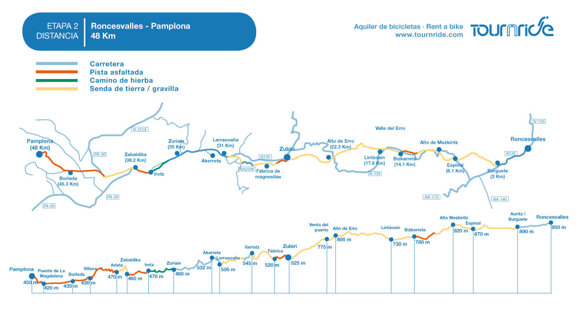
Distance to Santiago: 753 km
Distance in stage:: 48 km
Estimated time: 4-5 hours
Minimum height: 420 m
Maximum height: 962 m
Difficulty of the route: medium – high
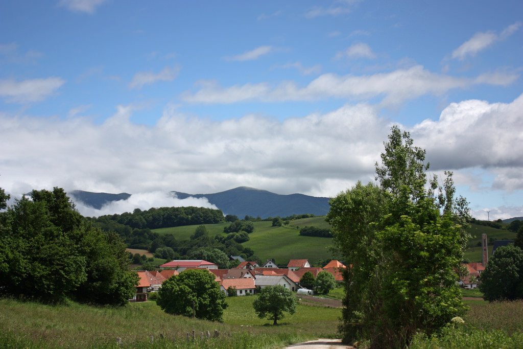
Places of interest: Bizkarreta, Zubiri, Villaba, Pamplona
Itinerary in Google Maps: To see the route in Google Maps click here
Click on the image to enlarge
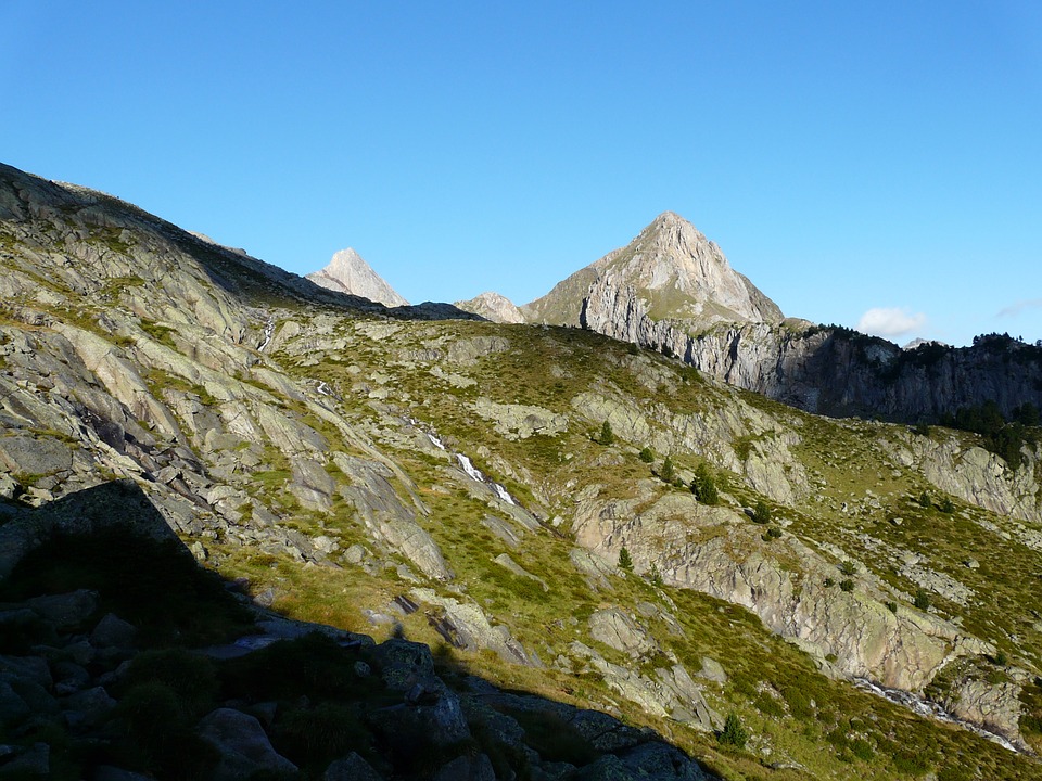
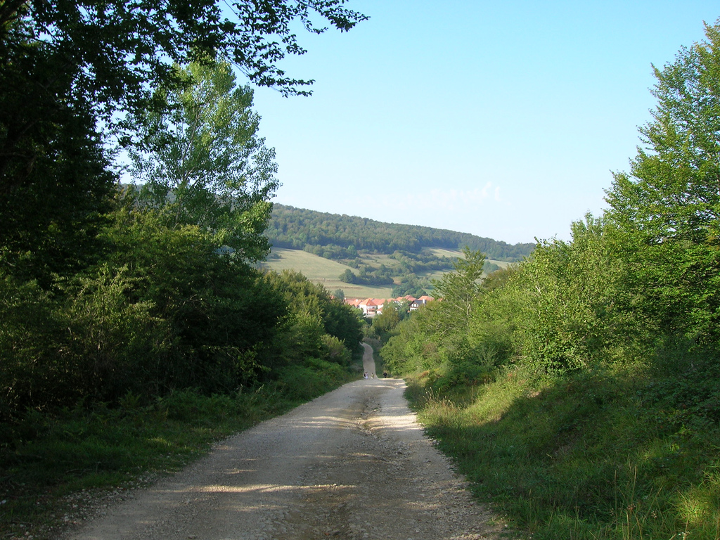
After a first stage very demanding on a physical level but has allowed us to enjoy a spectacular landscape, we began our second day of pedaling in a stage of brittle but simpler profile.
From Roncesvalles to Pamplona we will cross forests of beech, oak and bojs; Cross medieval bridges such as La Rabia or Los Bandidos and enjoy the charm of picturesque towns such as Zubiri or Villaba. We will finish the day “by the big door”, as the bullfighters of the first great city that we will visit in our pilgrimage: Pamplona.
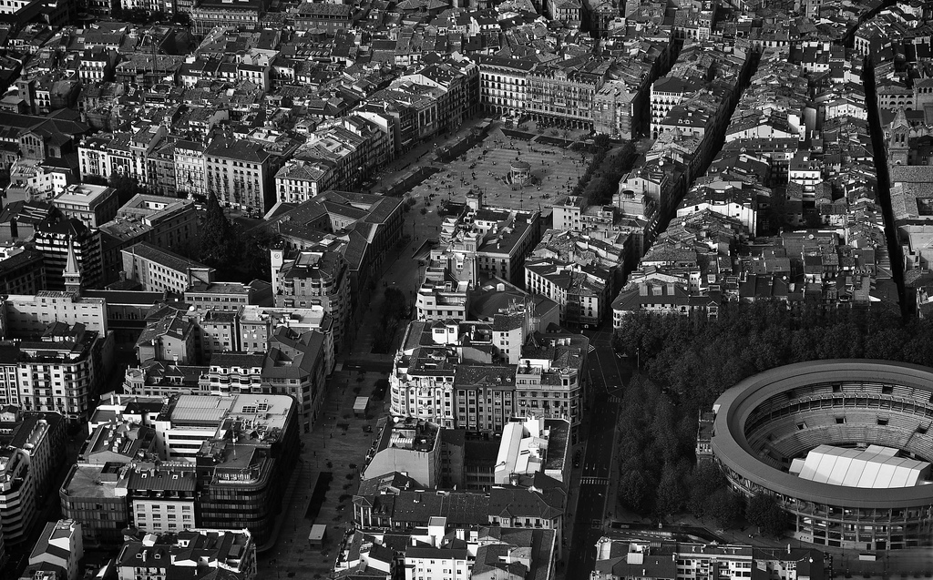
Pamplona in aerial view, with Castle Square in the center (photo courtesy of Unai Pascual Loyarte on Flickr under the following conditions)
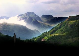
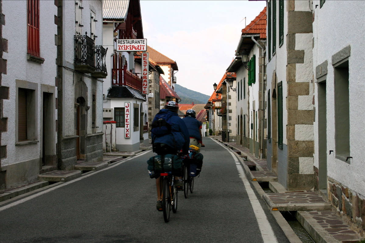
To go from Roncesvalles to Pamplona by bicycle you can follow practically all the route the original way that also pilgrims go on foot. Of course, to be able to do it without problems is necessary to have a mountain bike suitable for complicated terrain. This stage is not as demanding on a physical level as the previous one but it does have a rather rough profile and the terrain is sometimes not very firm.
In general, it is more complicated at the technical level, although the physical effort is smaller than in the previous one. If you do not have a good bike, you are not accustomed to go down rocky terrain or carry too much weight in the saddlebags you can always deviate in some sections and go by road.
You can even do the whole stage following the N135.This is a traditionally biked area and drivers are accustomed to sharing lanes with people on bicycles.
Although we often want to follow the original path as much as possible, if you think you will feel more comfortable leaving it at some points, we encourage you to do so from Tournride. As we have already said, it is a matter of making the Camino a rewarding experience, adjusting its demands to our specific times and circumstances.
PROFILE AND STAGE’S MAIN ROUTES
We now explain in general the profile of the stages of the Roncesvalles-Pamplona stage. It is a question of giving you an idea of what awaits you on this second day.
We begin by crossing the 2.7 km that separate our starting point from Burguete, the nearest town. It descends by a gentle slope that crosses the forest of the Valley of the Arga and arrives to Espinal, where there is a camping that can serve us of lodging. From there we will face our first ascent: we will reach Mezquiriz Alto (960 m), surpassing an average slope of 4% for 1.7 km.
Landscape from Espinal to Alto de Mezkiriz (photo courtesy of José Antonio Gil on Flickr under the following conditions)
When you reach Alto de Mezquiriz you cross the N135 with the original path. If we decide to continue without taking it, we will face the first descent with technical difficulty. We go down a fairly steep slope that will lead us to a small “jump” after which we will arrive at Bizkarreta. From there we expect the hardest climb of the day, towards Alto de Erro. The difference in height is 120 meters. Although the average slope is 5%, there are sections with fairly marked jumps. The ramp can be a little complicated because there are loose stones. Above crosses again the N135 and, if you have felt insecure at some point in the original path, we recommend that you take it.
The descent from the Error is the most difficult slope since it is very fast. It hasan average of 5% of slope, but the terrain is not firm and there are quite a few jumps. Going down for about 4 km you will arrive to Zubiri, where there are also accommodations.
From Zubiri we are about 20 km of stage that we will do without losing sight of the river Arga. The terrain will vary according to the time of the route. We will begin with a soft 2% down a track that will change from asphalt to gravel or dirt until we reach Larrasoaña first and then Irotz. When passing Larrasoaña, in Akerreta, we will find a short but rapid descent that requires caution.
Road to Zubiri (photo courtesy Malditofriki on Flickr under the following conditions)
After passing Irotz we will arrive at Zabaldika, where we will find that the road unfolds in two:
– Going straight ahead we will go along the original path that, after an initial climb, will take us through Arre and Villaba to finish in Pamplona.
– Towards the left we will cross a cement track for a very beautiful river walk to Huarte and from there we will go straight to the old town of Pamplona.
The second option is more comfortable for cyclists, because the terrain is better conditioned and is a quiet stage end. But if we choose the traditional option we will pass through Villaba which, besides being the town where Miguel Induráin was born, is also a very beautiful town.
Bridge at the entrance of Villaba (photo courtesy Javier Mendía García on Flickr under the following conditions)
So, in summary, at this stage we have three itinerary options:
- Follow along the route the original path, taking into account that we will find fast descents and some steep slope. It is the path that requires us more physically and technically, especially because the terrain is not very firm.
- Do the stages by road following the N135, which in addition to saving 5 km of pedaling makes us follow a profile less rugged and always go by asphalt.
- Interleave the original path with the N135. The two itineraries are crossed in all the populations of the stage and, in addition, in the Alto de Mezquiriz and Alto de Erro.
If you want to follow the original path but want to avoid the more complicated points, we recommend that after climbing the top of Mezquiriz you take the N135 to Zubiri and there you take the traditional route again. If it rains, we recommend choosing the second or third option.
As for which route option is best to take from Zabaldika to enter Pamplona, for cyclists it is usually preferable to go by Huarte. The ride is nice and much less bumpy. Although if you are fans of Induráin perhaps you want to pay homage to him passing through the picturesque town that gave birth to him.
Paseo de Huarte at the entrance to Pamplona (photo courtesy Hans-Jakob Weinz on Flickr under the following conditions)
PRACTICAL TIPS
- If you start the road in Roncesvalles and therefore this is your first stage, we help you get there . It is best to go to Pamplona by train, plane or bus and, once in the city, choose one of the following options
- Go inbus. Tickets are bought at the ticket office at the station itself and cost about € 6 (plus another € 6 for each bicycle).
- Taking a cab. If you take it in the center of Pamplona, the average price is about 60 € to Roncesvalles (on Saturdays and holidays costs 10 or 15 € more). You can also use the taxi sharing service for pilgrims
- At the Roncesvalles hostel you can book a place before going, but you must pay in advance with a credit card or bank transfer. You will be given all the information if before you write an email to info@alberguederoncesvalles.com
- Although we have warned that the profile of this stage is uneven, we do not want to scare you. It can be done with a good mountain bike. Just be careful in the descent from the Alto de Erro and with the fast ramp between Akerreta and Zuriáin.
- The N135 makes it easy to take the road at any time but also creates hazards, watch out for road and road junctions that require precaution to avoid accidents.
- During this stage we will find many towns and, with them, places of accommodation in which we can stay if we find ourselves tired. The passage through them also facilitates the provisioning, we will find enough sources to replenish water and places to buy food.
NATURAL, HISTORICAL AND CULTURAL HERITAGE AND DETAILED ITINERARY
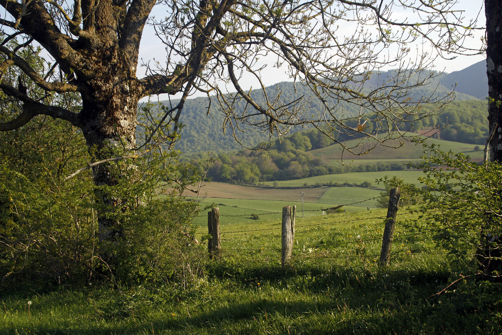
In this second stage we will cross two valleys: the Valley of Errobetween the high Mezkiriz and Erro and the Valley of Esteribar between Zubiri and Pamplona. The configuration of the terrain and the climatology of the area have meant that this whole area has been populated since many centuries ago. In fact, some of the localities that we will pass through are of medieval foundation and its growth is due to the Camino de Santiago.
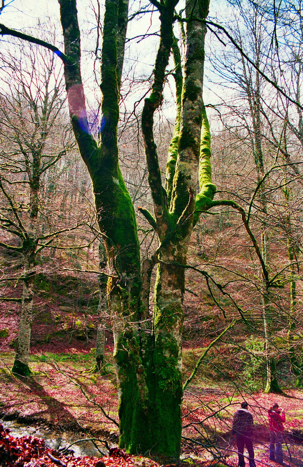
Tree in the Valley of Error (photo courtesy of Jose Maria Miñarro in Flickr under the following conditions, having been modified)
WE START IN RONCESVALLES WITH ONE
OF THE MYSTERIES OF THE ROAD…
We have already discussed what to see in Roncesvalles in the previous stage in a shortwalk. Shortly after leaving the N135 we will find our first point of interest: the “Cross of the pilgrims”.. Along with the “Iron Cross” of Leon, it is the most famous of the French Way and, although one knows why it is there, it is not known who or when it was made.
This cross is related to many legendary characters and, despite the simplicity of its forms, many pilgrims stop to give an offering. Its primitive stature is gothic (of about S. XIV) and in her it is possible to be seen Jesus crucified in the superior part and to the Virgin with the Child in the inferior one. The other two figures would be that of the monarchs Sancho “the Strong” and Clemencia, his wife.
It is known who placed the cross in that place, because there are documents that explain that in 1880 the prior of Roncesvalles, called Francisco Polit, had it placed there taking advantage of the remains of several different crosses. The origin of these remains is what creates controversy: some believe that it would have remains of the Cross of Roldán (S. XV) and others that would be part of a carving of the times of the same Charlemagne (S. VIII). The truth is that in the Codex Calixtino it is said that Charlemagne had had a cross installed in the Alto de Ibañeta, in the Pyrenees, and his remains may have been made the one we see today when leaving Roncesvalles.
FIRST RISE: FROM BURGUETE TO THE HIGH OF MEZKIRIZ
With this unresolved mystery we continue our way and we arrive until the first population: Burguete. Its name comes from its origin as “boroupgh” (village) dependent on the hospital of pilgrims of Roncesvalles. As outstanding patrimony, it is possible to emphasize the church of San Nicolás de Bari. Although most of what we see today is the S. XX, the façade is baroque (S. XVII). Inside there is an altarpiece, also Baroque, which is worth stopping to admire.
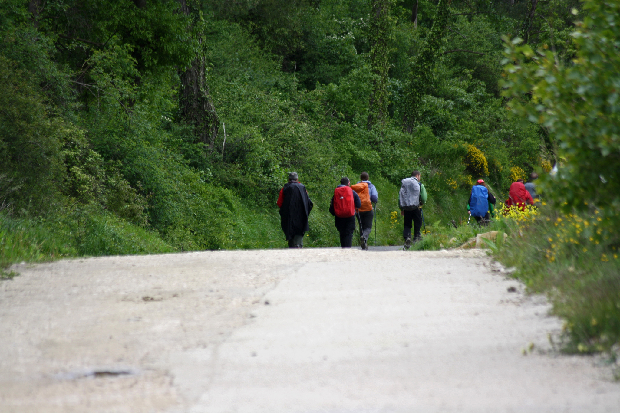
Pilgrims on bicycle in Burguete (photo courtesy of Juan Pablo Olmo on Flickr under the following conditions)
Road from Burguete to Espinal (photo courtesy of José Antonio Gil on Flickr under the following conditions)
We leave Burguete and continue to Espinal, a small town-street. It is surrounded by a landscape so beautiful that even Ernest Hemingway referred to it in his book “Fiesta” of 1926. We walk along its main road with houses with balconies and more than eight centuries of Jacobean tradition and in it we will see the church of San Bartolomé. It emphasizes its pointy roof with attic windows. This area is generally famous for trout fishing on the Rio Irati, as well as for a cuisine focused on mushrooms and mushrooms (especially in autumn).
Village of Espinal among the green landscape (photo courtesy of Alex Bikfalvi on Flickr under the following conditions)
Espinal landscape (photo courtesy of Alex Bikfalvi on Flickr under the following conditions)
Leaving Espinal we have to face the ascent to Alto de Mezkiriz. When we reach the top, we will find a stone stele. In it there is a carving of the Virgin and Child: it is called Virgen de Roncesvalles. The inscription asks to pray a salve by the “queen”, which helps to pass the difficult mountainous stage of the Pyrenees and allows to enter the “land of the Navarrese, rich in bread, milk and livestock”; as described by the Aymeric monk in his “guide” of the 12th century.
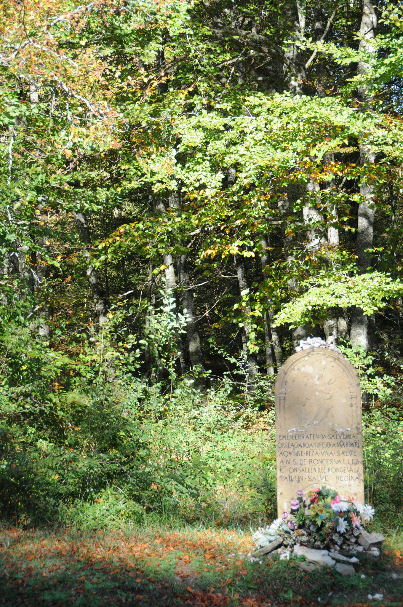
Estela de la Virgen in Alto de Mezkiriz (photo courtesy of José Antonio Gil on Flickr under the following conditions)
DOWN WITH CARE FROM THE HIGH OF MEZKIRIZ TO ZUBIRI
Going down from the Alto de Mezkiriz we will meet Ureta and we will arrive later to Bizkarreta. This population was founded at the beginning of S. XII with the name of “biscaretum” and was very important because it had a great hospital of pilgrims. Roncesvalles was eclipsing with the passage of time and its primitive hospital is only a few remains, which we will see next to the path.
Today, the main point of interest of Bizkarreta is the church of San Pedro. From its initial factory we only have the cover. It is Romanesque, very simple. Following the characteristics of its style, the walls are thick and the decoration very simple. In this case, the most salient are the three archivolts that mark the arch of its main door. Most of the remaining elements of the church are later, from the S. XVIII.
Before the ascent to Alto de Erro we pass through Linzoáin. This small and picturesque village has as only one outstanding monument another church, that of San Saturnino, also Romanesque and very simple. But what makes it special is rather its peaceful environment, on the bank of the river Erro and with large cattle houses. You can breathe the tranquility of the Navarrese countryside.
Livestock house in Linzoain (photo courtesy of Alex Bikfalvi under the following conditions)
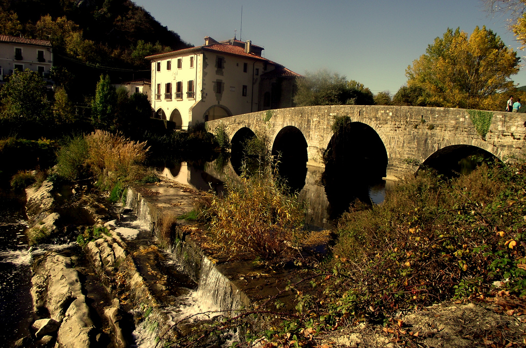
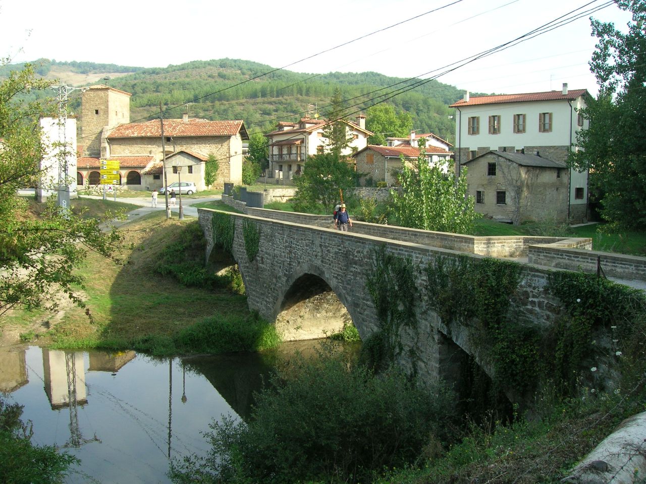
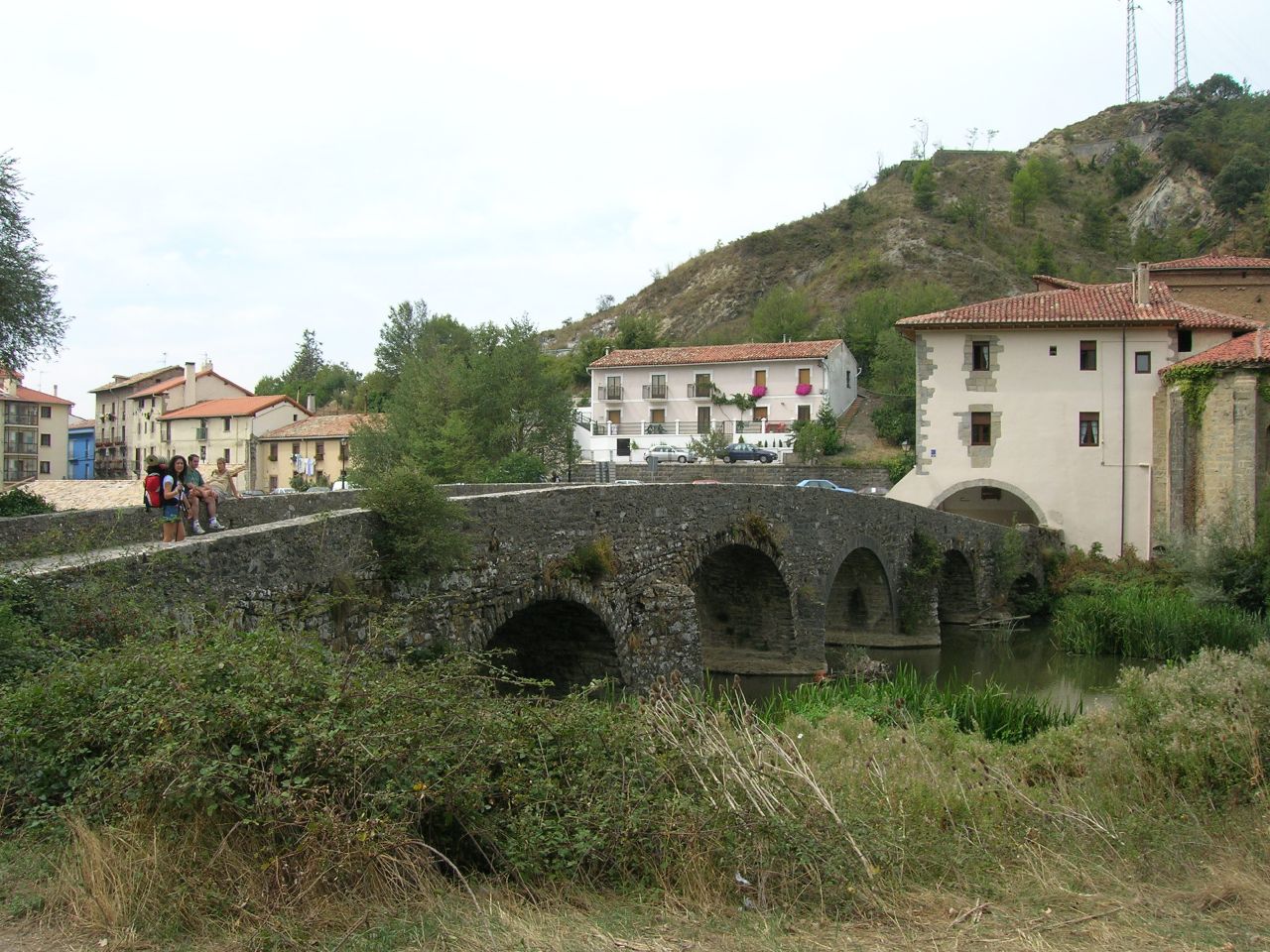
After this respite of peace, it touches the Alto de Erro. Along the way we will find the monument to a Japanese pilgrim who died making the road. After the descent we will reach Zubiri, we will reach Zubiri, the administrative capital of the Esteribar Valley and the only industrialized nucleus, especially for its large magnesite processing plant. Its name in Euskera means “town of the bridge”, of zubi (bridge) and iri (town) and is that known as “Bridge of the Rage” is one of its great attractions.
FROM ZUBIRI TO ZABALDIKA BY LARRASOAÑA: THE THING GOES FROM BRIDGES!
If you are tired, in Zubiri there are several hostels that can serve as a stopover place for you. You can sleep in one of them and spend the next day in Pamplona, which is just over 20 km. If you do not want to stop, to follow the road you do not have to enter Zubiri. Still, from Tournride we recommend you to approach the entrance of the village to see the Bridge of Rage.

Puente de la Rabia in Zubiri (photo courtesy of José Antonio Gil on Flickr under the following conditions)
This medieval bridge crosses the River Arga. Its name derives from an ancient tradition whereby traders made their animals take a turn around the central pillar of the bridge. It was believed that this column had a supernatural power that avoided the disease of rabies. The bridge supports the passage over two large semicircular arches and its pillars have a large cutwater that relieves the pressure of the stream of water. From the bridge, we can see the great cereal fields, the most important cultivation of the valley.
ubiri, in its origins, was constituted mainly by the bridge and a street that united it with the church of San Esteban and the hospital of Santa Magdalena. Today the church is newly built because the original was used as a military barracks during the Carlist Wars of the 19th century and ended up being destroyed. The hospital was next to the bridge, but it has not been possible to preserve it either.
Zubiri (photo courtesy of José Antonio Gil on Flickr under the following conditions)
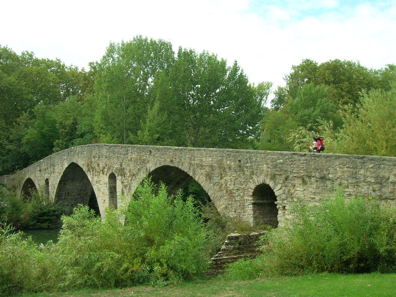
To continue with the route we return on our steps from Zubiri and, a kilometer later, we find the magnesite company in front of us. We skirt along the road until we reach the exit of the industrial area. We may have to get off the steps by getting off the bike. A stone path leads to Illaratz, Ezkirotz (which in the 10th century had a fairly important monastery) and ends at Larrasoaña.
The main attraction of Larrasoaña is the Bandidos Bridge. Like the Rabia, it is also medieval and crosses the river Arga. It is so called because in this place the thieves used to attack the pilgrims.
Bandit Bridge in Larrasoaña (photo courtesy of José Antonio Gil on Flickr under the following conditions)
To continue to Akerreta do not enter Larrasoaña, but once again we encourage you to deviate a few hundred meters to see the bridge. In addition, the town of Larrasoaña has a lot of Jacobean tradition, being an example of development thanks to the Camino de Santiago. In the 12th century it received what was called the “fuero de los Francos,” a series of tax-exempt laws to encourage foreigners who made the pilgrimage to settle on the side of the road. These types of towns always end up with the same configuration: a large central street, through which the road passes, flanked by other buildings. It must be taken into account that all foreigners who made the road were called “francs” to enter France, not because they were French.
After a short ascent, we arrive at Akerreta and from there we cross a dense forest by a narrow path that goes to the side of the river Arga. So we reached Zuriáin. At this point you have to take the road a little and then we can decide if we turn left to take a path of grass and go through Iroz or if we go straight to Zabaldika. Iroz has nothing remarkable at artistic level, but the original path goes by.
ALL ROADS LEAD TO PAMPLONA: ZABALDIKA DECISION
Zabaldika is the point at which the route is divided, near a rest area.
If we take Huarte on the left, we will have to pass a first stretch of road and track and then we will take a nice river walk through the Tejeria Park. After crossing the Puente de la Magdalena we will enter Pamplona.
Puente de la Magdalena, at the entrance to Pamplona (photo courtesy of José Antonio Gil on Flickr under the following conditions)
This bridge was declared good of Cultural Interest an Artistic Historical Monument. It was built between the 12th and 15th centuries and its name is given by the neighborhood in which it is located: The Barrio de la Magdalena. On one bank there us an elaborate cruise with the image of the apostle. Following the path we reach the walls of Pamplona. The profile of the whole walk is quite flat and the itinerary is a little longer than the original path.
If, on the contrary, we choose to go head-on, we will take the historical route that passes through Arre and Villaba. We will begin by climbing a small slope that leads to an old manor, now in ruins. Continuing along the track and patch of grass, we will find a ring road. We can avoid it by going through an underground tunnel.
This way we will have reached Arre, where another bridge allows us to enter the village. It is a medieval bridge of 55 meters, bigger than the previous ones, which crosses the river Ulzama and leads towards the convent of the Trinity. The Ulzama River ends at the Arga River and has 9 medieval bridges that cross it. This leads directly to a hostel complex and basilica for pilgrims. It was all an old hospital of pilgrims of S. XI. In the interior of the church, dedicated to the Holy Trinity, there is a Neo-Roman altarpiece of the S. XIX. Everything is managed by a brotherhood and by the Order of Marists.
Trinidad de Arre (photo courtesy of José Antonio Gil on Flickr under the following conditions)
Villaba was founded in the 12th century by royal mandate. Its proximity to Pamplona and the improvement of communications during the XXth century with the construction of an electric railway made it linked to the urban expansion of Pamplona. Its main street is the street of the Jacobean footpath. In a roundabout they installed a sculpture as honorary monument to Miguel Induráin, who was born in this town in 1964. It consists of the metallic silhouette of the cyclist, climbing up the straight line of a sloping stage profile.
AND,AT THE END… ¡PAMPLONA!
We leave Villaba and we arrive at our end of stage: Pamplona. Known internationally for its San Fermines, it is a city that has much to offer us. After stamping our credentials and getting some rest in the hostel, we cannot miss the opportunity to visit and try some of their delicious “pintxos”.
A RIDE FOR PAMPLONA
At Tournride we want you to make the most of your pilgrimage. As we are aware that sometimes it is difficult to reach the cities and get time to find out what to see there, we have decided to propose a walk for each end of the stage.
In Pamplona, one of the largest cities in which we will stop to Santiago, there is much to see and do. We have designed a 50 minute walk that we have marked on this map and in which everything relevant is visited in the city. If you think it is too long, we recommend not walking to the Citadel and staying closer to the monumental area.
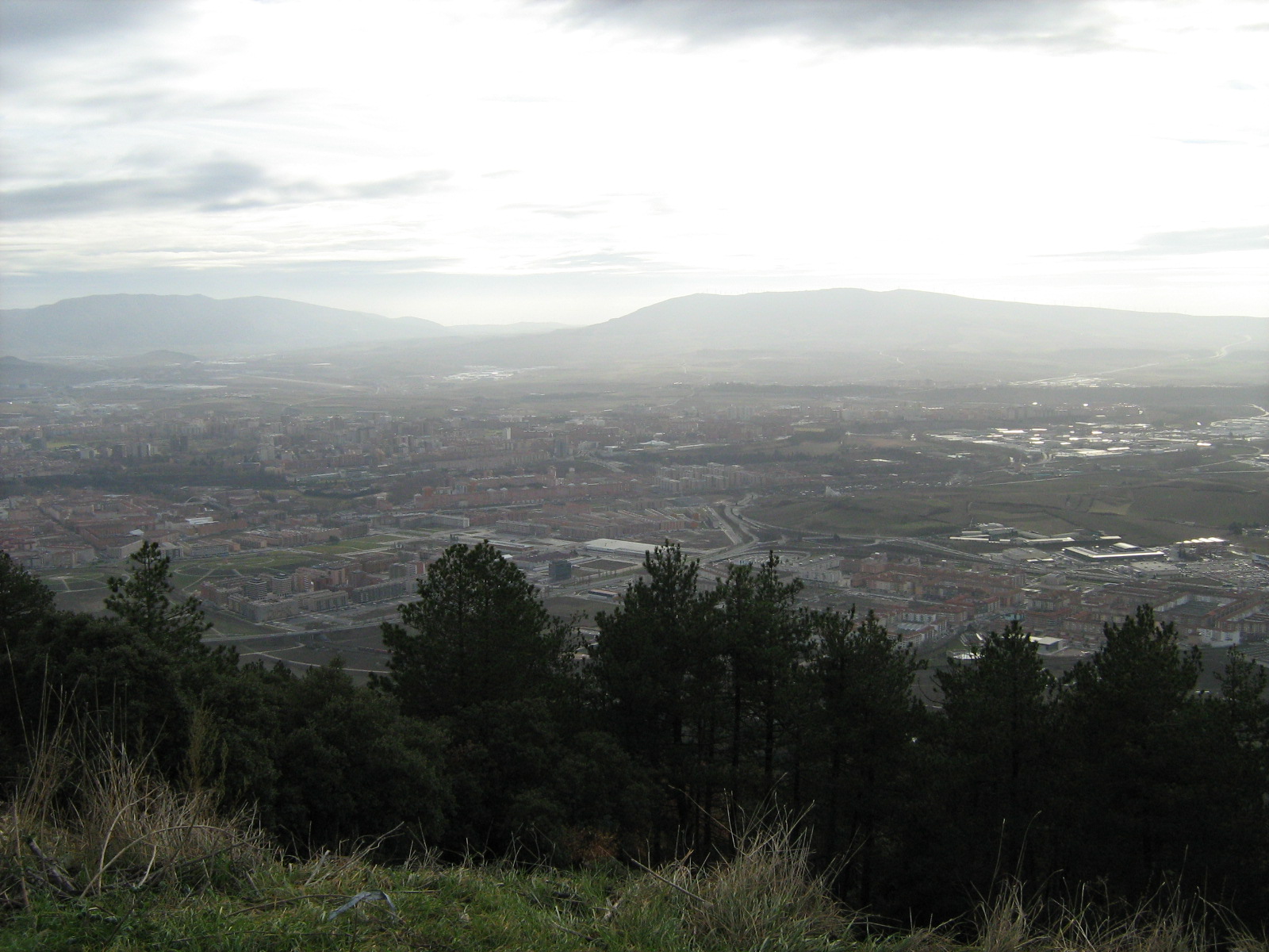
Pamplona from mount Ezkaba
To begin with, a bit of History…
Pamplona has been populated for thousands of years. In fact, they have found useful and menhirs beneath their soil that date back more than 75 000 years! This territory charged with History has been conditioned, especially since the 9th century, by three main factors::
- The different “fueros” (laws or specific ordinations) that the city has had and that gave much power to the clergy against the civil power.
- Its status as a reception point for immigrants or “francs” who created their own neighborhoods since the 11th century
- Its strategic position on a high near the border with France. Since Pamplona becomes part of the Crown of Castile in the XV century, will be an important defense in all wars that will remain with the neighboring country.
In reality, what we know today as Pamplona is the union of three boroughs or different cities. The first nucleus, which today would be the part of the cathedral (the highest in the city), was populated from centuries before the arrival of the Romans in 75 BC. Its inhabitants were the “vascones”. When the Romans saw the position of that nucleus, raised over a valley and surrounded by the river Arga, they conquered it and made it a strategic point of the empire. They urbanized it and used it as a knot of communication between the Peninsula and Europe.
With the fall of the empire comes the Visigoths and then the Muslims. In the war to drive the Arab conqueror, the clergy helps decisively. As a thank-you, the king decides to give special powers to the city church and gives him a condition of private self-government.The “Kingdom of Pamplona” is created, governed by a jurisdiction in which the bishop is the lord of the city and the cathedral his nerve center.
While this nucleus is still very important, in the XI century reach the territory “francs”, immigrants who create a population next to that and are engaged in trade. In the XII comes another wave of immigrants called “Navarros” and also create their own town: the “navarrería”.
During the following centuries each borough is walled and tensions are created between them, untying fights that end when the king Carlos III unites them in a single entity in the year 1423.
At that moment Pamplona can be said to arise, as we understand it today. In the S. XVI happens to be of the Crown of Castile. As the city is very close to the French border and during that century there are different clashes between both crowns, Pamplona must be fortified. The citadel is built, one of the best examples of Renaissance military architecture in Europe. Today it is preserved very well and in it there is a large park that is worth visiting.
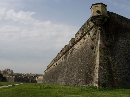
Citadel wall (photo courtesy of Isumelzo on Flickr under the following conditions)
Thus we arrive at the S. XVIII. The role of the Church and its strategic military and commercial situation created a curious social composition. Although it was normal that the majority of the population were farmers or artisans, in Pamplona there was a high percentage of high clergy and aristocracy; which made it a very traditional city. Therefore, in that century it was decided to “modernize” the city: it is urbanized, it provides services such as municipal sewerage and major buildings are remodeled. For example, the façade of the cathedral was reformed in that century, so it is neoclassical.
All this process is interrupted when in the XIX century Napoleon conquered the city. After the War of Independence that frees to the peninsula of the French conqueror, a struggle for the power between the liberals and the carlistas takes place. The Liberals supported the creation of a central government that controlled all Spanish territory without distinctions, whereas the Carlists were more traditional and wanted to maintain the regime of special fueros of Navarra.
Monument to the fueros (photo courtesy of Mario Sánchez Prada on Flickr under the following conditions)
In Pamplona the negotiation between the two sides for the constitution of a government ended up making the city in particular, and Navarre in general, have special conditions of self-government in some aspects. In fact, at the end of the nineteenth century, attempts were made to abolish these privileges, but a great social demonstration prevented it. In honor of that episode the Monument to the Fueros was erected in Paseo de Sarasate.
From that moment until today, the city has not stopped growing. Successive extensions are built and many of the walls that, like inheritance of that division in three boroughs, were continued separating the districts.
Nowadays it is a very modern city, with large extensions of green areas and a great amount of cultural life. Do you dare to meet her?
A day trip through Pamplona: as true “pamplonicos”
In Tournride we suggest a day trip through Pamplona so that you can get a general idea of the place, because we know that you will probably have to continue pedaling towards Santiago the next day. Anyway, Pamplona is one of the main stops of the French Way and if you cannot regret to extend the stop and dedicate a few days to this beautiful city. We give you additional plans below for this.
If you arrive before lunch you can recover forces by eating at one of the places that offer a menu of the day (with astonishing value for money) near the town hall. Afterwards, we start the afternoon touring some of the best known places in Pamplona as part of the tour of the San Fermines.
Monument to the San Fermines in Pamplona
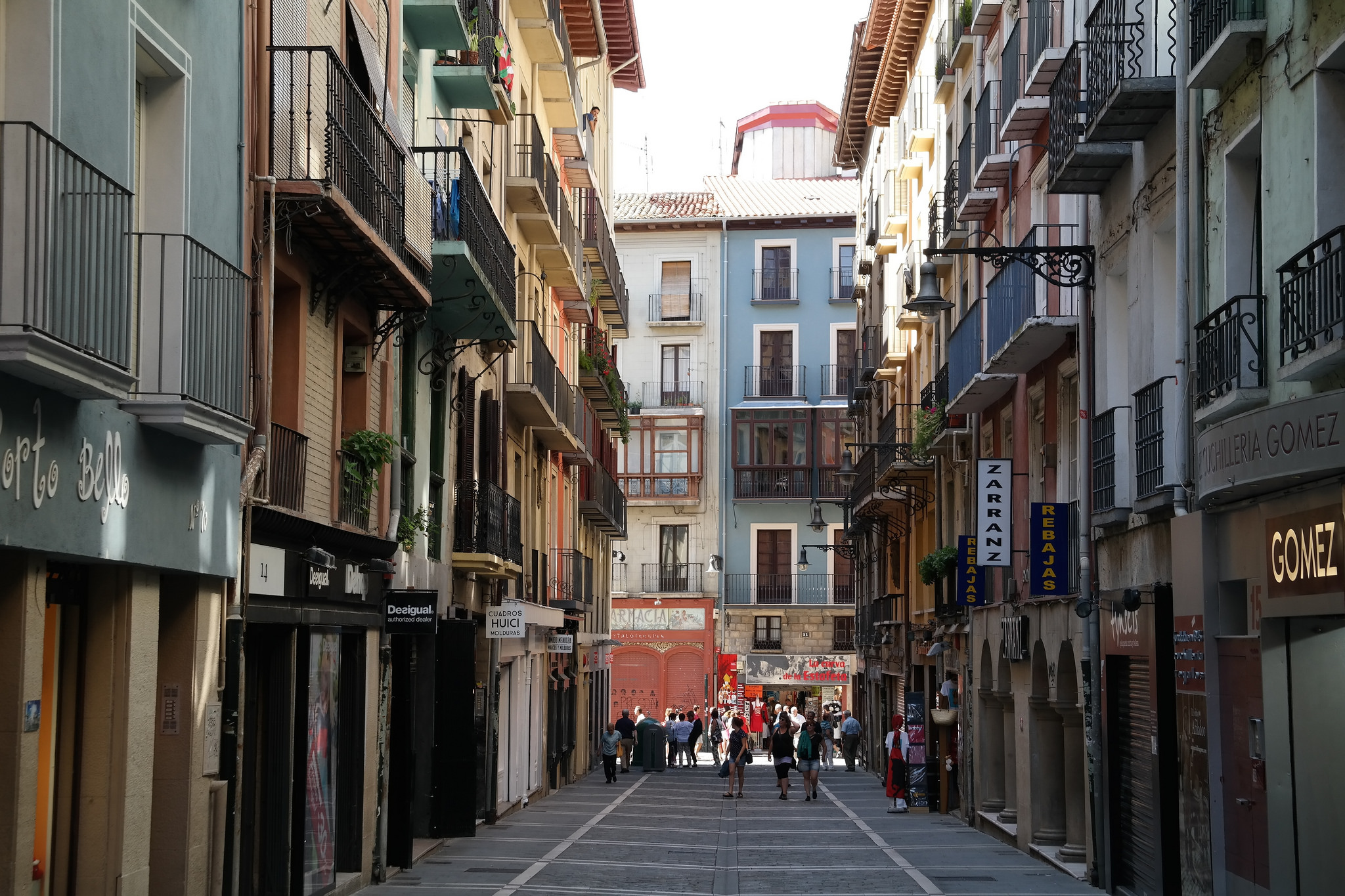
From the Plaza Consistorial. we leave the Mercaderes Street and from there we turn to the pedestrian Estafeta. The corner of meeting of both streets is one of the most mythical points of the bulls. Once in Estafeta, we will see in the middle of the street a few stairs to the right. Upwards we will leave the route that the bulls follow and the great Plaza del Castillo will open before us.
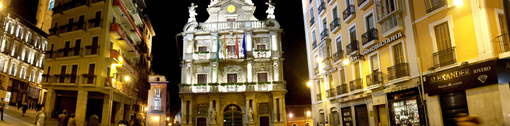
Plaza Consistorial de Pamplona (photo courtesy of Total13 on Flickr under the following conditions)
This square is well known because it takes place two of the most important moments of the San Fermines. From it the “chupinazo” is launched, which kicks off the festivities on July 6 and, in it, the “poor me” is sung, which puts an end to the celebrations. At 12 o’clock on the 14th of July a crowd gathers in the square and sings holding a candle a song that says “poor me, poor me; That the parties of San Fermín have finished”.
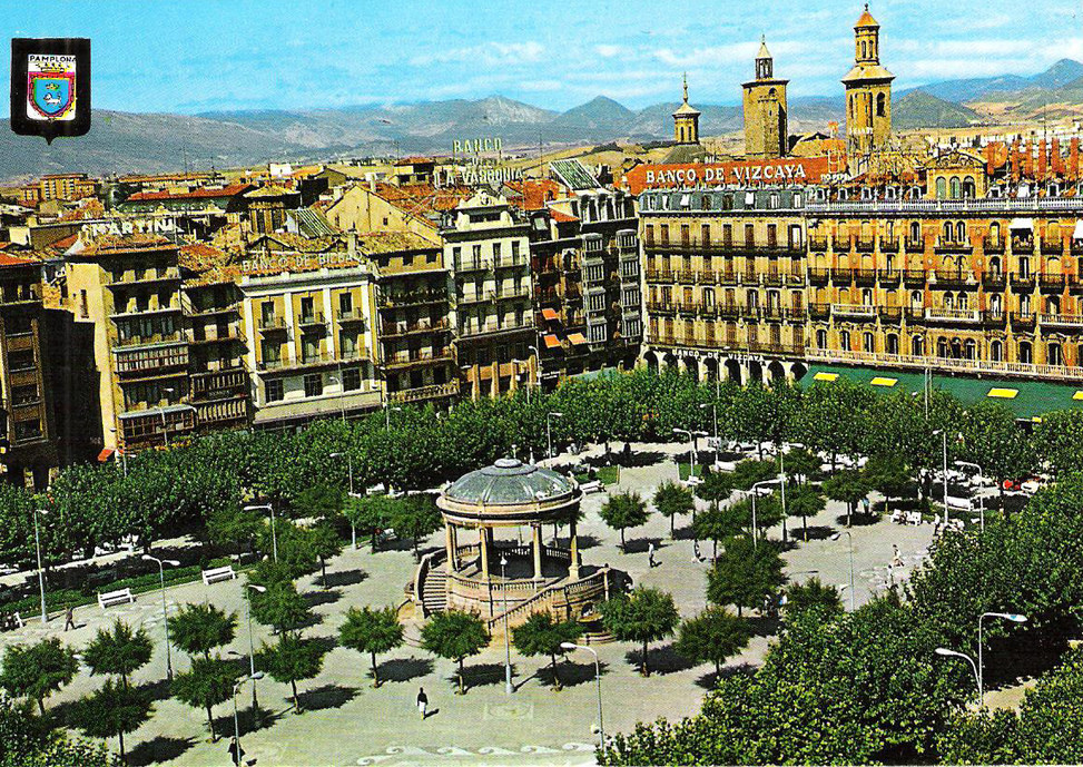
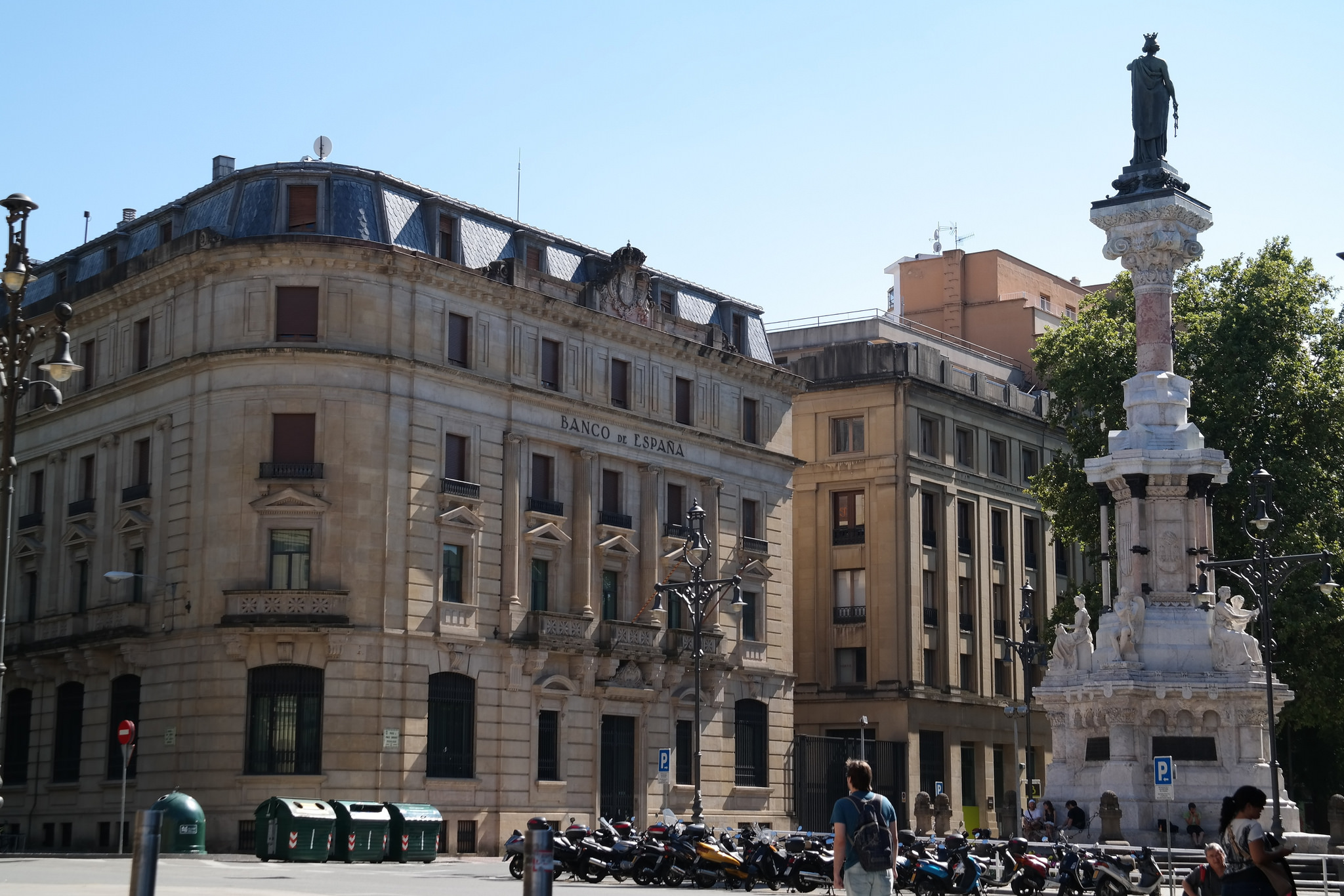
Plaza Del Castillo on Pamplona (photo courtesy of Batto on Flickr under the following conditions)
This place is the nerve Center of town. Formerly there was a Castle close, hence your name. Before the bullfighting became in this Plaza, as in many other cities of Spain that they had no bullring. Is fenced with a “Curro” Wood and was covered the floor of sand. Today has spaces landscaped and many cafes in their arcades.
One of the corners of square we can see the walk sarasate. There is the Church of St. Nicholas, one of the largest of the many adorning the city. Formerly St. Nicholas was one of the three Burgos constituting Pamplona. The Church we see today has aspect of strength in the outside because it was thinking about it as place defensive, given the multiple clashes that produced with the other two Burgos. In fact, tower is actually a Watchtower.
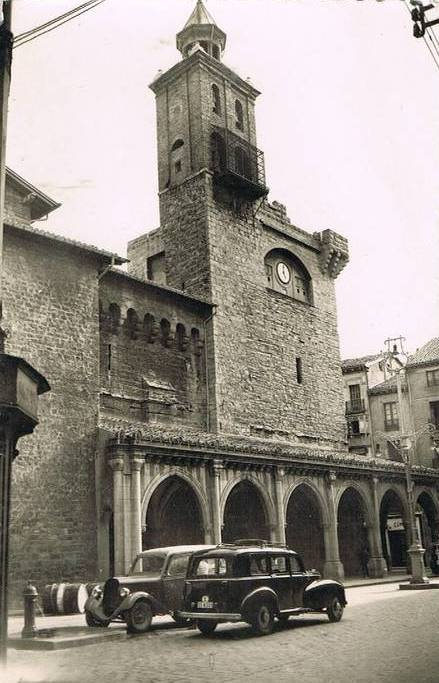
Vintage photography of the Church of St. Nicholas (assigned by Batto on Flickr under the following conditions)
This aspect of strength outside contrasts with the inside: a beautiful domes Gothic with sizes very thin and wonderful for its height. Recommend stand also to admire the body. Is Baroque and is the most important of the city.
We follow by walk sarasate where to end we turn to the right to take the taconera. There is Park the taconera, one of the places Green more special Pamplona. In the old pit the Wall we will see a lot of animals: deer, Ducks, Peacocks…. all of them live in half freedom, surrounded by a beautiful Park with different tree species. All a Haven peace. In fact, if you don’t want to eat in space hospitality, from Tournride you recommend that you sit down in one of its banks or in its fluffy grass to the shadow of a tree for picnic. Then, you can coffee in coffee Viennese, a Bohemian and quiet meeting point intellectual Pamplona.
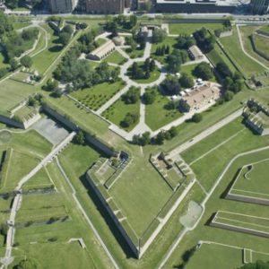
Photo air part of the Citadel (photography assigned by the city Council Pamplona).
Leaving the taconera we will Citadel. This old fortification military is now a Park 280 000 square meters full of attractions: sculptures, pavilions exhibition, more than 30 tree species, all amenities child … it is important to know that is prohibited the entrance with any type of vehicle (including bikes) and that only open during the day.
Designed in the time Renaissance, in which Italy lived a great time cultural and intellectual, fortification was designed by a military engineer of neighboring country: Giacomo palearo. Also had another as like in Antwerp. Have 5 defenses to give you a way similar to that of a star, but two of them are missing. Was surrounded by a pits, which today are Green areas, where there was bridges drawbridges.
Returning about our steps we left to the left the taconera and walked down the Street greater where to get we will see the Church of San Lorenzo. It is the Chapel San Fermín Amiens, pattern of the city. Party in his honor became match a “fair Franca” in medieval times, that is, a fair traders with some tax exemptions. As part of what is sold was won, became bullfighting and closures. Became party employer and since 1950 has been doing more and more famous, to get to the party international is today.
We continue down the Street greater and come back to square Hall. Taking back Street merchants, we continue straight and we directly to the Cathedral where, if not yet what you have done, you can seal the badge.
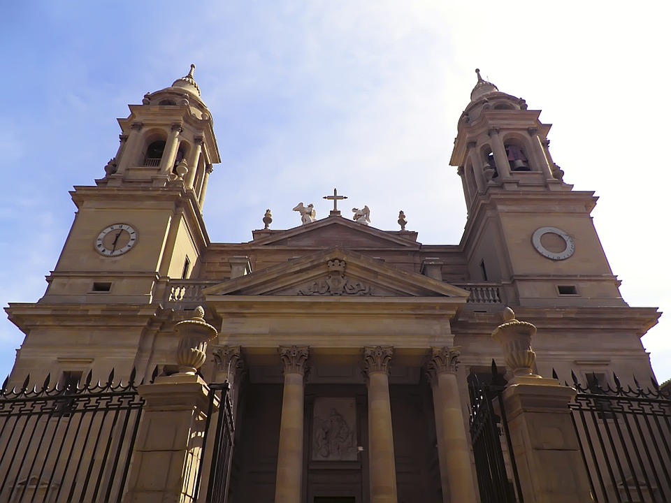
Cover of de Santa María la Real
The Santa Maria de Real Cathedral was made, for the most part, in the S. XIV and fifteenth. Before had another Church, but are pulled to build this great and sober Temple with large Windows ojivales (Arcos targeted). But what I really can’t stop visit is your cloister. Is one of the best examples Gothic Europe and their Stone arches with drafts very thin and wonderful to all who sees him. Cathedral has schedule and have to pay for log in, but discounts are pilgrims. To see this data you can see the Cathedral’s page.
Leaving the Cathedral we take the Street from the Navarrería, old borough of immigrants Navarre, and at the end turn right on the Street Del Carmen. At the end, in the portal France, we return to turn right and we arrived to corner of the White horse.. Here we have stunning views of the bottom of the city and is the perfect place to end a day full of discoveries. There are different bars and restaurants with terraces in which we can take some drink or eat
.
Corner of the White Horse Pamplona
If we find no site or not we want to end here, we can re-down to the Center of the core historical. In the streets post office, merchants and shoe shop, surrounding square Castle, we can try the famous “pintxos” of the city. High cuisine to quite good price. If we want to try different spikes in bars different but we don’t want to take a lot of drink, we can ask for a “zurito” in each. Would be the equivalent to ask for a “short” (a cane small) in Navarre..
This entire tour sum in total more, of course, as long as we want to devote to each place to visit only 50 minutes walking. A jaunt loaded history, Green areas and good food. ¡SO, leave the bike and walk!
FEW DAYS PAMPLONA: WHAT ELSE TO SEE AND DO?
Of course, the walk we proposed in the previous section is susceptible of divided and made more calm. But, in addition to what we have already described, listed here some of the other attractions that has the city:
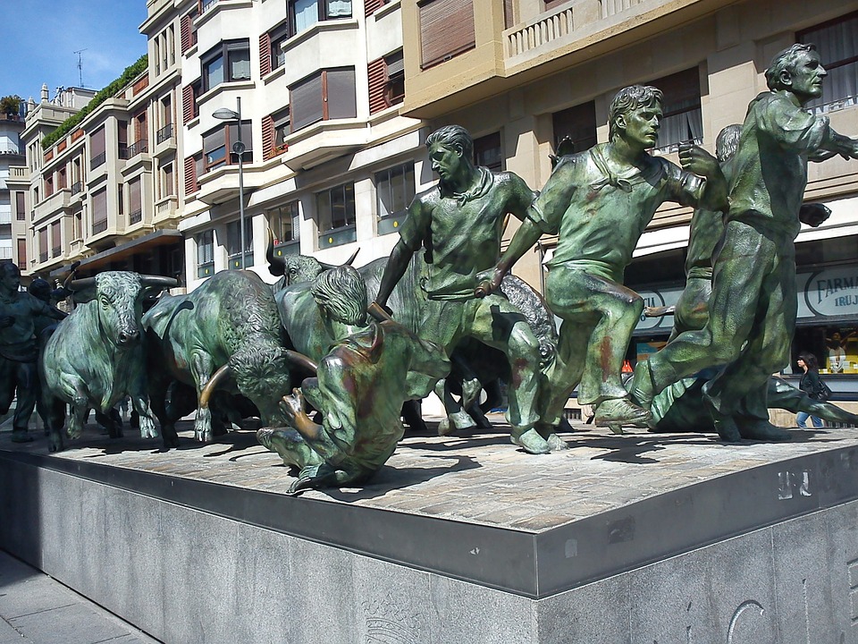
- Follow know a little more tradition Taurine visiting elsewhere mythical of the city: bullring, built in early S. twentieth and that is the fourth world’s largest or monument to closure. It’s a huge bronze sculpture representing perfectly movement and dynamics of a closure, all a work of art. We can see it in Avenue Roncesvalles with walk Carlos III.
- See great art collections. In the city are two important museums:
- The Navarra’s Museum. From sculptures of the facade old Cathedral up boxes Goya all together under one roof. More information, rates and schedules here.
- The Navarra’s University museum. Modern building has a beautiful collection of contemporary art, formed from the legacy of a collector private met over 100 works of artists as Picasso, chillida, Rothko or Kandinsky. It is gone by adding other collections ceded or private. if you like art, you’ll find here a space in which you will feel at home.
- To browse the walled part of the city that we lack. Pamplona is an example beautiful city fortified and care with which held can enjoy long walks. If you want to learn a little more about this topic you can visit Fortin St. Bartholomew, a former strong today is home to the Center of interpretation of the fortifications Pamplona. Is an informative space and its approach is very teaching, not precisely guide. For more information visit their website.
- Enjoy some cultural show. Pamplona has a lot of life cultural, if you like music or performing Arts sure you can find something to your measure. You can see the cultural agenda on the city council of Pamplona website.
In addition to all this plans, Tournride simply recommends you, the following: enjoy high quality of the food Navarre and relax in many places calm Pamplona. There is still a way up to Santiago,’ you deserve it!