Tag Archives: bicycle

STAGE 3: FROM PAMPLONA TO ESTELLA – FRENCH ROUTE BY BIKE

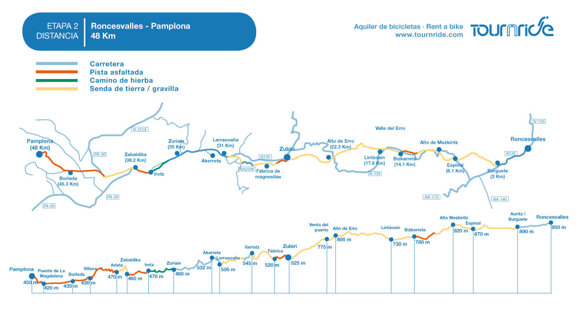
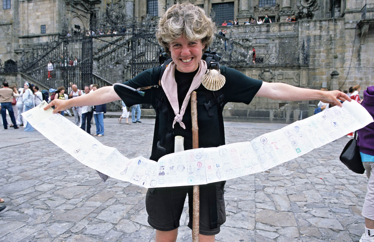
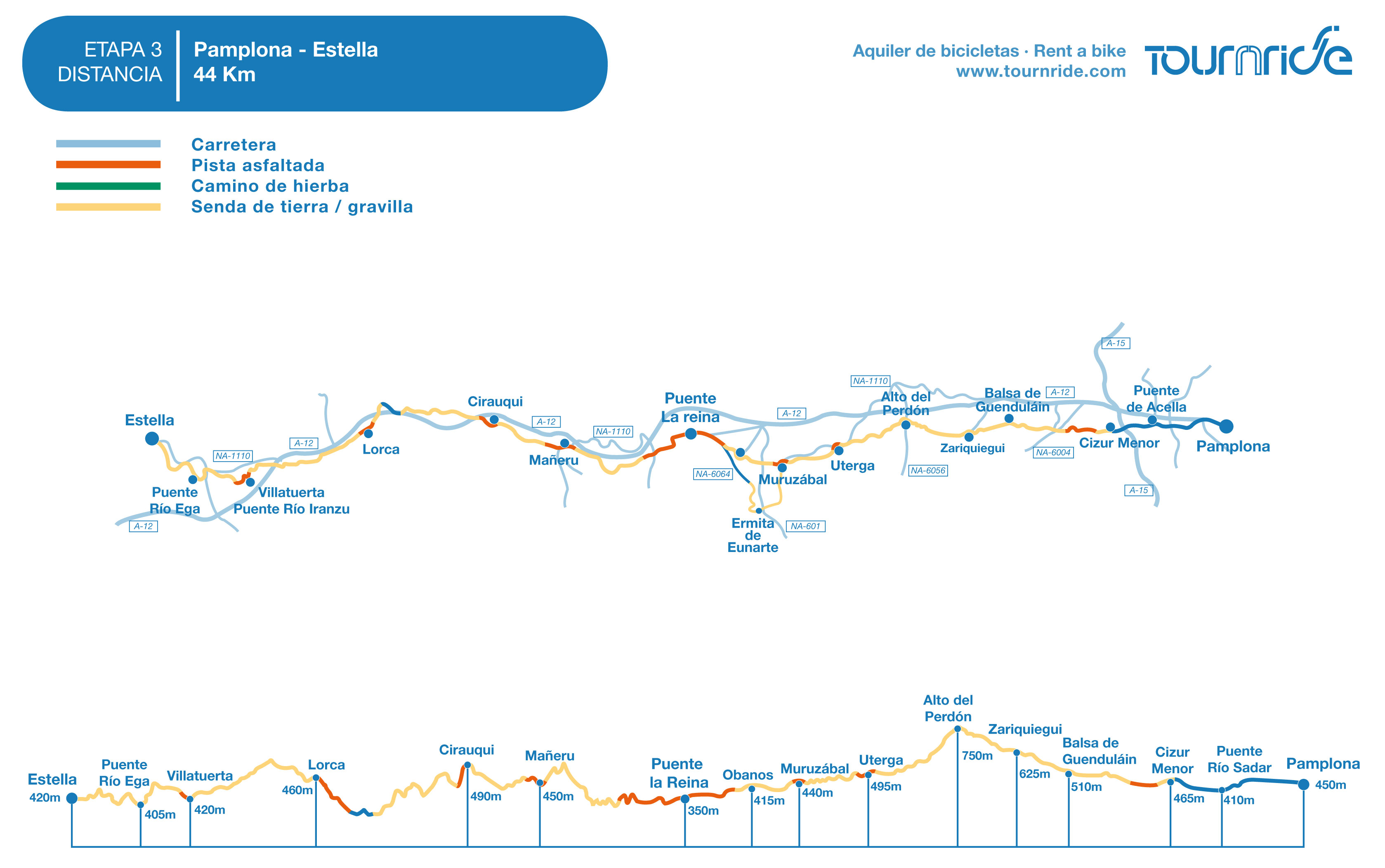
Distance to Santiago: 705 km

Stage distance: 44 km

Estimated time: 4 hours – 4 and a half hour

Minimal height: 397 m

Maximum quota: 780 m

Difficulty of the route: mid

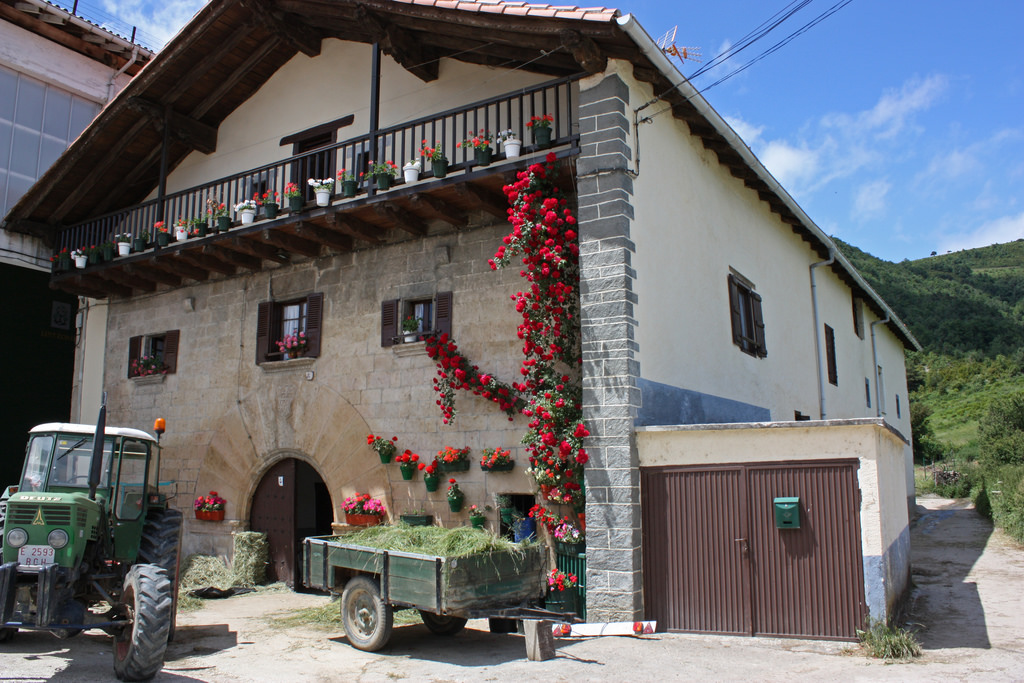
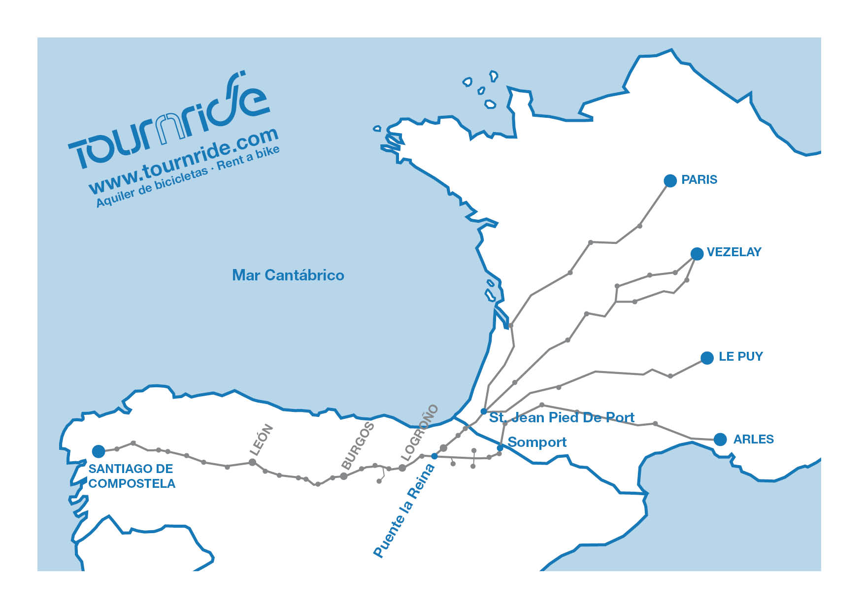
Places of interest: Alto del Perdón, Church of Santa María de Eunate, Puente la Reina, Cirauqui, Estella.

Itinerary in Google Maps: To see the tour in Google Maps click here

Stage 3 of the French way by bike: from Pamplona to Estella doing the Saint James Way

Click on the map to zoom it

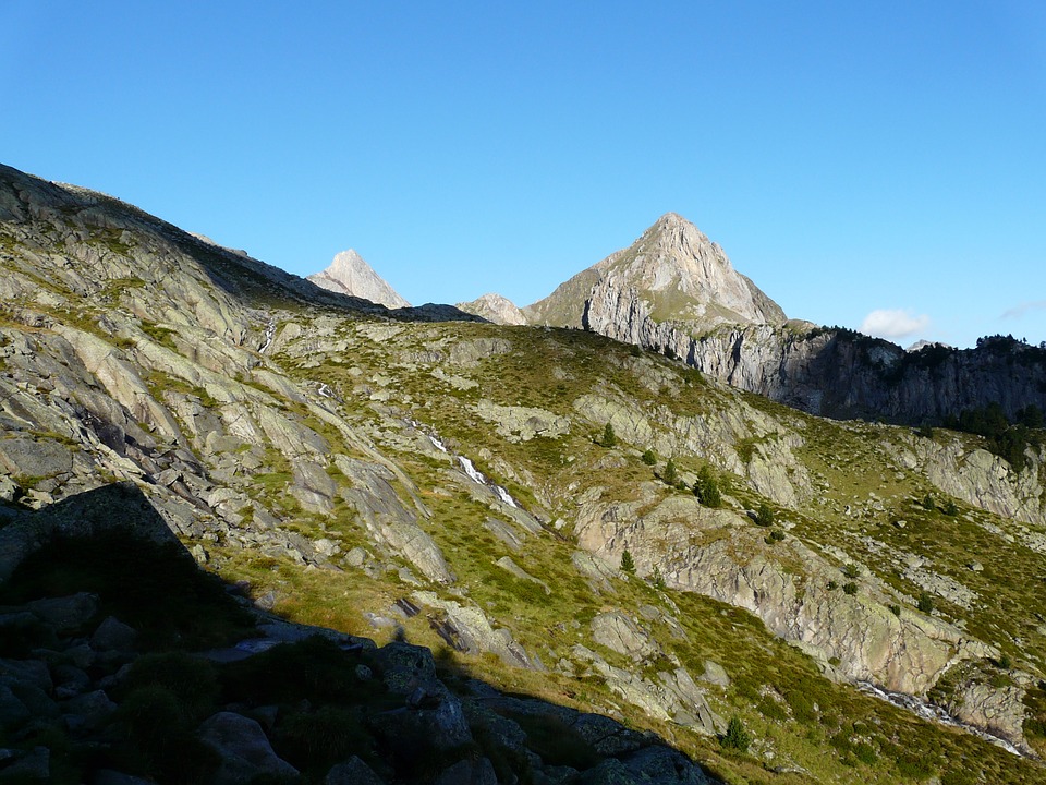
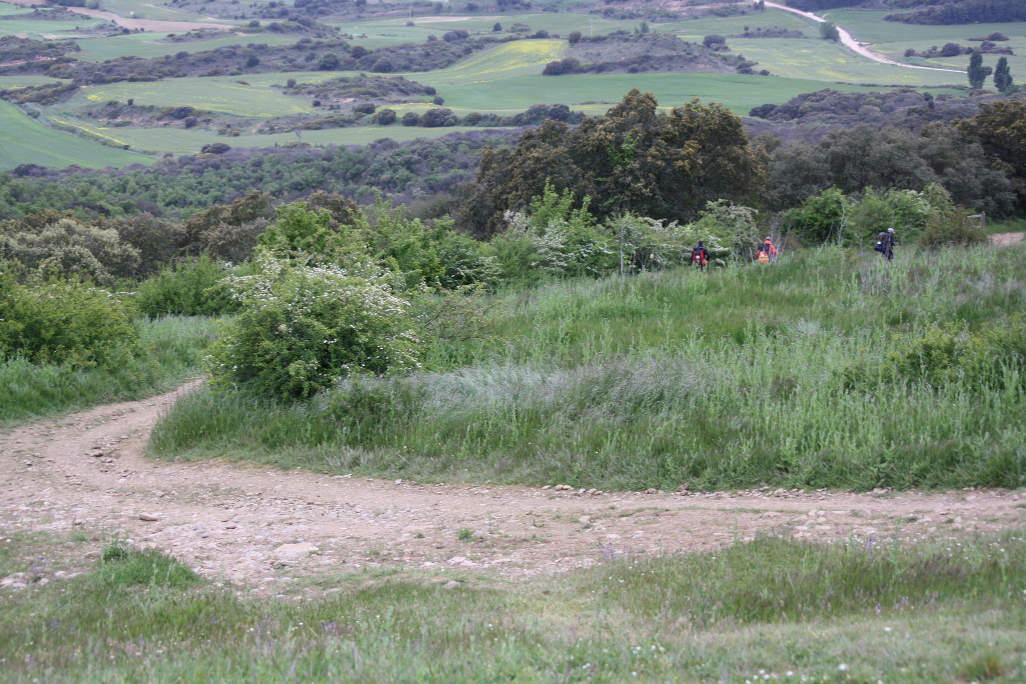
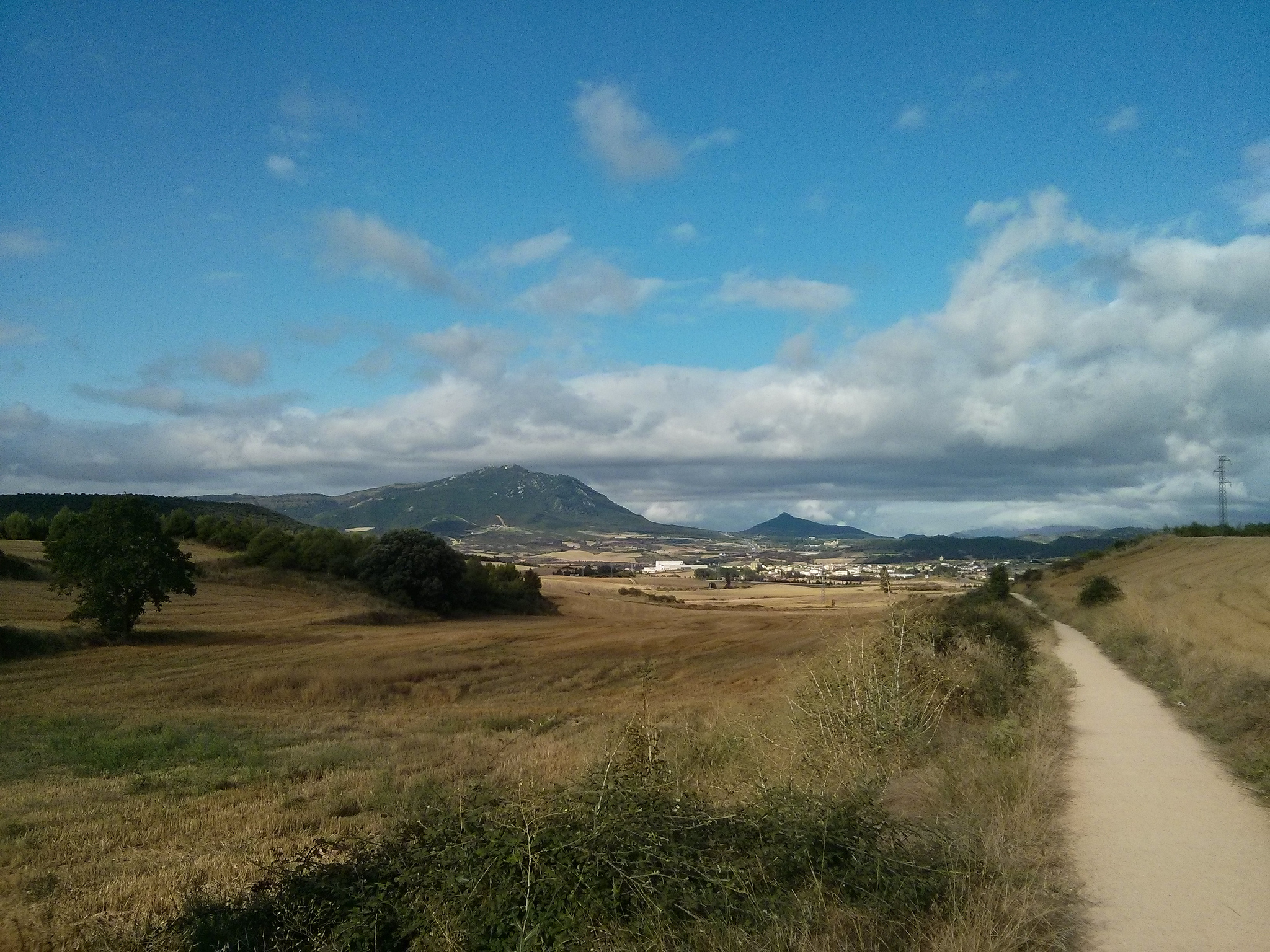
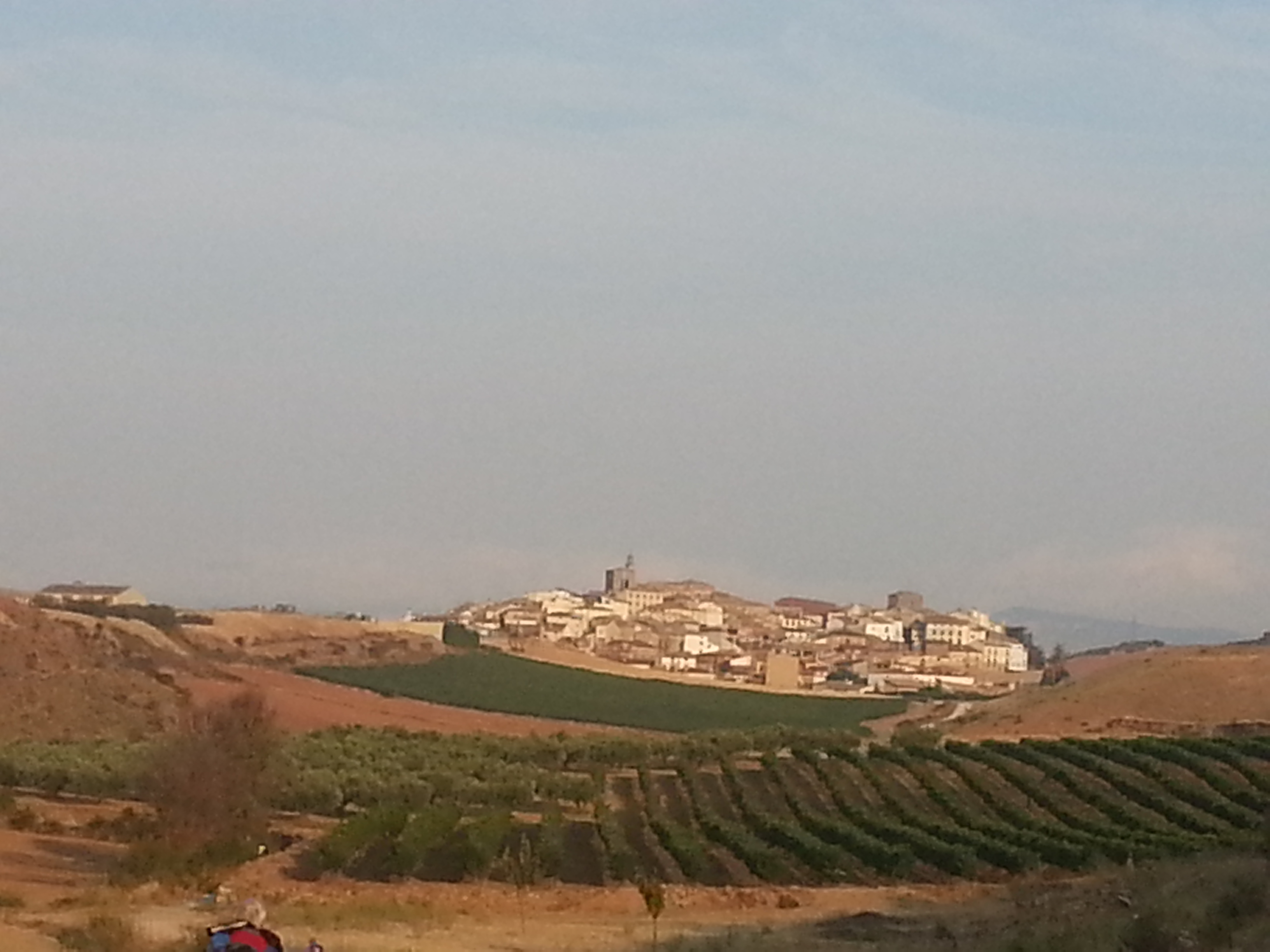
This stage of 44 km is characterized by a continuous ascent from Pamplona during the first 12 km until reaching the Alto del Perdón (780 m), maximum route quota. From there we will descend for about 4 km on a steep slope until we reach Uterga. We recommend caution to avoid injuries. But, as always, “after the storm, calm always comes.” Therefore, a much smoother terrain profile will lead us to our end of stage: Estella.

In addition, today the pilgrims, who started in Somport and have toured the so-called Aragonese Road, will be joining us. Near Puente la Reina, in the middle of the stage, we will meet them and will be together until arriving at Santiago de Compostela.
Along the road, today we can see a curious monument to the pilgrims in Alto del Perdón. We will also pass by one of the most emblematic localities of the Camino Francés: Puente la Reina, urban prototype of population born around the pilgrimage route. Near Muruzábal we can turn aside to visit the church of Santa Maria de Eunate, one of the most magical temples of the road.
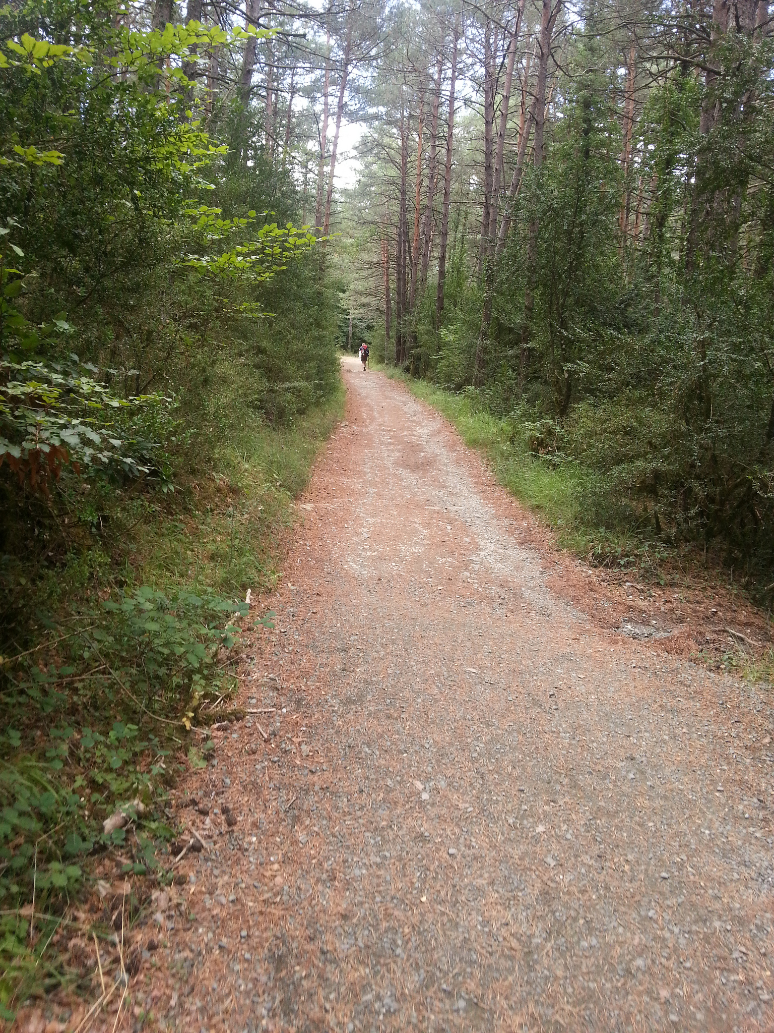
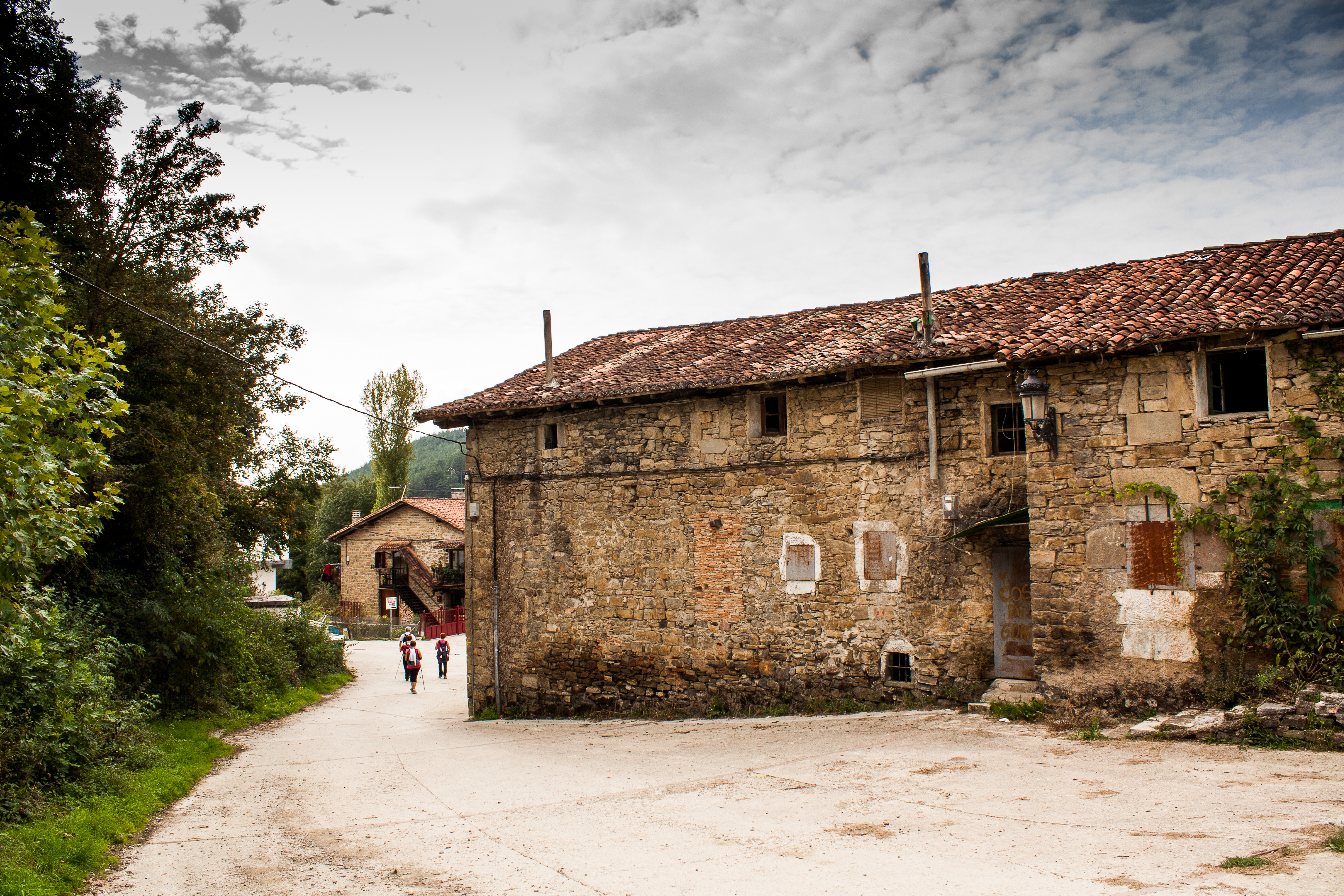
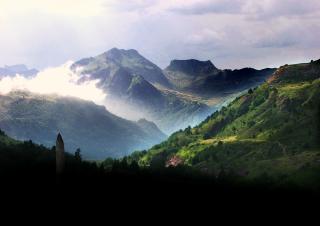
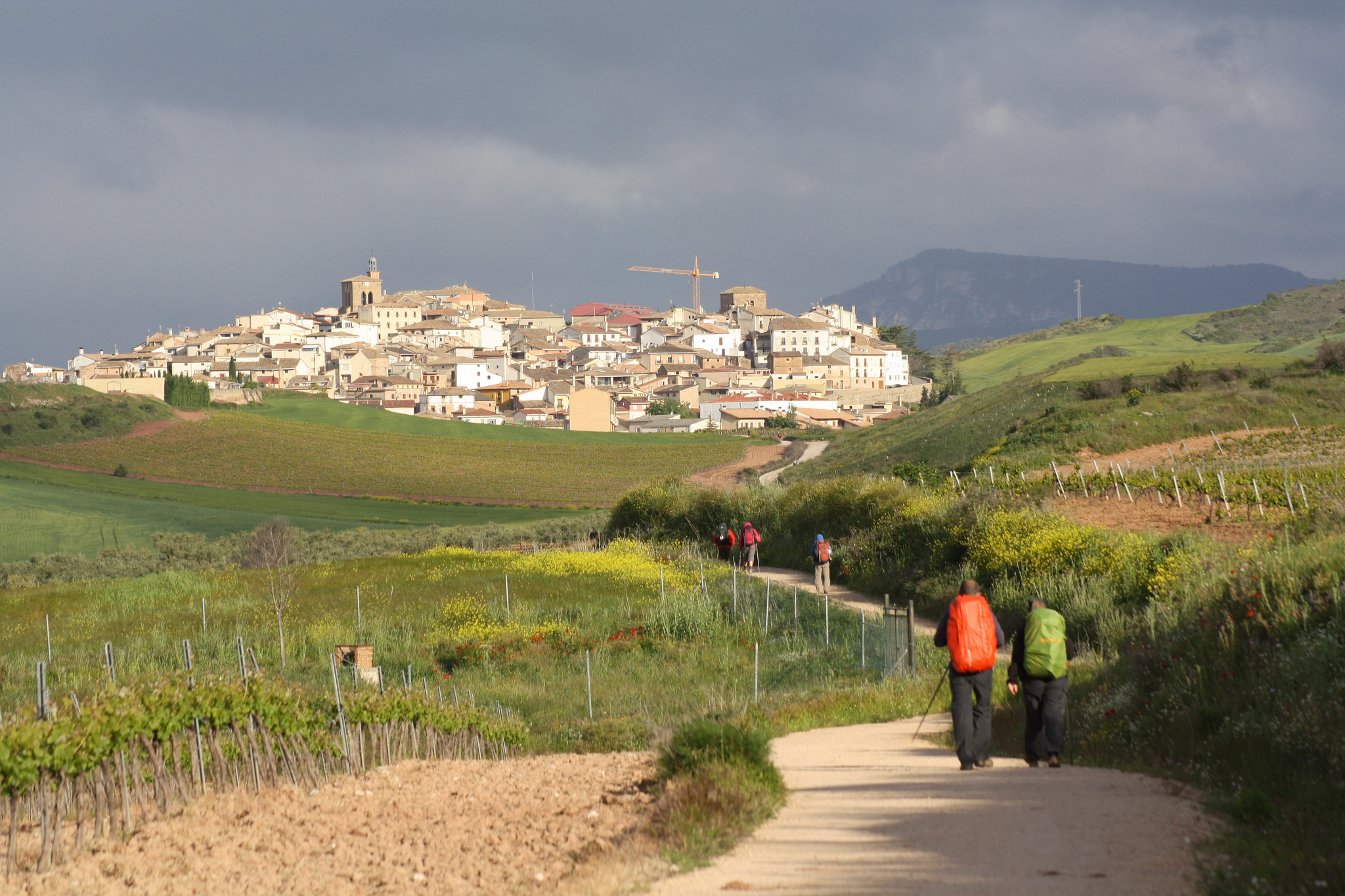
Medieval and picturesque villages will splatter our route, which we travel through agricultural paths or ancient Roman roads between large tracts of cereal fields and vineyards.

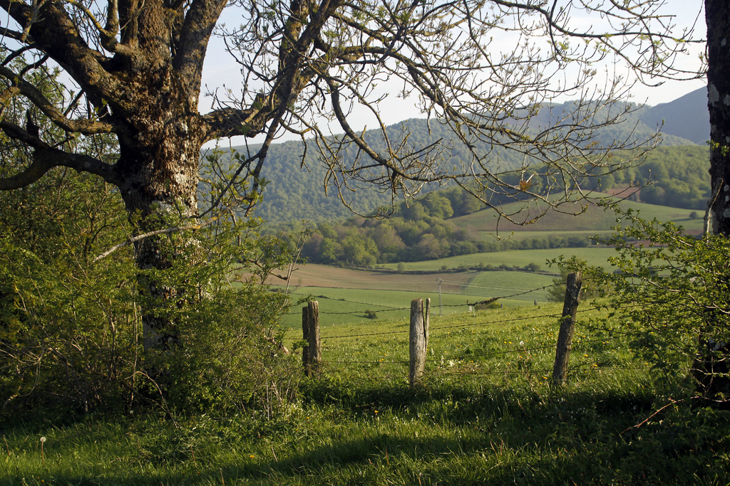
Welcome to the Navarran countryside, a haven of peace!

The outbound trail from Pamplona on the way to Santiago de Compostela

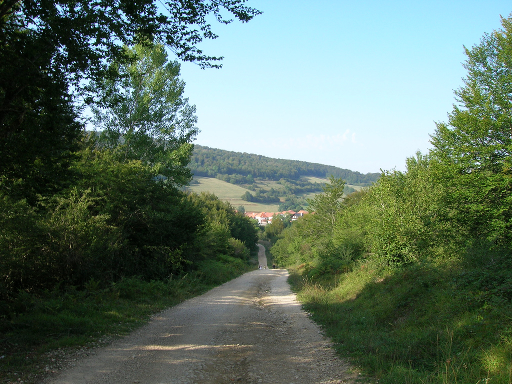
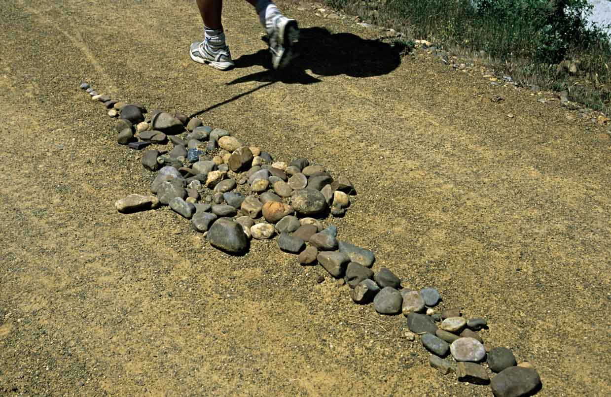
Pamplona Outbound Trail (photo by Flickr provided by Hans-Jakob Weinz under the following conditions)

GENERAL PROFILE STAGE AND ROUTE

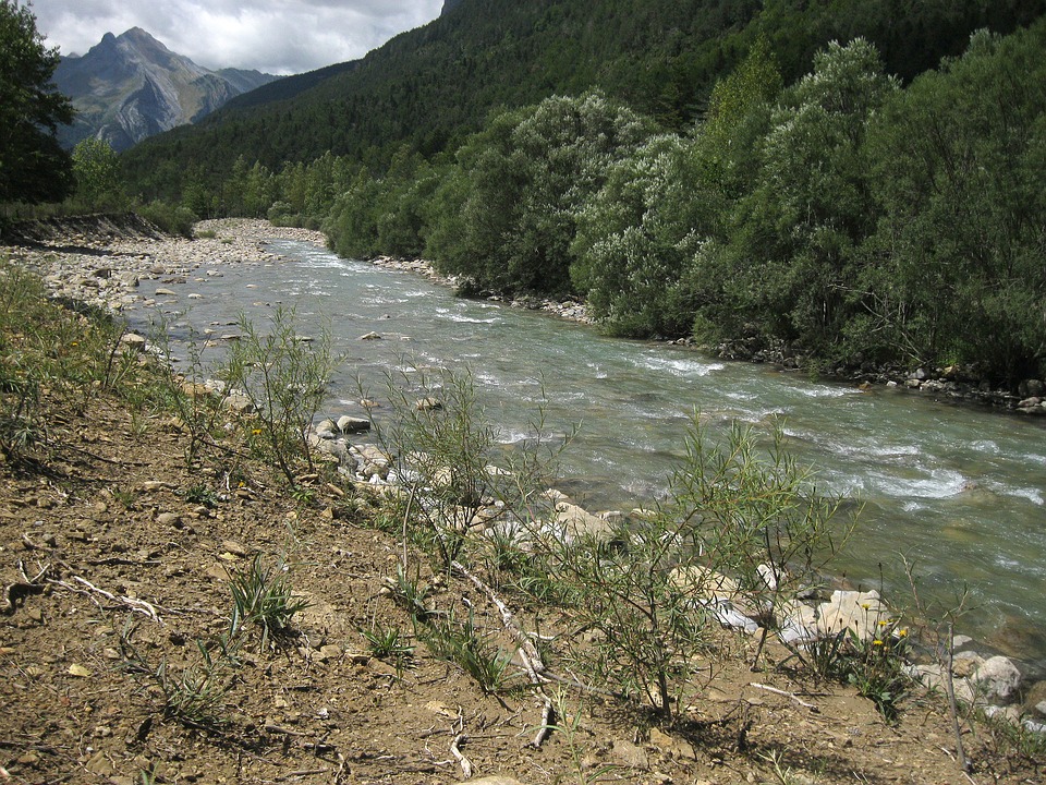
As we have already noted, the profile of this stage is much less brittle, but requires an initial effort to climb to the Alto del Perdón, where we can see the road from Pamplona at our left, and on our right, the valley that we still have to go. From Puente la Reina there is only one ramp that will really make us sweat. It is 1.5 km and takes us from the edge of the Arga leaving from Puente la Reina until Mañeru. The rest of the road to Estella runs along paths between cereal fields and vineyards, crossing several times with the A-12 in underground steps.

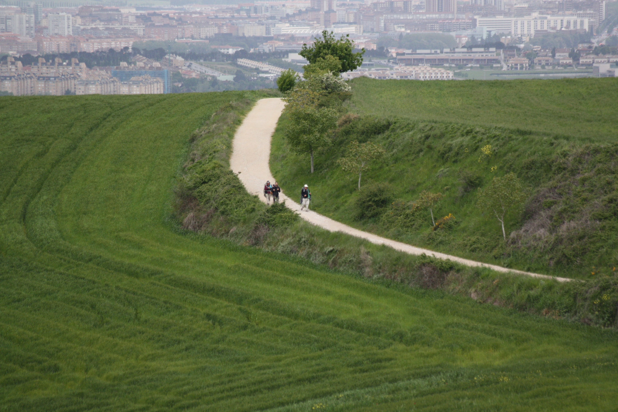
Leaving Pamplona by the university we will take a quiet road that crosses a fluvial park and, in a slight ramp, we arrive to Cizur Menor. We left the residential nucleus and started to climb towards Alto del Perdón by a first dirt track and a grass road later, with an average slope of 2%. At the end of the grass road, a little before the eighth kilometer of our stage, left to the left Guenduláin, now uninhabited.
Here the slope will become higher and higher From Guenduláin to Zariquiegui the average climb inclination will be about 5%. Arriving at Zariquiegui we will be at the foot of the Monte del Perdón peak (1034 m) and we will see in front of us the ramp that will take us to the high that we will reach in this route, with a quota of 780 m.

Cyclist reaching the top of Alto del Perdón

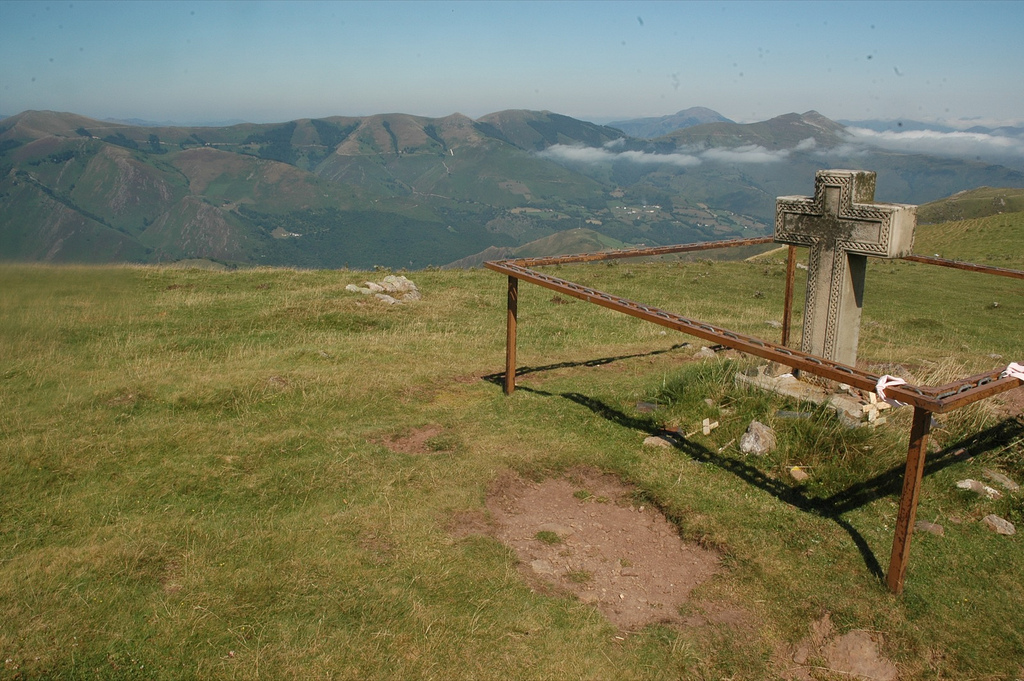
Climb to Alto del Perdón (photo courtesy Paul Quayle)

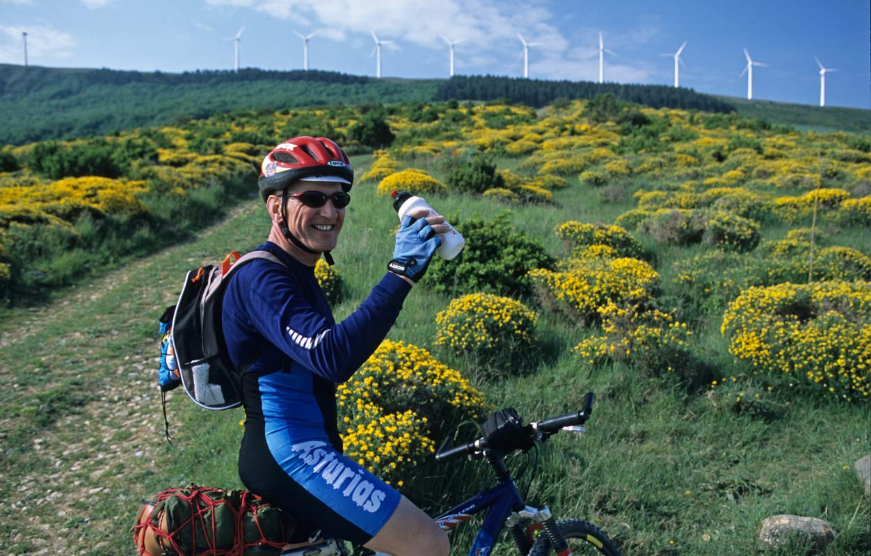
To reach the Alto del Perdón from Zariquiegui we saved a difference in altitude of 125 m in less than 2.5 km, following a ramp that can reach 15% incline several times. This rise can sometimes be made harder if there is a lot of wind, a circumstance that is not unusual. In fact, the sound of windmills moving with the air will be with us through the road.

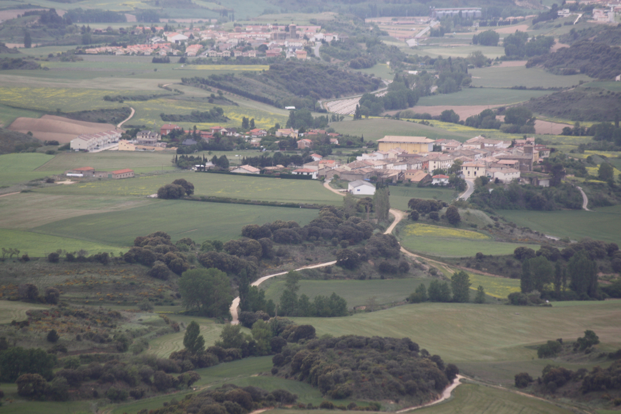
When arriving at Alto del Perdón we can stop to rest, admiring the views. To our right, we will see the valley that we will cross to Estella, a whole picture of cereal fields dotted with small towns.

Views on the top of Alto del Perdón

Views from the Alto del Perdón (photo provided on Flickr by Hans-Jakob Weinz under the following conditions)

With the descent from Alto del Perdón you have to be very careful, especially if it rains. It is difficult because it can have a slope of up to 12.5% (although the average will be 7%) and the ground is unstable. There are enough loose stones and it can wind up, which does not help the balance. If you do not have much experience in complicated slopes and you see that the wheel begins to slide, do not hesitate to get off and take the bike to your side helping you with the brakes. The descent is about 3.5 km so you will not lose much time. If you want to abolish this whole stretch, take before the Alto del Perdon the N-111 and border the mountain.

Trail down from the Alto del Perdón on the way to Estella

Trail down from the Alto del Perdón (photo provided on Flickr by Hans-Jakob Weinz under the following conditions)

The descent takes us straight to Uterga. After crossing the village we go to Muruzábal, where we will arrive after the 18 km route. There you have to take a dirt track that runs to the right from the village. Just 2 km after walking that flat path, we will arrive at Obanos.

Kind of between Muruzábal and Obanos there is a stop that we cannot miss: the church of Santa Maria de Eunate. It is a very unique Romanesque temple in an uninhabited place, for which it is well worth adding a few kilometers to the stage. To get to it we have to detour in Muruzábal, taking a different road from the center of the village and traveling for 2 km. It is not very well marked, so it is recommended to ask the villagers. They will be more than accustomed to seeing doubting pilgrims!

Temple of Santa María de Eunate in the night

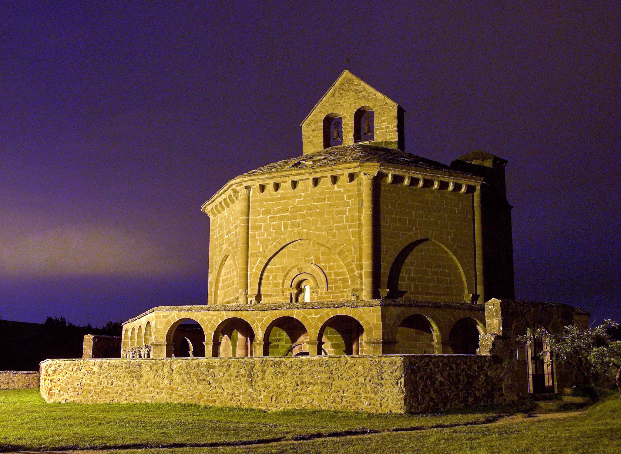
Temple of Santa Maria de Eunate (photo provided on Flickr by Xabi M. Lezea under the following conditions)

After about two kilometers we arrive to the church. Near this point we will see how the pilgrims who have traveled the Aragonese Way, which begins in Somport, also arrive.

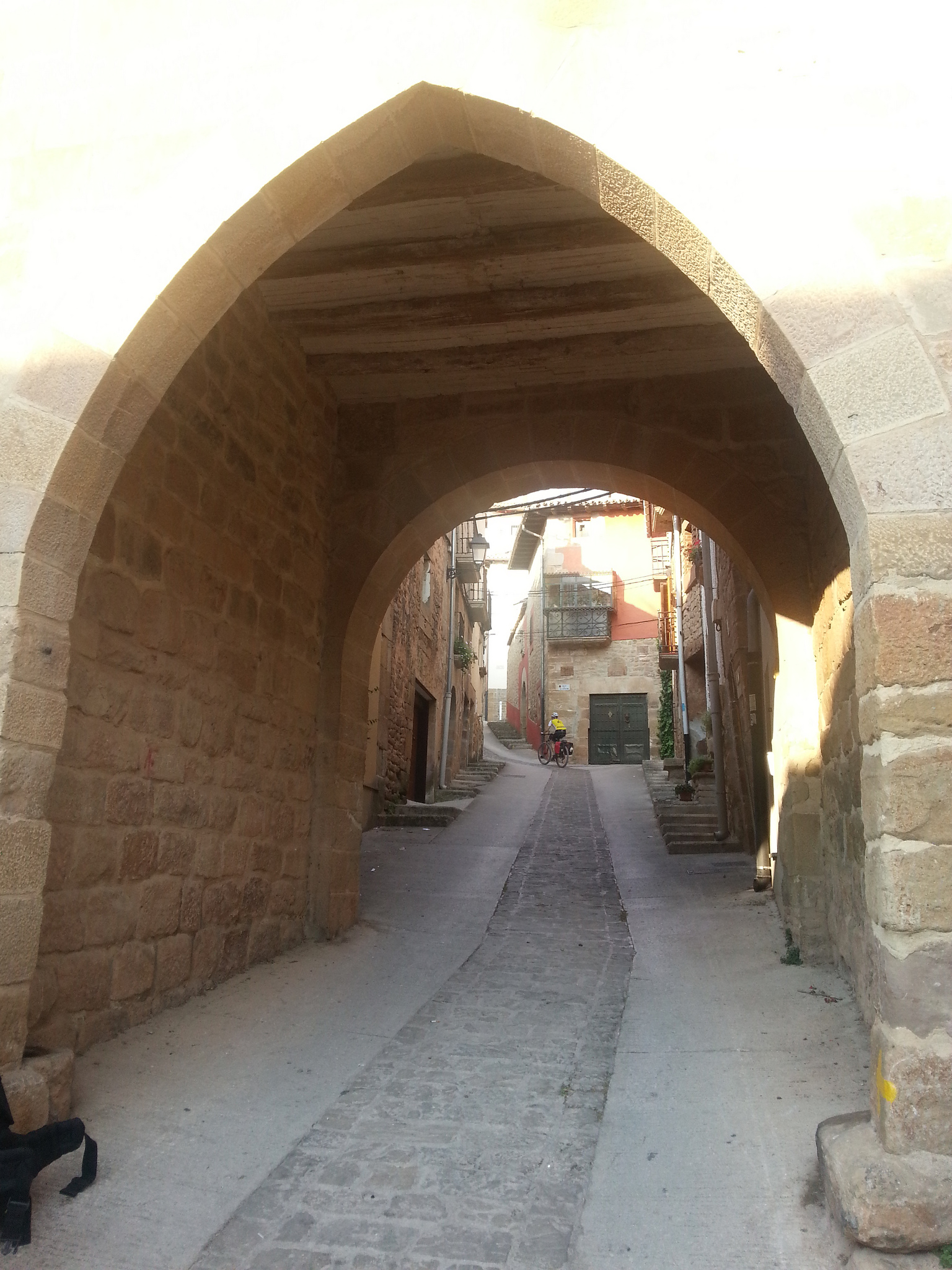
From the church we must take the path towards the west, to reach Obanos, where we will retrace the path with those who have gone directly from Muruzábal without visiting the church of Santa Maria de Eunate. To get out of Obanos you have to go through a stone arch, and there is little to get to Puente la Reina, by a dirt track with a slight slope. It is a very pleasant walk.

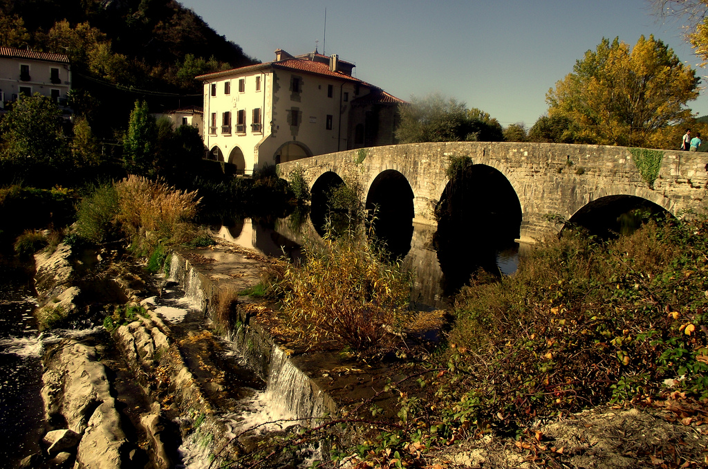
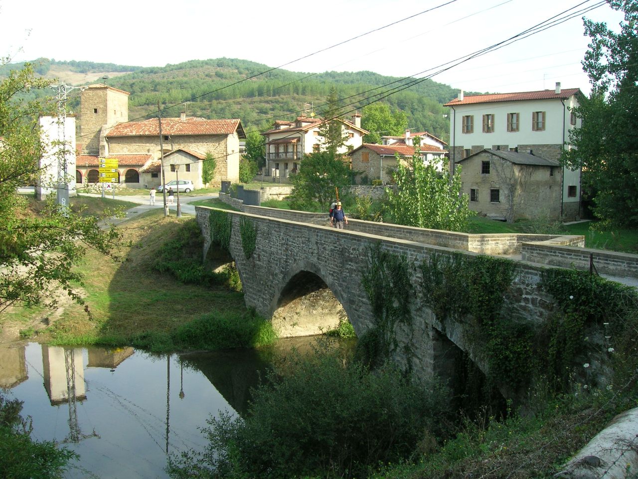
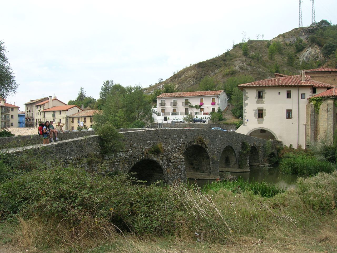
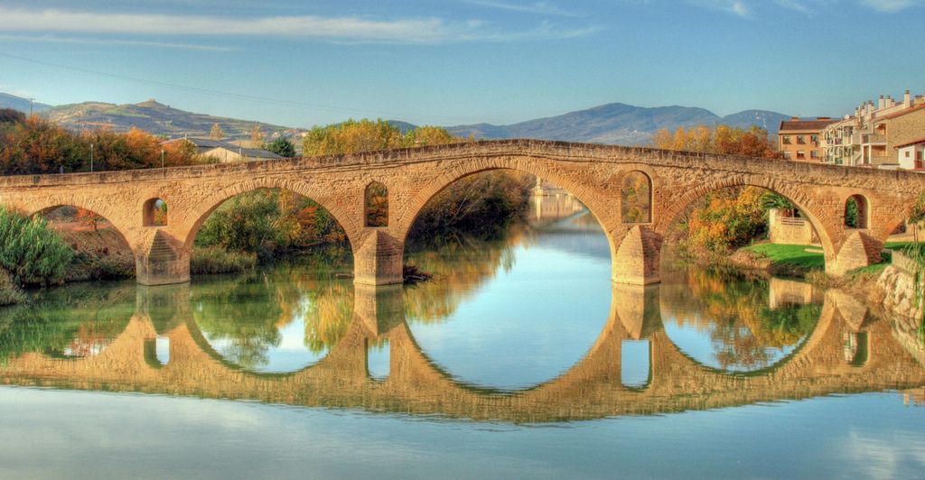
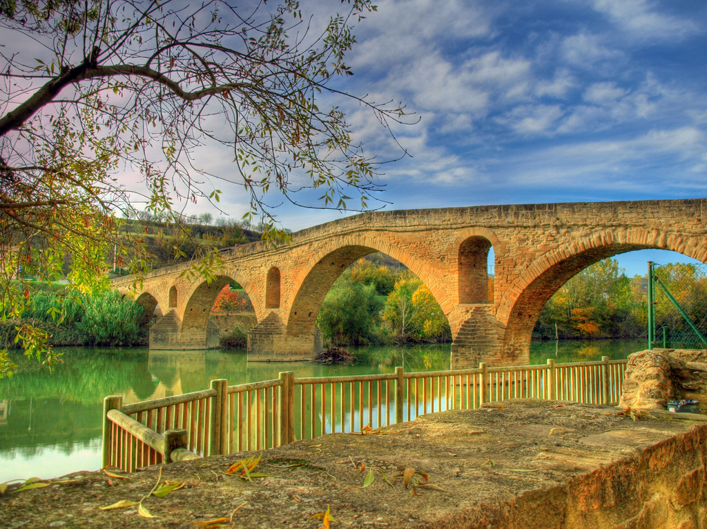
We arrive to the Ecuador of our route in Puente la Reina (22 km), , one of the most emblematic localities of the road. We cross it and we leave town by its famous medieval bridge, passing on the same river that we crossed at the beginning of the stage: the Arga River.

Medieval bridge over a river in Puente la Reina

Medieval bridge in Puente la Reina (photo courtesy Flickr by Aherrero under the following conditions)

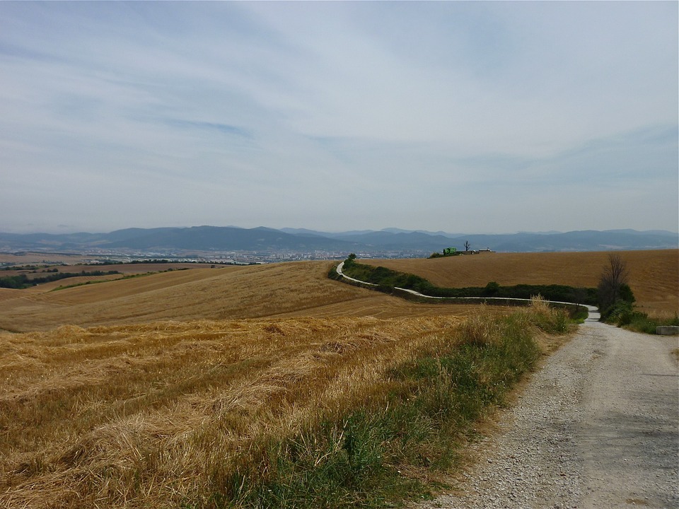
From Puente la Reina to Estella, the profile is so much flatter. We will only find two moments of quite a ramp: when leaving Puente la Reina to go to Mañeru and when we cross the town of Cirauqui, of steep medieval streets.

After leaving Puente la Reina we climb the ramp of 1.5 km between pine trees through a dirt track and we arrive to Mañeru. We cross the village and from there, we see a path of about 2.5 km in almost flat profile to Cirauqui. This path is very beautiful, runs between agricultural fields in a very quiet environment.

Arriving at Cirauqui we will have already passed 29 km traveling through this stage. This population of medieval origin has very steep streets. After crossing it, going up to the town hall and then going back down, we must walk 5.5 km until we reach Lorca.

Three pilgrims at the entrance of Cirauqui with the village on the background

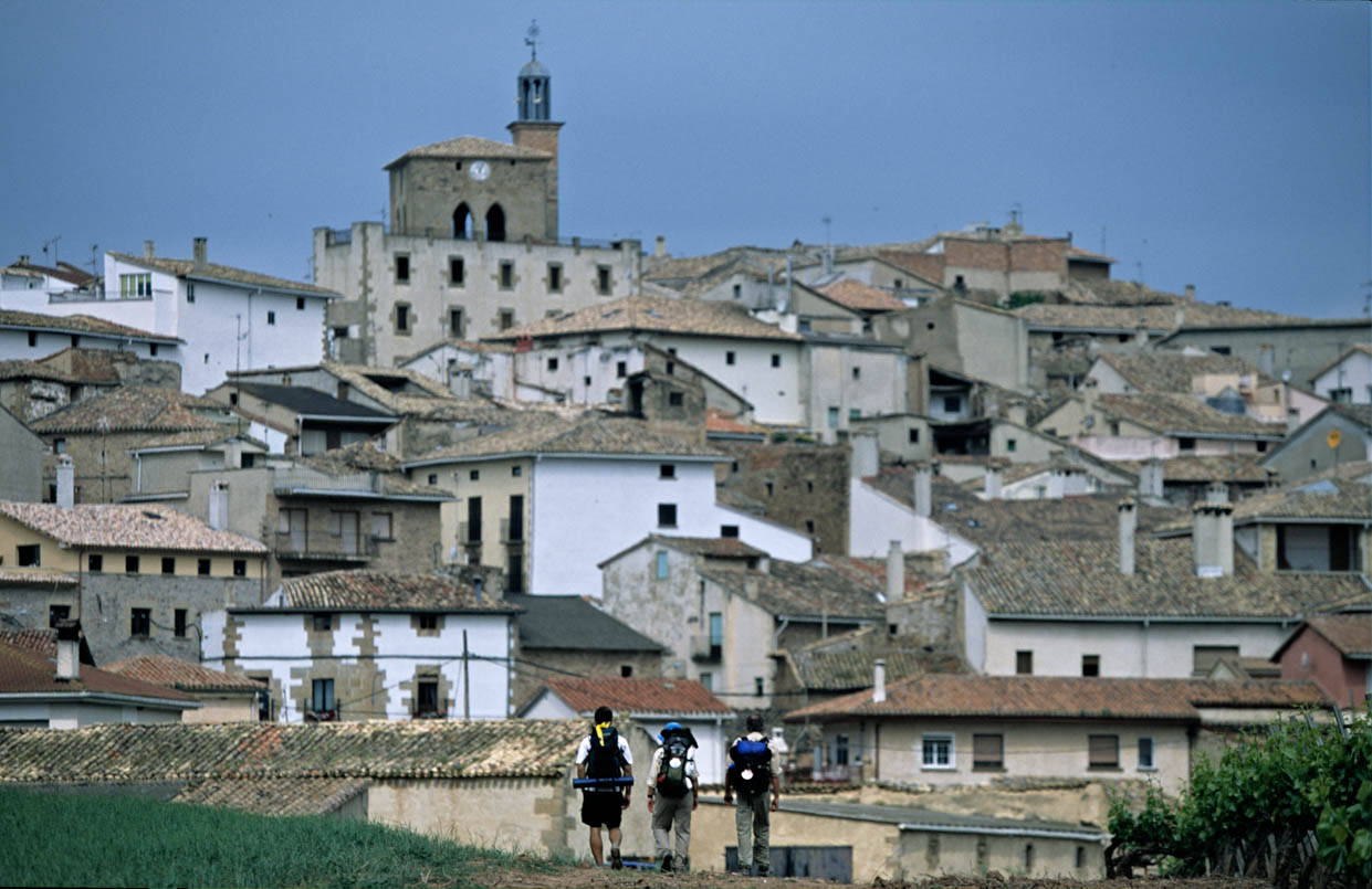
Entrance to Cirauqui (photo courtesy Paul Quayle)

The Cirauqui-Lorca route is very quiet: a profile with gentle inclinations by dirt tracks and asphalt crossing the A-12 through different steps.Already in Lorca we are only 8.7 km to reach Estella.
The landscape will remain similar, with large cereal plantations and vineyards delimited by agricultural tracks and national highways. We must first pass through Villatuerta, 4.5 km from Lorca. We can go by road (NA 1110, before part of the N-111) or take it to leave Lorca, and then follow a dirt path that leads us to cross a bridge and an underground passage to end at Villatuerta.

From Villatuerta we face the last 4 km, which we will walk on a slight slope, so it will be a pleasant stage end. With the same dynamic, we will follow agricultural tracks and we will have to pass through a last bridge and an underground passage. And at last, Estella.

Narrow path that lead to Estella from Puente la Reina

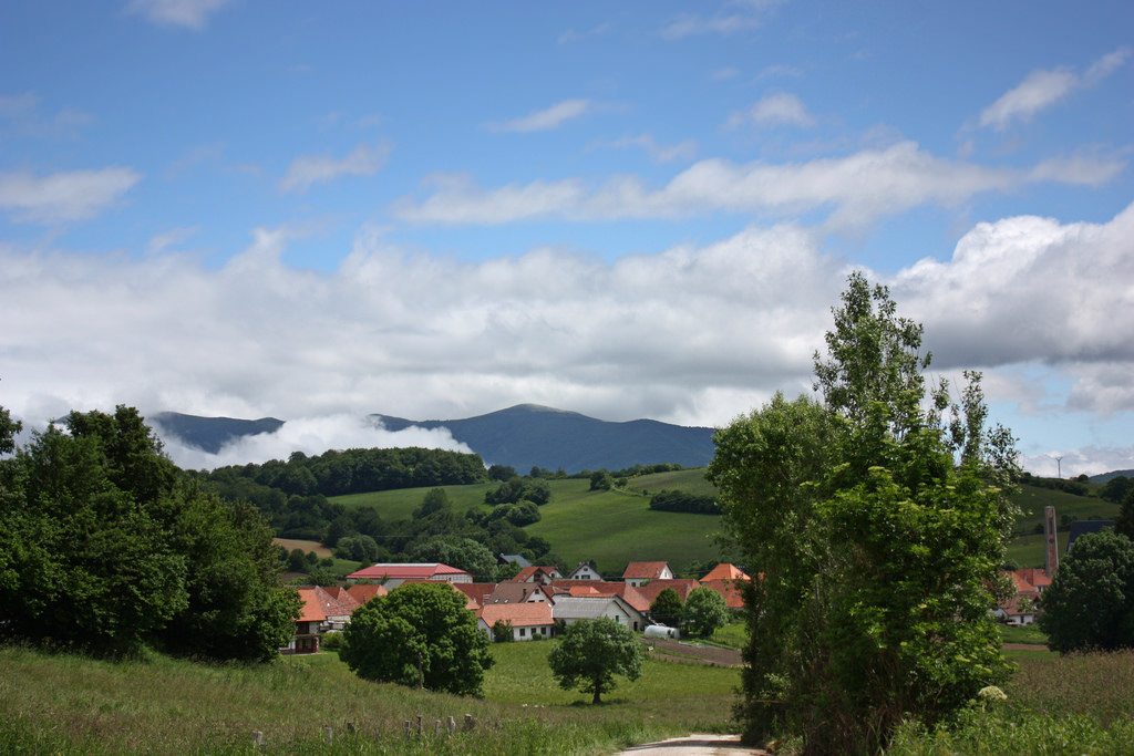
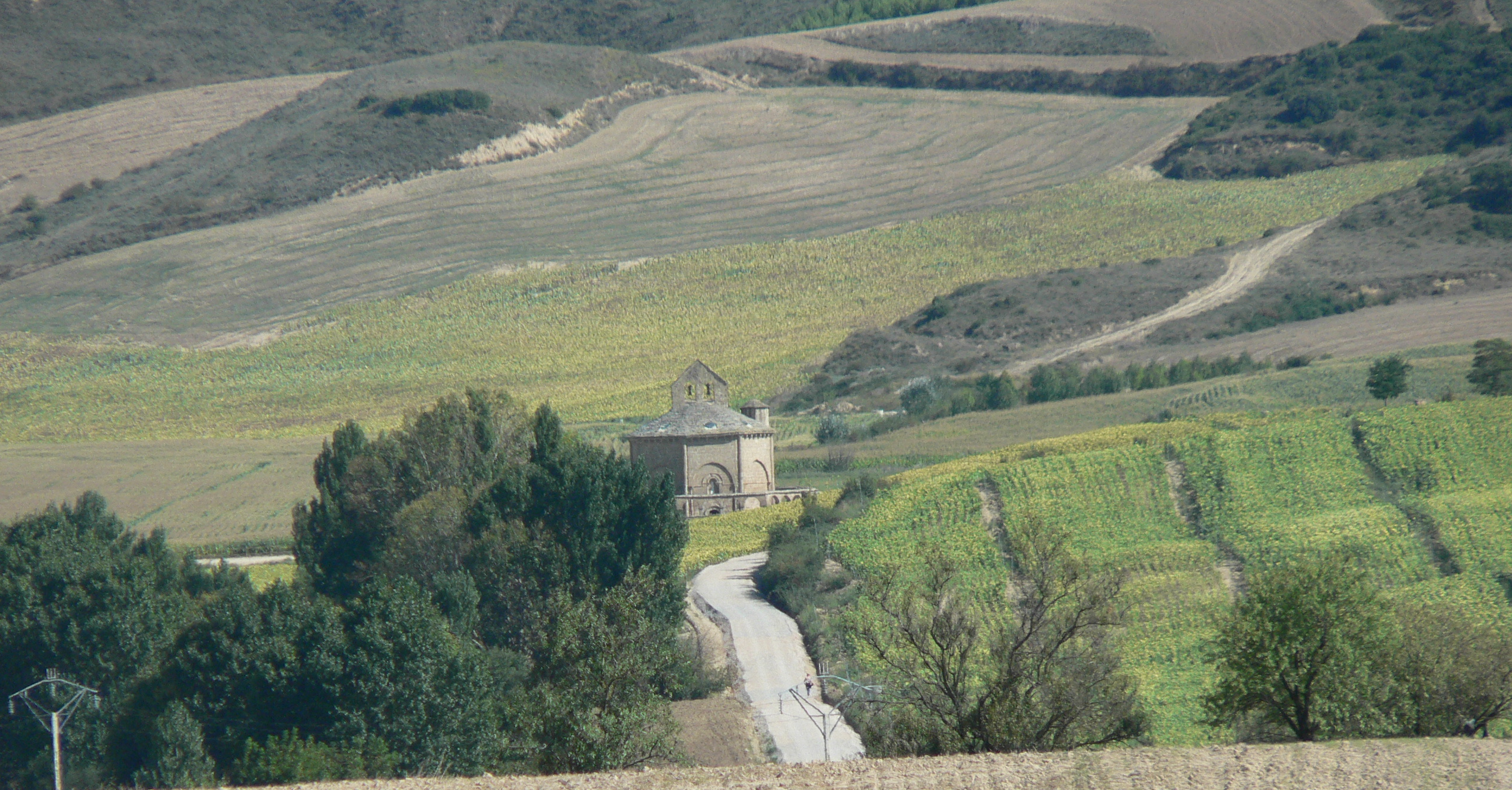
From Puente la Reina to Estella (photo provided on Flickr by Antonio Periago Miñarro under the following conditions)

Resuming, although this stage can be done completely by local road, the original path is quite affordable and therefore Tournride recommends you to follow it. We only have to take precaution between kilometers 10 and 16 of our route, when the Alto del Perdón goes up and down. If you do not feel safe, you can skirt the mountain by road or get off the bike and push in some moments.

PRACTICAL TIPS

  • Pamplona and Puente la Reina are places where many people start the journey. If this is your case, we give you options to get there:
  1. How to get Pamplona:

This modern city has a bus station, train stations and airport. Among all these safe transport modes you will find some that will bring you to the city.

2. How to get to Puente la Reina:

The best transportation option is the bus. The company that has most connections is La Estellesa with departures from Irún (2h 45min), Pamplona (30min), Logroño (1h 30min) and San Sebastián (1h15min). Conda and Avanza leave from Pamplona.

You can also go by taxi; there are special services for pilgrims. A 7-seater taxi from Pamplona costs around € 30.

** Remember that at Tournride we have luggage transfer service from start to finish on the way. Tell us where you begin to pedal and where you finish: we will leave the bicycle in your accommodation and take the excess luggage, which will wait for you in the place that you choose. If you have any questions you can consult our FAQ section or contact us.

  • Many of the stage populations have shelters, in case you are tired and do not arrive until Estella. There are hostels in Muruzábal, Mañeru, Cirauqui and Lorca and, of course, in Puente la Reina.As in that locality joins our way with the Aragonese, there may be many pilgrims. Hikers have preference over cyclists in hostels. So, if you see that all are full but you want to stop, know that there is a camping-hostel past the bridge. You can also continue to Mañeru (5, 2 km), although you have to save a ramp of 1.5 km.
  • In this stage we go through many towns and is a very traveled by pilgrims area, so it has many services. You will not have problems to obtain provisions and in the way you will be able to accede to enough doctors’ offices if it were necessary.

DETAILED ITINERARY AND HISTORICAL-ARTISTIC HERITAGE

Today we say goodbye to one of the great cities that we will cross in our cycling adventure, but we do it to discover wonderful things: medieval towns as emblematic as Puente la Reina, or the special Romanesque church of Santa Maria de Eunate. Our path will continue to be dotted with bridges from different eras and will run between large cereal fields and vineyards.

FROM PAMPLONA TO ZARIQUIEGUI: WE GET THROUGH THE NAVARRO FIELD

To leave Pamplona we must cross the university campus of the city. We leave by the Calle Mayor that takes us to the Park of the Taconera, the miniature zoo of the “pamplonicos”.We leave it to our right and we continue by the Pío XII Avenue until the Sancho el Fuerte Avenue, where we turn left and then in the first one to the right, by the street Fuente de Hierro. Going down this street we go now to the university campus of Pamplona.
We continue straight and go down University Street, along the campus bike path. When we reach the roundabout where the cars cross the Arga River, we follow the bike path that diverts right at the first exit of the roundabout. We cross the zebra crossing a little further and, now, we pass over the Arga River.

To cross the Arga River we pass on the stone bridge of Acella Landa. This bridge, three meters wide, has a single arch of about eight meters height. It is part of the Pamplona river park.

Stone bridge of Acella Landa over the river Arga

Acella Landa Bridge (photo courtesy of the Pamplona City Council)

When crossing it, we enter directly in the municipality of Cizur Menor.After following the road for less than 2 km, passing over the motorway, we reach the population nucleus. Due to its proximity to Pamplona, this town is very urbanized and serves as a residential area adjacent to the city. In spite of this also it has heritage of great antiquity, like the Romanesque church of San Miguel Arcángel.

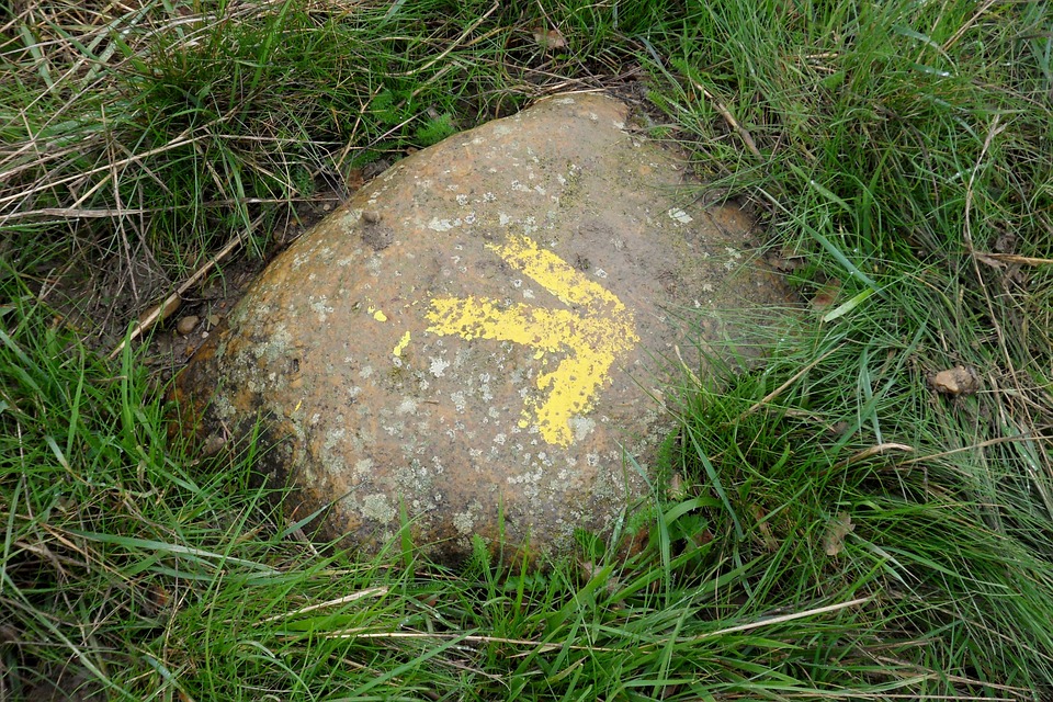
We cross from northeast to southwest, by a large urbanization. Afterwards, yellow arrows painted on pivots and a milestone with the shell on Zelaia Street indicates the path of the French Way.

Old road at the exit of Pamplona surrounded by cereal fields

Road to the exit of Pamplona, surrounded by cereal fields

We continue along the road, seeing to our left large extensions of cereal fields and, to our right, the urbanized area of Cizur Mayor.Almost 5 km of ramp that is hardening progressively takes us between agricultural fields and makes us leave behind Guenduláin to arrive at Zariquiegui.

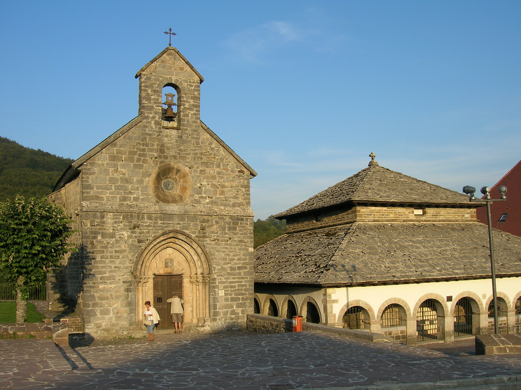
When entering Zariquiegui, we find in our left the church of San Andrés. Of Romanesque style, it emphasizes its great cover with several archivolts and the vegetal decoration of its capitals. In the tympanum, as we saw in the church of Santiago de Roncesvalles, there is a carving of a crismón. Like there, it is a pictogram that representing Christ as the beginning and end of all things, through the first and last letter of the Greek alphabet.

Church of San Andres in Zariquiegui on the way to Estella doing the French Way

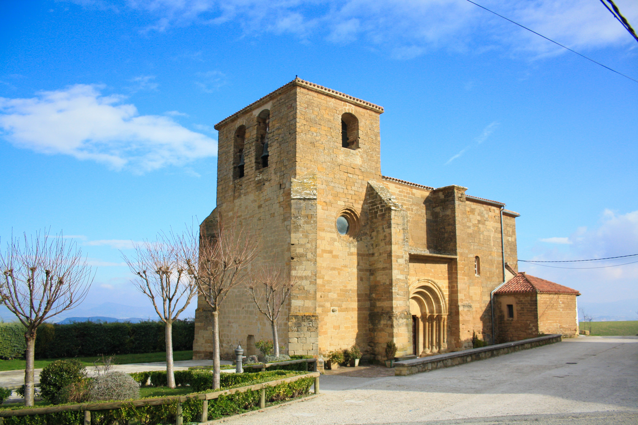
Church of San Andres in Zariquiegui (photo courtesy Flickr by Lucas Martínez Farrapeira under the following conditions)

WITH THE WIND PUSHING UP TO THE HIGH OF FORGIVENESS, EMBLEMATIC PLACE OF THE FRENCH ROAD

The sturdiness of this temple, which has been welcoming pilgrims since the 13th century, gives us the strength to face the ascent to the Alto del Perdón. It is a ramp of little more than 2 km that is not especially fatiguing, but it can harden if it is very windy and, as already said, it is not unusual that that happens.
In fact, on reaching the summit of Alto del Perdón (780 m) we will see how one of the figures of the sculpture that is there can be read: “where the road of the wind crosses with that of the stars”. This sculpture was designed by the artist Vicente Galbete in 1996. The fact that it refers to the Camino de Santiago as the “one of the stars”, it’s related to the legend of the discovery of the remains of the apostle. It is said that the hermit who discovered them, did so because he saw stars raining over a valley. Hence the name of the city and the road: Santiago de Compostela would be Santiago of the campus stellae. Meaning stars field.

Sculpture in the Alto del Perdón with mills in the background

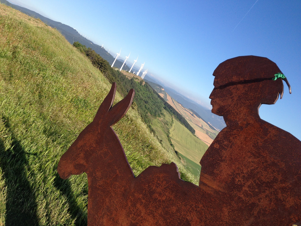
Detail of the sculpture in the Alto del Perdón, with the mills in the background

In this case, the allusion to the “path of the stars” also refers to what the sculpture itself represents. Formed by different forms of plaque, you can see a group of pilgrims from different times heading towards Santiago guided by the Milky Way.

In Alto del Perdón we can also see a marker with distances to different world capitals and a wall with an empty niche. The remains of stone remind us that formerly there was a complex formed by a hermitage and a hospital of pilgrims, abdicated to the Virgin of Forgiveness. The sculpture of the Virgin today is found in Astrain church. It was carried there in the 19th century, when Napoleon’s army desecrated the hermitage during the Independence War.

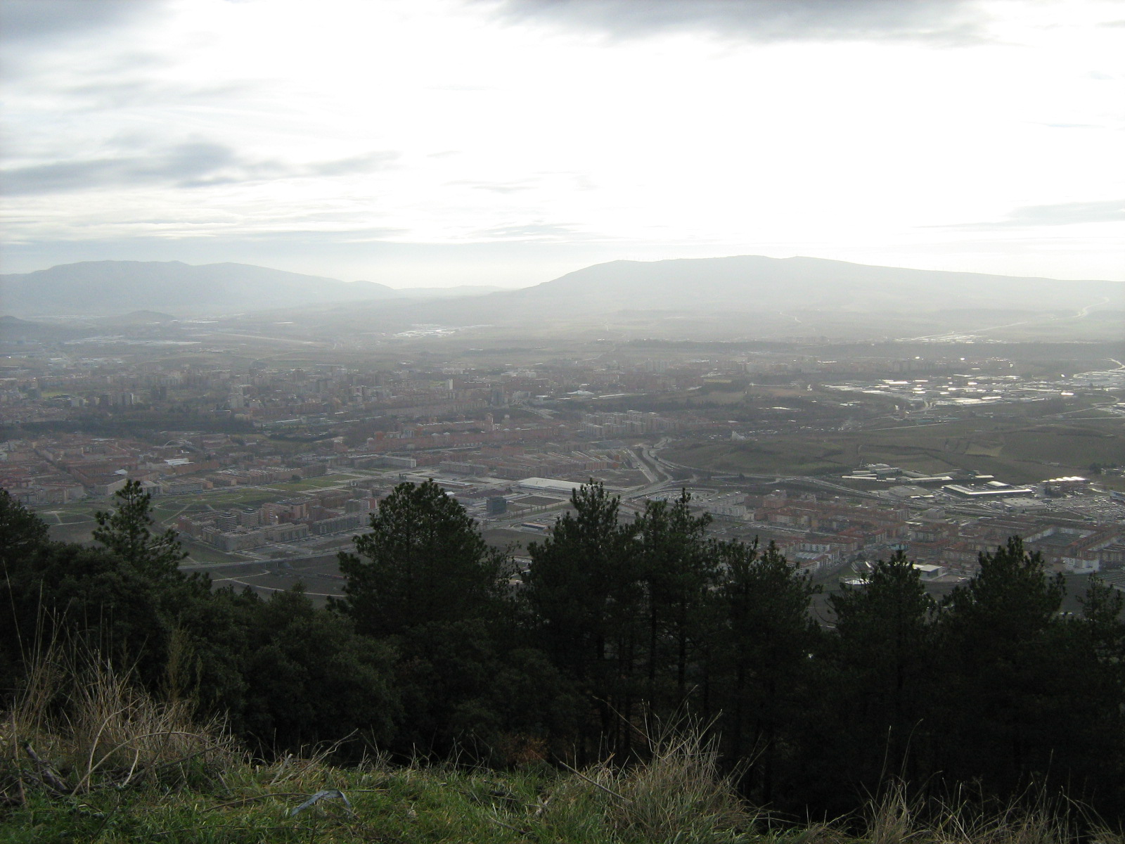
But the thing that makes the Alto del Perdón really special is the views it offers from the Navarrese landscape. Behind us lies the basin of Pamplona and, ahead, we see Valdizarbe Valley and its hills, behind which is the Puente la Reina.

This is one of the most emblematic points of the French Way. Its name remembers the integral forgiveness of sins obtained by the pilgrimage, which has been an incentive for the realization of the Way from the Middle Ages. Surely also in reference to this sense of the fight against the sins arose a legend that is situated in this place.

Two pilgrims on the Alto del Perdón watching the fields and trees in the background

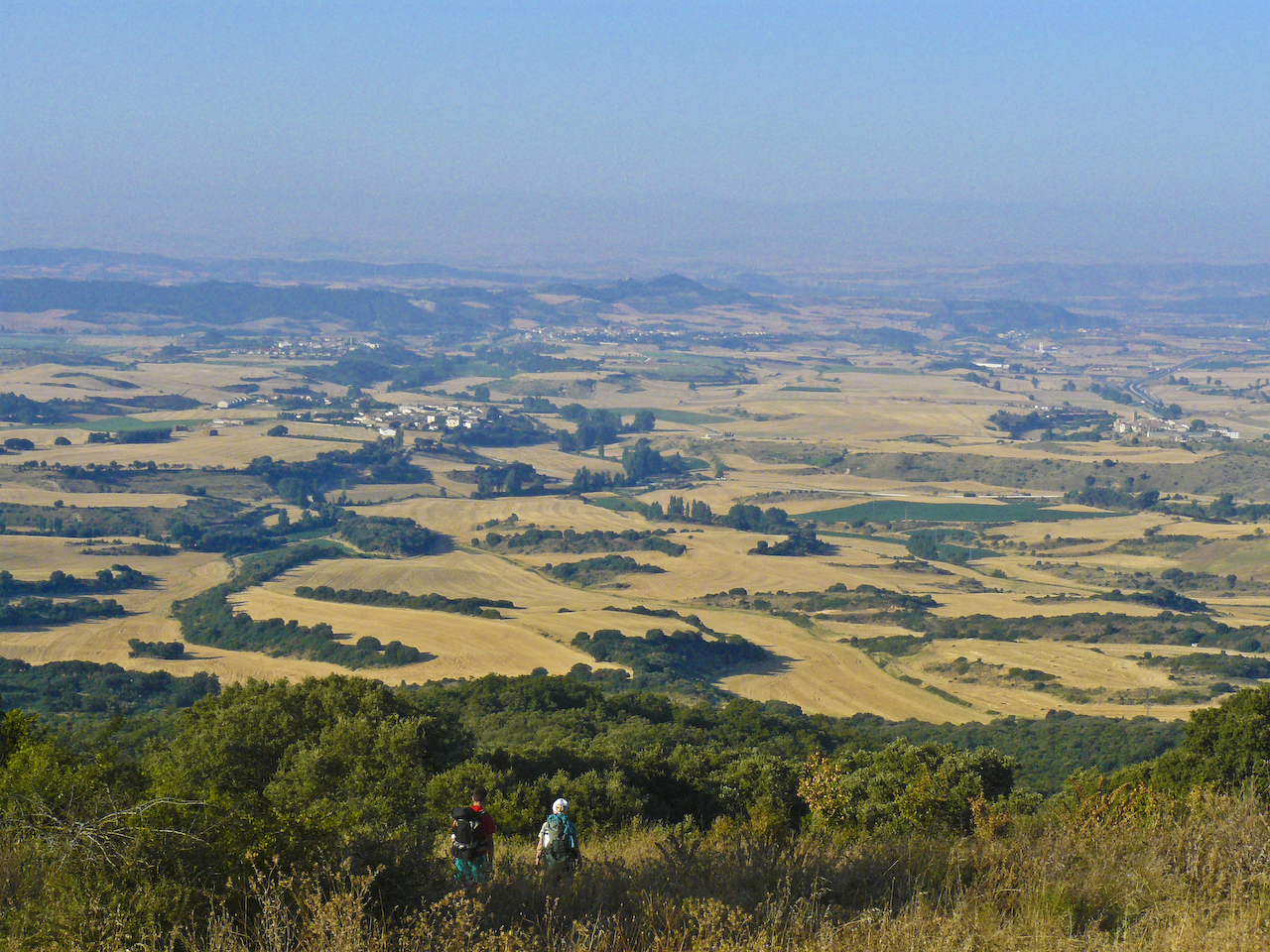
Views from the Alto del Perdón (photo courtesy of Flickr by Giovanni Ricardi under the following conditions)

It is said that the devil tried to buy the will of a thirsty pilgrim by offering water from a source of this mountain range. He asked that, in return for water, renounce God, the Virgin and Santiago. But the walker did not fall into the trap, and finally the apostle himself appeared miraculously to cast Satan.

GOING DOWN WITH CARE TO VALDIZARBE VALLEY. FIRST STOPS: UTERGA AND MURUZABAL

If we continue along the path from Alto del Perdón, we will descend from the sierra by a steep slope. It’s a tricky descent. Alternative: go by road, not a big detour. 

To go by road we take the NA 6056 that passes through Alto del Perdón and we make the final curve to join the NA 1110. In less than two kilometers we turn left to link with the NA 6016 that leads directly to Uterga.

However, all the roads lead us to Uterga! We enter the Asuncion street, where is the church that bears the same name.Its solidity resembles that of Zariquiegui, but this temple is later, from the 16th century. The tower and the portico, the two elements that most characterize it, are of the XVII and XIX respectively. The portico is reddish brick and in front of it there is a precious olive tree and benches to sit on. Another good place to do a little break.

Views of Uterga village at the entrance


Views of Uterga from the driveway (photo provided on Flickr by Hans-Jakob Weinz under the following conditions)

We leave the village by the street of the Eras and in less than 2.5 km by an agricultural path in profile on a slight slope we descend to Muruzábal. From this point we are going to see how the cereal fields leave space also to the vineyards.
In tune with the introduction of the vineyard in the landscape, we find in Muruzábal a winery that can be visited. It is located in the Muruzábal Palace, a large baroque building that was erected as a residence of an important Navarrese family. Nowadays it is bottled in its own wine and, together with the church of San Esteban, is one of the great attractions of the town.

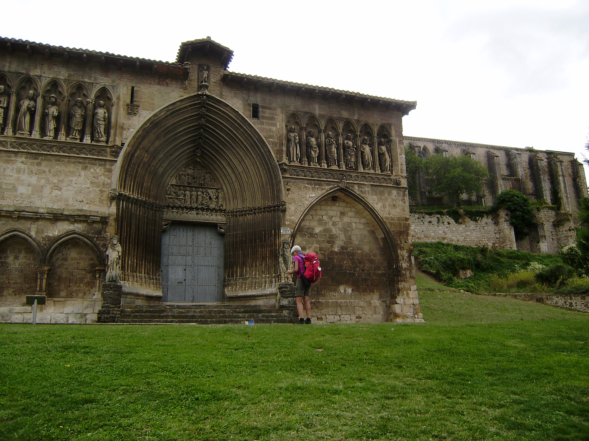
LET’S TAKE A DEVIATION…. EVERYTHING FOR THE PEACE THAT TRANSMITS SANTA MARÍA DE EUNATE

Whether or not you are great lovers of Romanesque art, from Tournride we recommend you visit the church of Santa Maria de Eunate. It is one of those magical places of the French Way, a special and wonderful construction in the middle of acres of agricultural field.

Church of Santa Maria de Eunate surrounded by fields of cereal and vineyards

Church of Santa Maria de Eunate surrounded by fields of cereal and vineyards (photo courtesy Flickr by P1040058 under the following conditions)

In fact, the detour does not increase the distance so much. If you go direct from Muruzábal to Obanos, you will cross a path of 2 km. If, instead, you leave Muruzábal in a southeasterly direction to get to the church and then you go to Obanos, you only add a kilometer to your route. Worth it!

Detail of the church of Santa María de Eunate

Detail of the church of Santa María de Eunate(photo provided on Flickr by Zubitarra under the following conditions)

There are many beliefs and legends that surround this temple in such a characteristic way. Santa Maria de Eunate is special, above all, for three reasons:

  • Its location. Plus being even today “in the middle of nowhere”, it is located exactly in what, according to our current political map, is the center of Navarra. They say the experts in the subject that is erected in a place in which different flows of energies come together.
  • The lack of documentation about the church. Although the majority of experts date it in the S. XII and that forms part of the Way of Santiago, almost is not mentioned in almost any historical text. Strange, do not you think?
  • Its way. The church is Romanesque and octagonal, which by itself is rare. But, besides, it is not a perfect octagon and it is known that given the constructive quality of the building they could have done it well if they had wanted to. In addition, a portico exempt of 33 arcs repeats that same form around it, and there was never a cover that unites it to the building, since there are no marks of fastenings in the stone. Why then build those arches? Why not give a perfect shape to the temple?
Church of Santa Maria de Eunate on a sunny day

Church of Santa Maria de Eunate (photo ceded on Flickr by Gianfranco Petrella under the following conditions)

Many questions and few answers. Since the church resembles in its form the Holy Sepulcher, it was said that it could have relation with the Templars Order. But historically speaking, this does not make much sense. What is believed is that it could be of the Order of the Knights of San Juan, who attended and protected the pilgrims. This is thought because it is known that this area had influence and have been found remains of ancient burials with scallop shells around the church. That is why one hypothesis is that in this place this order had a hospital for pilgrims.

If so, it could also be that the central tower of the church serves as a lighthouse. By lighting a fire in it would be seen from afar and so the pilgrims would not be lost on the road.

AFTER A MAGIC STOP, WE REMEMBER JACOBEAN LEGENDS IN OBANOS AND GO TO PUENTE LA REINA

From the church of Santa Maria, we take a path of earth in a westerly direction that in few meters ends in the road that takes to Puente la Reina. But, before arriving, we will leave Obanos to our right.

For those who decide not to go to see the church of Eunate and therefore pass through this town or, also, for the curious who decide to stop there to meet her, we leave here a little information about this place.

Obanos is a town with a great Jacobean tradition. In fact, the most important party of the town is every two years and consists of a theatrical performance in which more than 600 people participate and in which a legend of the Camino de Santiago is staged. According to the so-called “Misterio de Obanos”, a duke pilgrimed with his wife when they passed through the town and she decided to stay there to help in the hospital of pilgrims. Her husband was so angry for his decision that he ended up killing her and crying about it for the rest of his life. Later, he returned to the village and retired until he died in the hermitage of Arnotegui, which still exists today and is in the vicinity of the village.

Western facade of the church of San Juan Bautista in Obanos

Western facade of the church of San Juan Bautista in Obanos (photo courtesy of Flickr by Zubitarra under the following conditions)

Architecturally, Obanos is characterized by its cobbled streets and the beauty of some of its houses and civil buildings, with large arches of stone.. The best known are Casa Muzqui, Tximonco or Cildoz.
the two variants of the French road (the one that begins in Somport and the one of Roncesvalles) converge. Sometimes it is said that the two roads meet in Puente la Reina, as many pilgrims pass through Obanos bordering it and therefore join with the rest in the next stop.

The church of San Juan Bautista is of 1912, of neo-gothic style. Their asymmetry is because they reused some of the parts of the previous Gothic church, so it only has a tower. The cover is also from S. XIV. Inside, a large nave covered with white tiles welcomes visitors, with an altarpiece in the apse, S. XVII.
When leaving the town, we won’t be lost thanks to the low originality of the street names: both taking the street Pilgrims of Compostela and the Way of Santiago will end at NA-6064, which after turning to the left to take the NA -1110 will take us direct to Puente la Reina.

ROUTE ECUADOR… THE EMBLEMATIC PUENTE LA REINA!

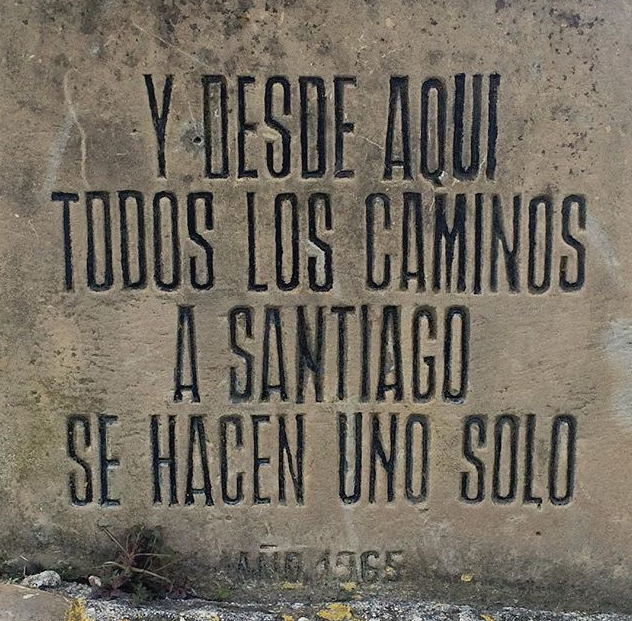
At the entrance of Puente la Reina we receive a monument to the pilgrim way.. Since 1965 welcomes all visitors on a basis in which you can read: ““And from here all the roads to Santiago become one””. Although we already know that, being strict, it is not where they converge but in our already visited population of Obanos.

Base of the monument to the pilgrim at the entrance of Puente la Reina

Base of the monument to the pilgrim at the entrance of Puente la Reina

We have already passed through other towns with much of their history linked to the Camino de Santiago. But, never better, we can say that this is the “queen” of all: born by and for the pilgrims. Other towns that we passed risen due to its proximity to a hospital of pilgrims or a monastery, but Puente la Reina is a town whose main vertebrae is its own road and that, in addition, preserves that original urban plot of “town-street”.

Therefore, it reflects in its urban design its own history. Its main streets are parallel to the Calle Mayor, the road to Santiago. In the middle of this is the Playa Mayor. And the streets which are today the “new enclosure” and “old enclosure” that close the old area, which formerly were the wall itself. Everything closes in, creating an almost perfect rectangle.

Image of the medieval bridge over a river at the exit of Puente la Reina

Image of the medieval bridge of exit of Puente la Reina (photo ceded in Flickr by Victor Rivera under the following conditions)

In fact, its original inhabitants were the “francs”, those foreigners who entered through France on the peninsula of which we have already spoken previously. King Alfonso I gave them a “carta puebla” to promote the founding of the city, that is, he gave them a series of trade deals and taxes in exchange for being settled in that place.
The reason for this is that in the 12th century the Arabs were losing territory, and one way of securing it was to create settlements in territories that were once again of the Crown. where Puente la Reina is today, a few years before Queen Doña Magna had built a large stone bridge so that the pilgrims could save the Arga River. On the edges of the Camino, next to that bridge and in the quiet valley of Valdizarbe; King Alfonso I found a good place for a new settlement.
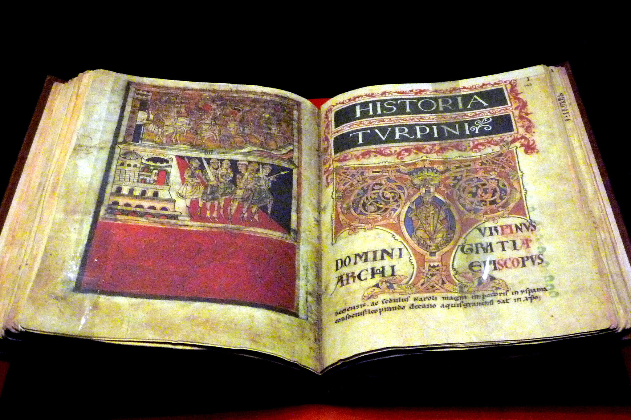
The town was created having as axis the Road and during the following two centuries the pilgrimage to Santiago was a great medieval “phenomenon of masses” and this locality grew around that main street: churches, hospitals of pilgrims and trades for the walkers. Even the monk Aymeric Picaud, the creator of the first “guide” of the western world, mentions the place in the Codex Calixtino as a point of convergence of the Aragonese Way with the three that came through Saint Jean Pied de Port.

Today, all this overlap of stone history is in an exceptional state of preservation for the pilgrims who, almost a thousand years later, continue to visit it..

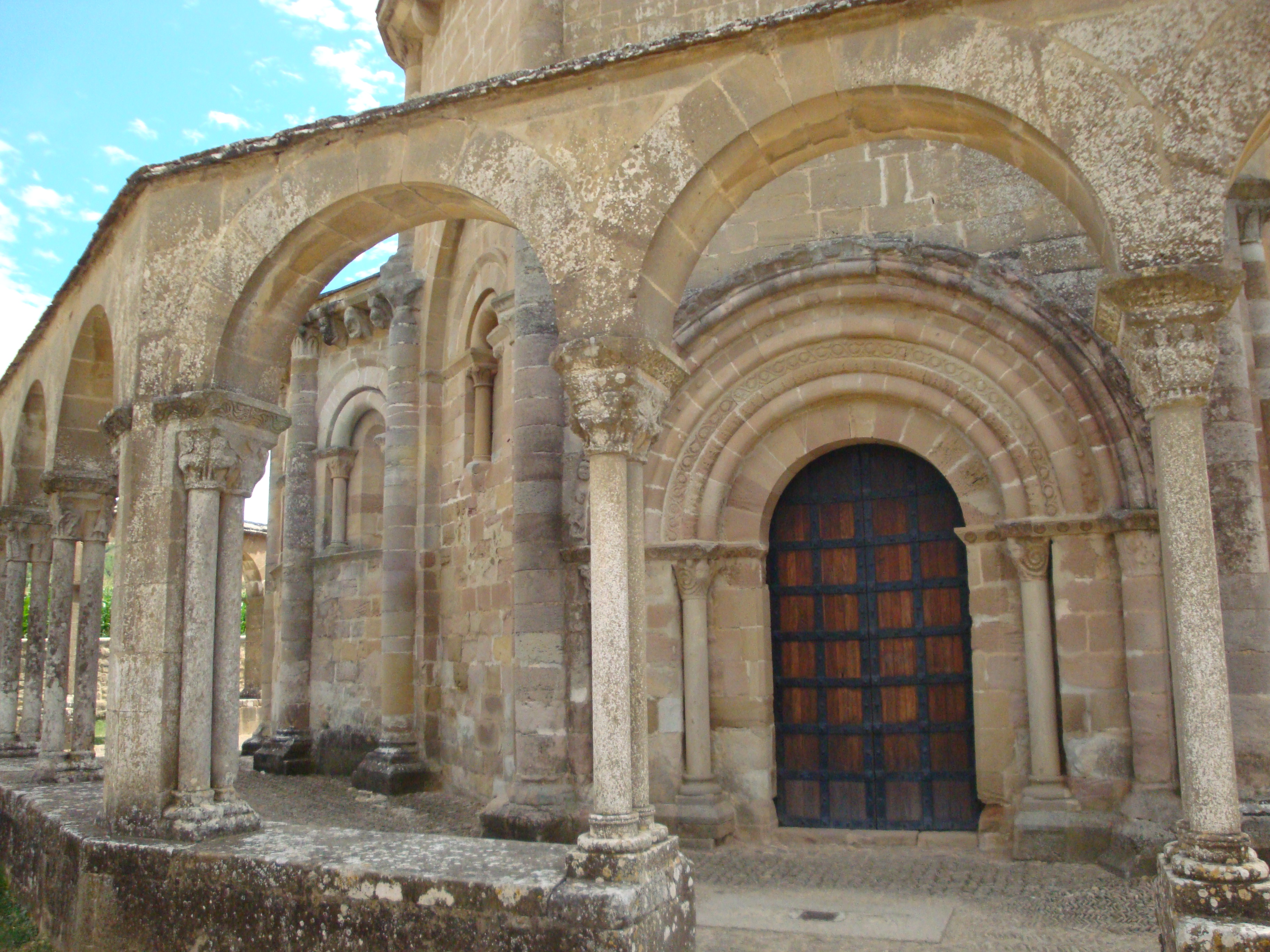
Just after entering the town, following the Jacobean sign that from the road points to the left, we find a stony memory of the antiquity of the place: the Romanesque church of the Crucifix. From the end of the 12th century, it was born as part of the complex of the old hospital of pilgrims (now a school) and owes its name to the old Cofradía del Crucifijo which from the S. XV managed the hospital.

 Image of Christ in the church of the Crucifix

Image of Christ in the church of the Crucifix (photo courtesy Flickr by Antonio Periago Miñarro)

In addition, inside the church, there is a large Gothic crucifix from the beginning of the fourteenth century, which marvels at both its size and its originality. Instead of having a “T” shape, Christ stands on a large “Y” carved so that the cross seems to be formed by large, natural trunks. The sculpture of Jesus gives a good account of the changes experienced from the Romanesque to the Gothic: it is a realistic and naturalistic Christ, who gives an impression of pregnancy and covered by large cloths that give a lot of dynamism. In spite of its large size there is correction in proportion and, in addition, the fineness in the size of each trait transmits to us sensation of pain and sorrow. One of the great works of Gothic imagery.
There are different speculations about the origin of this crucified Christ. Some relate it to the Templar Order and others say it was a gift from some Germans who carried the size throughout their pilgrimage and who ended up giving it as a gift to the hospital of pilgrims.

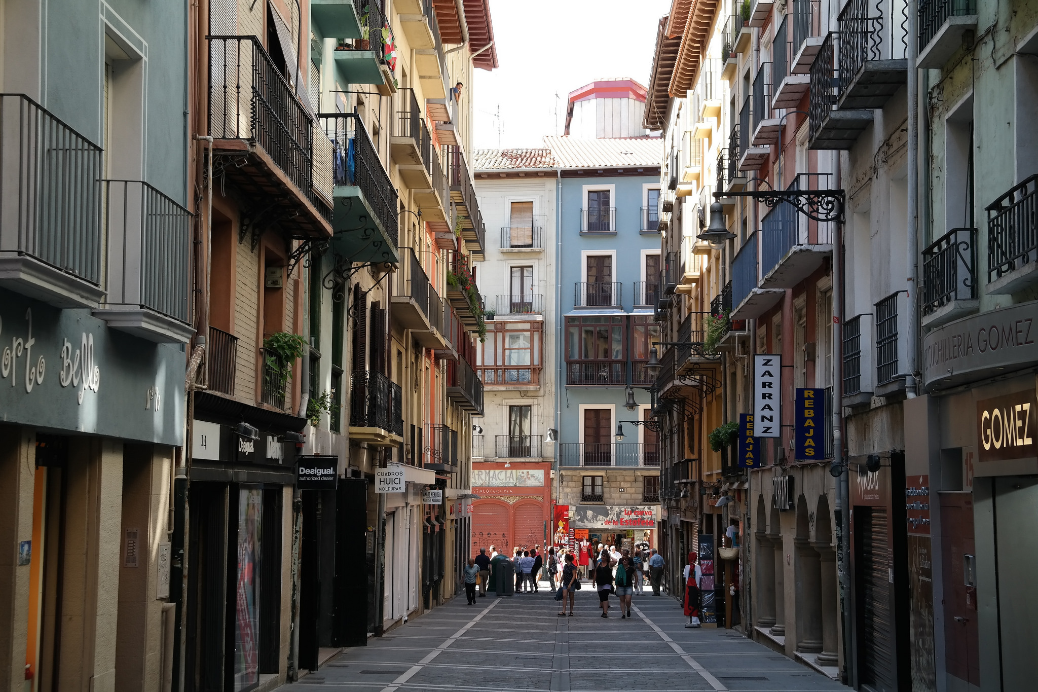
The street of the Crucifix takes us direct to the Main Street. In it we will see a whole life revolve around the pilgrims, in the form of shops in low stone big houses, with balconies forged in iron and large arched doors. When you go there you will find three points worth visiting: the church of Santiago, the Playa Mayor and the church of San Pedro.

Puente la Reina Main Street with the Church at the end

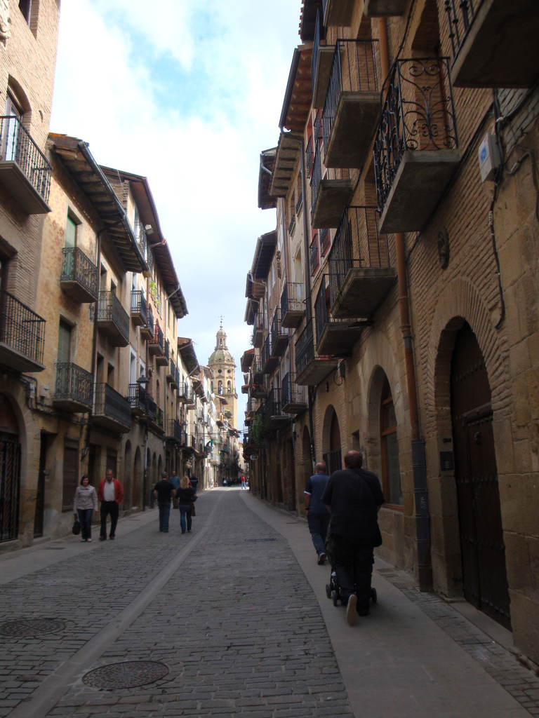
Calle mayor in Puente la Reina (photo provided on Flickr by Zubitarra under the following conditions)

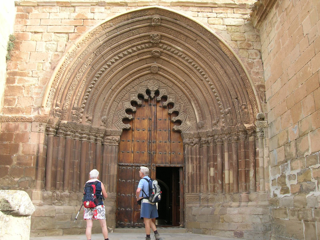
The church of Santiago was built almost contemporaneously with the one of the Crucifix, but today it is much larger due to the successive reforms it was undergoing. Also for this reason we can find a mixture of different styles in it: from Romanesque to Late Gothic and Renaissance.
Inside, the vaults of the main nave create complicated starry shapes with their nerves. They are held by huge Renaissance pillars. In addition, inside this temple we will be able to see one of the most famous carvings on the Camino, from which we already had an aperitif in the form of a copy in our visit to Roncesvalles: la escultura de Santiago “Beltza” o Santiago “Negro”. Although in all the French Way you can see more than 300 sizes of the apostle, this is one of the most known and admired. It is called the “black” (beltza in euskera) because before it was restored its complexion was that color.

Leaving the church, we continue along the main street and we arrive at the main square of the village. A good place to make a stop if we need it, sheltering us under its portico gallery. They adorn the place the beautiful buildings that give shape to it, especially the so-called “Flatware House”.

We continue along the Calle Mayor and, before leaving the village, we pass by the church of San Pedro. This one is way modern than the other two, of the S. XVI, although it has a chapel of gothic origin along with other three Baroque. The highlight of this temple is an altarpiece and a carving of the Virgin. The sculpture used to be a hollow of the medieval bridge that gives out to the town, and it is called the Virgin of the Txori (“little bird” in Euskera) because supposedly a small bird washed the face to him every day with water that caught of the river with its peak.

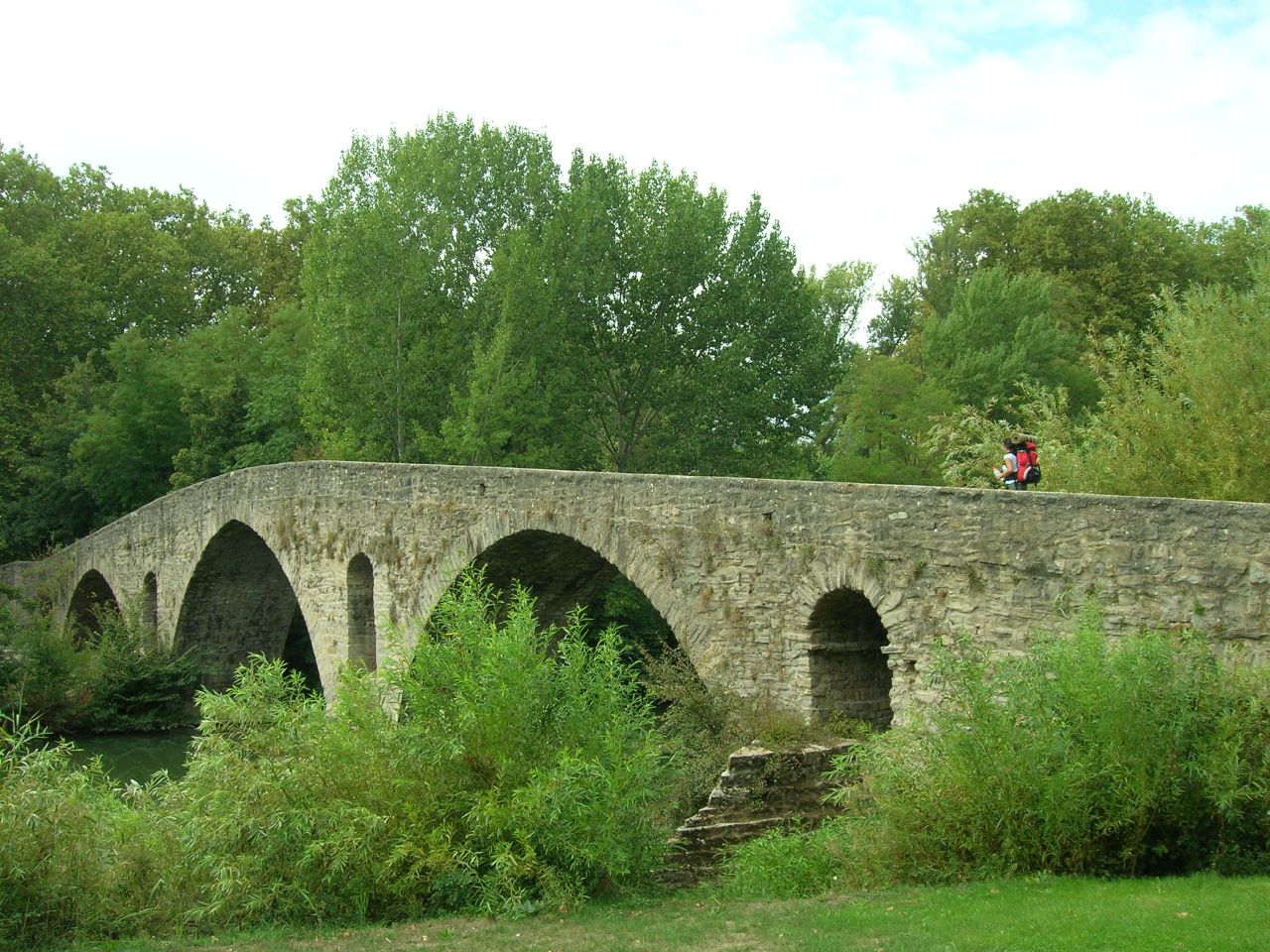
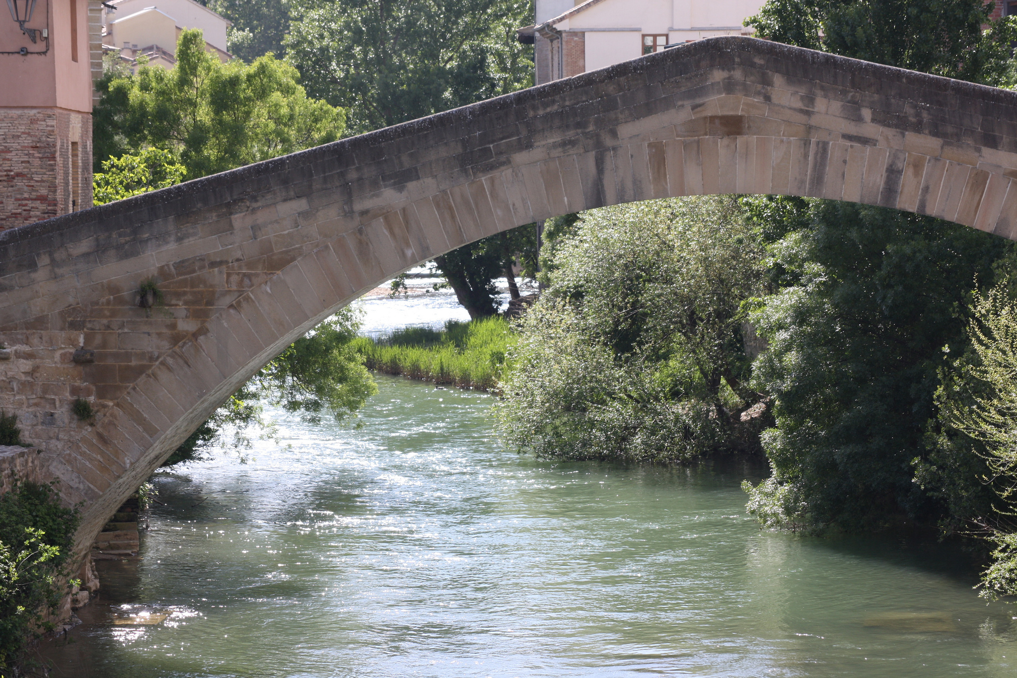
After leaving the Calle Mayor behind us we arrive at the great medieval bridge that bids us from Puente la Reina and gives the start signal to the second half of our stage.

This marvelous medieval construction was commissioned in the 11th century by Queen Doña Mayor, wife of the Navarra King. Although most scholars argue that the name of the town is due to this fact, there are others who believe that since the Arga River was called “rune” in Basque, could be derived from “pons rune” (bridge over the Arga).

Bridge to the exit of Puente la Reina over a river in a sunny day

Bridge to the exit of Puente la Reina

The stone bridge has 5 large pillars with mole that hold 6 round arches. The central arch is larger and the eastern one is not visible today because it has been buried. Formerly the bridge had three towers and in one of them was where the hole was where the Virgin of the txori, was, who according to legend washed a little bird with water from its beak.

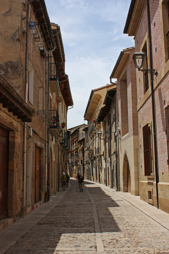
TO MAÑERU AND CIRAUQUI BY AGRICULTURAL TRAILS: “POSTAL PHOTOS” FOR OUR ROAD

We leave Puente la Reina crossing its medieval bridge and then turn left.We cross a zebra crossing that introduces us to the neighborhood of Zubiurrutia, the so-called “barrio de las monjas” (Nuns´s Neighborhood), because it has a convent of Augustinians since the 13th century. The Arga River follows us parallel to our leftand so we continue straight until passing the purifier. A large pine grove on steep terrain occupies the space between the river and the A-12 motorway, the Auto via del Camino.

View of Mañeru surrounded by wineyards and green fields

View of Mañeru (photo courtesy of Flickr by Malditofriki under the following conditions)

To get to Mañeru, which is next to the freeway, we will have to climb that ramp between pines. It is not a very long slope and it is also the last great effort of this stage but they are still more than 20 km ahead so, if you are tired; do not hesitate to raise it by pushing the bike.

We arrive to Mañeru, delimited by the A-12 by the north. We cross the village on its side and, leaving the villa, one of the most endearing views of the road we open before us. A whole path of land, between cereal fields and vineyards and, in the background, is Cirauqui.

Mañeru is a picturesque medieval village of less than 500 inhabitants.. Like our next stop, Cirauqui, it also retains its medieval layout set on a hill. This village has a great wine tradition, although nowadays the cultivation destined to vineyards has lost ground in favor of the cereal. Even so, a wine called “Belardi” is still produced and produced in a cooperative way.

A pilgrim doing thw Saint James Way by bike in a narrow street in Mañeru

Narrow street in Mañeru (photo provided on Flickr by Malditofriki under the following conditions)

During the middle Age the town was under the control of the San Juan Order, and soon happened to depend on Puente la Reina linked to the monastery of the Crucifix. It was also the scene of the first Carlist War. Today we can find in Mañeru all the services that we need.

After crossing the town through its narrow streets and passing through the great square of the Fueros, we went through the cemetery area towards Cirauqui. To get there, we cross 2.5 km of agricultural path between large fields.

When arriving at Cirauqui we have to face the last great ramp of the day, since to cross the town means to cross its steep streets, entering by what is left of the old wall until reaching the city council. Before arriving to the town hall, from Tournride we recommend that you get off the bike for a few minutes to visit the Church of San Román.

Two pilgrims doing the Saint James Way arriving at Cirauqui

Arrival path to Cirauqui (photo provided on Flickr by Hans-Jakob Weinz under the following conditions)

This church was built in the 12th century and belonged to the monastery of San Millán de la Cogolla (like the whole village). Although it has undergone many additions and reforms, it preserves its southern door intact. This cover is very interesting because it is a sample of the mixture of three different influences that could be found at the end of the XII century in the Iberian Peninsula: it has elements of the Romanesque sculpture, the way to make covers of the Cistercian order and, also, decorations reminiscent of the Arab world. All of it a conjunction of currents.

Stone cover of the church of San Román

Cover of the church of San Román (photo ceded on Flickr by Jose Antonio Gil Martínez under the following conditions)

Also there is a possibility of itinerary signalized at the entrance of Cirauqui that borders the town instead of crossing it. Precisely, it is designed for cyclists who want to avoid the ramps of the locality.

FROM CIRAUQUI TO LORCA IT’S ALL ABOUT ENGINEERING: FROM ROMAN FOOTWEAR TO MEDIEVAL AND MODERN AQUEDUCT BRIDGES

The path we take when leaving Cirauqui is part of an ancient Roman road and takes us straight to a bridge of the S. XVIII, built on another previous that was also Roman. Rolling on this road so old we arrive in a few meters to an overpass on one of the most modern roadway of Navarra, the A-12 or “Del Camino”.
We crossed the pass and followed the road for almost three kilometers, always with the freeway to our left. Then we must cross the highway again through an underpass. We arrive at a roundabout where we turn right to take the NA-7171, which crosses the A-12 below. After pedaling for about 500 meters we will see a great structure that crosses the NA-7171 above us: it is the viaduct of Alloz.
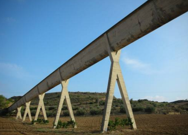
Viaduct of Alloz on the way from Pamplona to Estella

Viaduct of Alloz

El viaducto de Alloz fue diseñado por Eduardo Torroja en 1939. Alloz viaduct was designed by Eduardo Torroja in 1939. Surely many do not sound their name, but that of their granddaughter: Ana Torroja, the singer of the missing group Mecano. Even so, we must not forget this great Spanish engineer, considered one of the great masters and artists of the reinforced concrete of S. XX. Designed this great structure to carry the water from the reservoir of Mañeru and today it is still standing, fulfilling its function and has already become an incentive for the realization of the Way of Santiago by Navarra.

A few meters later after passing the viaduct, a dirt road leaves from the road. When we take it we will arrive direct to another work of engineering, this time instead medieval, which is the bridge that crosses the Salado River.

This bridge is supported above two arches and is mentioned in the Codex Calixtino. Monica Picaud warns all pilgrims in his book to be careful, because he says that here they used the bandits to assault the walkers. Standing on the bank of the river and sharpening their knives, they told the pilgrims to give their horses to drink from the water of the river, which, because of the saltiness it was, killed them. Afterwards, they slaughtered the horses and took away the belongings of their owners.

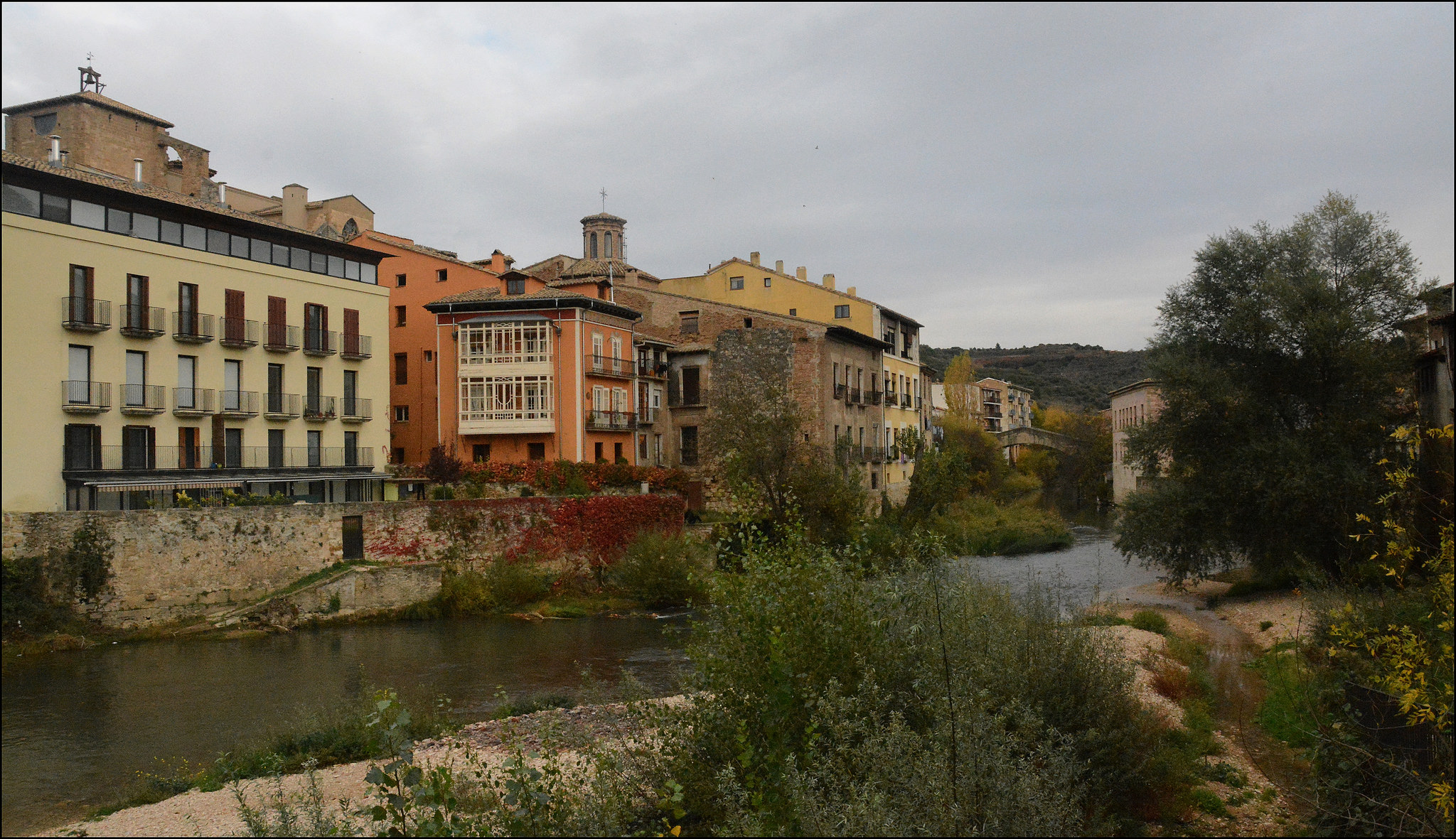
LAST 10 KM … LITTLE MISSING TO ACHIEVE ESTELLA! We pass through Lorca and Villatuerta

After crossing the bridge, we turn left and continue along a dirt track until we pass through a tunnel that crosses, again, the A-12. When leaving the underground passage we will see an asphalted track that will take us direct to Lorca (kilometer 36 of route), that we will cross from east to west by the Calle Mayor.

Like many of the towns in the area, this locality in which today less than 100 people live has its history closely linked to the Camino de Santiago. More than 900 years ago it had a hospital for pilgrims and today it has two private shelters.

A pilgrim passing through a stone bridge in Lorca

Lorca exit bridge (photo provided on Flickr by Elcaminodesantiago0920 under the following conditions)

We leave the main street of Lorca to undertake the last 9.5 km of route to Estella. But first we must travel about 4.5 km to Villatuerta. We have two itinerary options:

  • Go through the NA-1110 road.
  • Take a dirt path that appears at our left when leaving Lorca and continue between paths of crops and vineyards. After crossing another underpass under the motorway, we will arrive at Villatuerta.

If you take the second option, you will see that there is a rest area just before passing the tunnel that crosses the freeway. There has been installed a monument in honor of a Canadian who died in 2002 when she was doing pilgrimage to Santiago.

WE ARRIVE TO VILLATUERTA AND WE UNDERSTAND THE LAST STEPS TO ESTELLA

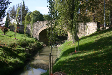
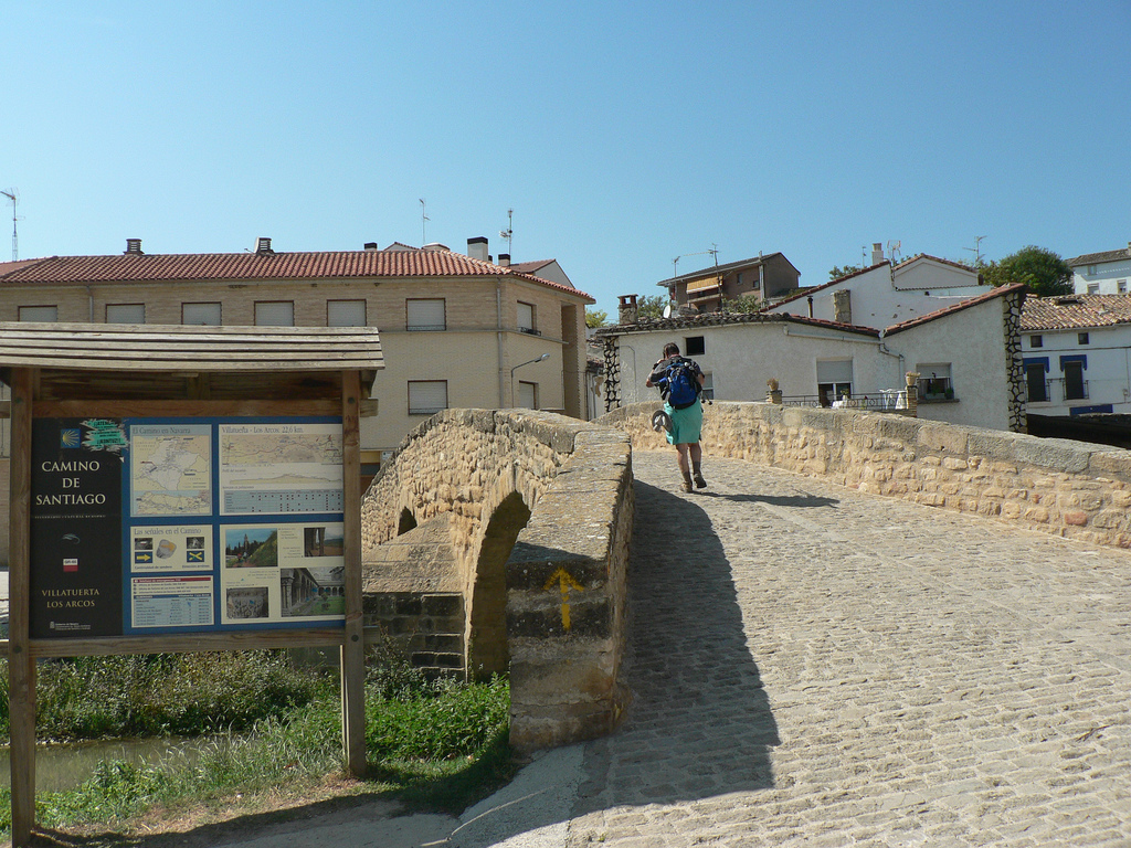
Villatuerta is divided in two by the Irantzu River and to cross it we must follow the streets until arriving at a stone bridge of medieval origin. Like that of Puente la Reina, it is higher in the center than in the extremes. This is called “dromedary-type” bridges. Although, of course, this one is much smaller.

Villatuerta bridge doing the Saint James Way by bike

Villatuerta Bridge (photo provided on Flickr by Jose Antonio Gil Martínez under the following conditions)

The other monument is the temple of the Asuncion. Formerly there was another tard-roman church in its place, but it caught fire in S. XIV and for that reason was constructed the gothic temple that we see today. It emphasizes, above all, its interior. It is very decorated, with even the remains of murals.
We leave the town by the northwest, by the “Camino de Estella”. We crossed a zebra crossing and came to a dirt path. When we see the road (NA 1110) we turn left to, for a short way, reach the hermitage of San Miguel.

This temple is almost obligatory visit for those who make the French Way. It rises like a fort, a huge stone mass surrounded by fields. It is the first pre-Romanesque temple that we will see in our route and, inside, many pilgrims leave papers with desires and rest for a while,, enjoying the peace that transmits the place and marveling with its splendid copper altarpiece with semi-precious stones. A medieval jewel.

In addition to being a traditional stop for pilgrims, the temple is also related to rites for fertility or to cure pains. Women who wanted to get pregnant would sit on a rock and hear mass. Also, in the central chapel there is a small hole and the people put in him the head to cure chronic pains.

We leave this church so special and we return to the road, and very little! To return to the route we have to step back a bit, taking back the short path that took us to the hermitage. Back on the road, we have to cross a last underground passage on the A-12 to reach Estella.
When passing, we continue and we see a bridge that crosses the Ega river and by the end, we enter following the street Curtidores we entered by the southeast to Estella.

A WALK BY ESTELLA

As always, in Tournride we propose you an afternoon walk, so that you know what to see and what to do in Estella, your end of the stage. You can see the itinerary of the walk here. They are just 35 minutes walking, and you can know many monuments of the town aquí. They are just 35 minutes walking, and you can know many monuments of the town!

First, a little history about what is known as “Toledo del Norte”

The fact that the Camino de Santiago passes through Estella is due to a decision of King Sancho Ramirez.. In the year 1090 decided that the route was diverted until the Ega river that crosses the population and gave a Jurisdiction to the francs so that they developed their activities there. With the great phenomenon in which the pilgrimage became in the following centuries, great constructions were developed in Estella.
The city development made different neighborhoods appear, being also very important the Jewish community of the place (until the Jews were expelled from Spain in 1492). In addition, it should be noted that the whole movement of the pilgrimage involved the expansion of artistic currents, which was reflected in the populations of el Camino. The monumental result of all this in Estella makes it often called “the North Toledo”.

Houses on the banks of the river Ega

Houses on the banks of the river Ega (photo courtesy Flickr by Miguel Ángel García under the following conditions)

We go for a walk, too much to admire in just half an hour!

Upon entering Estella, either by the NA-1110 or by the original path, you will end up in the Curtidores Street. In it you will find a municipal hostel where you can rest, but if you are full you can always try to find a place in the other four hostels of the village (see more about accommodation on practical advice stage).

Curtidores Street

Street Curtidores (photo courtesy Flickr by Alex Bikfalvi under the followingconditions)

In the vicinity of the Curtidores Street, we find a point with several interesting monuments:the Santo Sepulcro church, the Santo Domingo convent, the Santa Maria Jus del Castillo church and, following the street by the river, The the Navarra Kings Palace.

The Holy Sepulcher church is the first thing we will see upon entering Estella. During the Middle Age it was the main temple of some of the neighborhoods or boroughs that constituted the locality. Today we can see the different influences that left a dent in his factory since the 12th century. Only one of the ships is from that century and most of what remains is from the S. XIV (Gothic). A particular note is the main front, with 12 archivolts forming a huge flare door. It has a lot of decoration, highlighting a Santiago figure dressed as a pilgrim.

Cover of the church of the Holy Sepulcher

Cover of the church of the Holy Sepulcher (photo provided on Flickr by Magnus under the following conditions)

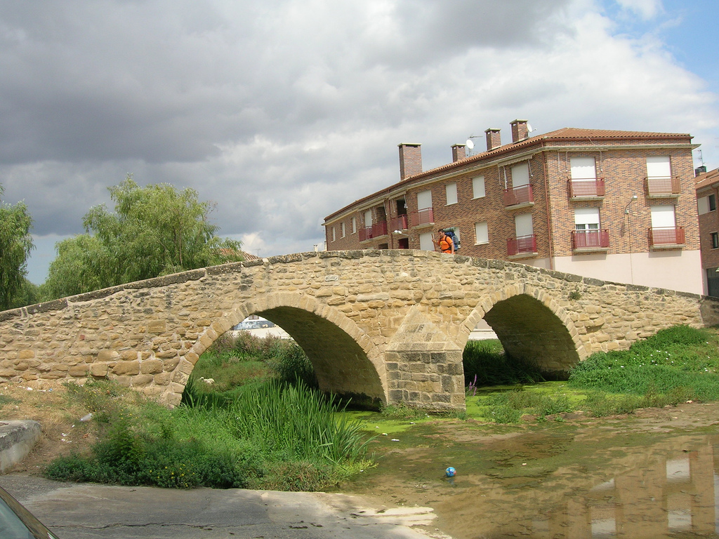
Side by side, are the Santo Domingo convent and the church of Santa Maria Jus Del Castillo.To go from one to another we will return to the Curtidores Street and see the Picudo bridge over the Ega river, another example of the “dromedary” type.

Weeping Bridge surrounded by trees

Weeping Bridge (photo provided on Flickr by Hans-Jakob Weinz under the following conditions)

The Santo Domingo convent reflects the importance of the relationship between the Church and the Crown in the middle Ages. It was the king of Navarra who ordered and paid for the construction, but the Dominicans, who were going to occupy it, gave benefits to the faithful and helped to maintain it. Due to the cruelty of the Independence War before Napoleon, the monks flee the convent and although it is later inhabited intermittently, with the confiscation of 1939 is abandoned and remains in disuse, until at the middle of the century only remained the Walls. In the 60’s and 70’s it was rehabilitated and now functions as a nursing home, so it cannot be visited in the interior.

Almost adjacent to the present residence is the church of Santa Maria Jus del Castillo. Formerly, in the place where it is, there was a synagogue. In the 12th century, the site is occupied and this Christian temple is built, which maintains its function as a church until the XVII C. Although initially called the Holy Mary and All Saintschurch, with the construction of the castle of Zalatambor in a nearby high, you will begin to know as the church “under the castle” (“jus” del Castillo, in euskera).Then begins a process of deterioration that stops when at the end of S. XX it is decided to use this valuable space artistically and historically as a center of Interpretation of the Romanesque and Camino de Santiago.
If we return to Curtidores Street, we will arrive at the Museum of Carlism, which is right next to the pilgrims’ hostel we already mentioned. It occupies the space of the old palace of the Governor of Navarra, of the XVII Century. If you are interested in Contemporary History you will surely find here a place to enjoy learning, since in addition to promoting research on Carlism, the museum has a clear didactic and pedagogical approach.

People at the entrance to the Carlismo Museum

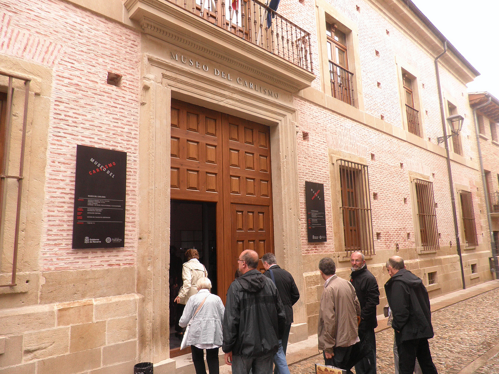
Entrance to the Carlismo Museum (photo courtesy Flickr by Zumalakarregi Museoa under the following conditions)

Carlism was a political movement that appeared in the nineteenth century in opposition to liberalism. While the new liberal political current wanted to remove the Bourbons from power and change the political and economic system, the Carlists were betting on a system more similar to the Old Regime in which the Church and the Crown had a lot of presence. Basically, its essence is summarized in the motto “God, Fatherland, King”. The curious thing about this movement is that it extended and evolved a lot over time, as it even persisted until the end of the Franco dictatorship. In addition, during the S. XIX the different attempts to seize the power of his followers led to three different civil wars.

Many of the areas that today are part of the Camino de Santiago in Navarra were scenario of battles during these three Carlist wars, which is why this space has been dedicated to the study and research of this political movement.

Coming back to Curtidores street, we continue walking it towards the west and we arrive at the San Martín Square. In it there is a beautiful 16th century Renaissance fountain with trees and benches where to rest admiring the two monuments that surround us: the palace of the Kings of Navarra, in the square itself and, on the other side, the San Pedro church.

Old photograph of the Palace of the Kings of Navarre

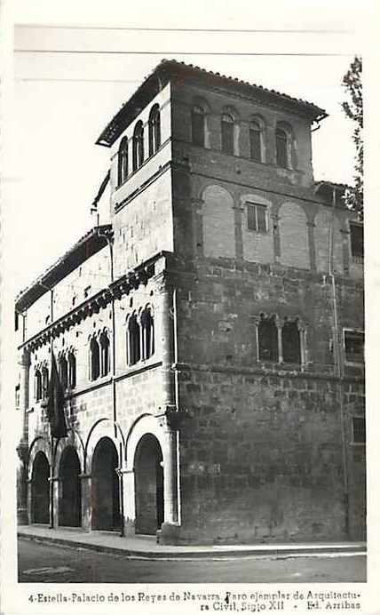
Old photograph of the Palace of the Kings of Navarre (photo courtesy of Flickr by Batto0 under the following conditions)

The palace of the Navarra Kings is very important because it is the only rest that remains in Navarra of Romanesque style civil architecture. As we have seen so far, most of what remains of this movement of the 11th and 13th centuries is reduced to religious buildings. But, in this case, we can see how it is applied in a civil construction, although the original function of the space is not clear. There are some scholars who believe that the Franks with power were there that governed the different boroughs of the old Estella. Others believe it could be a large cellar and barn with a room for the governor of the kingdom.
Regardless of its original function, the building stands out for its conservation. Its current facade is divided into three horizontal bodies with two towers. The medium body, with large windows, rests on a large porticoed gallery. The upper part is an extension of the XVII. Nowadays it houses the artist´s Gustavo de Maetzu museum.

In front of this square you will find, on a higher level (there are stairs and a lift to get there) the largest church in the town and one of the main attractions of the place: the San Pedro de la Rua church.

Views from the church of San Pedro de la Rúa

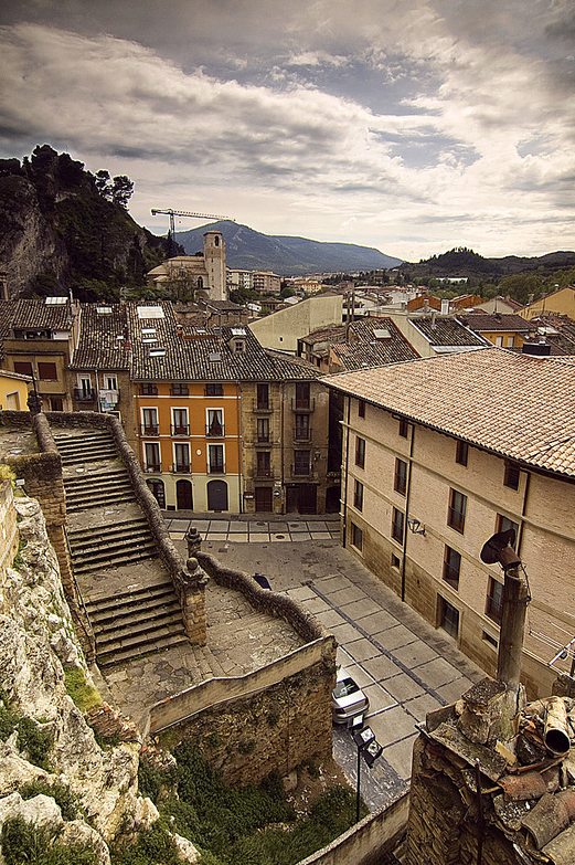
Views from the church of San Pedro de la Rúa (photo courtesy Flickr by Ignacio Gómez Cuesta under the following conditions)

This temple occupied what was the center of the medieval city of Estella and it emphasizes especially with its cloister, very decorated. It was next to the old castle, from there its position in a high of the slope, of defensive end. In fact, the tower at the foot of the church gives the whole military aspect. Its oldest remains are of the XII Century and worked during the Average Age like pilgrims cemetery.

In addition to the remains of the cloister, stands out its entrance portico. As we have already seen in the church of San Roman de Cirauqui, the polylobulated forms of this one remind us of the influence of the Arab art that during XIII Century predominated in the south of the Iberian Peninsula.

San Pedro de la Rúa Church

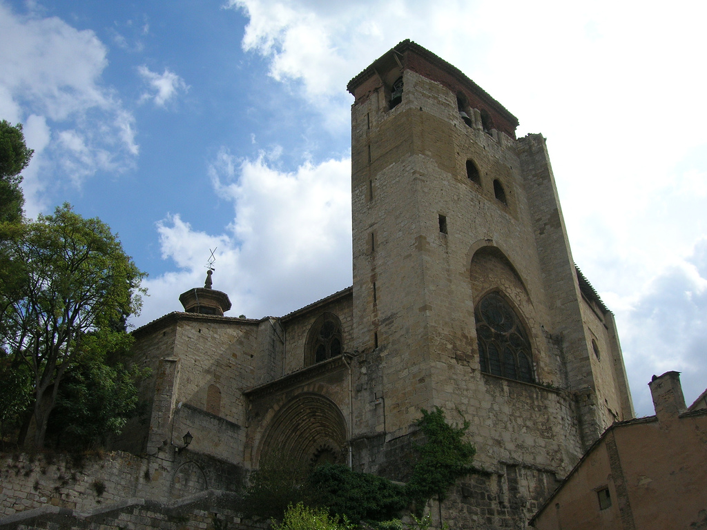
San Pedro de la Rúa Church (photo courtesy Flickr by Jose Antonio Gil Martínez under the following conditions)

The climb to the church is worth not only to see the whole in itself, but also by the views offered by Estella. We recommend you to stand on the stairs down to the square and enjoy a beautiful sunset with the Navarrese landscape in the background.

We restore forces with good gastronomy and places to rest

After so much racking of stage and tourism, we are sure that you want to rest and to eat something appetizing. Estella is a good place for it, not in vain Already in S. XII warned the monk Aymeric in his guide of the Way that was a place of “good bread, excellent wine, much meat and fish and all type of happiness”.

If you are of fish, you cannot leave without trying the ajorriero codfish, with vegetables and tomato. You can also find trout cooked in different ways. The carnivores will find in the roasts their great ally, especially of suckling pig (look for the “gorrín” in the letters of the restaurants) or of all type of hunting. In addition, like all the Community of Navarra, stands out for the good quality of its vegetables.

Sweet Tooths know that there are several shops with a lot of pastry tradition in the village. They are famous, above all, the puff pastry of Estella (“alpargatas”) and the chocolates bonbons.

If you prefer a more economical option, you can buy something to eat and enjoy it by picnicking in the Llanos Park, on the banks of the Ega River. There are also pools where you can take a bath and those who say that its waters are medicinal and have healing properties.

But do not forget to rest well after this day full of discoveries … Tomorrow we change community and do wine immersion in La Rioja!

STAGE 2: FROM RONCESVALLES TO PAMPLONA – FRENCH ROUTE BY BIKE

Distance to Santiago: 753 km

Distance in stage:: 48 km

Estimated time: 4-5 hours

Minimum height: 420 m

Maximum height: 962 m

Difficulty of the route: medium – high

Places of interest: Bizkarreta, Zubiri, Villaba, Pamplona

Itinerary in Google Maps: To see the route in Google Maps click here

Stage 2 of the french way: from Roncesvalles to Pamplona

Click on the image to enlarge

After a first stage very demanding on a physical level but has allowed us to enjoy a spectacular landscape, we began our second day of pedaling in a stage of brittle but simpler profile.

From Roncesvalles to Pamplona we will cross forests of beech, oak and bojs; Cross medieval bridges such as La Rabia or Los Bandidos and enjoy the charm of picturesque towns such as Zubiri or Villaba. We will finish the day “by the big door”, as the bullfighters of the first great city that we will visit in our pilgrimage: Pamplona.

Aerial view of Pamplona during the french way by bicycle

Pamplona in aerial view, with Castle Square in the center (photo courtesy of Unai Pascual Loyarte on Flickr under the following conditions)

To go from Roncesvalles to Pamplona by bicycle you can follow practically all the route the original way that also pilgrims go on foot. Of course, to be able to do it without problems is necessary to have a mountain bike suitable for complicated terrain. This stage is not as demanding on a physical level as the previous one but it does have a rather rough profile and the terrain is sometimes not very firm.

In general, it is more complicated at the technical level, although the physical effort is smaller than in the previous one. If you do not have a good bike, you are not accustomed to go down rocky terrain or carry too much weight in the saddlebags you can always deviate in some sections and go by road.

You can even do the whole stage following the N135.This is a traditionally biked area and drivers are accustomed to sharing lanes with people on bicycles.

Although we often want to follow the original path as much as possible, if you think you will feel more comfortable leaving it at some points, we encourage you to do so from Tournride. As we have already said, it is a matter of making the Camino a rewarding experience, adjusting its demands to our specific times and circumstances.

PROFILE AND STAGE’S MAIN ROUTES

We now explain in general the profile of the stages of the Roncesvalles-Pamplona stage. It is a question of giving you an idea of what awaits you on this second day. 

We begin by crossing the 2.7 km that separate our starting point from Burguete, the nearest town. It descends by a gentle slope that crosses the forest of the Valley of the Arga and arrives to Espinal, where there is a camping that can serve us of lodging. From there we will face our first ascent: we will reach Mezquiriz Alto (960 m), surpassing an average slope of 4% for 1.7 km.

Green landscape of the path that lead from Espinal to Alto de Mezkiriz

Landscape from Espinal to Alto de Mezkiriz (photo courtesy of José Antonio Gil on Flickr under the following conditions)

When you reach Alto de Mezquiriz you cross the N135 with the original path. If we decide to continue without taking it, we will face the first descent with technical difficulty. We go down a fairly steep slope that will lead us to a small “jump” after which we will arrive at Bizkarreta. From there we expect the hardest climb of the day, towards Alto de Erro. The difference in height is 120 meters. Although the average slope is 5%, there are sections with fairly marked jumps. The ramp can be a little complicated because there are loose stones. Above crosses again the N135 and, if you have felt insecure at some point in the original path, we recommend that you take it.

The descent from the Error is the most difficult slope since it is very fast. It hasan average of 5% of slope, but the terrain is not firm and there are quite a few jumps. Going down for about 4 km you will arrive to Zubiri, where there are also accommodations.

From Zubiri we are about 20 km of stage that we will do without losing sight of the river Arga. The terrain will vary according to the time of the route. We will begin with a soft 2% down a track that will change from asphalt to gravel or dirt until we reach Larrasoaña first and then Irotz. When passing Larrasoaña, in Akerreta, we will find a short but rapid descent that requires caution.

Path on the mountain that lead to Zubiri

Road to Zubiri (photo courtesy Malditofriki on Flickr under the following conditions)

After passing Irotz we will arrive at Zabaldika, where we will find that the road unfolds in two:

– Going straight ahead we will go along the original path that, after an initial climb, will take us through Arre and Villaba to finish in Pamplona.

– Towards the left we will cross a cement track for a very beautiful river walk to Huarte and from there we will go straight to the old town of Pamplona.

The second option is more comfortable for cyclists, because the terrain is better conditioned and is a quiet stage end. But if we choose the traditional option we will pass through Villaba which, besides being the town where Miguel Induráin was born, is also a very beautiful town.

Passing through the bridge at the entrance of Villaba by bike

Bridge at the entrance of Villaba (photo courtesy Javier Mendía García on Flickr under the following conditions)

So, in summary, at this stage we have three itinerary options:

  1. Follow along the route the original path, taking into account that we will find fast descents and some steep slope. It is the path that requires us more physically and technically, especially because the terrain is not very firm.
  2. Do the stages by road following the N135, which in addition to saving 5 km of pedaling makes us follow a profile less rugged and always go by asphalt.
  3. Interleave the original path with the N135. The two itineraries are crossed in all the populations of the stage and, in addition, in the Alto de Mezquiriz and Alto de Erro.

If you want to follow the original path but want to avoid the more complicated points, we recommend that after climbing the top of Mezquiriz you take the N135 to Zubiri and there you take the traditional route again. If it rains, we recommend choosing the second or third option.

As for which route option is best to take from Zabaldika to enter Pamplona, for cyclists it is usually preferable to go by Huarte. The ride is nice and much less bumpy. Although if you are fans of Induráin perhaps you want to pay homage to him passing through the picturesque town that gave birth to him.

Paseo de Huarte at the entrance to Pamplona in the stage from Roncesvalles to Pamplona by bycicle

Paseo de Huarte at the entrance to Pamplona (photo courtesy Hans-Jakob Weinz on Flickr under the following conditions)

PRACTICAL TIPS

  • If you start the road in Roncesvalles and therefore this is your first stage, we help you get there . It is best to go to Pamplona by train, plane or bus and, once in the city, choose one of the following options
  • Go inbus. Tickets are bought at the ticket office at the station itself and cost about € 6 (plus another € 6 for each bicycle).
  • Taking a cab. If you take it in the center of Pamplona, the average price is about 60 € to Roncesvalles (on Saturdays and holidays costs 10 or 15 € more). You can also use the taxi sharing service for pilgrims
  • At the Roncesvalles hostel you can book a place before going, but you must pay in advance with a credit card or bank transfer. You will be given all the information if before you write an email to info@alberguederoncesvalles.com
  • Although we have warned that the profile of this stage is uneven, we do not want to scare you. It can be done with a good mountain bike. Just be careful in the descent from the Alto de Erro and with the fast ramp between Akerreta and Zuriáin.
  • The N135 makes it easy to take the road at any time but also creates hazards, watch out for road and road junctions that require precaution to avoid accidents.
  • During this stage we will find many towns and, with them, places of accommodation in which we can stay if we find ourselves tired. The passage through them also facilitates the provisioning, we will find enough sources to replenish water and places to buy food.

NATURAL, HISTORICAL AND CULTURAL HERITAGE AND DETAILED ITINERARY

In this second stage we will cross two valleys: the Valley of Errobetween the high Mezkiriz and Erro and the Valley of Esteribar between Zubiri and Pamplona. The configuration of the terrain and the climatology of the area have meant that this whole area has been populated since many centuries ago. In fact, some of the localities that we will pass through are of medieval foundation and its growth is due to the Camino de Santiago.

Photo of Tree in the Valley of Error

Tree in the Valley of Error (photo courtesy of Jose Maria Miñarro in Flickr under the following conditions, having been modified)

WE START IN RONCESVALLES WITH ONE

OF THE MYSTERIES OF THE ROAD…

We have already discussed what to see in Roncesvalles in the previous stage in a shortwalk. Shortly after leaving the N135 we will find our first point of interest: the “Cross of the pilgrims”.. Along with the “Iron Cross” of Leon, it is the most famous of the French Way and, although one knows why it is there, it is not known who or when it was made.

This cross is related to many legendary characters and, despite the simplicity of its forms, many pilgrims stop to give an offering. Its primitive stature is gothic (of about S. XIV) and in her it is possible to be seen Jesus crucified in the superior part and to the Virgin with the Child in the inferior one. The other two figures would be that of the monarchs Sancho “the Strong” and Clemencia, his wife.

It is known who placed the cross in that place, because there are documents that explain that in 1880 the prior of Roncesvalles, called Francisco Polit, had it placed there taking advantage of the remains of several different crosses. The origin of these remains is what creates controversy: some believe that it would have remains of the Cross of Roldán (S. XV) and others that would be part of a carving of the times of the same Charlemagne (S. VIII). The truth is that in the Codex Calixtino it is said that Charlemagne had had a cross installed in the Alto de Ibañeta, in the Pyrenees, and his remains may have been made the one we see today when leaving Roncesvalles.

FIRST RISE: FROM BURGUETE TO THE HIGH OF MEZKIRIZ

With this unresolved mystery we continue our way and we arrive until the first population: Burguete. Its name comes from its origin as “boroupgh” (village) dependent on the hospital of pilgrims of Roncesvalles. As outstanding patrimony, it is possible to emphasize the church of San Nicolás de Bari. Although most of what we see today is the S. XX, the façade is baroque (S. XVII). Inside there is an altarpiece, also Baroque, which is worth stopping to admire.

Pilgrims on the road by bicycle in Burguete

Pilgrims on bicycle in Burguete (photo courtesy of Juan Pablo Olmo on Flickr under the following conditions)

Path without pavement from Burguete to Espinal

Road from Burguete to Espinal (photo courtesy of José Antonio Gil on Flickr under the following conditions)

We leave Burguete and continue to Espinal, a small town-street. It is surrounded by a landscape so beautiful that even Ernest Hemingway referred to it in his book “Fiesta” of 1926. We walk along its main road with houses with balconies and more than eight centuries of Jacobean tradition and in it we will see the church of San Bartolomé. It emphasizes its pointy roof with attic windows. This area is generally famous for trout fishing on the Rio Irati, as well as for a cuisine focused on mushrooms and mushrooms (especially in autumn).

Village of Espinal among the green landscape in a sunny day

Village of Espinal among the green landscape (photo courtesy of Alex Bikfalvi on Flickr under the following conditions)

The green landscape of Espinal

Espinal landscape (photo courtesy of Alex Bikfalvi on Flickr under the following conditions)

Leaving Espinal we have to face the ascent to Alto de Mezkiriz. When we reach the top, we will find a stone stele. In it there is a carving of the Virgin and Child: it is called Virgen de Roncesvalles. The inscription asks to pray a salve by the “queen”, which helps to pass the difficult mountainous stage of the Pyrenees and allows to enter the “land of the Navarrese, rich in bread, milk and livestock”; as described by the Aymeric monk in his “guide” of the 12th century.

Estela de la Virgen tombstone in Alto de Mezkiriz

Estela de la Virgen in Alto de Mezkiriz (photo courtesy of José Antonio Gil on Flickr under the following conditions)

DOWN WITH CARE FROM THE HIGH OF MEZKIRIZ TO ZUBIRI

Going down from the Alto de Mezkiriz we will meet Ureta and we will arrive later to Bizkarreta. This population was founded at the beginning of S. XII with the name of “biscaretum” and was very important because it had a great hospital of pilgrims. Roncesvalles was eclipsing with the passage of time and its primitive hospital is only a few remains, which we will see next to the path.

Today, the main point of interest of Bizkarreta is the church of San Pedro. From its initial factory we only have the cover. It is Romanesque, very simple. Following the characteristics of its style, the walls are thick and the decoration very simple. In this case, the most salient are the three archivolts that mark the arch of its main door. Most of the remaining elements of the church are later, from the S. XVIII. 

Before the ascent to Alto de Erro we pass through Linzoáin. This small and picturesque village has as only one outstanding monument another church, that of San Saturnino, also Romanesque and very simple. But what makes it special is rather its peaceful environment, on the bank of the river Erro and with large cattle houses. You can breathe the tranquility of the Navarrese countryside.

Livestock house in Linzoain in the way to Pamplona

Livestock house in Linzoain (photo courtesy of Alex Bikfalvi under the following conditions)

After this respite of peace, it touches the Alto de Erro. Along the way we will find the monument to a Japanese pilgrim who died making the road. After the descent we will reach Zubiri, we will reach Zubiri, the administrative capital of the Esteribar Valley and the only industrialized nucleus, especially for its large magnesite processing plant. Its name in Euskera means “town of the bridge”, of zubi (bridge) and iri (town) and is that known as “Bridge of the Rage” is one of its great attractions.

FROM ZUBIRI TO ZABALDIKA BY LARRASOAÑA: THE THING GOES FROM BRIDGES!

If you are tired, in Zubiri there are several hostels that can serve as a stopover place for you. You can sleep in one of them and spend the next day in Pamplona, which is just over 20 km. If you do not want to stop, to follow the road you do not have to enter Zubiri. Still, from Tournride we recommend you to approach the entrance of the village to see the Bridge of Rage.

Puente de la Rabia in Zubiri over a river, surrounded by green trees

Puente de la Rabia in Zubiri (photo courtesy of José Antonio Gil on Flickr under the following conditions)

This medieval bridge crosses the River Arga. Its name derives from an ancient tradition whereby traders made their animals take a turn around the central pillar of the bridge. It was believed that this column had a supernatural power that avoided the disease of rabies. The bridge supports the passage over two large semicircular arches and its pillars have a large cutwater that relieves the pressure of the stream of water. From the bridge, we can see the great cereal fields, the most important cultivation of the valley.

ubiri, in its origins, was constituted mainly by the bridge and a street that united it with the church of San Esteban and the hospital of Santa Magdalena. Today the church is newly built because the original was used as a military barracks during the Carlist Wars of the 19th century and ended up being destroyed. The hospital was next to the bridge, but it has not been possible to preserve it either.

ZUBIRI, roncesvalles to pamplona, bicycle, french way

Zubiri (photo courtesy of José Antonio Gil on Flickr under the following conditions)

To continue with the route we return on our steps from Zubiri and, a kilometer later, we find the magnesite company in front of us. We skirt along the road until we reach the exit of the industrial area. We may have to get off the steps by getting off the bike. A stone path leads to Illaratz, Ezkirotz (which in the 10th century had a fairly important monastery) and ends at Larrasoaña.

The main attraction of Larrasoaña is the Bandidos Bridge. Like the Rabia, it is also medieval and crosses the river Arga. It is so called because in this place the thieves used to attack the pilgrims. 

Pilgrim passing through Bandidos Bridge in Larrasoaña

Bandit Bridge in Larrasoaña (photo courtesy of José Antonio Gil on Flickr under the following conditions)

To continue to Akerreta do not enter Larrasoaña, but once again we encourage you to deviate a few hundred meters to see the bridge. In addition, the town of Larrasoaña has a lot of Jacobean tradition, being an example of development thanks to the Camino de Santiago. In the 12th century it received what was called the “fuero de los Francos,” a series of tax-exempt laws to encourage foreigners who made the pilgrimage to settle on the side of the road. These types of towns always end up with the same configuration: a large central street, through which the road passes, flanked by other buildings. It must be taken into account that all foreigners who made the road were called “francs” to enter France, not because they were French.

After a short ascent, we arrive at Akerreta and from there we cross a dense forest by a narrow path that goes to the side of the river Arga. So we reached Zuriáin. At this point you have to take the road a little and then we can decide if we turn left to take a path of grass and go through Iroz or if we go straight to Zabaldika. Iroz has nothing remarkable at artistic level, but the original path goes by.

ALL ROADS LEAD TO PAMPLONA: ZABALDIKA DECISION

Zabaldika is the point at which the route is divided, near a rest area.

If we take Huarte on the left, we will have to pass a first stretch of road and track and then we will take a nice river walk through the Tejeria Park. After crossing the Puente de la Magdalena we will enter Pamplona. 

Magdalena Bridge, roncesvalles to pamplona, bicycle, french way

Puente de la Magdalena, at the entrance to Pamplona (photo courtesy of José Antonio Gil on Flickr under the following conditions)

This bridge was declared good of Cultural Interest an Artistic Historical Monument. It was built between the 12th and 15th centuries and its name is given by the neighborhood in which it is located: The Barrio de la Magdalena. On one bank there us an elaborate cruise with the image of the apostle. Following the path we reach the walls of Pamplona. The profile of the whole walk is quite flat and the itinerary is a little longer than the original path.

If, on the contrary, we choose to go head-on, we will take the historical route that passes through Arre and Villaba. We will begin by climbing a small slope that leads to an old manor, now in ruins. Continuing along the track and patch of grass, we will find a ring road. We can avoid it by going through an underground tunnel.

This way we will have reached Arre, where another bridge allows us to enter the village. It is a medieval bridge of 55 meters, bigger than the previous ones, which crosses the river Ulzama and leads towards the convent of the Trinity. The Ulzama River ends at the Arga River and has 9 medieval bridges that cross it. This leads directly to a hostel complex and basilica for pilgrims. It was all an old hospital of pilgrims of S. XI. In the interior of the church, dedicated to the Holy Trinity, there is a Neo-Roman altarpiece of the S. XIX. Everything is managed by a brotherhood and by the Order of Marists.

Trinidad de arre, roncesvalles to pamplona, bicycle, french way

Trinidad de Arre (photo courtesy of José Antonio Gil on Flickr under the following conditions)

Villaba was founded in the 12th century by royal mandate. Its proximity to Pamplona and the improvement of communications during the XXth century with the construction of an electric railway made it linked to the urban expansion of Pamplona. Its main street is the street of the Jacobean footpath. In a roundabout they installed a sculpture as honorary monument to Miguel Induráin, who was born in this town in 1964. It consists of the metallic silhouette of the cyclist, climbing up the straight line of a sloping stage profile.

AND,AT THE END… ¡PAMPLONA!

We leave Villaba and we arrive at our end of stage: Pamplona. Known internationally for its San Fermines, it is a city that has much to offer us. After stamping our credentials and getting some rest in the hostel, we cannot miss the opportunity to visit and try some of their delicious “pintxos”.

A RIDE FOR PAMPLONA

At Tournride we want you to make the most of your pilgrimage. As we are aware that sometimes it is difficult to reach the cities and get time to find out what to see there, we have decided to propose a walk for each end of the stage.

In Pamplona, one of the largest cities in which we will stop to Santiago, there is much to see and do. We have designed a 50 minute walk that we have marked on this map and in which everything relevant is visited in the city. If you think it is too long, we recommend not walking to the Citadel and staying closer to the monumental area.

Pamplona from mount Ezkaba

To begin with, a bit of History…

Pamplona has been populated for thousands of years. In fact, they have found useful and menhirs beneath their soil that date back more than 75 000 years! This territory charged with History has been conditioned, especially since the 9th century, by three main factors::

  • The different “fueros” (laws or specific ordinations) that the city has had and that gave much power to the clergy against the civil power.
  • Its status as a reception point for immigrants or “francs” who created their own neighborhoods since the 11th century
  • Its strategic position on a high near the border with France. Since Pamplona becomes part of the Crown of Castile in the XV century, will be an important defense in all wars that will remain with the neighboring country.

In reality, what we know today as Pamplona is the union of three boroughs or different cities. The first nucleus, which today would be the part of the cathedral (the highest in the city), was populated from centuries before the arrival of the Romans in 75 BC. Its inhabitants were the “vascones”. When the Romans saw the position of that nucleus, raised over a valley and surrounded by the river Arga, they conquered it and made it a strategic point of the empire. They urbanized it and used it as a knot of communication between the Peninsula and Europe.

aereal view PAMPLONA, roncesvalles to pamplona, bicycle, french way

With the fall of the empire comes the Visigoths and then the Muslims. In the war to drive the Arab conqueror, the clergy helps decisively. As a thank-you, the king decides to give special powers to the city church and gives him a condition of private self-government.The “Kingdom of Pamplona” is created, governed by a jurisdiction in which the bishop is the lord of the city and the cathedral his nerve center.

While this nucleus is still very important, in the XI century reach the territory “francs”, immigrants who create a population next to that and are engaged in trade. In the XII comes another wave of immigrants called “Navarros” and also create their own town: the “navarrería”.

old town pamplona, roncesvalles to pamplona, bicycle, french way width=

During the following centuries each borough is walled and tensions are created between them, untying fights that end when the king Carlos III unites them in a single entity in the year 1423.

At that moment Pamplona can be said to arise, as we understand it today. In the S. XVI happens to be of the Crown of Castile. As the city is very close to the French border and during that century there are different clashes between both crowns, Pamplona must be fortified. The citadel is built, one of the best examples of Renaissance military architecture in Europe. Today it is preserved very well and in it there is a large park that is worth visiting.

citadel pamplona

Citadel wall (photo courtesy of Isumelzo on Flickr under the following conditions)

Thus we arrive at the S. XVIII. The role of the Church and its strategic military and commercial situation created a curious social composition. Although it was normal that the majority of the population were farmers or artisans, in Pamplona there was a high percentage of high clergy and aristocracy; which made it a very traditional city. Therefore, in that century it was decided to “modernize” the city: it is urbanized, it provides services such as municipal sewerage and major buildings are remodeled. For example, the façade of the cathedral was reformed in that century, so it is neoclassical.

All this process is interrupted when in the XIX century Napoleon conquered the city. After the War of Independence that frees to the peninsula of the French conqueror, a struggle for the power between the liberals and the carlistas takes place. The Liberals supported the creation of a central government that controlled all Spanish territory without distinctions, whereas the Carlists were more traditional and wanted to maintain the regime of special fueros of Navarra.

pamplona monument to the regional code of law, roncesvalles to pamplona, bicycle, french way

Monument to the fueros (photo courtesy of Mario Sánchez Prada on Flickr under the following conditions)

In Pamplona the negotiation between the two sides for the constitution of a government ended up making the city in particular, and Navarre in general, have special conditions of self-government in some aspects. In fact, at the end of the nineteenth century, attempts were made to abolish these privileges, but a great social demonstration prevented it. In honor of that episode the Monument to the Fueros was erected in Paseo de Sarasate.

From that moment until today, the city has not stopped growing. Successive extensions are built and many of the walls that, like inheritance of that division in three boroughs, were continued separating the districts.
Nowadays it is a very modern city, with large extensions of green areas and a great amount of cultural life. Do you dare to meet her?

A day trip through Pamplona: as true “pamplonicos”

In Tournride we suggest a day trip through Pamplona so that you can get a general idea of the place, because we know that you will probably have to continue pedaling towards Santiago the next day. Anyway, Pamplona is one of the main stops of the French Way and if you cannot regret to extend the stop and dedicate a few days to this beautiful city. We give you additional plans below for this.

If you arrive before lunch you can recover forces by eating at one of the places that offer a menu of the day (with astonishing value for money) near the town hall. Afterwards, we start the afternoon touring some of the best known places in Pamplona as part of the tour of the San Fermines.

PAMPLONA MONUMENT, roncesvalles to pamplona, bicycle, french way

Monument to the San Fermines in Pamplona

From the Plaza Consistorial. we leave the Mercaderes Street and from there we turn to the pedestrian Estafeta. The corner of meeting of both streets is one of the most mythical points of the bulls. Once in Estafeta, we will see in the middle of the street a few stairs to the right. Upwards we will leave the route that the bulls follow and the great Plaza del Castillo will open before us.

PAMPLONA City Hall, roncesvalles to pamplona, bicycle, french way

Plaza Consistorial de Pamplona (photo courtesy of Total13 on Flickr under the following conditions)

This square is well known because it takes place two of the most important moments of the San Fermines. From it the “chupinazo” is launched, which kicks off the festivities on July 6 and, in it, the “poor me” is sung, which puts an end to the celebrations. At 12 o’clock on the 14th of July a crowd gathers in the square and sings holding a candle a song that says “poor me, poor me; That the parties of San Fermín have finished”.

pamplona, roncesvalles to pamplona, bicycle, french way

Plaza Del Castillo on Pamplona (photo courtesy of Batto on Flickr under the following conditions)

This place is the nerve Center of town. Formerly there was a Castle close, hence your name. Before the bullfighting became in this Plaza, as in many other cities of Spain that they had no bullring. Is fenced with a “Curro” Wood and was covered the floor of sand. Today has spaces landscaped and many cafes in their arcades.

One of the corners of square we can see the walk sarasate. There is the Church of St. Nicholas, one of the largest of the many adorning the city. Formerly St. Nicholas was one of the three Burgos constituting Pamplona. The Church we see today has aspect of strength in the outside because it was thinking about it as place defensive, given the multiple clashes that produced with the other two Burgos. In fact, tower is actually a Watchtower.

pamplona san nicolas, roncesvalles to pamplona, bicycle, french way

Vintage photography of the Church of St. Nicholas (assigned by Batto on Flickr under the following conditions)

This aspect of strength outside contrasts with the inside: a beautiful domes Gothic with sizes very thin and wonderful for its height. Recommend stand also to admire the body. Is Baroque and is the most important of the city.

We follow by walk sarasate where to end we turn to the right to take the taconera. There is Park the taconera, one of the places Green more special Pamplona. In the old pit the Wall we will see a lot of animals: deer, Ducks, Peacocks…. all of them live in half freedom, surrounded by a beautiful Park with different tree species. All a Haven peace. In fact, if you don’t want to eat in space hospitality, from Tournride you recommend that you sit down in one of its banks or in its fluffy grass to the shadow of a tree for picnic. Then, you can coffee in coffee Viennese, a Bohemian and quiet meeting point intellectual Pamplona.

citadel, pamplona, roncesvalles to pamplona, bicycle, french way

Photo air part of the Citadel (photography assigned by the city Council Pamplona).

Leaving the taconera we will Citadel. This old fortification military is now a Park 280 000 square meters full of attractions: sculptures, pavilions exhibition, more than 30 tree species, all amenities child … it is important to know that is prohibited the entrance with any type of vehicle (including bikes) and that only open during the day.

Designed in the time Renaissance, in which Italy lived a great time cultural and intellectual, fortification was designed by a military engineer of neighboring country: Giacomo palearo. Also had another as like in Antwerp. Have 5 defenses to give you a way similar to that of a star, but two of them are missing. Was surrounded by a pits, which today are Green areas, where there was bridges drawbridges.

Returning about our steps we left to the left the taconera and walked down the Street greater where to get we will see the Church of San Lorenzo. It is the Chapel San Fermín Amiens, pattern of the city. Party in his honor became match a “fair Franca” in medieval times, that is, a fair traders with some tax exemptions. As part of what is sold was won, became bullfighting and closures. Became party employer and since 1950 has been doing more and more famous, to get to the party international is today.

We continue down the Street greater and come back to square Hall. Taking back Street merchants, we continue straight and we directly to the Cathedral where, if not yet what you have done, you can seal the badge.

pamplona, roncesvalles to pamplona, bicycle, french way

Cover of de Santa María la Real

The Santa Maria de Real Cathedral was made, for the most part, in the S. XIV and fifteenth. Before had another Church, but are pulled to build this great and sober Temple with large Windows ojivales (Arcos targeted). But what I really can’t stop visit is your cloister. Is one of the best examples Gothic Europe and their Stone arches with drafts very thin and wonderful to all who sees him. Cathedral has schedule and have to pay for log in, but discounts are pilgrims. To see this data you can see the Cathedral’s page. 

Leaving the Cathedral we take the Street from the Navarrería, old borough of immigrants Navarre, and at the end turn right on the Street Del Carmen. At the end, in the portal France, we return to turn right and we arrived to corner of the White horse.. Here we have stunning views of the bottom of the city and is the perfect place to end a day full of discoveries. There are different bars and restaurants with terraces in which we can take some drink or eat

.

PAMPLONA White Horse, roncesvalles to pamplona, bicycle, french way

Corner of the White Horse Pamplona

If we find no site or not we want to end here, we can re-down to the Center of the core historical. In the streets post office, merchants and shoe shop, surrounding square Castle, we can try the famous “pintxos” of the city. High cuisine to quite good price. If we want to try different spikes in bars different but we don’t want to take a lot of drink, we can ask for a “zurito” in each. Would be the equivalent to ask for a “short” (a cane small) in Navarre..

This entire tour sum in total more, of course, as long as we want to devote to each place to visit only 50 minutes walking. A jaunt loaded history, Green areas and good food. ¡SO, leave the bike and walk!

FEW DAYS PAMPLONA: WHAT ELSE TO SEE AND DO?

Of course, the walk we proposed in the previous section is susceptible of divided and made more calm. But, in addition to what we have already described, listed here some of the other attractions that has the city:

  • Follow know a little more tradition Taurine visiting elsewhere mythical of the city: bullring, built in early S. twentieth and that is the fourth world’s largest or monument to closure. It’s a huge bronze sculpture representing perfectly movement and dynamics of a closure, all a work of art. We can see it in Avenue Roncesvalles with walk Carlos III.
  • See great art collections. In the city are two important museums:
  1. The Navarra’s Museum. From sculptures of the facade old Cathedral up boxes Goya all together under one roof. More information, rates and schedules here.
  2. The Navarra’s University museum. Modern building has a beautiful collection of contemporary art, formed from the legacy of a collector private met over 100 works of artists as Picasso, chillida, Rothko or Kandinsky. It is gone by adding other collections ceded or private. if you like art, you’ll find here a space in which you will feel at home.
  • To browse the walled part of the city that we lack. Pamplona is an example beautiful city fortified and care with which held can enjoy long walks. If you want to learn a little more about this topic you can visit Fortin St. Bartholomew, a former strong today is home to the Center of interpretation of the fortifications Pamplona. Is an informative space and its approach is very teaching, not precisely guide. For more information visit their website.

In addition to all this plans, Tournride simply recommends you, the following: enjoy high quality of the food Navarre and relax in many places calm Pamplona. There is still a way up to Santiago,’ you deserve it!

STAGE 1: SAINT-JEAN PIED DE PORT TO RONCESVALLES

Distance to Santiago: 765 km

Distance in phase: 26 km by Route of the Ports of Cize / 28 by Route of Valcarlos

Estimated time: 4-5 hours

Minimal height: 233 m in Saint Jean Pied de Port

Maximum height: 1480 m in Alto de Lepoeder by the Route of the Ports of Cize / 1057m, in Alto de Ibañeta by Ruta de Valcarlos

Route Difficulty: High / Very High

Places of interest: Saint Jean Pied de Port, Upper of Ibañeta, Roncesvalles

Itineraries on Google Maps: To see the route on Google Maps click here

Camino de Santiago stage 1 from Saint-Jean Pied de Port to Roncesvalles

In this first phase we will face what may be the hardest route of all, but it as a reward to us we get one of the most spectacular views of the road. We will cross the Pyrenees from Saint-Jean Pied de Port to Roncesvalles, an extraordinary landscape full of history in a stage in which we will overcome about 1250 meters of unevenness.

View of the Pyrenees during the french way, from Saint-Jean Pied de Port to Roncesvalles

PROFILE AND STAGE’S MAIN ROUTES

At this stage we have two itinerary options:

  1. Choosing the traditional route that Pilgrims walk on foot, called “Route of the ports of Cize” or the “Route of Napoleon”
  2. Skipping this route and choose to hit the road, following the D399 and the N135. This route is known as “Ruta de Valcarlos”, because it goes through that place.

The considerations to take into account to choose one or another route are mainly weather, our physical form and the month of the year in which we peregrinate.

Due to the mountain accidents that some pilgrims have suffered during winter when crossing the traditional route by disinformation, or due to excess of confidence the transit by the Route of the Ports of Cize between the 1 of November and the 31 of March has been banned. If we pilgrimage during these months, we must obligatorily do it by the road route.

If you choose the Route of the Ports Cize…

Despite its difficulty, the Route of the Ports of Cize is the most spectacular and the effort to make it really worth it. If you are in a plenty physical form, you are able to deal with this sender. Always realize that at some points you’ll have to bike off and push, but it is more of having patience than fighting against exhaustion. In this road we will feel way more the weight of the saddlebags, when climbing some stretches with more than ten kilograms, can get noticed.

Even if you are there within the months allowed, if it is bad weather, either because it rains or snows, or because it is very windy or cloudy, do not take this traditional route. It can be very dangerous in bad weather, rain muds the ground and with lots of wind the effort ascending multiplies. If it is very cloudy we will not get any reward in views and landscapes speaking, therefore, it doesn’t make much sense to go by the Ports of Cize.

If you choose the Route of Valcarlos…

The road route is less spectacular but necessary in case of bad weather and easier. If your fitness is not so good, this may be a very good option for you. The route follows the route of the national road D933 until Arnéguy, where it crosses the border with France and enters in Spain by the N135. Pass through Valcarlos and continue to the mythical Alto de Ibañeta (1057 m.).

The general phase profile condition for the Cize Port Route is quite uneven. As we have already mentioned, they are almost 1250 meters of climbing. Still, we must keep in mind that the main slope will be found shortly after leaving Saint-Jean, where we will climb a slope of almost 13% over more than 4 kilometers. Although it is almost at the beginning of your path, do not hesitate to get off the bike if necessary, otherwise you could get exhaust and have problems to face the rest of the road. Also remember, completing the road in electric bikes is always a very good option and can help you in moments like these. When arriving at the viewpoint of Arbola Azpian the slope gets smoother and thus it will continue like that until the maximum quota of the phase, in the Height of Lepoeder (1480 m.). From that moment we will start a descent to Roncesvalles which is much enjoyed, although we must go down and not relax as it also requires some technical difficulty.

On the other hand, the phase profile on the Route of Valcarlos is smoother than the traditional route; in total it overcomes a difference of less than 900 meters. Leaving Saint-Jean Pied de Port we will take the D933 road and through the first eight kilometers the unevenness to overcome will be only about 200 meters. Arriving Arnéguy, where the French-Spanish border crosses, the D933 road becomes the N135 and the slope will become progressively steeper as we approach the Alto de Ibañeta, the highest point on this itinerary. The overall slope in that stretch will be about 6%. In this route we must be careful with cars/Trucks traffic. It is a general road and we always must take the necessary precautions, wearing the reflective vest, or lights if necessary.

Route variants

A third route option would be to combine both routes. We can take the Route of the Ports of Cize and when arriving at Collado Leopeder and take a detour that will take us direct to Alto de Ibañeta, where we continue along the N135 until arriving at Roncesvalles.

If you are an experienced rider and when you reach Roncesvalles you still see yourself with strength or you find that there is no place to sleep, you can continue to Zubiri. It is about 22 km more to go, but it is all downhill and it is a rather gently road. If there is no place in Roncesvalles but you do not see yourself able to get to Zubiri, there are intermediate places where you can stay overnight, such as camping in Burguete (which is only 3 km away from Roncesvalles).

Pilgrims going by bike in a green path

PRACTICAL TIPS

From Tournride we want to make easier your beginning of the journey. To do this, we gather here some tips and useful information for this first phase:

    • They always say that “beginnings are hard” and this phase is an example of it. If you decide to do it you will get an incredible experience and an incredible connection with nature, but you must do it calmly and listen to your body. If you feel that you should stop and push the bike at some point, do it.

    • Never forget that since 2015 it is prohibited to take the traditional route of the Ports of Cize between 1 November and 31 March.

    • Since that through the Route of the Ports of Cize does not pass practically by any population, a refuge has been enabled to spend the night in case of emergency. It is called Izandorre refuge, and it’s located in Lepoeder. Inside we will also find a communication system (TETRA network) that will always have coverage and that will put us in touch with the 112 with the push of a button

    • Bring food and water for the whole route, especially if we take the traditional route. Sometimes the sources are dry.

    • We always insist that it is necessary to find an appropriate balance between the weight of the saddlebags and what we need to carry with us. It may be the case that for being this first phase, you did not bring some things and think about picking them up when you need them. But if you choose the Route of the Ports of Cize it is interesting that you think a little more about bringing adequate provisions, both food and drink as shelter or tools in case you have to fix something on your bike. If you have rented a bike with Tournride, you will have the assistance insurance that can assist you and repair your bicycle, as well as a basic pack of tools in the saddlebags.

    • If you start the road in Saint-Jean, you can take the pilgrim’s card and get the first stamp in the office of attention to the pilgrim (number 39 Rue of the Citadelle).

    • Confusing signposting points along the route:

To leave Saint-Jean Pied de Port you have to cross the Rue d’Espagne, whatever route you want to take. At the end you will find a sign that marks the Route of the Ports of Cize, nailed next to the symbol of the shell (it is written in French and you can read Chamin de Saint Jacques de Compostelle). If you want to go along the Route de Valcarlos, obviate that sign and continue straight until you find the yellow sign that, pointing to the right, indicates the road to Arnéguy and Valcarlo.

During the Route of the Ports of Cize you have to be careful when crossing the border with Spain. From Saint-Jean Pied de Port we can follow the secondary road D428 but, when we reach that point, we have to abandon it and travel a little less than two kilometers along a grassy track. The detour is indicated by a wooden sign that points to the right, next to the road. In the grass, a few meters ahead, there is a cross of fenced wood with flowers and offerings around that can serve as reference. It is called the Thibault Cross.

Already in Spain, the Navarrese government has greatly improved signaling by installing series of numbered posts that serve as a good reference to never doubt that we are on the right path.

  • To get to Saint-Jean and start from there, you have several options:

  1. Take a bus from Pamplona to Saint-Jean Pied de Port. There are not available all year round, usually only until October. Always confirm before leaving on the Alsa (LINK) page. Average price is 20-22 € and depending on the month there are two to four daily departures

  2. Take a bus from Pamplona to Roncesvalles (Alsa or Conda from the page of Movelia LINK http://www.movelia.es/transicion_conda/venta.htm# ). When you arrive in Roncesvalles you can find people with whom to share a taxi to Saint-Jean, they are waiting for you to get off the bus.

  3. You can reach any nearby town in France or Spain and from there look on pages like BlaBlaCar (https://www.blablacar.es) or forums of the Camino de Santiago to get to Saint-Jean.

  • If you start the road in Saint-Jean remember that in Tournride we have a luggage pick-up service at the beginning of the road and delivery at the end (link) and delivery of bicycles (link). If you rent the bike with us, we will leave it in the place that you have already chosen or in the office of our partner Express Bourricout (http://www.expressbourricot.com/es/ ), which is next to the tourism office. There, Maialen will give you your bike with all the material (link) prepared to start the road and will pick up what you do not need for pilgrimage. When Arriving Santiago de Compostela your luggage will be waiting for you in your hotel or in our office (LINK), where we will also pick up the bike.

  • We inform you that in Roncesvalles there are no ATMs, although in Saint-Jean there are several. Since in Saint-Jean you can have extra charges for taking money from abroad, we recommend that you take the money you will need to spend that night in Saint-Jean and the next in Roncesvalles. The first ATM you’ll find will be when passing Roncesvalles, in Burguete.

WHAT AM I GOING TO FIND ON THIS PHASE? NATURAL AND HISTORICAL-ARTISTIC HERITAGE

As we have mentioned in other occasions, the French Way is a living and ever-changing story, a great millennial story carved in stone. During your tour you will be impressed by its large medieval and modern buildings. But in this first phase we will have the opportunity to immerse ourselves in natural landscapes so immense that will make us forget, at least for a day, the great achievements of Humanity and will remind us of the grandeur of nature.

View of the Pyrenees covered with snow

The Pyrenees: nature, mythology and important historical border

We’ll cross the Pyrenees, a mountain range of 415 kilometers long that naturally separates France and Spain. The names of some of its peaks of more than 3000 meters remind us of its magnificence and also its dangerousness: Monte Perdido or Pico Cursed almost lose the title of the highest before the Aneto (3404 m altitude)

Pico de Paderna in the Pyrenees in a sunny day

All the etymological explanations that come from the denomination “Pyrenees” come from ancient times. For some people the name of the mountain range was given in memory of the tragic love story of Pyrenees, a girl who fell in love with Hercules. Legend tells that he left her in this area and she, crazy in love, began to chase after him, but some wild animals devoured her. When Hercules heard her screams and came back to try to help her, it was too late. Feeling distressed and guilty, he built a grand mausoleum piling up rocks to form the huge mountain range we now call the Pyrenees.

Paint of Hércules in the Pyrennees

Other explanations relate the word “Pyrenees” to pyros, “fire” in Greek. Greek historians such as Strabo speak of such a colossal fire that it even melted the underground gold and silver mines, caused by the clearing of crops by some shepherds. It could also refer to another mythological history of Pyrenees. This one tells that she gave birth to a snake just before she died and that when she placed her body in a bonfire, she created a fire so monumental that made those who saw it, would call these blazing mountains the “Pyrenees”.

The Pyrenees have been since ancient times a very important natural border that has influenced the advance or retreat of conquests and civilizations. The route that pilgrims follow today, which we have called the Port Route of Cize, is based on what used to be a Roman road: Via Trajana, which linked Astorga with Bordeaux.

The same path was used by the Arabs when in the 8th century, after conquering the Iberian Peninsula; they crossed the Pyrenees to try to do the same with the rest of Europe. After losing to Carlos Martel in the Battle of Poitiers in AD 732, they had to retreat and the Pyrenees served as a natural border between the two sides. There Charlemagne put the “Hispanic Mark”, the border of his empire with Islam.

The same old Via Trajana was the one that the cleric Aymeric Picaud toured in the 12th century when he wrote his “guide” of the Way of Santiago, collected today in the Codex Calixtino. Also Napoleón crossed through it in the XIX century when he tried to conquer Spain, what triggered the War of the Independence, portrayed by Goya in its famous picture of the executions of the three of May.

The "Fusilamientos del 3 de Mayo" of Francisco de Goya

We leave from Saint-Jean visiting his main monuments

And which monuments can we find today as we traverse those paths loaded with history? Let’s start at the beginning of our stage: Saint-Jean Pied de Port, named for being “at the foot of the port” of the mountain. This small village was founded in the middle Ages and today, combining its mountain location and its antiquity, it becomes a picturesque place to start the journey. In fact, it is estimated that 1 in 4 pilgrims arriving in Santiago have left or have passed over there.

Its main streets are two: the Rue d’Espagne and the Rue de la Citadelle. The town is divided by Nive River and La Rue d’Espagne links these two sections by a bridge. On the north bank is the church of the Assumption, also known as Notre Dame church du Bout du Pont, named after precisely because it is at the “end of the bridge”. The red stone church has the appearance of fortress and is medieval. Even it is Gothic style, its facade is quite compact and lack of decoration, although inside the fineness of its vaults and obsidian crystals that recall the so-called “Gothic light architecture of “.

In the northern part of the Rue de la Citadelle is the Gate of Santiago, declared World Heritage in 1998 along with the routes of the French Way. The town is walled and has several doors, but this one is the famous because since the 11th century all the pilgrims from Europe chose to take the route through Saint-Jean to enter Spain. If we go up all the Rue de la Citadelle we will arrive at the Ciudadela de Mendiguren, an old fortification of the S. XVII which has a breathtaking view of the surroundings.

What can you see on the route of the Ports of Cize…

If we take the traditional route of the Ports of Cize, along the way we will find three key points. First, at kilometer 11.3 on our left we will see the Biakorri Virgin. She is the protector of the shepherds to whom the thousands of pilgrims who see her along the way leave offerings. From there, there are good views, so if you want to rest for a while this could be a good time to sit and recover forces admiring the landscape

Following the road, at kilometer 16.5 you will find the Fuente de Roldán. Roldán is a mythical commander of Charlemagne’s army who, according to Carolingian texts and songs of deeds, died fighting the Basques in a battle that took place near Roncesvalles between the 8th and 9th centuries.

At kilometer 21.6 we reached the highest level of the stage in Collado Lepoeder. From here we can continue down this route descending a steep slope with impressive views until arriving at Roncesvalles, or, deviate to reach Alto de Ibañeta (km 24, 1). In Ibañeta we will see a chapel with angular roofs built in the 60’s. It was made in memory of what was formerly part of an old monastery, in which there was a bell that was touched to prevent the medieval pilgrims from getting lost. From there, we have little of the phase left, now that in less than two kilometers of descent we can reach Roncesvalles.

What can you see on the Route of Valcarlos

Instead of taking the Route of Napoleon we take the Ruta de Valcarlos, we will pass by Arnéguy and through the town that gives name to this itinerary: Valcarlos. Already Aymeric Picaud wrote in his “guide” of the road that through the valley called Valcarlos “also pass many pilgrims who go to Santiago and do not want to climb the mountain.” The place is related to the battle of Charlemagne’s army against the Basques. In fact, it is said that his name can come from that fact (“valley of Carlos”).

In Valcarlos we can see the church of Santiago Apostól, built between the XVIII and XIX centuries. In the lower part has a triple arcade and, to break with the predominant horizontal of its facade, in the middle stands a square tower with a pyramidal roof. If we decide to go inside, we will see how most of the decoration is centered on the neo-Gothic altarpiece (S. XIX) that adorns the apse.

Near the church facade, following a little street, we will see a sculpture by the artist Jorge Oteiza, thought as a monument to the pilgrim. Six geometric figures of different materials are embedded in a concrete base, resembling a row of pilgrims walking towards the same place

In Valcarlos is still practicing an ancestral dance declared of Cultural Interest of Navarre. Their dancers are called “bolantes”, due that they dance in the air making fly colored ribbons that they hang on their white suits. If you have the opportunity to witness one of their performances, do not hesitate to stop and rest for a while. You always dance on Easter Sunday during Holy Week, but you can also look at the page of the town council of Valcarlos (LINK http://luzaide-valcarlos.net/es/inicio/ ) if there is one programmed

Continuing along the Route of Valcarlos we also reach the Alto de Ibañeta and, from there, we descend to Roncesvalles. In this town, where about 30 people live, we can see different monuments in relation to the Camino de Santiago.

Roncesvalles

We visit the Collegiate Church of Santa María and the Chapel of St. Augustine

The most emblematic is the Collegiate Church of Santa María. The building was built in the 13th century and, within the Iberian Peninsula, is one of the few examples of French Gothic. During the following five centuries it underwent through different fires that ended up favoring that in the XIX century it was decided to rebuild it practically complete. During these works much changed in its original form, so today we can see how in spite of the fact that in the interior it conserves the gothic lines (oval arches, gothic forms, clerestory …) in the exterior there are many baroque elements. In this church every day at 20.00 there is a special Mass dedicated to the pilgrims. At the end of it, the names of the people who have arrived that day to the town and those who start the next day are read, blessing them and asking for them while enjoying organ music.

Near the apse of the collegiate church, bordering the lodge, we arrive at the Chapel of St. Augustine, original of the XIV century, but rebuilt at the beginning of the XX. On the outside it looks very solid, looks almost like the tower of a fortress. However, its interior vault, supported by four huge corbels, stands out for its elegance and for the elaboration in the carving of the nerves that compose it. In the center of the space is the sepulcher of the king Sancho VII “the Fort”, formed by a size reconstructed in S. XIX on the primitive one of XIII century.

We finish in the chapel of Santiago and the Charlemagne´s Silo

Near the house of priority is the group formed by the church of Santiago and the Chapel of the Holy Spirit. The church or chapel of Santiago is a small Gothic temple (XIII Century) of rectangular plant and simple cover, of vault of ribbed arcs. The exterior is also sober, consisting of a wall of irregular ashlar. The arch of the cover, given that the temple is Gothic, is aimed. In the tympanum there is a carving of a monogram of Christ. The Christ is a pictogram that represents Christ. It contains the first two letters of the name of Christ in Greek (X and P) and has the letters alpha and omega, which were the first and last letter of the Greek alphabet, representing Jesus Christ as the beginning and the end of all things.

The Chapel of the Holy Spirit is also called Charlemagne’s Silo. It is the oldest building of the town, dating from the 12th century, although it is much transformed. It is said that Charlemagne built this building to bury his dead knights in the battle of Roncesvalles, among which was Roldán, from whom we already saw a commemorative fountain on the phase from Saint-Jean. It was built on a pit, in which the bones of the dead army members could have been thrown. In this ossuary it is said that during the centuries the remains of pilgrims were left. Over the pit was made the chapel, which is square and covered in a simple way. As this space was at a higher level it was decided in the XVII century to make a stone arcade on three sides. In it, under its semicircular arches, canons of the collegiate church of Santa Maria were buried.

Aerial view of the Pyrennees mountains

The French Route: Introduction and stage planning

The French Way is the route that has received more affluence of people since the pilgrimage to Santiago came up to be. It is the itinerary most mentioned in all historical sources, the best signposted and the one that is endowed with more services to the pilgrim.

With this presentation, we encourage you to know a little more about this millenary route and we help you plan your pilgrimage along the French Way.

Arrow formed with stones on a path of the French Way

Arrow formed with stones on a path of the French Way (photo courtesy of Paul Quayle)

HISTORY OF THE FRENCH WAY

The so-called French Way is the Jacobean route par excellence and, undoubtedly, the most traveled at all times in the history of the pilgrimage to Santiago. Several texts from the XI century speak of it and it is already described as a “mass phenomenon” in a text written by a monk in the 12th century, known today as the “Codex Calixtino” and considered the first tourist guide of history. 

The sponsorship of the Church and the Crown began to define an itinerary

Pilgrimage means going from an initial point to, in this case, Santiago de Compostela. It really does not matter which road you take as long as you get to the destination point, but the large number of people who went to the same place, since the Middle Ages, caused a series of infrastructures to arise to attend their necessities. The location of these infrastructures, the protection that some paths received by orders of knights who took care of the pilgrims and the morphology of the land ended up defining the different “roads” that today almost everyone continue to peregrinate.

The French Way and the towns by which it passes began to be defined from the moment in which the discovery of the relics of the apostle in the 9th century took place. It was a great help for the Crown to assure the territory that was recovered from the Arabs, sending Christian groups to populate the empty territories. That is why they created new villas and made the Way pass through them. The kings also gave the Order of Cluny support to create a whole network of monasteries throughout northern Spain. The Cluniac emerged in the 10th century in France and were a significant existence in Spain because of the large number of hospitals and shelters that they made available to the pilgrims. 

Monastery of the Order of Cluny in Carrión de los Condes in a sunny day during The Saint James Way by bike

Monastery of the Order of Cluny in Carrión de los Condes (photo courtesy of Miguel Ángel García on Flickr under the following conditions)

Moreover, when the pilgrimage started, one of the main problems of the travelers was undoubtedly security. For that reason, the specification of a marked way to peregrinate was important, since it allowed giving a greater protection to the pilgrims. This road was already fixed in the 11th century, mainly thanks to kings like Sancho III the Great or Alfonso VI.

France becomes the point of entry: the importance of the franks

The news of the discovery of the relics of Santiago began to spread throughout Europe in the 9th and 10th centuries. France, because of its border position, became the main place of passage for entry into the Iberian Peninsula.

Charlemagne’s court in the 10th century also served as an advertising spot for the pilgrimage to Santiago, since if the north of the peninsula were to become Christian again they would not have to worry about the pressure that the Arabs made in their border with the Pyrenees. The court went on to say that it was Charlemagne himself who had discovered the remains of the apostle. 

Capilla de Santiago and the well-known "silo de Carlomagno" in Roncesvalles

Capilla de Santiago and the well-known “silo de Carlomagno” in Roncesvalles (photo courtesy of José Antonio Gil Martínez on Flickr under the following conditions)

During the Middle Ages all those pilgrims who came through France were called francs, whether or not they came from Gaul territory (although most were). We have to take into account that today we can go home by train when we reach our destination, but at that time the people had to retrace their steps. For all the difficulties involved in the return, many francs remained in the Iberian peninsula.

In addition, from the 11th to the 13th century, kings gave many municipal charters to the Franks to settle in unpopulated places, causing the French Way to pass through these new locations. Municipal charters are real orders that grant tax or commercial advantages to a social group in exchange for being settled in a certain place.

Calle del Franco in Santiago de Compostela in the year 2013

Calle del Franco in Santiago de Compostela, 2013 (photo courtesy of Contando Estrelas on Flickr under the following conditions)

Even today we can find reminiscences of all this, as for example in the “Franco” neighborhood in Santiago de Compostela, named for its former residents, or in all the towns that grew along the French Way thanks to the services that they gave to the pilgrims. Places like Puente la Reina have their origin in a nucleus that is increasing in a linear way having the pilgrimage route in the middle.

El Códice Calixtino: the first “turistic guide” of the Camino Francés

We are sure that in the 12th century the routes of the French Way were fixed, since the Codex Calixtino is a conclusive evidence of that. The codex dates back to AD 1140 and is named like this because it begins with a letter from Pope Calixto II, addressed to the archbishop of Santiago (Diego Gelmírez) and to the monks of Cluny.

Book IV of the Codex Calixtino in the Cathedral of Santiago de Compostela

Book IV of the Codex Calixtino (photo courtesy of Manuel on Flickr under the following conditions)

The Codex Calixtinus is of great interest because besides including stories about miracles and the apostle, it also shows a book attributed to a French monk called Aymeric Picaud. This clergyman describes with great thoroughness the routes to Santiago de Compostela, as well as the sanctuaries that can be found in its ways; and also gives advice and anecdotes that could prove useful for pilgrims. It is what today we would call a kind of tourist guide and, because of its antiquity, the codex is invaluable. Unfortunately, it became known in recent years for its theft in the hands of a cathedral worker in 2011, although it was found and returned to his place in 2012.

A person with a costume of the Apostol Santiago infron of the CathedralA person dressed up with a costume of the Santiago Apostol and the Códice Calixtino in his hand

Inflow of the French Way during History


From medieval splendor to hiding relics

In his guide Aymeric describes the French Way as a mass itinerary, with thousands of people going towards Compostela. This splendor began to decay clearly in the sixteenth century, although already in the fourteenth century had been greatly affected by the great plague that ravaged Europe.

Theappearance of Protestantism also affected the pilgrimagesince even Luther tried to persuade the people not to go to Santiago. He doubted the authenticity of the relics, even saying that there the apostle could be as “a dead dog or horse.”

Luther sculpture in Berlin

Luther sculpture in Berlin

In addition, also in the S. XVI a series of pirate attacks occurs in Galicia, among them those of Francis Drake. This privateer had already expressed his intention to destroy the cathedral if he had the opportunity. Thus, the archbishop of Santiago, Juan de Sanclemente, decided to hide the relics of the apostle by burying them in the floor of the cathedral’s apse.

With him died the secret of the location of such precious treasure and it was not until 1879, almost three centuries later, when the Galician historian Lopez Ferreiro discovered the relics again. In the 19th century the pilgrimage lived its largest moment of decadence, also encouraged by the arrival of liberal governments to power, and this new discovery together with the papal declaration of authenticity of the relics five years later, contributed to give a push to the pilgrimage and the French Way.

This push was stopped by the state of total war that Europe suffered during the first half of the 20th century. But, in the postwar period, the French Way returned to welcome pilgrims who sought to recover in their paths the cultural unity of a Europe that had broken up due to internal fights. Associations began to emerge in relation to the Camino and the French Way is signposted properly.

Efforts since the 80s to revitalize the Way: from Elías Valiña to the Xacobeo Plan

Initially, this effort to energize the Way was carried out by people who, on an individual basis, decided to try to promote the pilgrimage and help all those who decided to undertake it.

The French Way was the first to be properly signposted and this is thanks to a parish priest of O Cebreiro named Elías Valiña, who was the creator of the yellow arrow symbol. Elías decided to rehabilitate the hospital of pilgrims in his parish and, as the pilgrims told him that they were lost on the way from France, in 1984 he bought the surplus paint to mark the roads and with a carriage and two horses he went from Roncesvalles to Santiago. It marked with an arrow all the places susceptible to create confusion for the pilgrims. Since then, that symbol of signaling, along with the scallop, has been maintained. 

Stone with yellow arrow on the Camino Frances during the Saint James Way

Stone with yellow arrow on the Camino Frances

In 1991, these institutional efforts were supplemented by the creation of the Xacobeo Plan by the Xunta de Galicia, an institution designed to investigate the Camino and strengthen the pilgrimage. Since then, the millenary route of the French Way has not stopped receiving more and more pilgrims, surpassing each year the record of pilgrims of the previous one.

ROUTES AND ITINERARIES ON THE FRENCH ROAD

We travel the same routes from the 12th century

The routes that the monk Aymeric Picaud defined in the 12th century for the French Way continue being the same nowadays. In his “guide” of 1140 the cleric defined four routes, which from Paris, Vezelay, Le Puy and Arles connected with the rest of the continent. The first three joined at Saint Jean Pied de Port and the last entered the border at Somport.

Map of the French route

Map of the Camino Francés routes

Today, many people opt to start their journey in Saint Jean,  climbing the hill that joins this small town with Roncesvalles in the first stage. It is a tough stage but it rewards pilgrims with spectacular views and scenery. From Roncesvalles, it crosses Navarra through Pamplona until it reaches the vicinity of Puente la Reina. 

Cross of the Pyrenees on the French Way in a sunny day

Cross of the Pyrenees on the French Way (photo courtesy of Emilio on Flickr under the following conditions)

If we start in Somport we will cross what is known as the Aragonese Way until near Puente la Reina, where the pilgrims of both routes coincide in the hermitage of San Salvador. The Aragonese itinerary follows, for the most part, the route of the Aragón River and in it we will find landscapes of singular beauty, across mountains, forests and prairies. We will also visit places of great patrimonial value, like the cathedral of Jaca or the monastery of Leyre.

It is necessary to take into account that the Aragonese Way is harder and of greater technical difficulty to peregrinate by bicycle, especially in the months of winter. Therefore, if it is the first time you feel like coming to Santiago, we advise you to choose the option of starting in Saint Jean or Roncesvalles. If you want to do it from Somport, depending on the weather you may have to take the road in some sections.

Aragon River in the Pyrenees surrounded by green trees

Aragón River in the Pyrenees

Number of stages, signs and services for cyclists on the French Trail

As for the number of bicycle stages both from Somport and from Saint Jean Pied de Port it takes, in general, about three days to pass through Puente la Reina. If we start at Somport we may want to add one more step to make the journey more relaxed.

In general, we pedal an average of 15 days from either of the two starting points. In kilometers, we will cross 785 from Saint Jean de Port and 820 from Somport. 

From Tournride we want to emphasize that, to enjoy the way, we should never take the pilgrimage as a race. There are people who make the French Way in 12 days and others who need 19 and, of course, the effort made is always just as commendable and everyone should feel proud of himself.

Pilgrim infront of the Cathedral of Santiago showing her  sealed credentialPilgrim in front of the Cathedral showing her sealed credential (photo courtesy of Paul Quayle)

What we do recommend is that you try to organize the stages and the time to not encounter obligations that make you leave the way halfway. Experience says that it is always much more comforting to reach the cathedral than to carry out intermediate stages without reaching the goal.

In addition, to obtain the Saint James’ Way accreditation, the “Compostella, you must made at least the last 200 kilometers by bicycle or 100 km on foot, and you have to get to Santiago. Of course, each one can chose their own timing or speed.

Credential of the Camino with the first stamp of a pilgrim

Credential with the first stamp of a pilgrim (photo courtesy of Juan Pablo Olmo on Flickr under the following conditions)

The French Way is well signposted and has many intermediate populations in which we will find the services that we need, so in each stage we will have a lot of flexibility to go and decide how far we want to go. On average, in the French Way there is a population every less than 4 km, most with some hostel. Many of them have enclosed places to store bicycles. Therefore, every day we will have several places that we can choose as end of stage. 

In addition to accommodation, in many of the towns we will find shops where we can buy things we need. Keep this in mind when filling your saddlebags because everything you put in at the beginning will accompany you as extra weight!

Proposal of planning stages for the French Road by bicycle

We have designed a plan of the Camino Francés for pilgrims on bicycle trying to make it suitable for most cyclists. Therefore, based on each profile of the terrain and its difficulty, the stages may have more or less kilometers. We have planned 14-day timing, traveling 26 kilometers a day in the shortest stage and 96 in the longest. The average will be about 58 km / day. Always remember that this is a suggestion, you can join or further divide the stages.

From Tournride we propose the following:

  • Saint-Jean Pied de Port – Santiago de Compostela:
  1. Saint-Jean Pied de Port – Roncesvalles (26 Km)
  2. Roncesvalles – Pamplona (48 Km)
  3. Pamplona – Estella (44 Km)
  4. Estella – Logroño (49 Km)
  5. Logroño – Santo Domingo de la Calzada (48 Km)
  6. Santo Domingo de la Calzada – Burgos (75 Km)
  7. Burgos – Carrión de los Condes (86 Km)
  8. Carrión de los Condes – León (96 Km)
  9. León – Astorga (49 Km)
  10. Astorga – Ponferrada (54 Km)
  11. Ponferrada – O Cebreiro (50 Km)
  12. O Cebreiro – Sarria (40 Km)
  13. Sarria – Melide (60 Km)
  14. Melide – Santiago de Compostela (56 Km)


  • Somport – Santiago de Compostela:
  1. Somport – Arrés (59 Km)
  2. Arrés – Sangüesa (49 Km)
  3. Sangüesa – Puente la Reina (56 Km)
  4. Puente la Reina – Logroño (76 Km)
  5. Logroño – Santo Domingo de la Calzada (48 Km)
  6. Santo Domingo de la Calzada – Burgos (75 Km)
  7. Burgos – Carrión de los Condes (86 Km)
  8. Carrión de los Condes – León (96 Km)
  9. León – Astorga (49 Km)
  10. Astorga – Ponferrada (54 Km)
  11. Ponferrada – O Cebreiro (50 Km)
  12. O Cebreiro – Sarria (40 Km)
  13. Sarria – Melide (60 Km)
  14. Melide – Santiago de Compostela (56 Km)

We will periodically publish information about each stage. You will be able to know the general profile of the terrain and what to see and do in that itinerary. We will also give practical advice on accommodation and access to services.

THE PATRIMONY OF THE FRENCH WAY

Art and architecture: a history carved in Stone

Since the discovery of the relics of the apostle in the 9th century, the paths of the French Way have been filled with history carved in stone. All these monuments today continue to receive visitors who decide to undertake the pilgrimage to Santiago and have become for themselves a reason to dedicate time and effort to the road.

Spire of the cathedral of Santiago, with a sculpture of the apostle Santiago as a pilgrim

Spire of the cathedral of Santiago, with a sculpture of the apostle as a pilgrim (photo courtesy of Contando Estrelas on Flickr under the following conditions)

In addition to this material heritage, the French Way has been in itself a generating element of culture. Through their routes traveled innovations, discoveries and ideas in the minds of those who passed them. Thanks to this, people from all walks of life and places in Europe were coming into contact and, for the first time in history, what we today can be understood as the “European identity” that, beyond economic explanations, gives Sense to our union. It is also because of the above that we can find for the first time an artistic style that extends beyond the local, encompassing different places of Europe: the Romanesque.

For all this the French Way was declared in 1987 “First European Cultural Itinerary”, in 1993 “World Cultural and National Heritage” by UNESCO and in 2004 they awarded the “Prince of Asturias Award to Concord”.

Poster of the Way of Santiago as European Cultural Itinerary during the French way by bycicle

Poster of the Way of Santiago as European Cultural Itinerary (photo courtesy Paul Quayle)

Besides the heritage that is specifically related to the road, we can see everything that Spain can offer us. The Iberian Peninsula is a territory that has been inhabited since ancient times eand the French Way allows us to visit places representative of many historical moments. From the archaeological remains of our predecessor hominids in the Burgos sierra of Atapuerca to the great contemporary constructions of cities like Burgos, León, Logroño or Astorga; Passing through different Roman, Visigothic and medieval remains.

The architectural and artistic religious heritage of cathedrals like Jaca or monasteries like the one of Miraflores of Burgos will be mixed with rest of civil architecture thought to facilitate the way of the pilgrims: medieval bridges like the one of Bridge the Queen or Templar castles like the one of Ponferrada Served to ease the way and protect the walkers.

Medieval bridge in Puente la Reina in Navarra

Medieval bridge in Puente la Reina, Navarra (photo courtesy of Aherrero on Flickr under the following conditions)

We will also find a multitude of pilgrim hospitals such as the impressive San Marcos hostel in León and we can satisfy our thirst in the different fountains built to help travelers. We will see them of different types, from the Gothic source of the Moors in Monjardín to the one of Bodegas Iratxe, that mana wine instead of water like homage to those medieval pilgrims whose base sustenance was the bread and the red one.

Parador de San Marcos during the night in the city of León

Parador de San Marcos in León (photo courtesy Antramir on Flickr under the following conditions)

Culture and folklore in the French Way

In addition to all the material patrimony already described, the French Way will cross a large number of towns in the north of Spain. This gives us the opportunity to immerse ourselves in its culture and traditions and, if we are lucky, to attend some of its popular festivals. We can match the famous San Fermines in Pamplona or even enter Santiago in full celebration of the Apostle.

San Fermines 2011 one of the most popular festivities in Spain

San Fermines 2011 (photo courtesy of Asier Solana on Flickr under the following conditions)

An added element to the experience of the road is to be able to taste the Spanish gastronomy. After hard days of pedaling we will enjoy as never of what many say is the best food in the world. You can try the typical sausages, such as chorizo and cecina; As well as the great variety of cheeses elaborated in traditional way. Popular dishes such as the cooked maragato, the Galician broth, the octopus, to the fair, etc., will help us to recover the strength to face the day the next day.

Galician octopus called "Pulpo a feira", an incredible spanish food

Galician octopus (photo courtesy of Santi Villamarín by Flickr under the following conditions)

In addition to food, we can also learn a very important element of Spanish culture: wine culture. The French Way runs through territories that are part of different denominations of origin like La Rioja, Bierzo or Ribeira Sacra and passes near others like Ribera del Duero or Toro. We can go touring Spain with our palate.

A pilgrim doing the saint james way on bike in Navarra during a sunny day

Camino Francés in Navarra (photo courtesy Paul Quayle)

Following the paths of the French Way will be part of a living history and in permanent transformation. It is the Way with capital letters and par excellence and, since the 9th century, has welcomed all the people who have wanted to leave their footprints in it. In addition, its good signage and quality of services facilitate its cycle route.Do you dare to become a franc and pedal with us?


Preparation

Now, you are determined to become a Pilgrim. The popularity of the Camino has increased in the last 25 years; therefore, you are likely to find pilgrims on the trail all year long. Keep in mind that winter months will witness the fewest pilgrims and the trail can be extra challenging due to weather; also, many restaurants and accommodations may close in the wintertime, especially in the more rural areas. The summer months has the highest pilgrim volumes since this time of year coincides with summer vacations and college breaks. Beware: the summer months can be very hot, especially on the treeless portions of the Camino in Castilla-Leon- and because of increased pilgrim volumes, it can be difficult to find accommodations along the way. By contrast, the Spring and Fall months typically offer more hospitable weather and somewhat fewer pilgrims.

Where to begin your Camino? and, how much time you need in order to get there? For the Camino Frances, the two most popular traditional starting points are the tiny villages of St. Jean Pied de Port (on the French side of the Pyrenees) and Roncevalles (on the Spanish side of the Pyrenees). Other popular starting points on the Camino Frances include the cities of Pamplona, Burgos, Leon, Astorga and Ponferrada, where those who wish to walk the minimum distance required to obtain the Compostela credential by bicycle typically start the Camino (approximately 200 km from Santiago).

Travel time and distances vary widely among pilgrims. Moreover, there is not a “right” or “wrong” starting point on the Camino – you can begin your journey from wherever you wish – you simply join the trail at that spot. If you want to ride the 500 kms (350 miles) stretch called the Camino Frances, you should budget 7 days. If you are in relatively good condition, you can expect to be able to cover an average of 50 kms per day.

Depending on your point of origin, you will typically require air, bus, and/or train travel to get you to your starting point. Larger cities are easier to get to than some of the smaller towns.

In order to prepare physically for the Camino, you should attempt to ride as much as possible, along varied terrain and in varied weather conditions. For best results, ride with your panniers on and filled with all of the things you will take – and wear the same gear you will wear on the Camino. Doing this will give your body a chance to adjust to the strain well in advance of your trip. Also, by sampling equipment and clothes early, you can make adjustments if something does not fit or feel right.