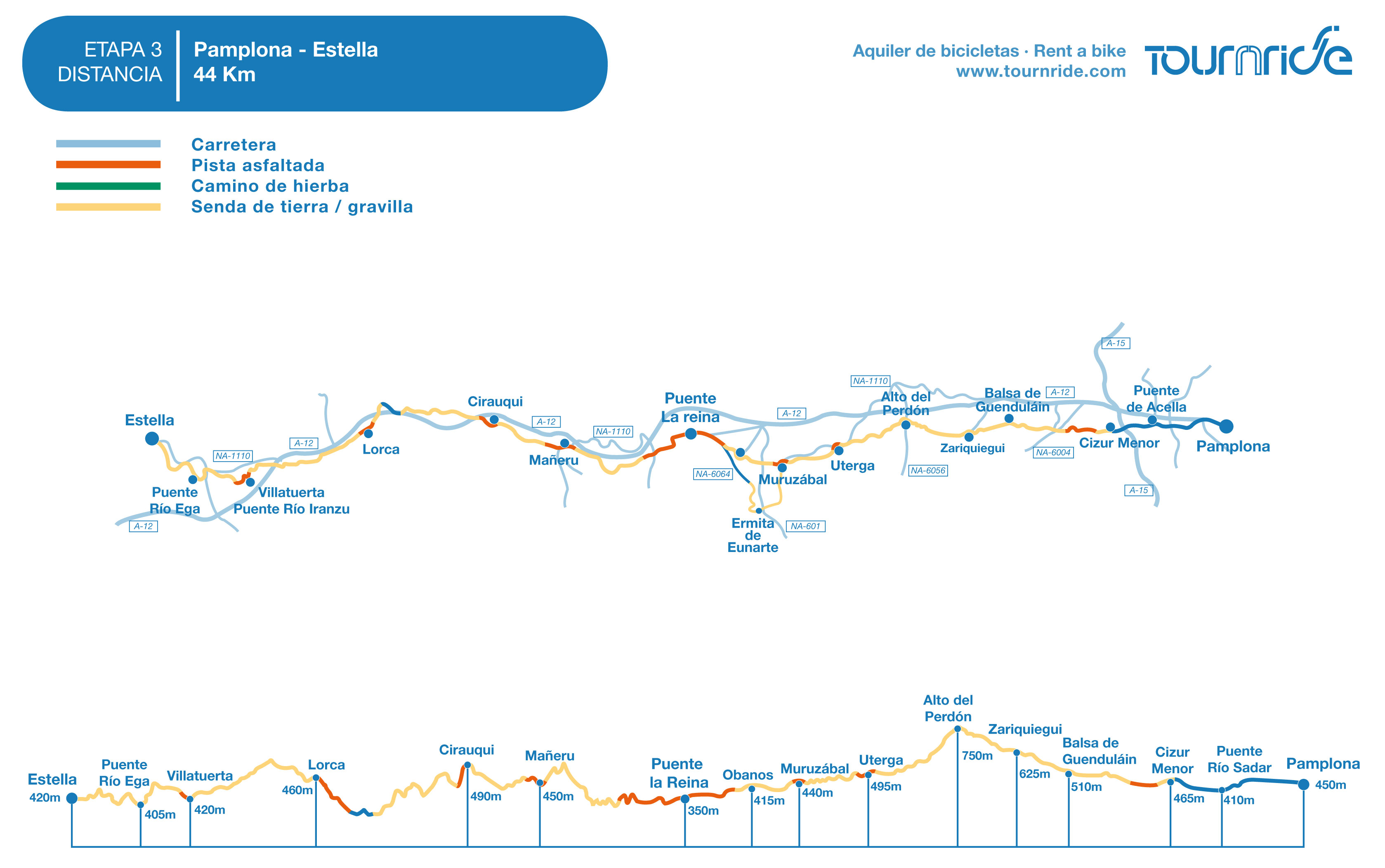
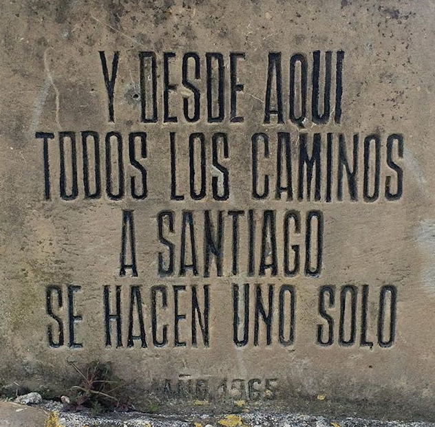
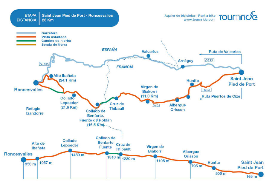
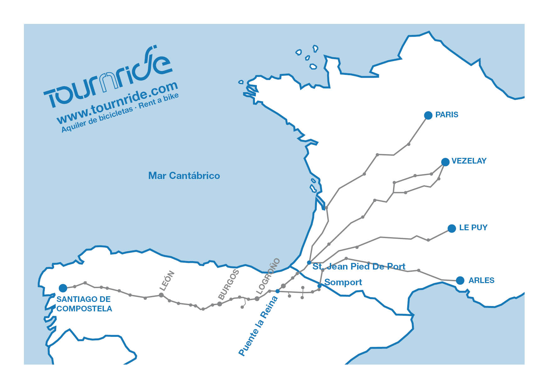
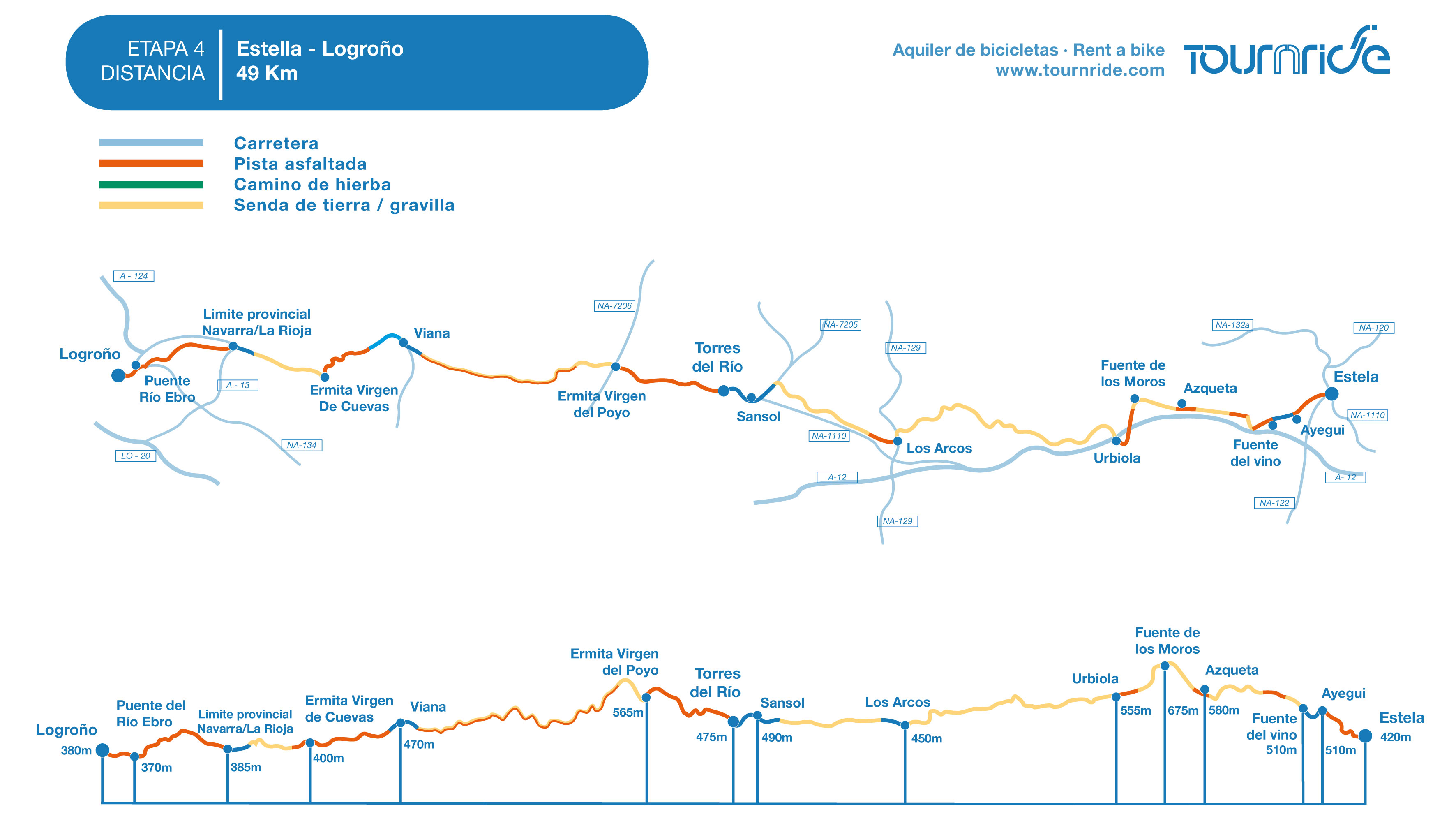
Distance to Santiago: 661 km
Stage distance: 49 km
Estimated time: 4 hours
Minimal height: 420 m
Max height: 590 m
Difficulty of the route: middle – low
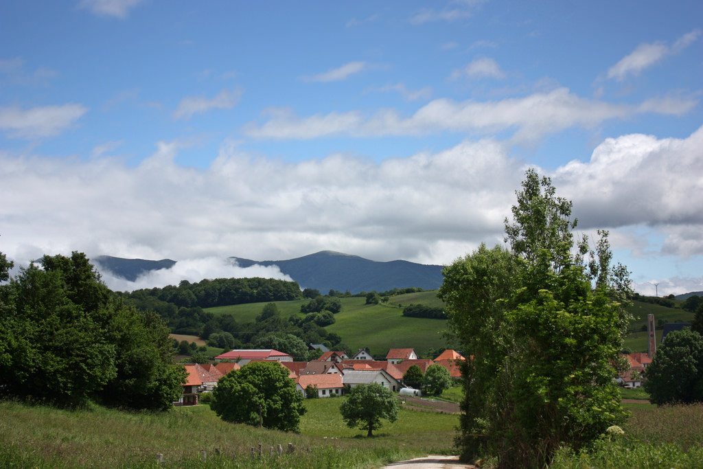
Places of interest: Los Arcos, Torres del Río, Viana, Logroño
Itinerary in Google Maps: To see the tour in Google Maps click here
Click on the image to enlarge
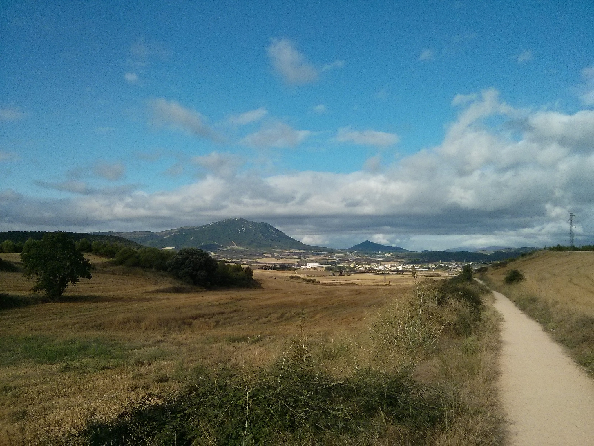
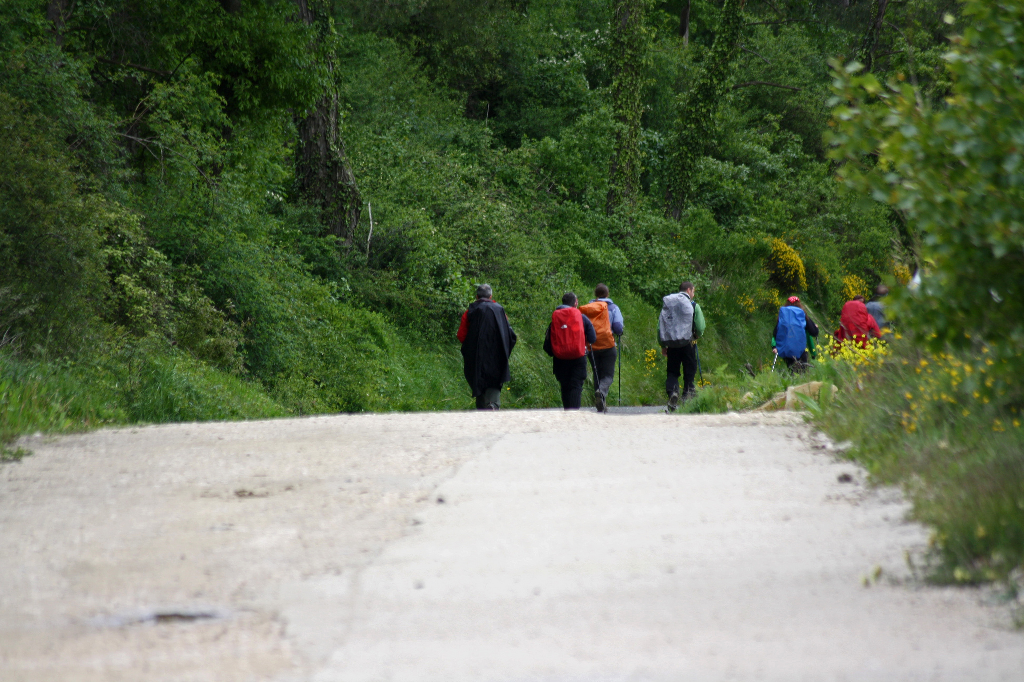
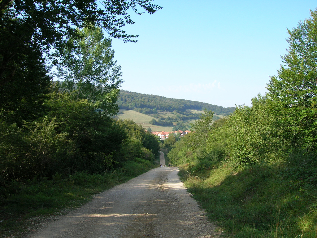
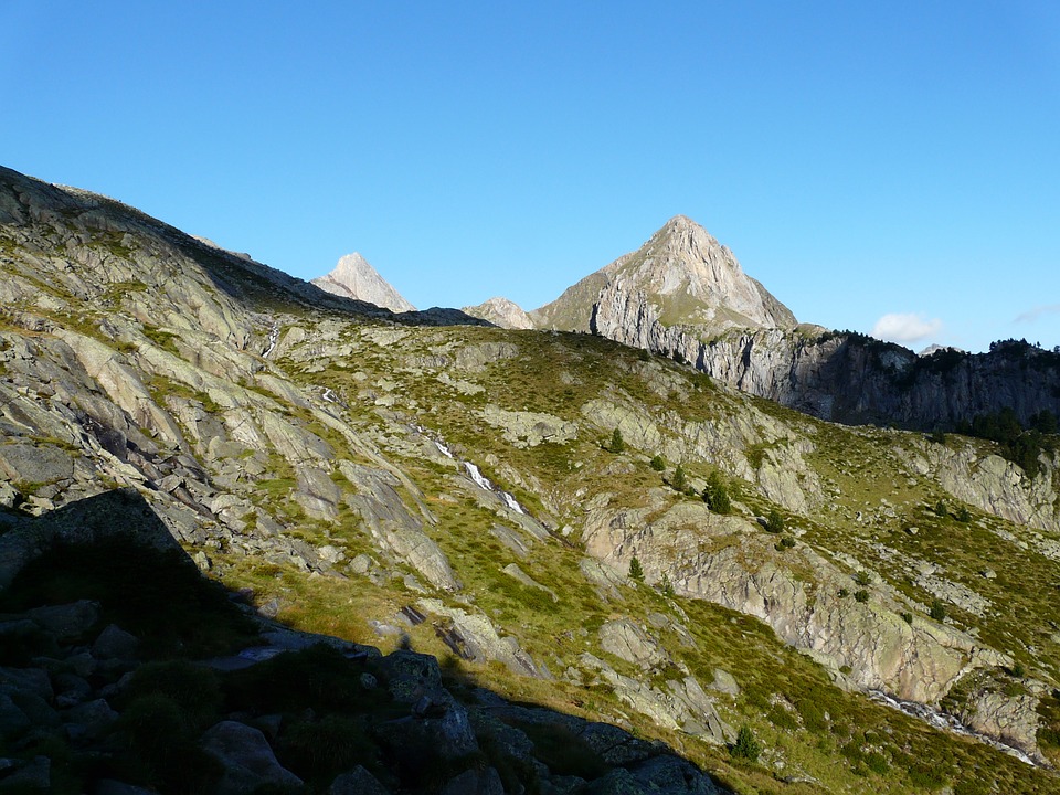
At this stage we will leave Navarra to enter La Rioja, the smallest community in Spain but internationally known for its wines. To get to Logroño and be able to taste them, we will have to cross 49 km that will combine quiet stretches of agricultural track with simple profile with two more complicated ones, especially the one of the about 11 km that separate Towers of the River of Viana.
From Tournride we tell you everything about the profile, services and heritage; to help you enjoy your Camino to the fullest and to make the best itinerary decision. Even so, if you have any doubts, you can always contact us.
Good way!
PROFILE AND STAGE’S MAIN ROUTES
We leave from Estella and we cross the about 2.5 km that separate us from Ayegui by a stony route in permanent rise, although with some jumps of abrupt slopes. A kick-start a bit break-legs, but nothing that cannot be carried.
After leaving Ayegui and making the obligatory stop at the Fuente de Bodegas Iratxe, there are two possible routes: follow Azqueta and Monjardín or go south and save the Montejurra to pass later for Luquín. Both options take us to Los Arcos, but from Tournride we choose (and recommend you) the traditional route through Azqueta and Villamayor de Monjardín.
When leaving Azqueta the land path begins to take slope and becomes narrower as it advances. At some point the route can become quite uncomfortable, so if you need to get off the bike, do not hesitate. This ramp lasts only 1.5 km and will reward us with the visit to another of the most emblematic sources of the Camino, the Fountain of the Moors.
Arrival at Villamayor de Monjardín (photo provided on Flickr by Antonio Periago Miñarro under the following conditions)
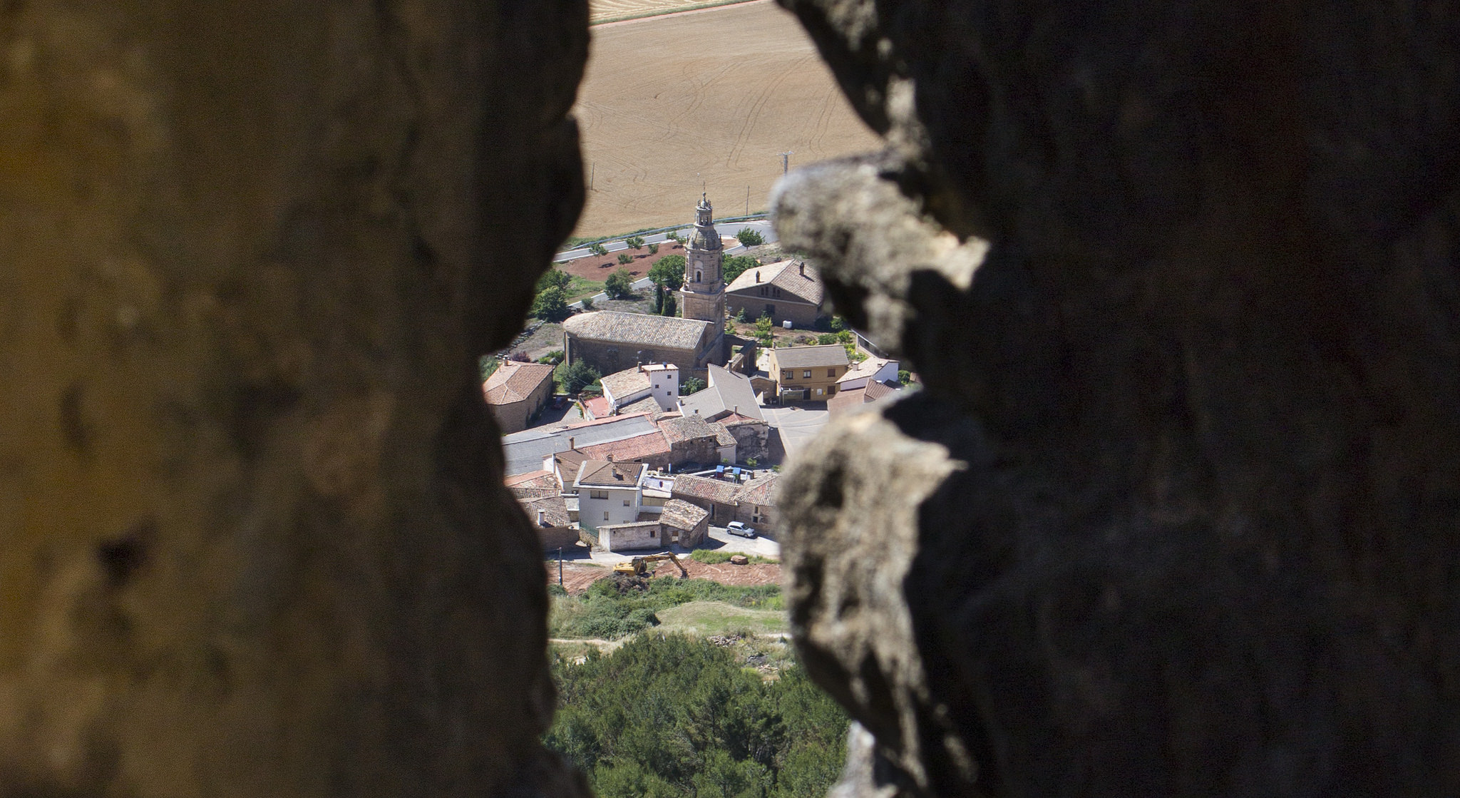
We will leave Los Arcos we will have to leave by the cemetery, in the east side of the town, to take another agricultural track of good firm that in 7 km will cause us to end in Sansol (kilometer 26 of route).
In Sansol we leave by the NA 1110 and from there we will be able to see Towers of the River to our left, in a lower quota. The road turns and takes us straight to the village. We enter Torres del Rio in the north and we go through the streets of the Race and the Sepulcher to find the yellow arrow on our right, which leads us to face the most complicated stretch of this stage.
The 10.5 km that separates Towers of the Viana River compose a true section “rompe-piernas” (break-legs), with permanent rises and falls and continuous changes of terrain. The most complicated part is the crossing of the ravine of Cornava, on horseback between both localities. Most of this part of the itinerary passes almost to the NA 1110 and does not cross any notable town or monument, except for the hermitage of the Poyo, at the edge of the road NA 1110. In addition, the road crosses several times the road of double meaning, which also makes this stretch dangerous.
For all this, despite trying to follow the traditional itinerary when making the Camino, in this case from Tournride we recommend that from Torres del Rio to Viana you go on the road NA 1110. When you reach Viana there are still 11 Km of road and it does not make sense to exhaust unnecessarily.
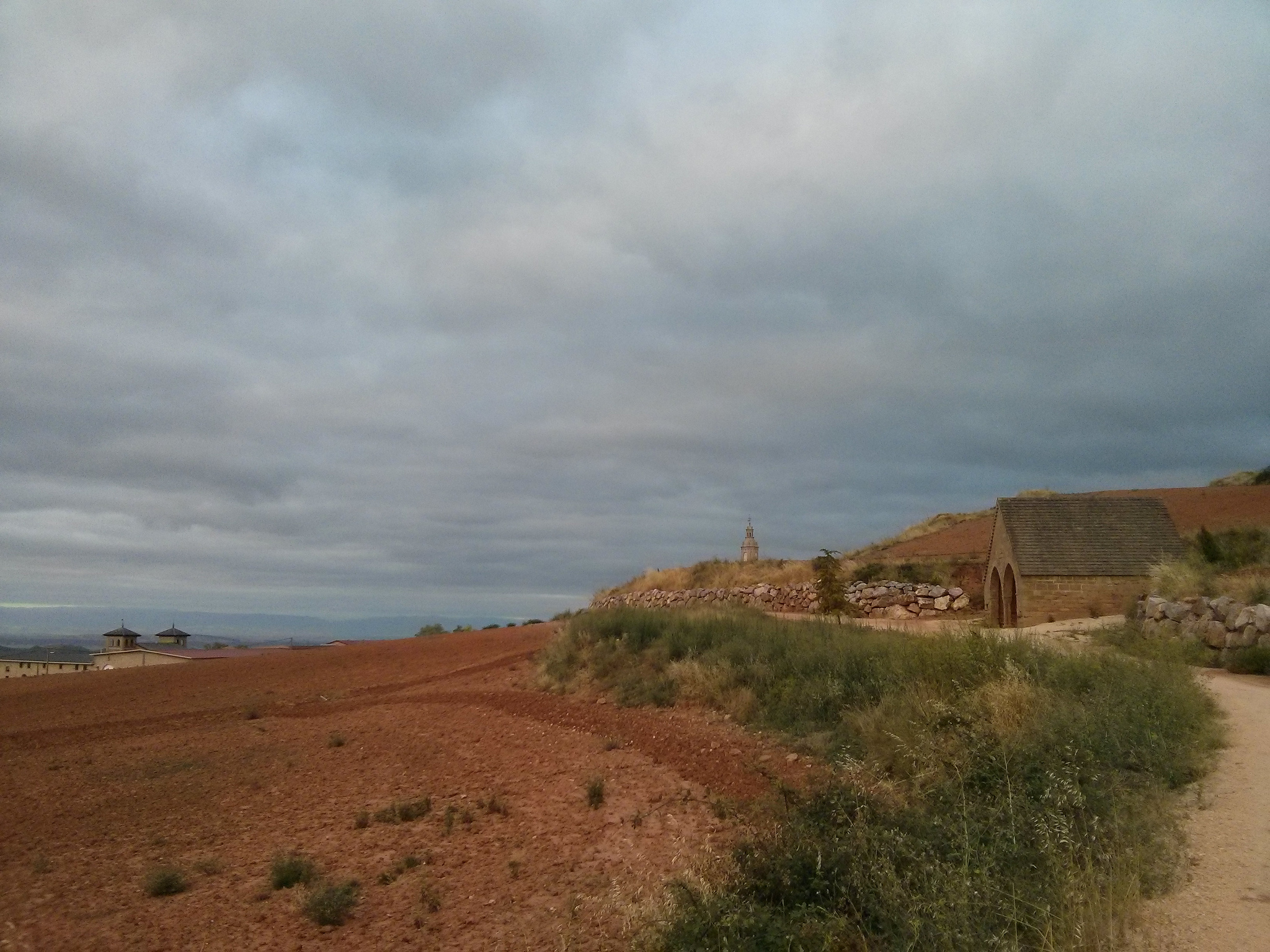
Once in Viana, the rest of the stage to Logroño is a steep slope, except for a small ramp that we will use to return to the road crossing the border between Navarra and La Rioja.
We leave from Viana on the N 111 (also we can follow the pedestrian path exiting the polygon and crossing the road by an underground passage) and after traveling less than 1 km we see a path of land with a military with the symbol of the shell and the Arrow on our left. We must take that asphalted track, which will take us direct to the hermitage of the Virgin of the Caves (kilometer 41 of stage).
From the hermitage we follow the asphalt sloped track and head west to return to the N 1111 by a slight ramp. When you get to the road and join it, we will see the green sign indicating that we enter the Rioja and, almost afterwards, the blue and yellow road sign that points us to the asphalt road that we must follow.
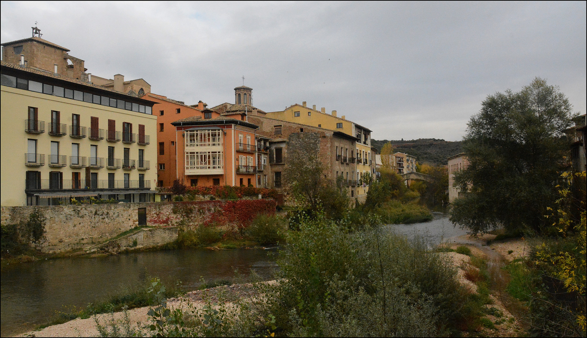
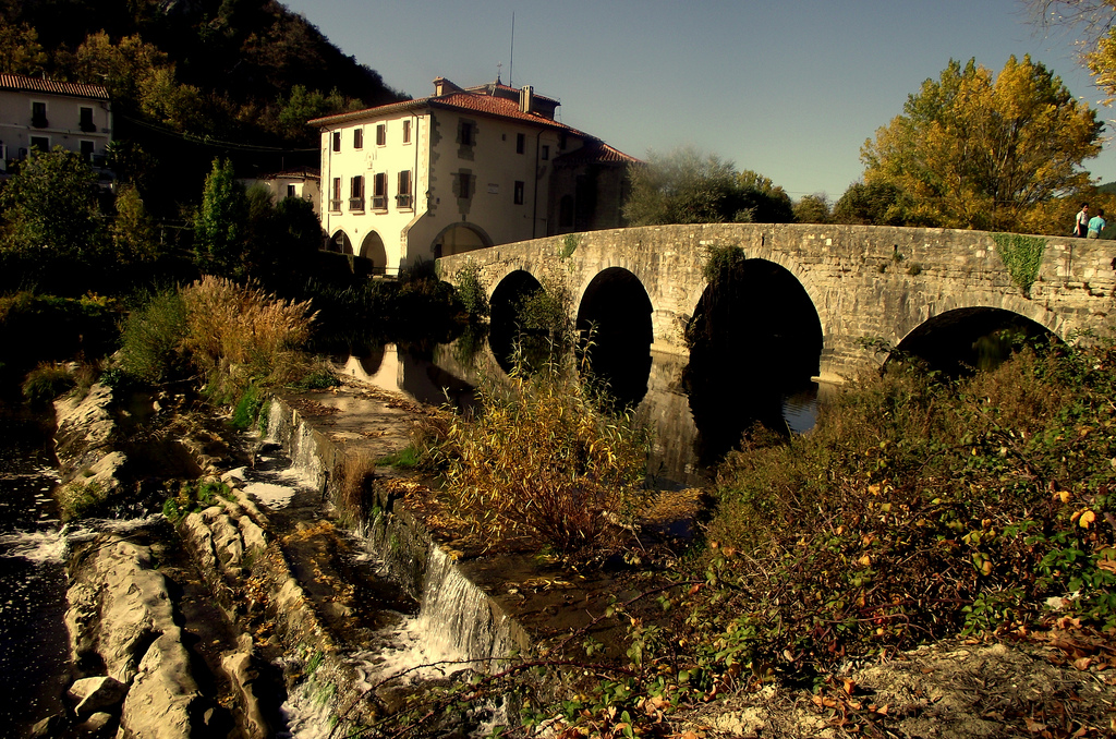
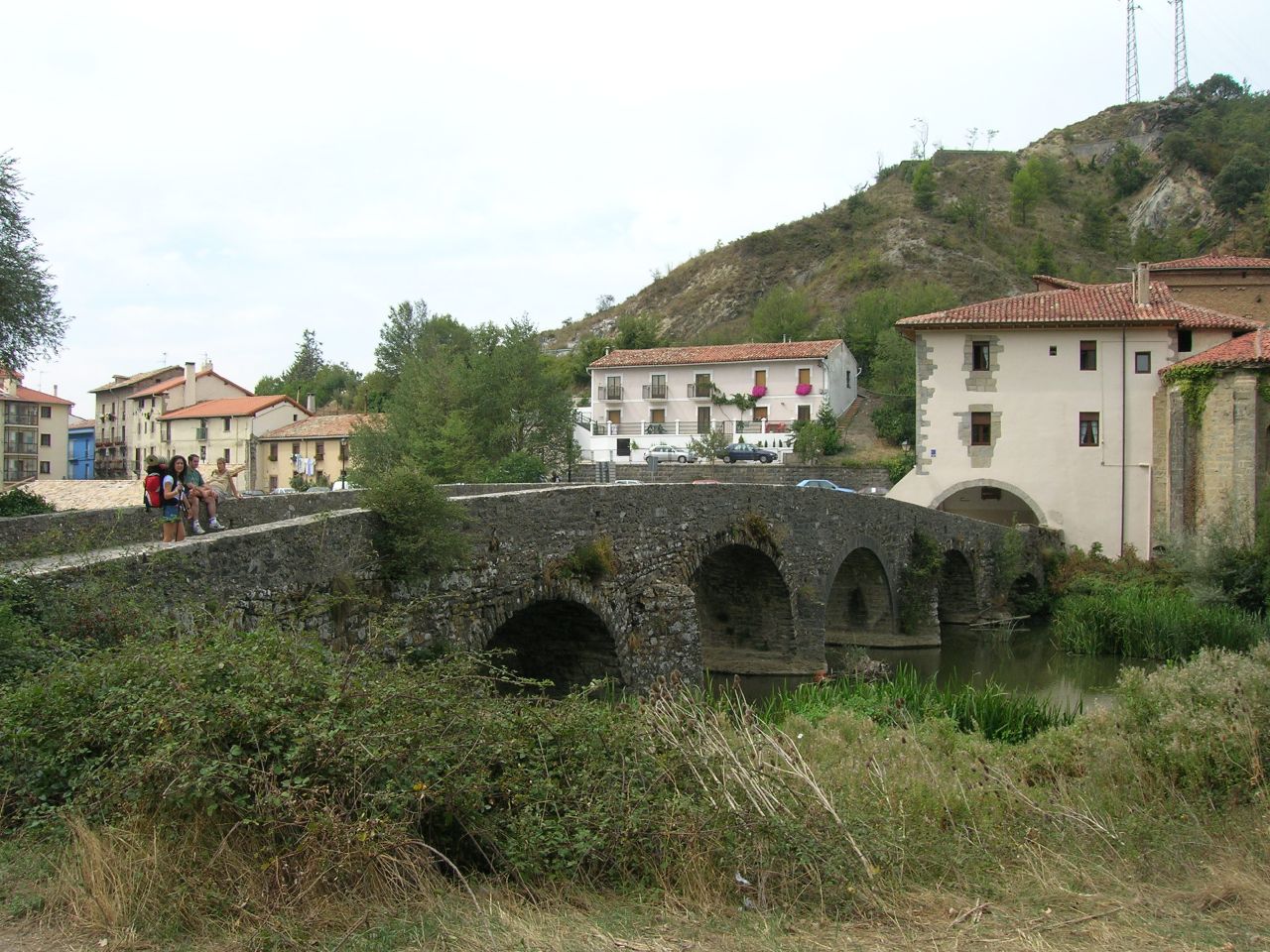
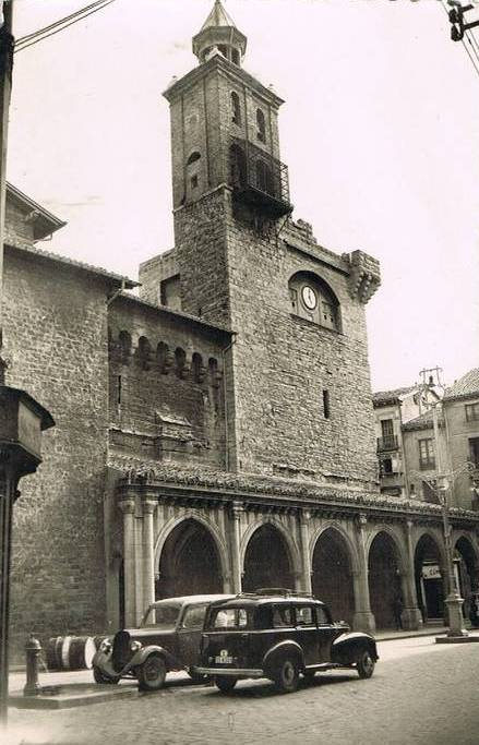
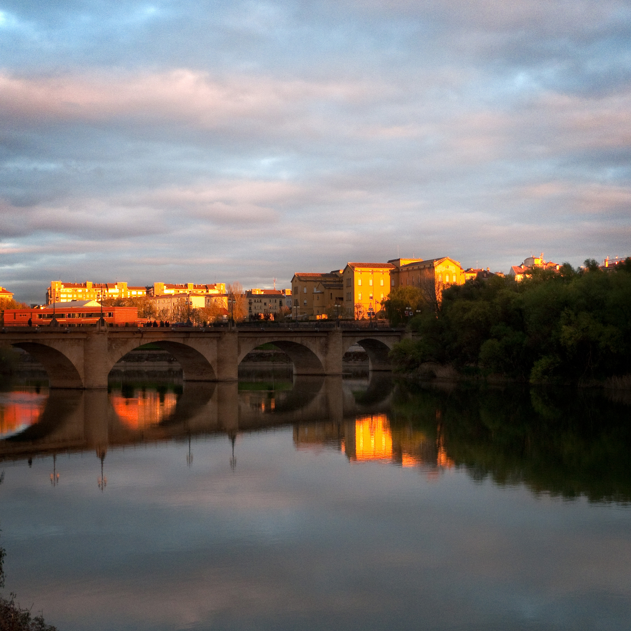
After crossing three underground steps, with the N 1111 to our right, in a little more than 2 km we will arrive at the Stone Bridge, entrance to our end of stage: Logroño.
Logroño stone bridge (photo provided on Flickr by Roberto Latxaga under the following conditions)
In summary…
In short, although this stage is the longest we have done since Saint Jean Pied de Port, the simple profile and the large number of paved tracks will make a large part of the kilometers to be traveled become a pleasant farewell Of the Navarrese fields.
We only remember here the two sections in which we have to be cautious and the possible variants of them:
- Azqueta – Monjardín. Rise of 1.5 km along a ramp sometimes quite uncomfortable. Variant: go through Montejurra and Luquín, although it is not a path of roses either (climb the mountain to a height of 970 m and lower it again).
- Torres del Río – Viana. 10.5 km stretch with variation of land type and permanent ups and downs, a full “rompepiernas” (break-legs). Variant: Do this part for the NA 1110, which we recommend from Tournride.
PRACTICAL TIPS
- If you start your way in Estella, the best way to get there is by bus, since there is no train station. Estellesa is a bus company with connections to Estella from Irún, Logroño, Pamplona, Puente la Reina and San Sebastian (in addition to many other smaller towns).
Another option is to take a taxi from Pamplona to Estella, if you contact Fermín on +34 609 44 70 58, you will get 55 euros on weekdays and 68 on holidays. Your taxi can accommodate up to 8 people, so you can organize groups of pilgrims to reduce the cost.
Remember that in Tournride we take the bikes to the place where you start and we can transport your surplus luggage at your end of the road.
- At this stage there are two stretches of kilometers where there is no place to buy water or food: 9.3 km from Urbiola to Los Arcos and 10.6 km from Torres del Rio to Viana. Therefore, we recommend provisioning in Villamayor de Monjardín or Urbiola and in Sansol or Torres Del Río.
- Much of the stage runs through tracks between open, shadowed fields. If you are going to travel this itinerary in summer, keep in mind the need to be well protected from the sun and with water to spare.
- Less in Azqueta and Urbiola, in the rest of towns that are passed in this stage there are shelters with closed places to store the bicycles: one in Ayegui, two in Villamayor de Monjardín, two in Los Arcos, one in Sansol, two In Torres del Rio, three in Viana and six in Logroño. The Logroño parish hostel does not have a closed place for bicycles.
DETAILED ITINERARY AND HISTORICAL-ARTISTIC HERITAGE
Today we have a lot to see: from medieval civil engineering in the form of fountains and bridges to large temples in Logroño and other smaller ones in Torres del Rio. We will visit the great Viana, historical and monumental nucleus and we will cross fields between vineyards. Start the geological experience in La Rioja!
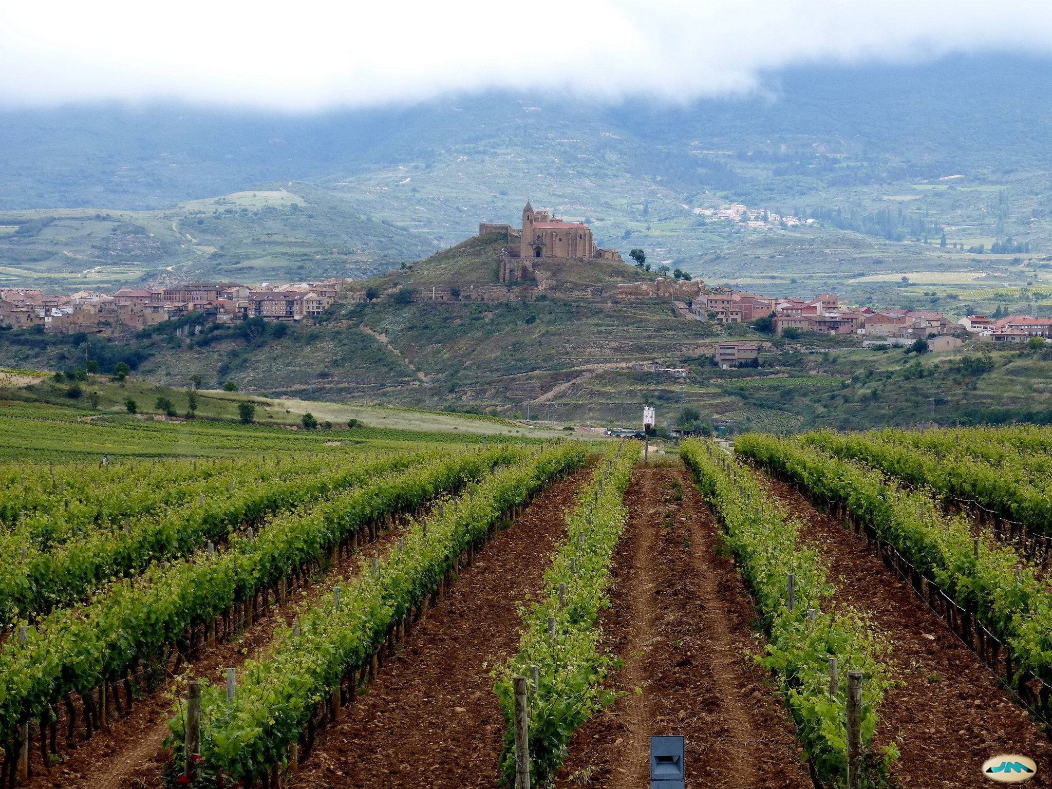
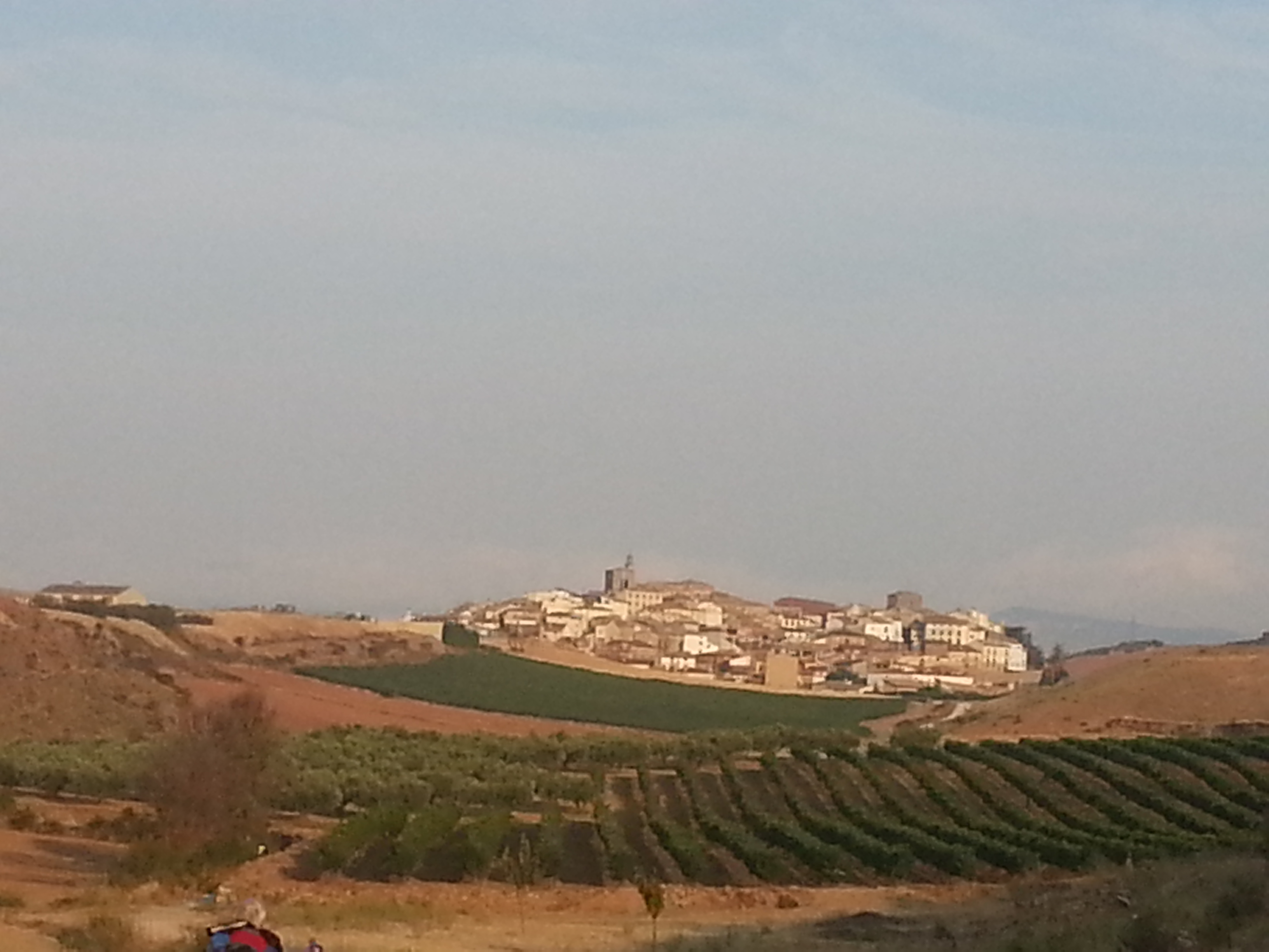
La Rioja vineyard with the village of Briones in the background (photo courtesy of Flickr by Juantigues under the following conditions)
Ayegui is practically an extension of Estella, reason why in this principle of stage we must face the route by these municipal terms populated and with heavy traffic.
We must leave Estella in the southwest. Both the street of San Nicolás (already visited in our walk of end of previous stage) and Fray Diego Street in Estella, which leaves of the bridge that crosses the Ega and connects with the center of the locality, they end in a roundabout that takes us to the street Carlos VII. On this street we leave for Ayegui, taking the second exit Calle de Estella towards at the next roundabout.
In less than 1 km we are in Ayegui, through which center passes the NA 1110 that we must pick up again after passing the Plaza de los Fueros. In about 200 meters we will see the sign of the pilgrim with the arrow that indicates that we take the street of the left that in less than half a kilometer will take us to our first obligatory stop of the day: the monastery of Santa Maria de Iratxe and the famous source of The wineries of the same name that, instead of water came.
First we will see to our right the source of Bodegas Irache, the call “source of the wine”. Of stone, it has a metal plaque with the Santiago Cross embossed with two pipes at its sides; one emanates water and the other leaves wine. This fantastic invention was built in 1991, with the idea that all the pilgrims could approach the source and corroborate what Aymeric said in his codex of the 12th century, that Estella was “a land of good bread and great wine.”
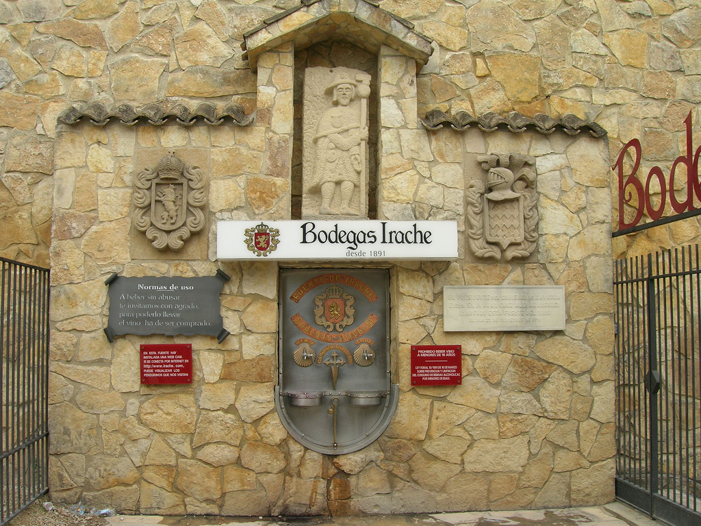
Source of Bodegas Irache (photo provided on Flickr by Jose Antonio Gil Martínez under the following conditions)
In fact, bread and wine used to be a substantial and important part of the diet of pilgrims, since products such as meat or eggs were not available to the majority of society.
In addition, the source combines that reference to the antiquity of the wine and the Camino in the area with the clearest modernity: there is a webcam installed in the fountain, which allows live viewing of pilgrims. Do not hesitate to advise your family and friends to keep an eye on you when you are there, it is always good to give healthy envy!
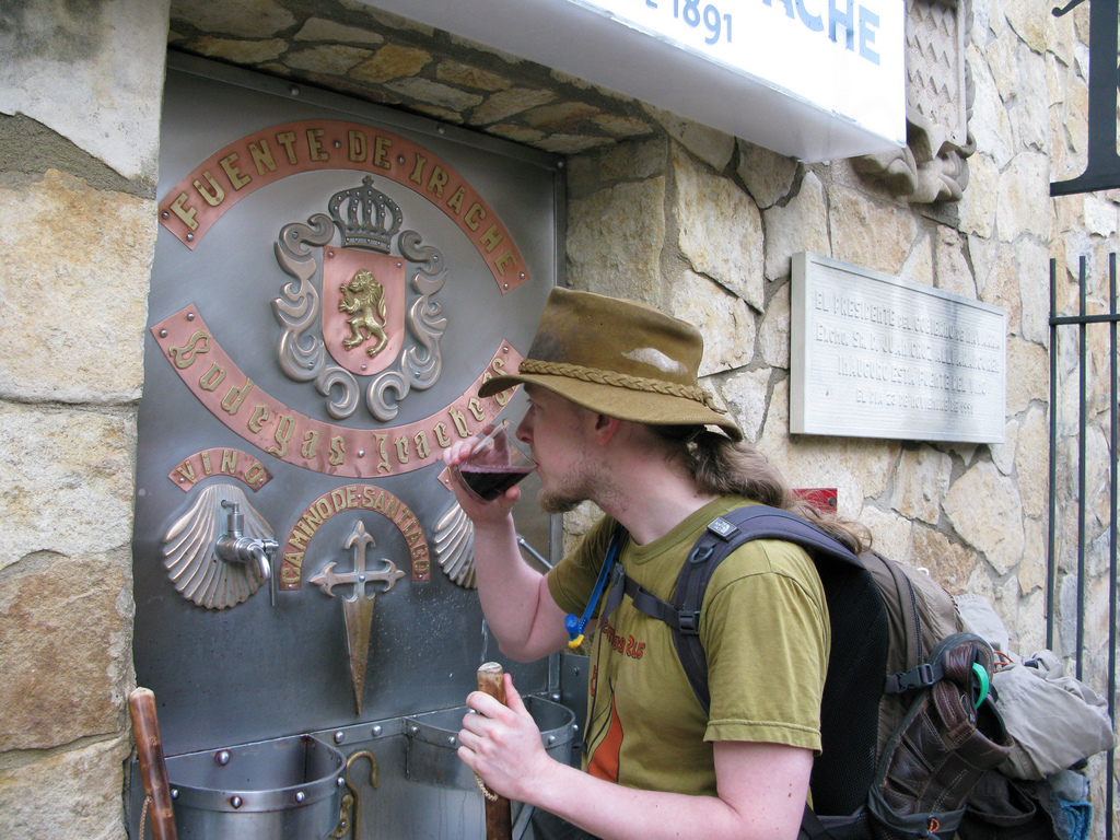
Pilgrim drinking a glass of wine at the fountain of Bodegas Irache
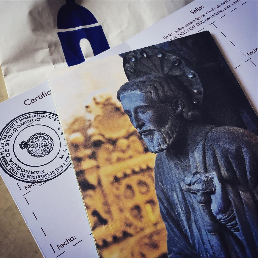
If we want, in the office near the source and in the Wine Museum of the winery can seal the credentials of pilgrims.
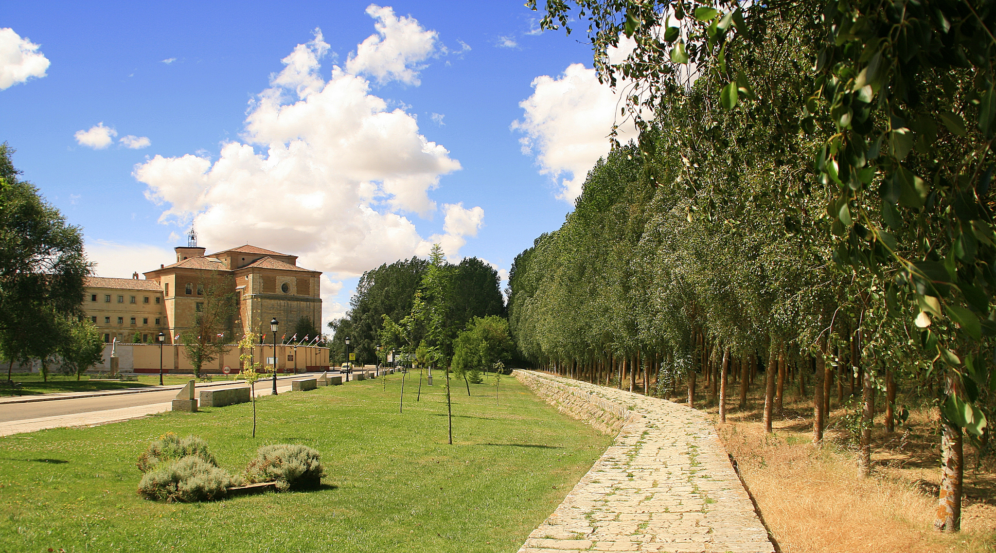
We continue along the road and a few meters further on we reach the square where the Monastery of Santa Maria de Iratxe is. This monumental construction that combines different styles began to be built in the S. XI on an earlier one of S. VIII. Since then it has been adding extensions and improvements and has been inhabited continuously since its birth until 1985. Today it occupies almost 7000 m2, of which more than 1000 correspond with its church.
It was the first hospital of pilgrims of Navarre, since the one of Roncesvalles did not begin until near 100 years later. In addition to hospital pilgrims has also functioned as a university and training place for clergymen.
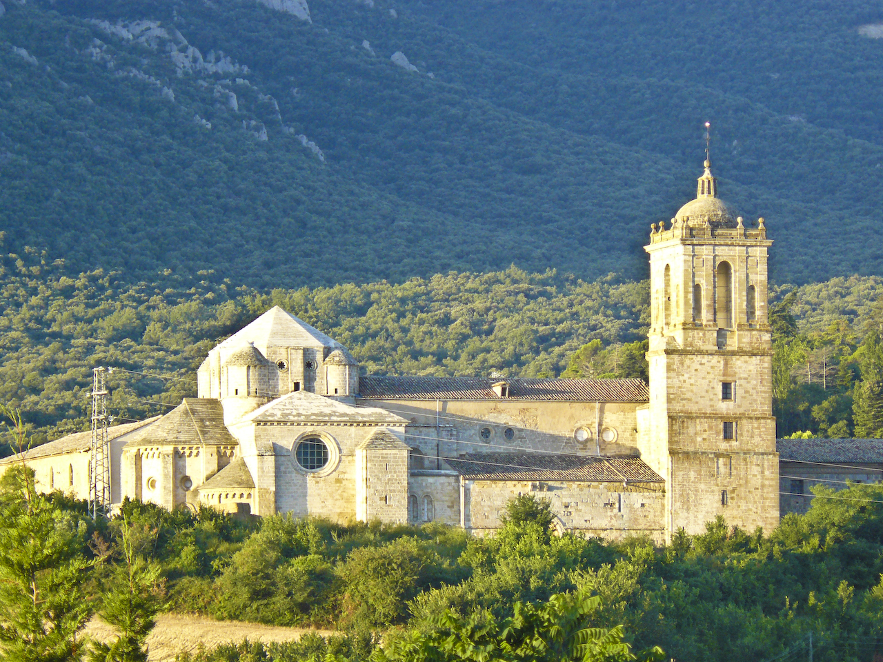
Monastery of Irache
From its initial construction, it is striking how the church, from the 12th century, has been preserved. The Romanesque temple is clearly influenced by Cistercian architecture. The Cister came as an opposition to the Order of Cluny, with the idea of restoring monasteries to asceticism and poverty. That’s why its architecture is not plagued by decoration, but is clean and elegant, like this temple.
In relation to this approach towards poverty, the legend says that the abbot of this monastery used to hide food from the monastery under his habit to give it to the poor and that, when the rest of monks reprimanded him for hiding it, when the habit Roses and flowers came out.
Cover of the Monastery of Irache (photo provided on Flickr by José Antonio Gil Martínez under the following conditions)
Besides the church, it is very worth the visit to the two cloisters of the whole, being one late gothic and the other Herrerian style.
We continue along the asphalt road until we reach a half-kilometer crossing. If we follow the yellow arrows painted on a stone that point us to the right, we will go towards Azqueta and Monjardín. On the other hand, if we continue along the dirt path that we have in front, we will see in a few meters a military road that will indicate that we continue straight, to make the route through Montejurra and Luquín. Both routes are well signposted.
FROM SOURCE TO SOURCE, PLEASE BE CAREFUL BY THE CURRENT: ROUTE BY AZQUETA AND MONJARDÍN
After this festive and cultural stop, we must follow our path, which will lead us to visit another of the emblematic sources of the Camino: the source of the Moors. For that we must reach Villamayor de Monjardín.
We follow the dirt road until we reach the road NA 1110 and then we cross it to take the Prado de Irache Avenue that goes a little to our right. This street will make us pass by the Camping Iratxe and then it will become a dirt path that crosses a road by a lower step. Following this narrow path of land between the populated vegetation, we will cross the road again and taking the NA 1110 to our left all the time, we will arrive at Azqueta.
From Tournride, we recommend that this small stretch between Ayegui and Azqueta be made by the NA 1110. The path is narrow and full of jumps. It is not technically complicated, but it is cumbersome and nothing is gained by going there, even if it is the traditional route.
Mention that Azqueta is natural one of the best known characters of the French Way, called Pablito. For pilgrims on a bicycle, it is a myth because he was one of the first people (if not the first) to ride the bike in the 60’s. He always waits for the pilgrims at the entrance of the village to give advice on how to walk correctly or tell stories in relation to the pilgrimage.
On Carrera Street we leave Azqueta, turning left after passing an industrial warehouse. On the front we have a ramp in the form of a path not too wide ground of about 1.5 km that ends directly in Monjardín. After climbing it, we’ll be able to refresh ourselves in a clear water source and we’ll have a quiet walk ahead to Los Arcos!
When arriving at Monjardín the land path becomes an asphalted track and to our left the medieval source of the Moors is pointed out. Although its roof was recently rebuilt, giving it the same shape it had when it was built in S. XIII; the rest of the fountain is a very special example of well-preserved medieval civil engineering and no additions.
Medieval Fountain of the Moors in Villamayor de Monjardín (photo courtesy Flickr by Dani Latorre under the following conditions)
The source of the Moors is actually a cistern, a word from Arabic meaning “well” or “deposit”. By the influences of Al-Ándalus in the Iberian Peninsula we can find this type of construction in different places. The Arabs always put them in the courtyard of their houses, in the form of a central pool to which they channeled rainwater. Therefore, more than a traditional Western source with pipes, this cistern looks like a shed with two large arches leading to stairs leading down to the water tank. If it is hot, this place will be perfect to cool off a little after the ramp you have touched up from Azqueta.
Says the municipality of Villamayor de Monjardin own this people is that of the four lies, because “it is neither Villa nor greater, nor has nuns nor garden. In fact, in ancient times the name of the town was simply Villamayor but as in Spain there are many localities with that name they added the one of the mountain in which it is. Before that mountain was called Deyo that is why to the castle that is in its summit is denominated San Esteban de Deyo.
Villamayor de Monjardín from the castle (photo courtesy Flickr by Mikel Culla under the following conditions)
The castle is said to have been “built by the Romans, made strong by the Moors and conquered by the Navarrese. The archaeological evidences date the castle in S. VIII so that the Romans could not build it and at the end of S. IX the town was conquered by the Arabs, although at the beginning of S. X the king Sancho Garcés recovers it. They say that this monarch was buried in the castle of the town, which was very important because his position at a high point on the adjoining land made it a strategic fort.
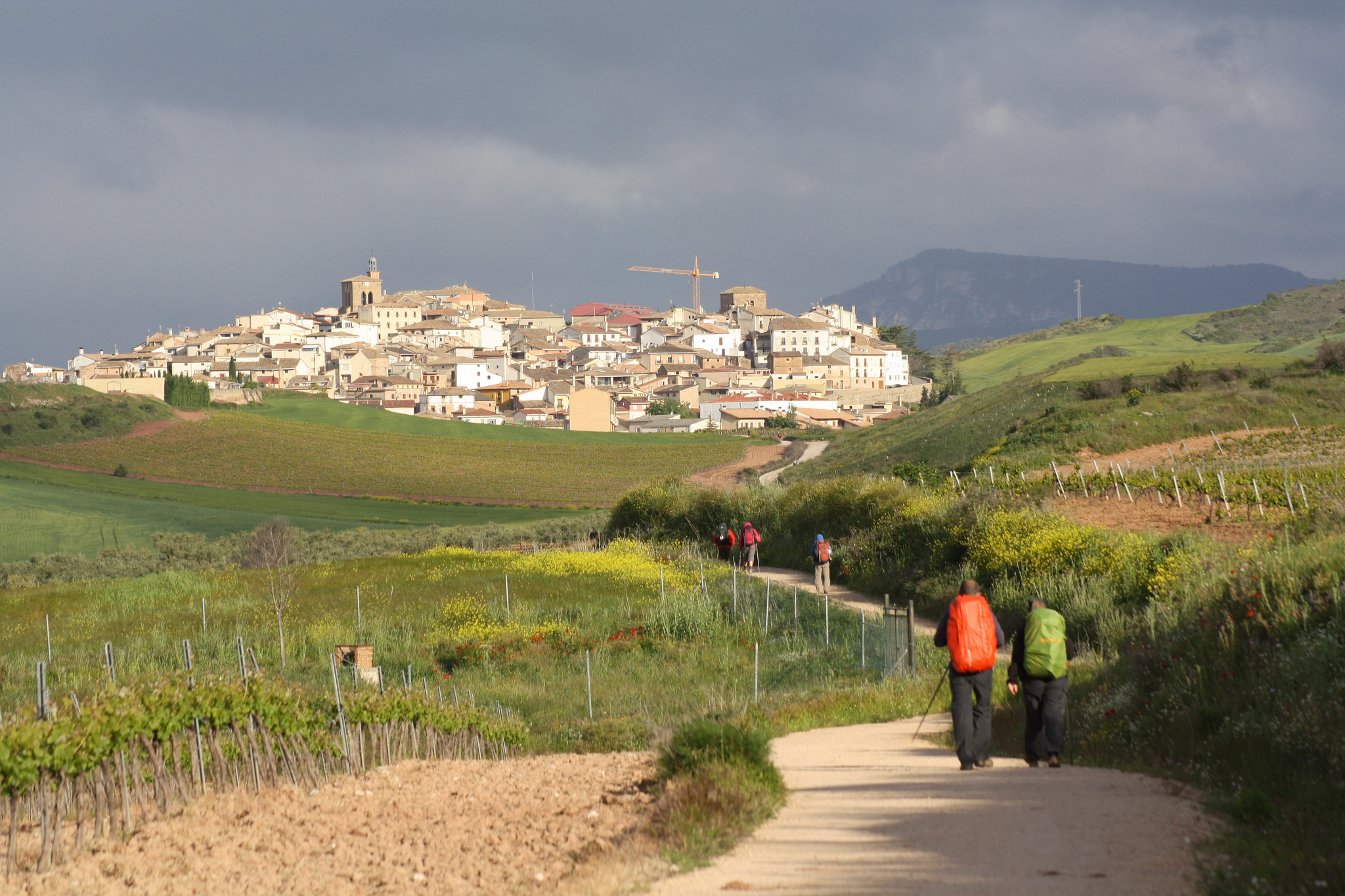
NICE WALK BY THE NAVARRO FIELD UNTIL ARCOS
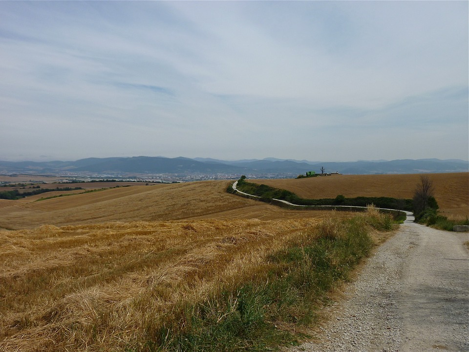
From Monjardín to Los Arcos, we have just over 13 km of dirt track in the form of agricultural land. When leaving Villamayor by the Romaje Road we will see the militaries that tell us to continue towards the south, crossing later the A-12 by a lower passage and climbing a very light ramp to Urbiola.
In Urbiola (or even before in Monjardín) it is not enough to provide food and water, since there is no other town to Los Arcos.
We leave Urbiola on Calle Mayor, we cross the NA 7400 and we see how the asphalt turns into an agricultural track that in about 600 m makes us cross the A 12 again through another underground passage. From that moment, we have more than 10 km of road well signposted in slight slope. Although it is not paved for most of the way the trail is quite wide, so we will have no problem.
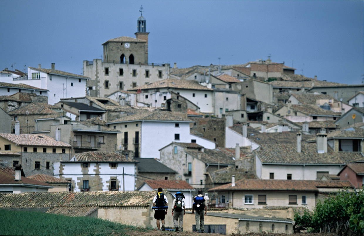
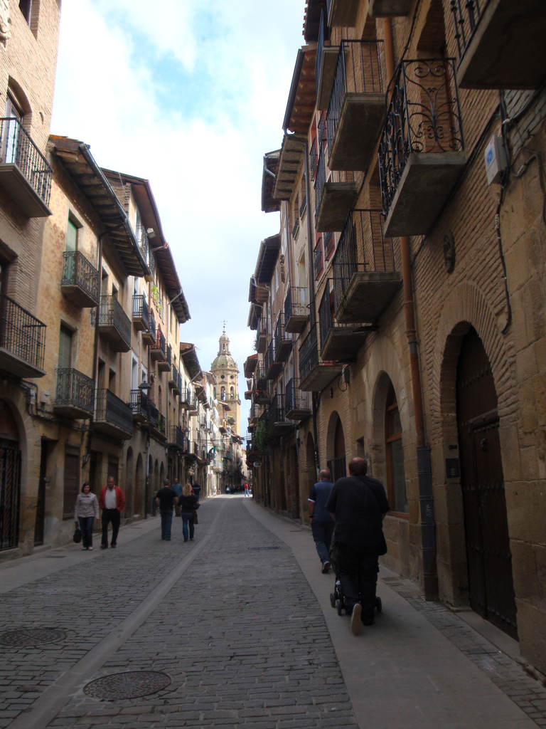
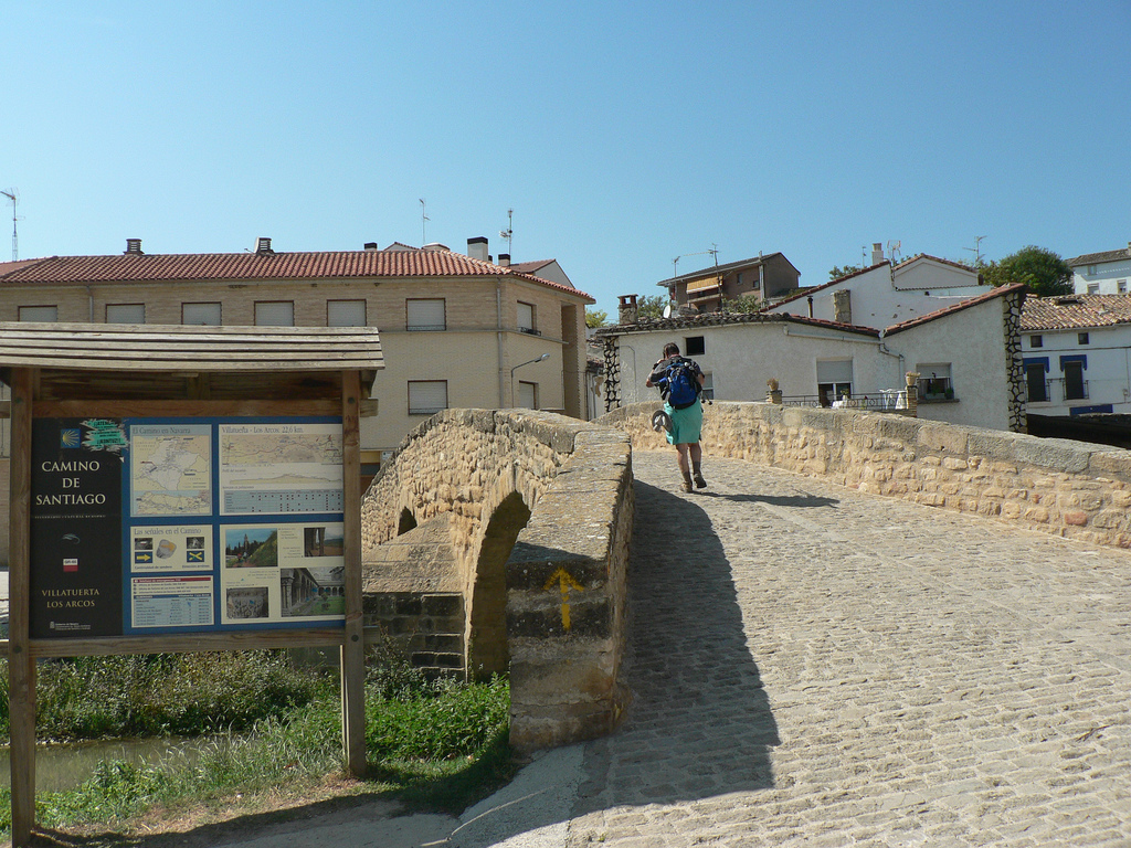
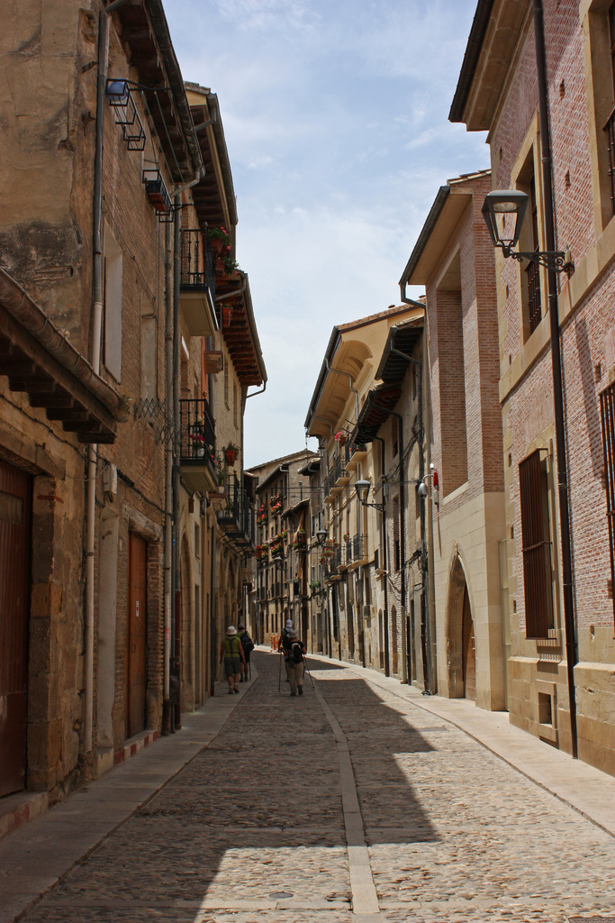
We entered the Arches in the north. This town owes its historical development to its position of “knot of roads”, among them the Camino de Santiago or the Roman trade routes. Due to the importance it has as a pilgrimage, it follows the village-street structure, with its main street coinciding with the itinerary of the French Way.
Today it is the end of the stage for many pilgrims, especially those who go on foot, and therefore has many services. In the old days it was like that and it had three hospitals of different pilgrims. One of them, that of St. Lazarus, catered to many sick pilgrims in longer stays (a great epidemic of leprosy is remembered).
After passing the poorly preserved hermitage of San Vicente, only vestige of a splendid past in which there was a large palace and a church, we headed down the main street to the center of town.
This main road is flanked by large stone houses with shields on the facades; I also remember the historical importance of the town, where important Navarrese families lived.
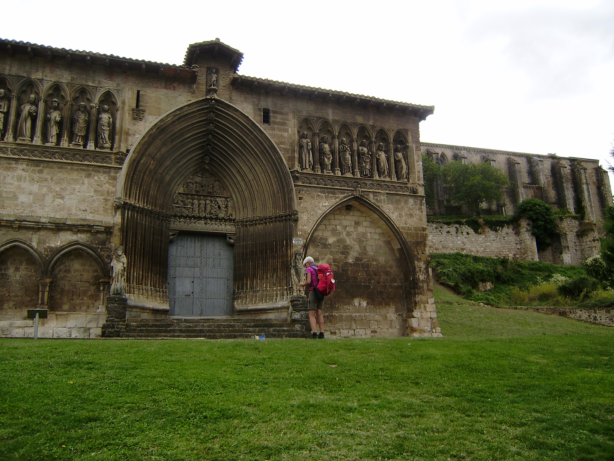
In the square of the fruit we must turn to the right to reach the square of Santa Maria, where we will automatically see the solemn construction of the same name, due to its magnificent stonework and wingspan. It is one of the most important churches in Navarre.
Again, the Camino de Santiago is again the cause that in medieval times it was decided to promote the construction of a temple. It began at the end of the 12th century, when the itinerary was a mass phenomenon of the time and was reformed until the S. XVIII.
From the outside, the 16th-century northern doorway is noteworthy, a great Renaissance example full of carvings of angels and cherubs. In the exterior there is also a large portico of later construction (S. XVIII), neoclassical and lacking of iconic decoration.
From the tower of this church used to ring the bell to guide the pilgrims who, since the road from Monjardín was not as well signposted as it is today (the signs that guide us today are the result of a collective effort initiated In the 80s), they lost and despaired to not see Los Arcos.
In Tournride we recommend you without hesitation to get off the bike to visit what may be the best of the church of Santa Maria: it’s interior. Filled with smaller altarpieces in rococo style, it also has a large main altarpiece in the Baroque style apse of the 17th century. The amount of colors and sizes everywhere marvel the visitor, full of small details that attract attention. It is also worth noting the Mannerist carving (between the Renaissance and the Baroque) of the choir chairs and, above all, in its organ of the S. XVIII, the most ostentatious of Navarre.
Outside the church is also worth visiting the cloister, from the 16th century and late-Gothic style.
FROM ARCOS TO TORRES DEL RÍO, MORE KILOMETERS FROM AGRICULTURAL TRACKS WITH SIMPLE PROFILE
We leave Los Arcos by the Plaza de Santa María, crossing the zebra crossing that is in the square itself and which ends at the Jacobean route. A paved road once again becomes a dirt road when leaving the town and, following a little more than 3 km in slight slope, we will arrive at a point where a military tells us that we take the track to the right.
Continuing straight on a slight ramp, we come to the road NA 7205 where another sign makes us turn left and continue on asphalt until reaching Sansol..
Sansol and Torres del Rio are practically glued, separated by a ravine. Therefore, when following the road we arrive at the NA 1110 and continue through it, we will see to our left Torres Del Río at a lower level.
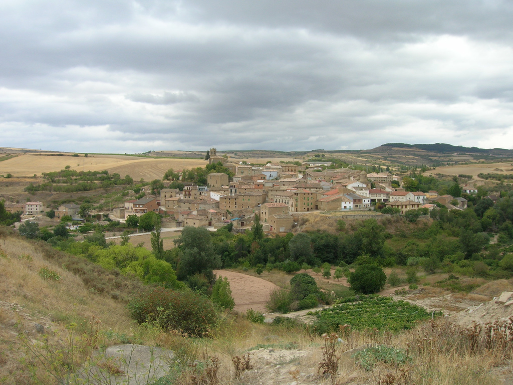
Sansol and Torres Del Río (photo provided on Flickr by Jose Antonio Gil Martínez under the following conditions)
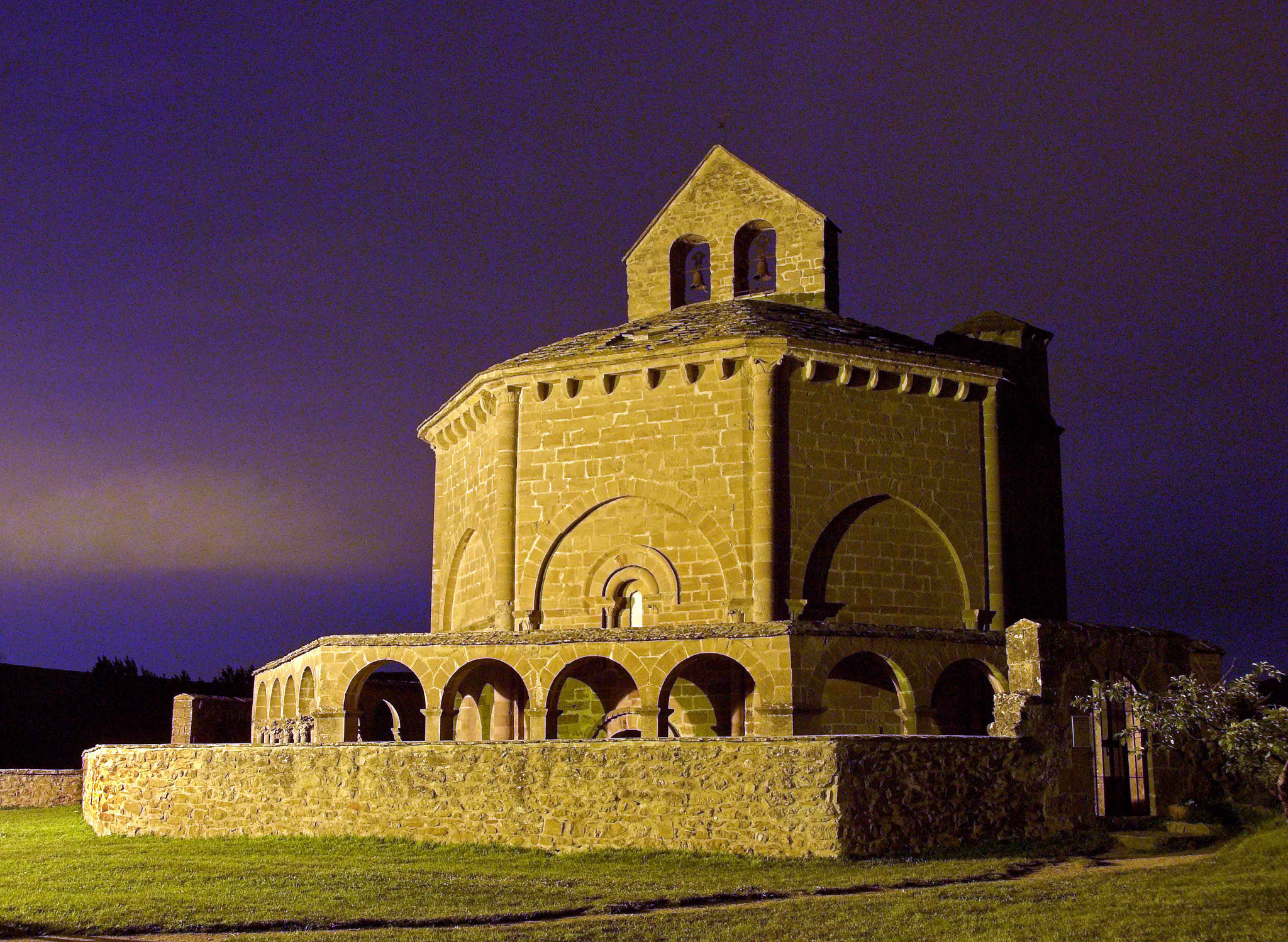
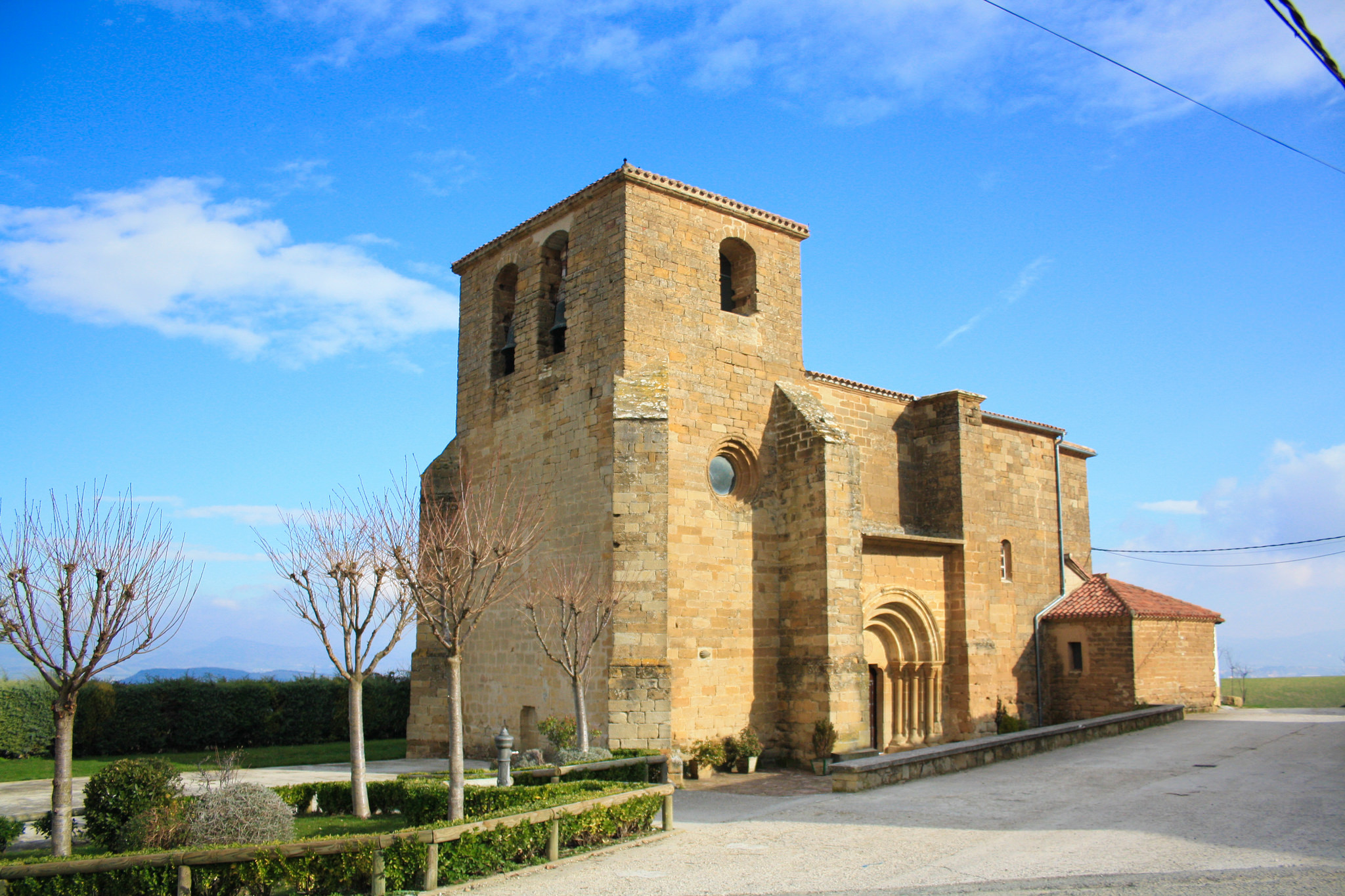
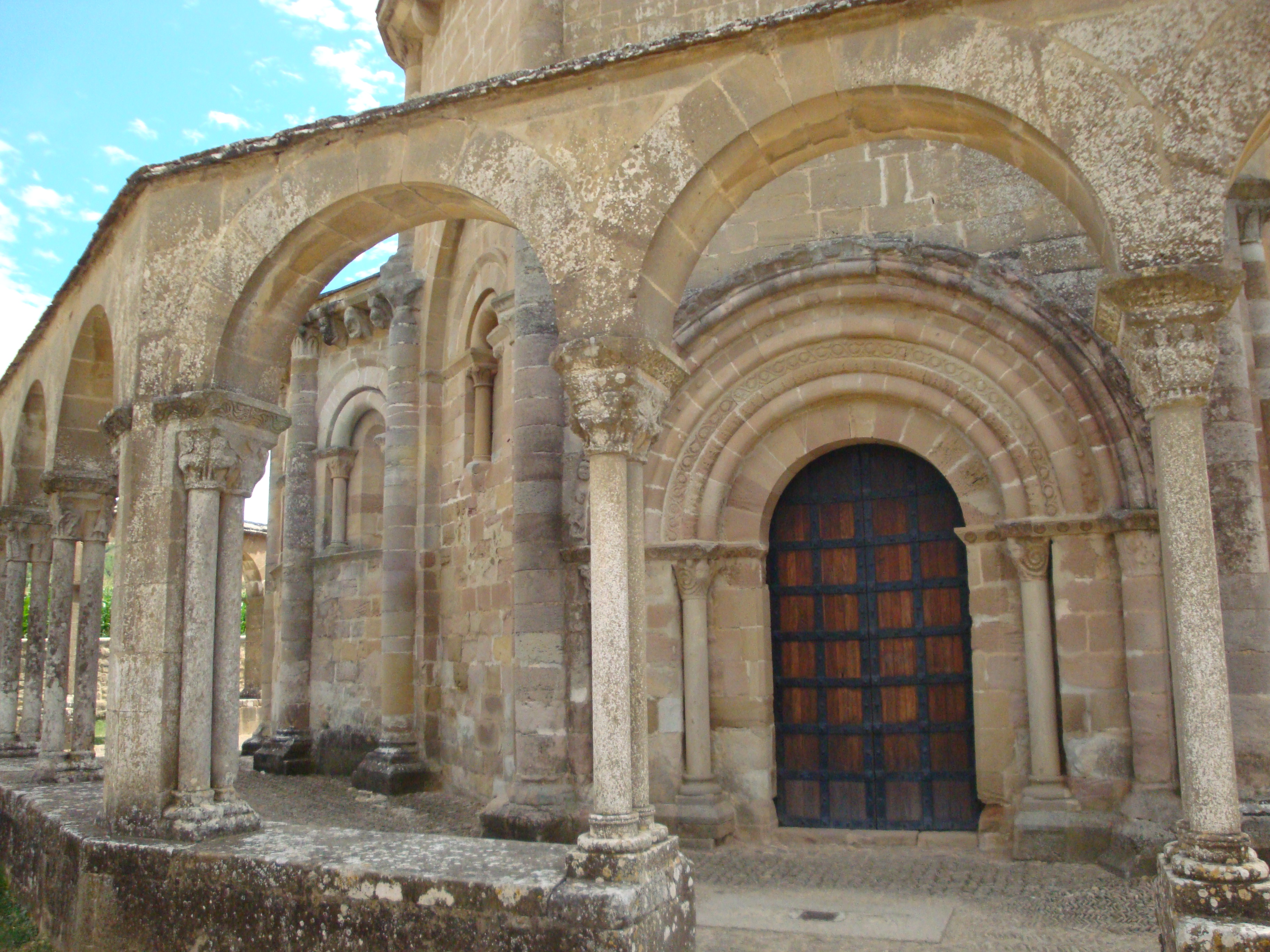
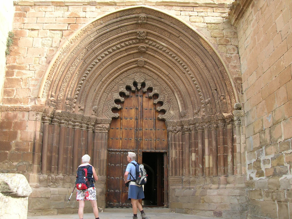
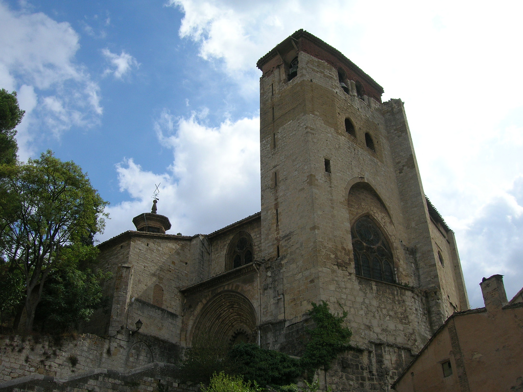
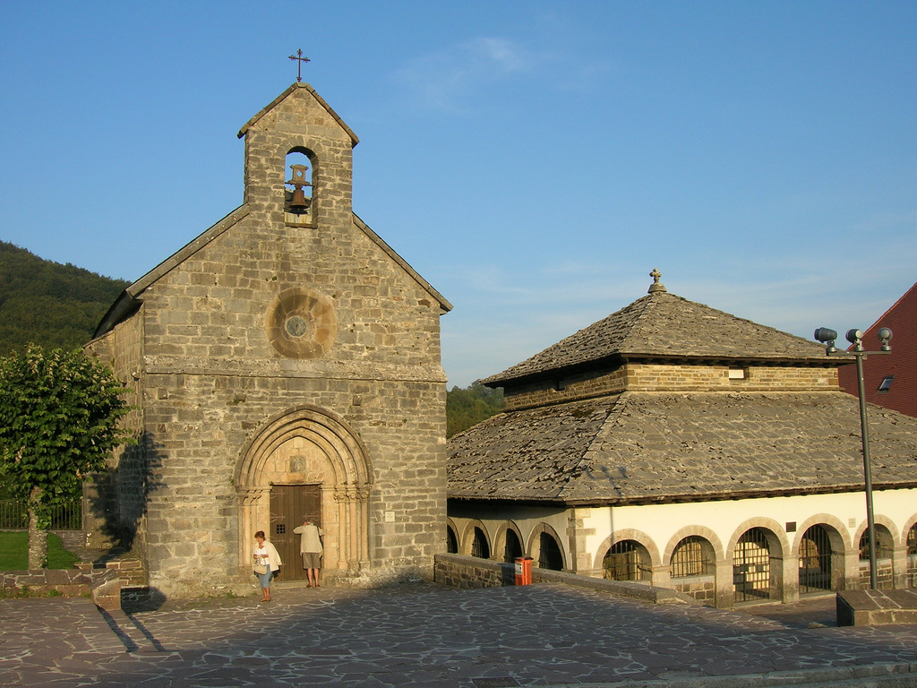
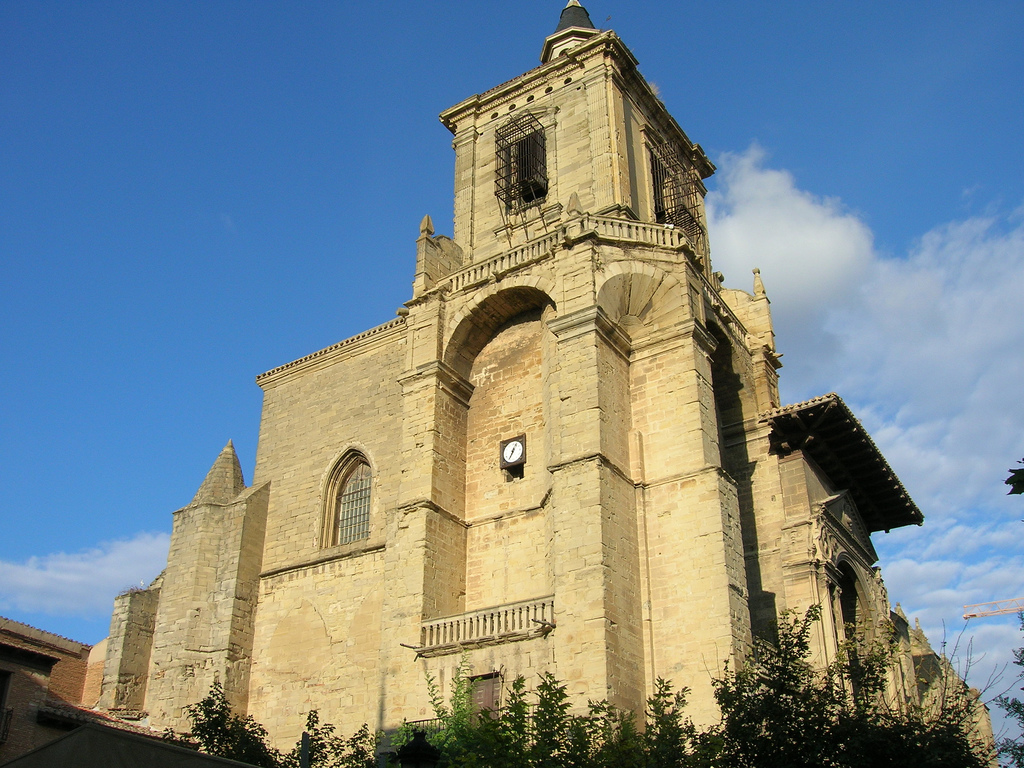
The NA 1110 will take us directly to the north of Torres del Rio, down a very steep slope. We enter Carrer de la Carrera and head to the town center to visit the Holy Sepulcher church, a strange jewel of the Romanesque.
To the pilgrims who before getting to Puente la Reina were curious and approached to visit the church of Santa Maria de Eunate, this temple sure reminds them of that previous visit. Like the other church, it is from the 12th century and is also related to the Order of the Temple (although there is no historical evidence of it) and in its form closely resembles the Holy Sepulcher of Jerusalem. The two also coincide in their octagonal form, although in this case their geometric shape is perfect.
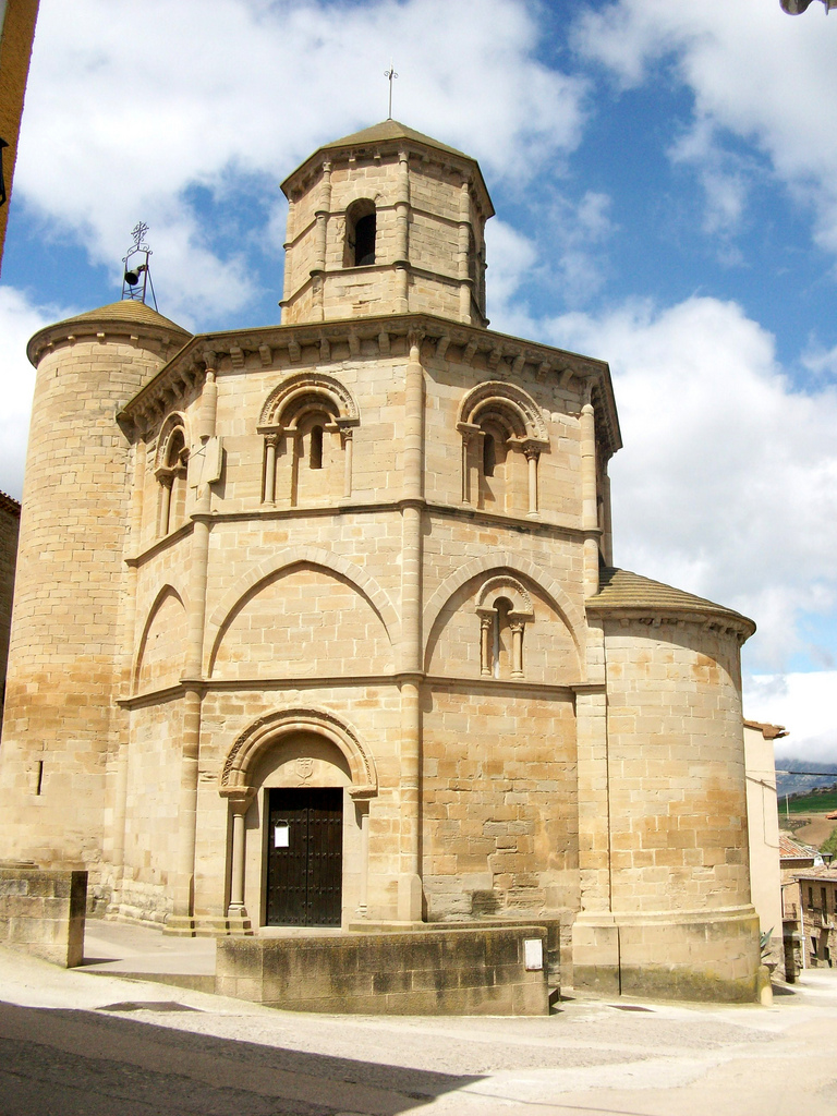
Church of the Holy Sepulcher in Torres Del Río (photo provided on Flickr by Total 13 under the following conditions)
Inside, the imposing vault attracts attention, with interspersed nerves reminiscent of the influence of Arabic architecture in this area. In fact, it is thought that it could be built by Christian artisans who lived for years under Muslim rule in the Iberian Peninsula and who then saw their work influenced by it.
Outside, it is curious how in spite of being Romanesque and therefore part of a style that tends to tend to robustness and horizontality; this temple has three floors with open spans illuminating the upper dome and a large cylindrical tower that provides much Verticality. Like other towers already seen, this was used as a beacon for the pilgrims at night, guiding their way.
COMPLICATED LINE BETWEEN TORRES DEL RÍO AND VIANA
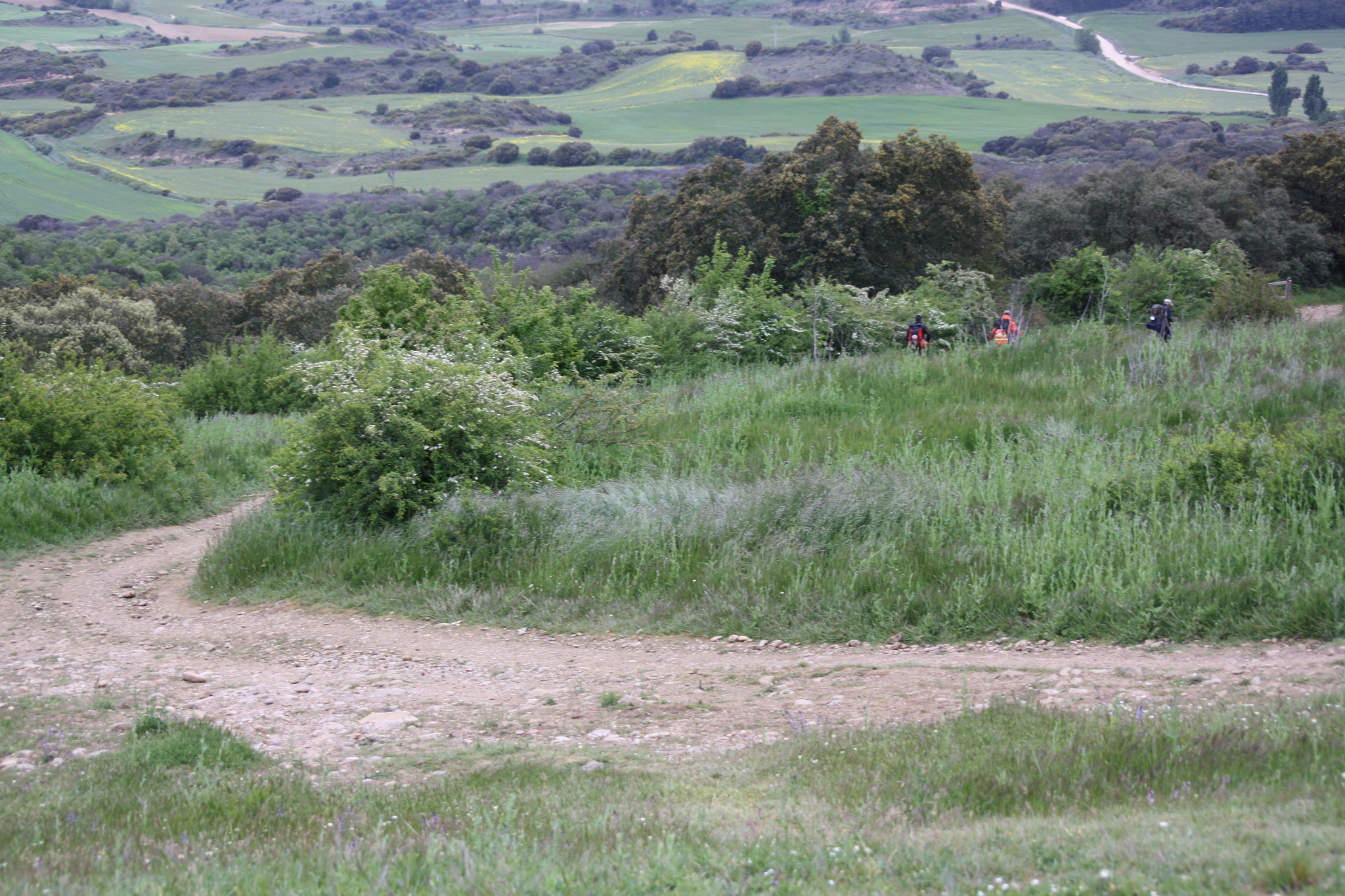
The stretch of Torres del Rio to Viana is uncomfortable, with continuous ascents and descents, with a firm change according to the necessities, surrounded by vegetation and crossing several times the NA 1110 near curves. As we mentioned at the beginning, we recommend doing this part of the stage directly on the road NA 1110, in this case it does not make sense for cyclists to follow the original path.
In any case, if you decide to take the traditional path of the road, you will see that it is well signposted. Leaving Torres del Rio along the asphalted road Camino de Santiago, it ends at a path that crosses the national road by a lower pass. In just over 2.5 km from Torres del Rio, we will arrive at the hermitage of Poyo.
The hermitage of the Virgen Del Poyo is on the north bank of NA 1110, so if you make the route by road you will pass here as well. Formerly in this place there was a hospital of pilgrims and a church dedicated to the Virgin, but all that is left is this hermitage, which is in a bad state of conservation. The initial work probably began in the sixteenth century but in the nineteenth century it was highly recommended and in that same century the temple suffered a great fire that burned its image of the virgin of the XVI. The sculpture that can be seen today is a copy of the original.
Road to Viana (photo provided on Flickr by Hans-Jacob Weinz under the following conditions)
After following for a few meters along the road, we cross them and take a road from the land that leads to another road, NA 7206. After less than 80 meters along that road we cross the sign on a path on the right and continue a strong hanging down the ravine of Valdecornava. With the road to our left, we crossed a small bridge over the Cornava River and we followed the path of the earth, crossing by a lower passage of the highway and continuing until arriving at the NA 1110 again. The last 2 km we make the road to enter Viana by its area of polygon (kilometer 38 of route).
When you reach Cristo Street, at the entrance of Viana on the NA 1110, you will see the sign of the pilgrim on the right that tells us to follow that street. Following practically straight all the time they arrived at the center of the locality, to the Place of the Forces.
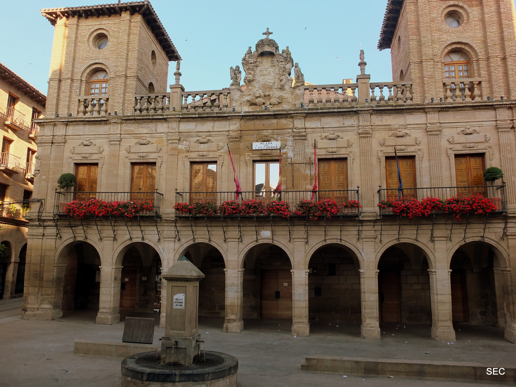
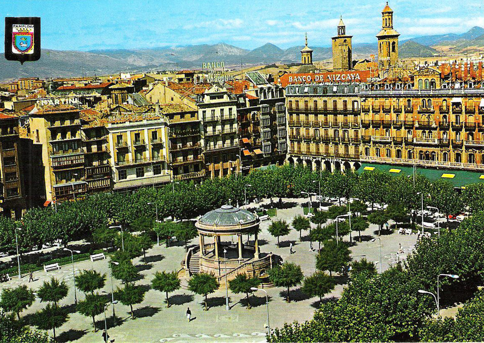
Plaza de los Fueros in Viana (photo courtesy Flickr by Instant 2010 under the following conditions)
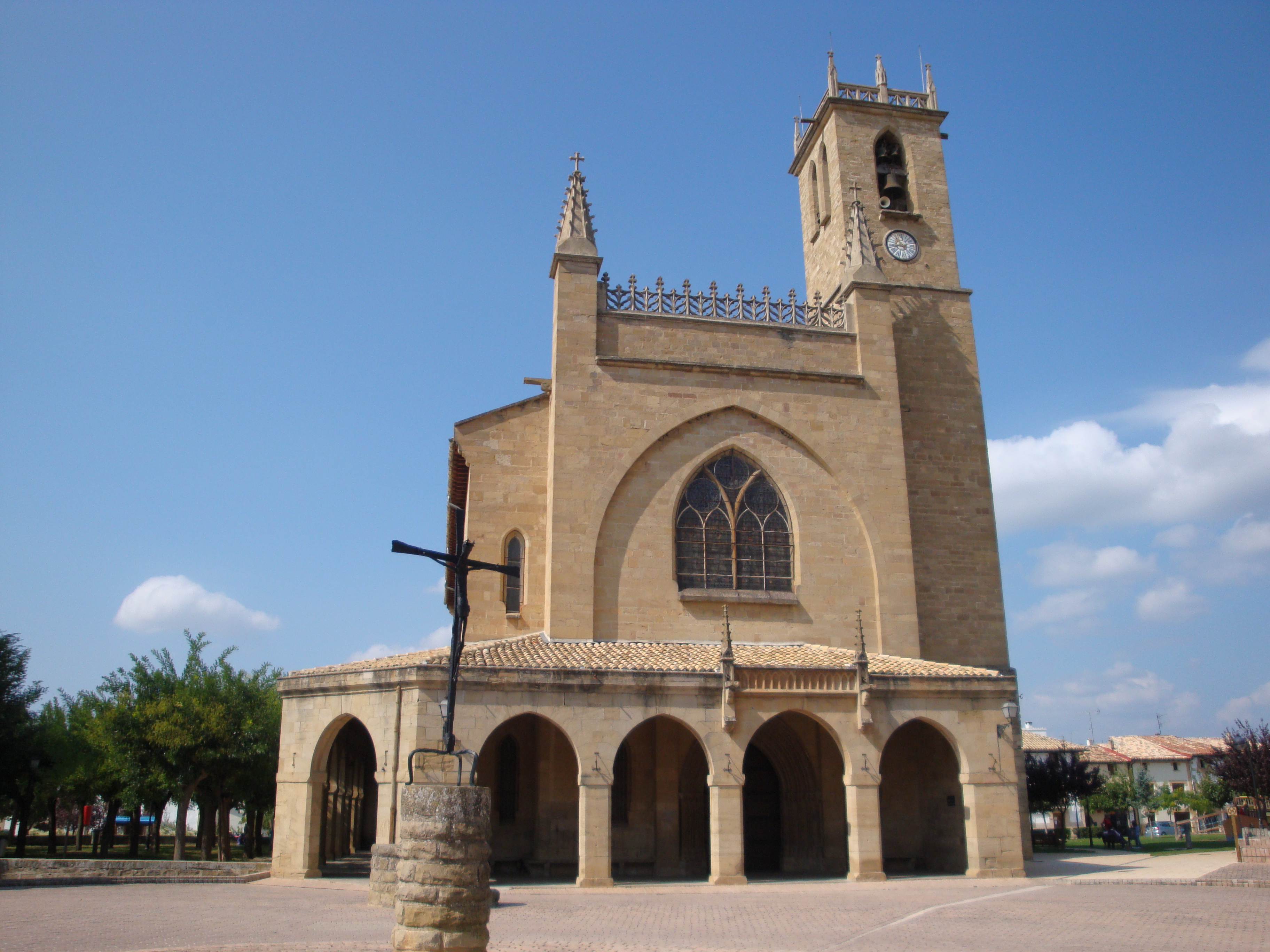
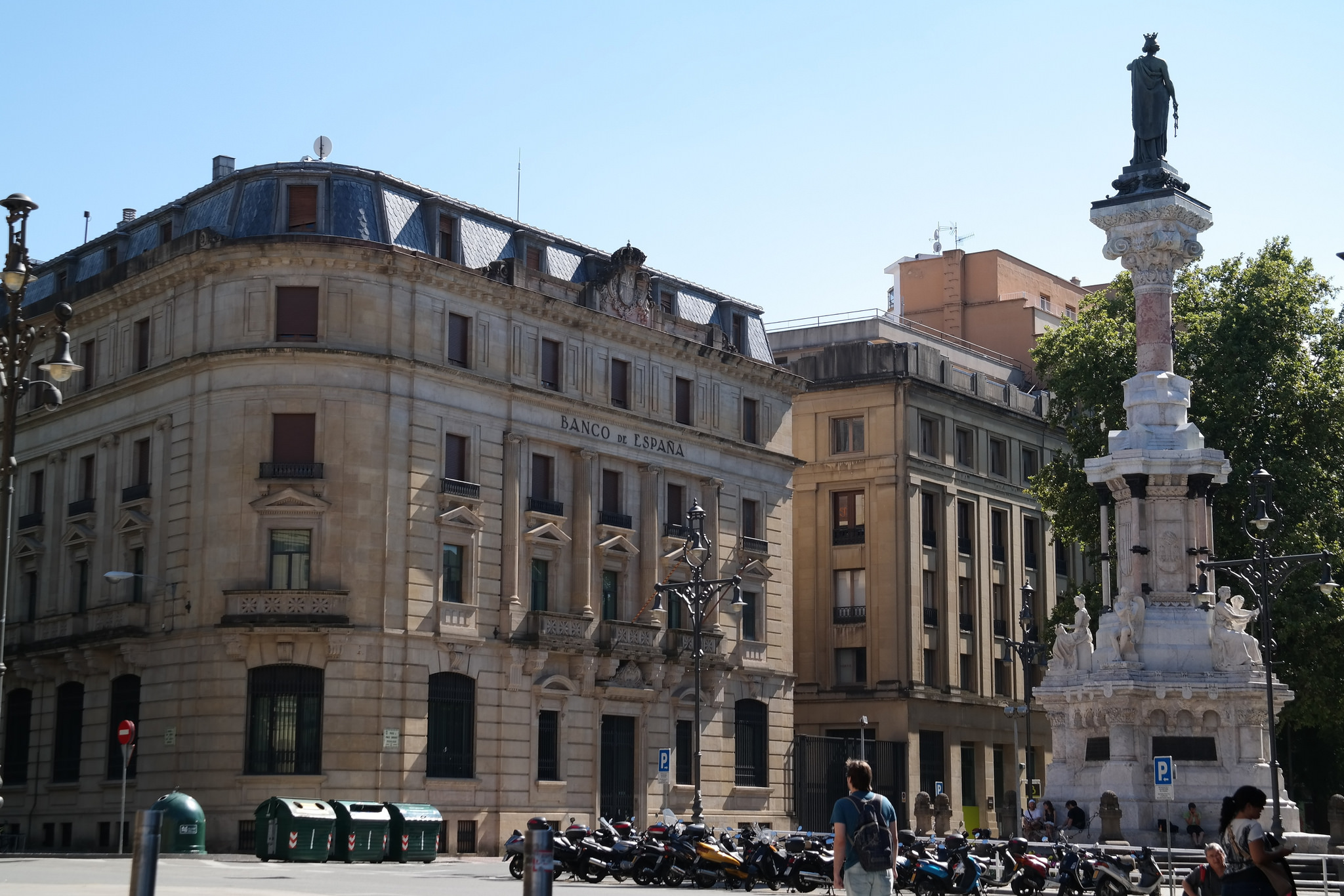
Viana is the last Navarre town we will visit on the French Way and the great number of monuments, remnants of ramparts and emblazoned houses testify to the importance of this town historically. Part of this importance is due to its strategic location, on a high near the border with Castile. It came to have six hospitals of pilgrims and nowadays it has all the services that a pilgrim may need. If you do not see the strength to get to Logroño (there are 11 km) is the other option you have to spend the night.
At our stop in Viana we cannot miss the visit to the Gothic church of Santa María, in the Plaza de los Fueros itself. Built between the 13th and 14th centuries in one of the most splendid moments of the town, it is a wonderful example of Gothic, with later additions. One of them is next to the south, Renaissance cover, where a tombstone reminds visitors that there is buried César Borgia, prince, warrior and cardinal.
Church of Santa María in Viana (photo ceded in Flickr by Jose Antonio Gil Martínez under the following conditions)
Son of Pope Alexander VI, of the Borgia family (known for his intrigues in the Vatican and for the succession of popes and powerful characters that were part of the Italian renaissance panorama), this character went down in history for his reputation of doing everything Necessary to achieve its objectives. This is summed up in his motto of “o Caesar or nothing”. In fact, it is said that it was he who inspired the work of Machiavelli’s “The Prince”, with his philosophy so influential in the politics of the Modern Age of “the end justifies the means.”
The name of the Borgia family is actually an Italianization of the house of Borja, of Navarrese origin. César Borgia was bishop of Pamplona with only 16 years and cardinal a year later. Like others of his lineage, it was wanted that it arrived at Pope, but the appointment of Julio II, staunch enemy of his family, led to his imprisonment. In the end he manages to return to Spain as a military man and ends up dying in a battle in Viana at the beginning of the 16th century.
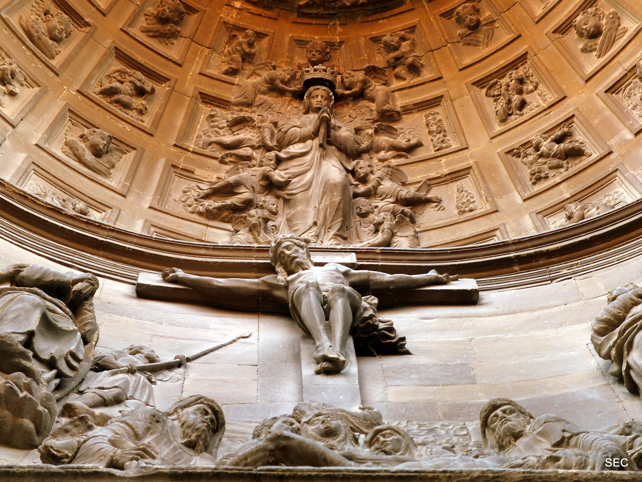
Renaissance dome on the tomb of César Borgia (photo courtesy Flickr by Instant 2010 under the following conditions)
The front page of his tomb is one of the best examples of the Spanish Renaissance, with many Biblical and mythological passages carved in stone.
The interior of the church almost makes us feel like in a great cathedral, with three large naves and different chapels very decorated, with frescoes in the vaults. You can go around the temple by the triforium, that is, the aisle above the side aisles on an upper level and facing the central nave. From there we will have a good view of the impressive baroque altarpiece that is in the apse of the church.
If you want to spend more time in Viana it is also interesting to go to see the town hall, the House of Culture (former pilgrim’s hospital), the convent of San Francisco and the church of San Pedro.
FROM VIANA TO LOGROÑO, LAST 11 KM FOR THE HERMIT OF THE VIRGIN OF THE CAVES
We leave Viana on the NA 1111 and after a kilometer we will see on the left a paved track marked with a military that in a little over another thousand meters will take us to the hermitage of the Virgin of the Caves, which will appear on our right.
The hermitage of the Virgen de las Cuevas does not impress artistically, since in the XVIII it was completely restored in a very simple way, with masonry and without much decoration. What attracts the most attention is the lowered arch that gives entrance to its portico.
But we still recommend the visit for several reasons. First, because that, is part of the traditional French road. Second, because it is located in a place where there was a village already since before the arrival of the Romans (town of Covas) that later in the S. XIII joined Viana. And finally, because the already mentioned Aymeric Picaud, this place is in his guide of the 12th century. Next to the chapel is a small picnic area with tables and stone benches. A good place to relax.
After the visit, we face the last 8 km of stage, continue along that track and in about 200 meters a military will point us a path of dirt and gravel to the right. Continuing on a slight slope (as from leaving Logroño) we find a tarmac track that leads to a roundabout of the NA 1111.
Road to Logroño (photo provided on Flickr by Hans-Jakob Weinz under the following conditions)
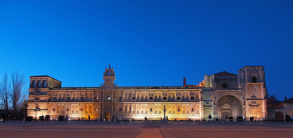
Continuing to the left, we see the sign that tells us that we enter La Rioja. We pass and we take the exit to the right, well signposted, that takes us to an underground passage and a paved track through which we entered Logroño. On the banks of the Ebro we reach a roundabout that connects with the Stone Bridge. Welcome to Logroño!
A RIDE BY LOGROÑO
As always, in Tournride we propose you a tour in the afternoon through the city end of stage, so that you can enjoy everything that Logroño can offer. In this case, in just 24 minutes walking in total you will be able to see much of the city’s impressive sacred and civil heritage, while diving in the atmosphere of a city where to go from pinchos and wines is a delight.
To start, a little bit of history…
Logroño is since 1982 the capital of the Autonomous Community of Rioja, the autonomy with less territory of Spain. Its territory has been occupied since before the arrival of the Romans in I a. C. and its historical development have been marked, above all, by three factors:
- Its localization next to the Ebro. In fact, the name of the city is believed to be derived from the root word celtíbera “gronio”, que significa “vado” o “paso”. which means “ford” or “step.” The celtiberians occupying area would refer to the continuous wading of the Ebro.
- To be point of passage of the Way of Santiago. Since in the 11th century the king decided that the Jacobean route passed through the city, the city did not stop taking on importance.
- Its border position with the kingdoms of Castile, Navarre and Aragon. Its strategic location surrounded by the river and near borders facilitated the construction of military infrastructures and also increased commerce. It was a crossroads place.
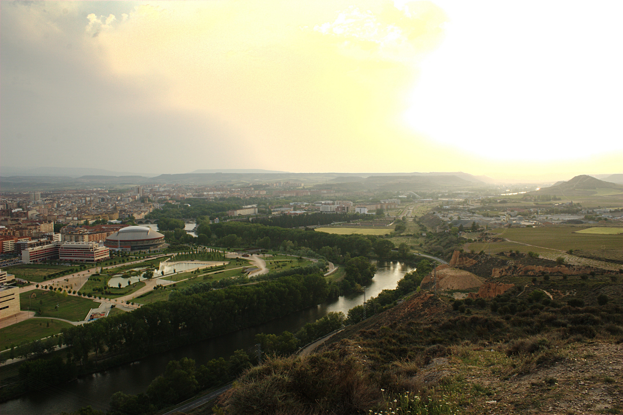
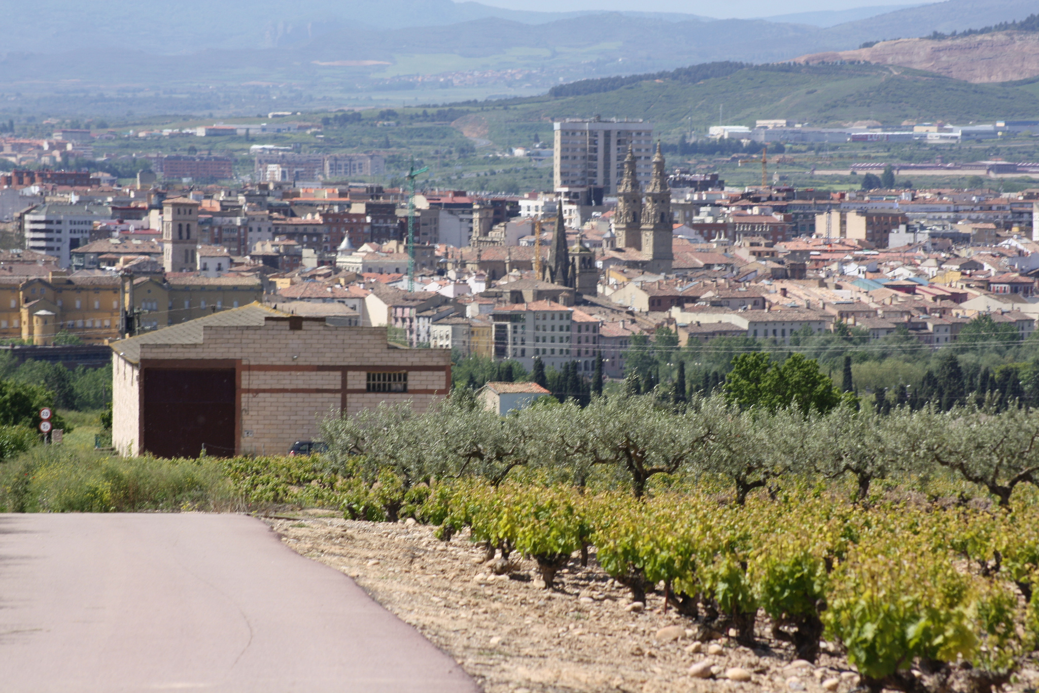
Ribera Park next to the Ebro, in Logroño in the background (photo courtesy Flickr by Marc Kjerland under the following conditions)
In the S. I a. C. was founded “Vareia”, the old Roman city, which gained much importance because like Ebro is a navigable river allowed connecting the commercial routes from Italy with the interior of the peninsula. It continued to gain importance in the following centuries but but in 1092 is destroyed by the Cid Campeador, but since its position was strategic, for the king of Castile it was important that it was populated and for that reason three years later it gives a jurisdiction to him to be restored. It grants citizenship to the Franks (foreigners) and allows them to appropriate land, among other things. Soon afterwards, it was decided that the Way pass by and the city grows, walks and infrastructures are created.
Today half the population of La Rioja lives in Logroño and is a city accustomed to receive pilgrims and visitors, with much history and heritage to know.
As it could not be otherwise, we start in the Ebro and go to the old town
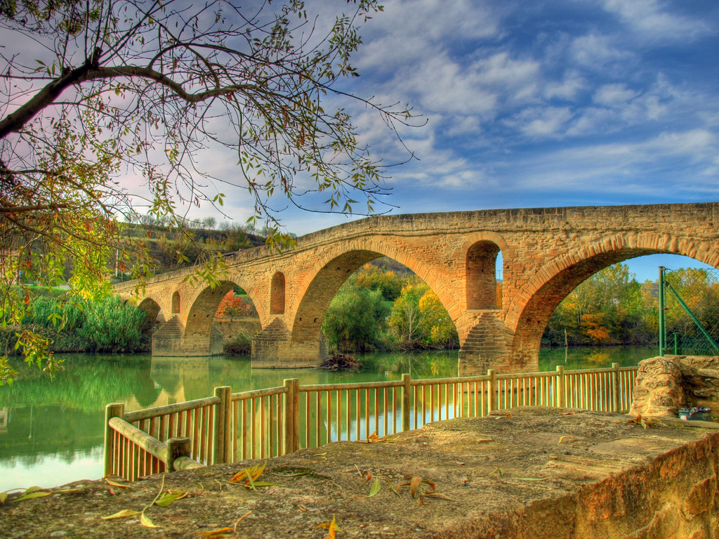
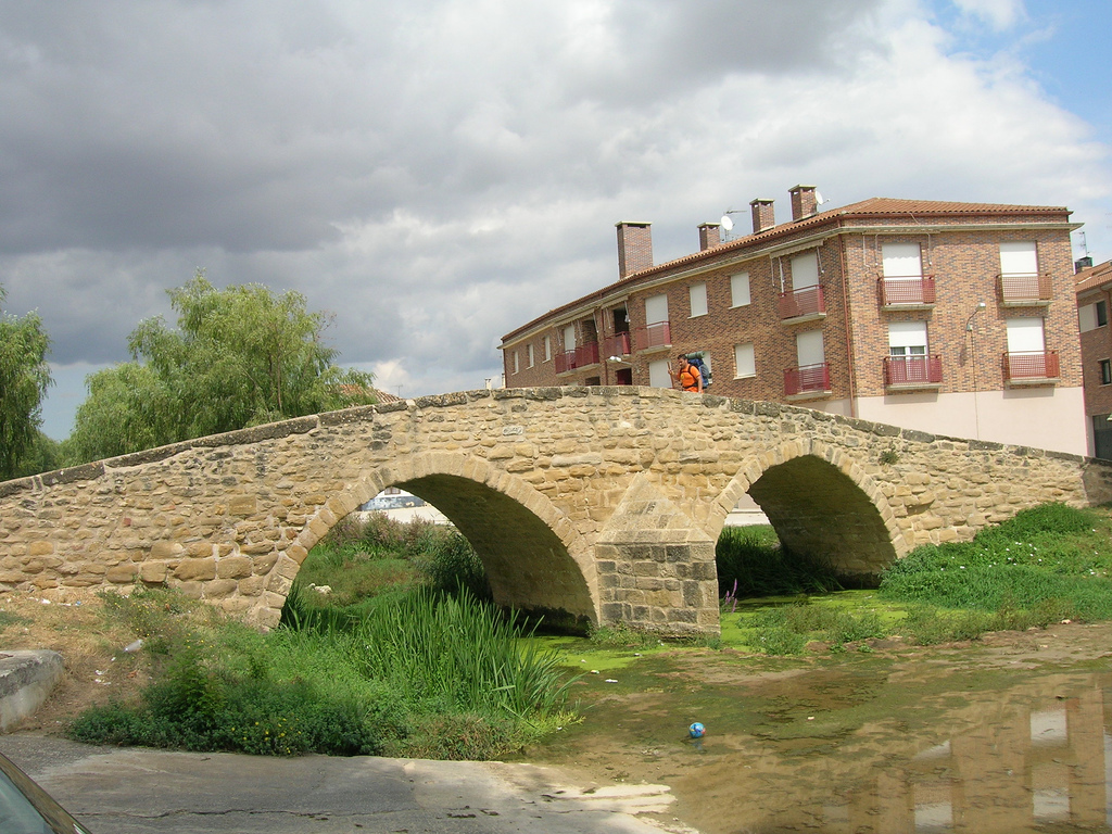
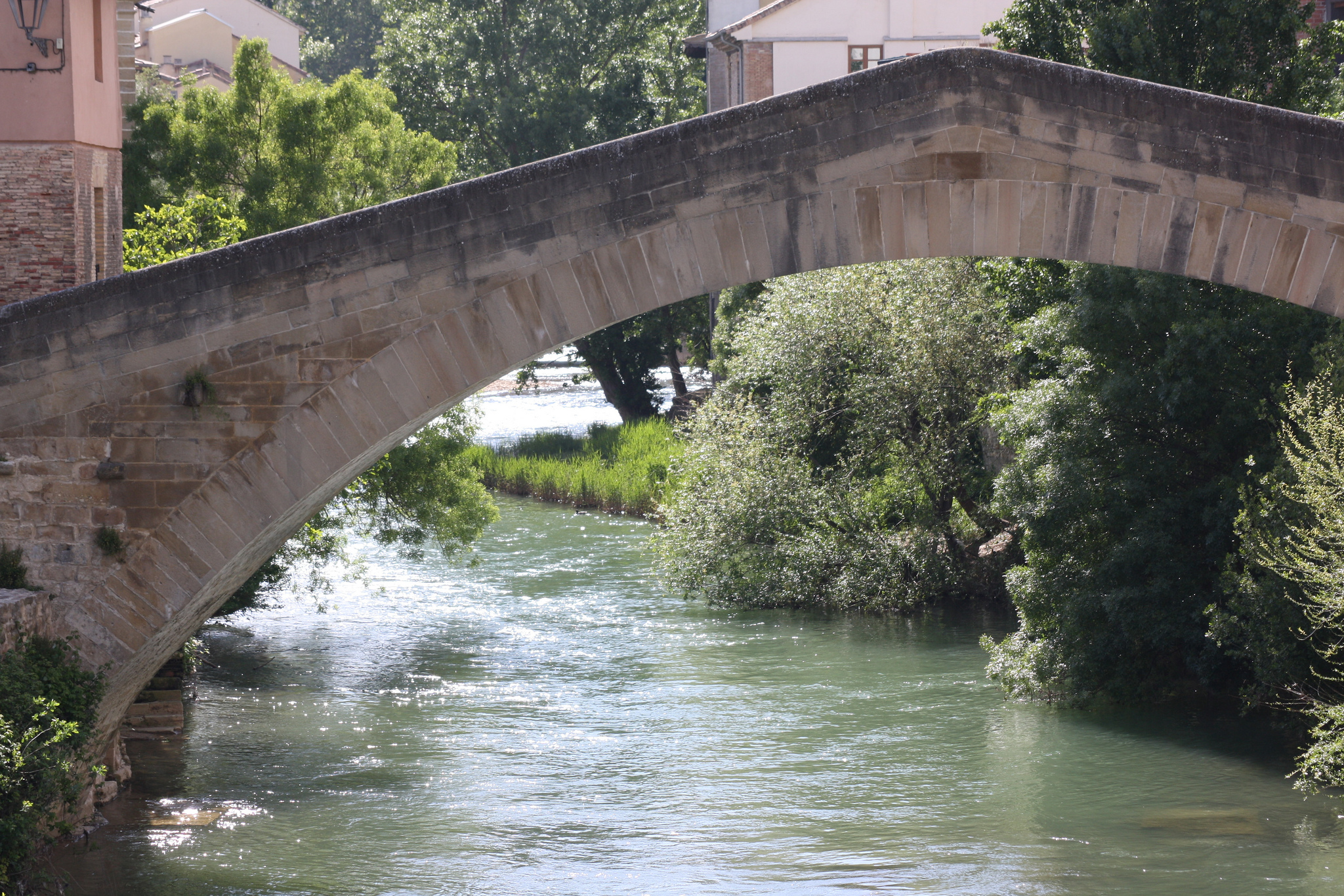
We start the visit on the stone bridge, which we have already passed on entering the city. Just cross it is the park of Pozo Cubillas to the right, and from there there is a viewpoint that allows us to see the Stone Bridge and the river.
The bridge is called this because there is also another one of iron and there was formerly one of wood. This one was inaugurated in 1884 and has seven arches and measures 198 meters. It was built by the poor state in which was the old stone bridge that had there, that had 17 arcs and two fortified towers and was the great symbol of the city (in fact appears in the shield of Logroño). It ended deteriorating by the continuous floods of the Ebro, today with the flow much more stabilized by the construction of dams and subsidiary channels.
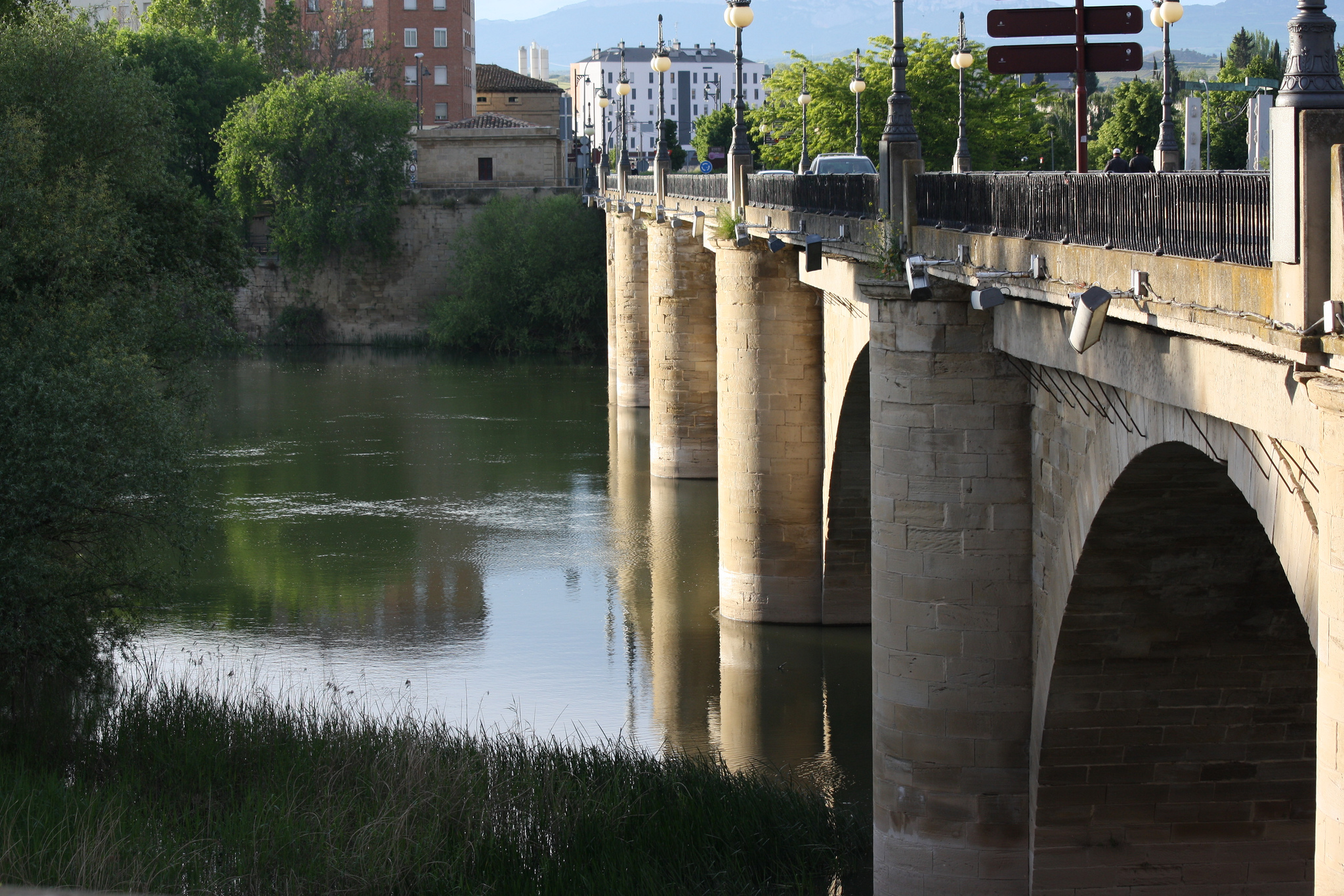
Stone bridge (photo provided on Flickr by Hans-Jakob Weinz under the following conditions)
We go to the roundabout and we go in the old town by the street Ruavieja, one of the oldest of the city. Turning in the first street on the left we reach the Santa Maria de Palacio church.
This church was built between the 12th and 13th centuries, with new contributions up to the 18th century. The most characteristic of it is its lantern tower, known as “la aguja”, (the needle), another of the symbols of the city. Its construction is related to the Order of the Holy Sepulcher, one of the religious and military organizations that protected the pilgrim’s also striking the Renaissance altarpiece of the temple.
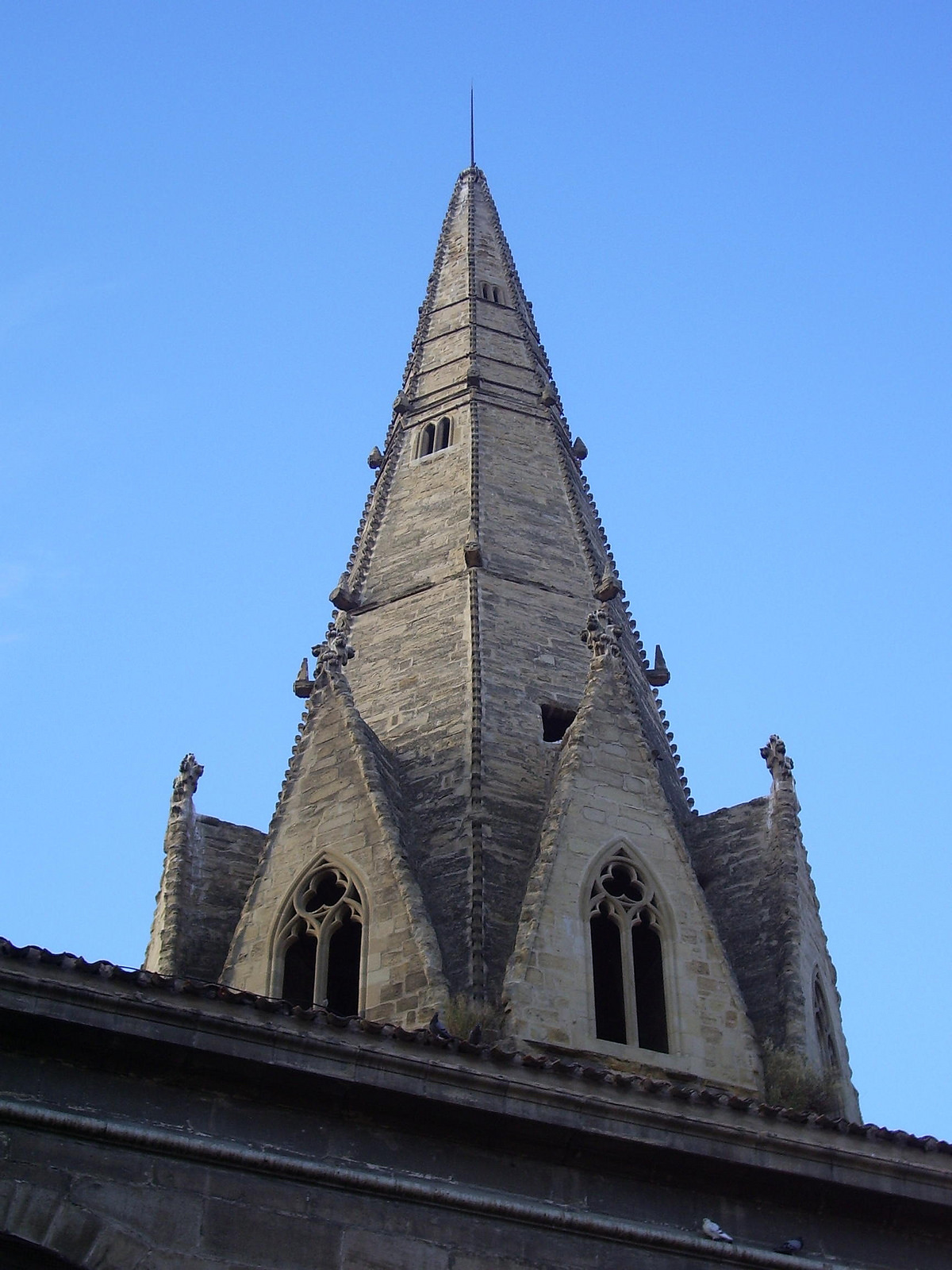
Tower called the “needle” (photo provided on Flickr by Jynus under the following conditions)
Plaza de Santiago, from Templar mysteries to miracles of the apostle
We return to Calle Ruavieja and Sagasta Street who cross it to get to Santiago Square, where there are three things that we cannot miss since they are all related to the Camino: The pilgrim’s fountain, the curious game of the “Oca” of human size and the Santiago’s church.
In the square we can see to our right some drawings in the ground, with enormous dice included, that represent a board of the Oca game. There is a theory that says that this game was invented by the Templars in the S. XI, as a representation of the Camino de Santiago with its bridges (“from bridge to bridge and shot because it takes me the current”) and with the goose as representation Of the protective role that the order exercised, since these animals make a lot of noise before strangers (“from goose to goose and shot because it touches me”). That is why in the ground each stop is represented as a city of the road, starting in Logroño, with important monuments marked.
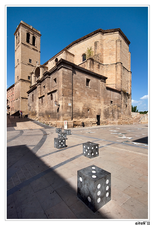
Game of the Goose and church of Santiago the Real in the background, in the square of Santiago (photo ceded in Flickr by Aitor Escauriza under the following conditions)
Opposite is the pilgrim’s fountain, built believed to be in 1675 but completely restored in 1986. This fountain is also called the fountain of Santiago, as it is next to the church of the same name.
The church of Santiago el Real is the oldest in the city, it is said that it was founded by a disciple of Santiago himself. When the apostle came to preach to the peninsula, a group of people followed him to Jerusalem, among them his disciple Arcadius, who is said to have founded this church (for more information see Santiago’s history).Obviously, the building we see today is not that, but a later one.
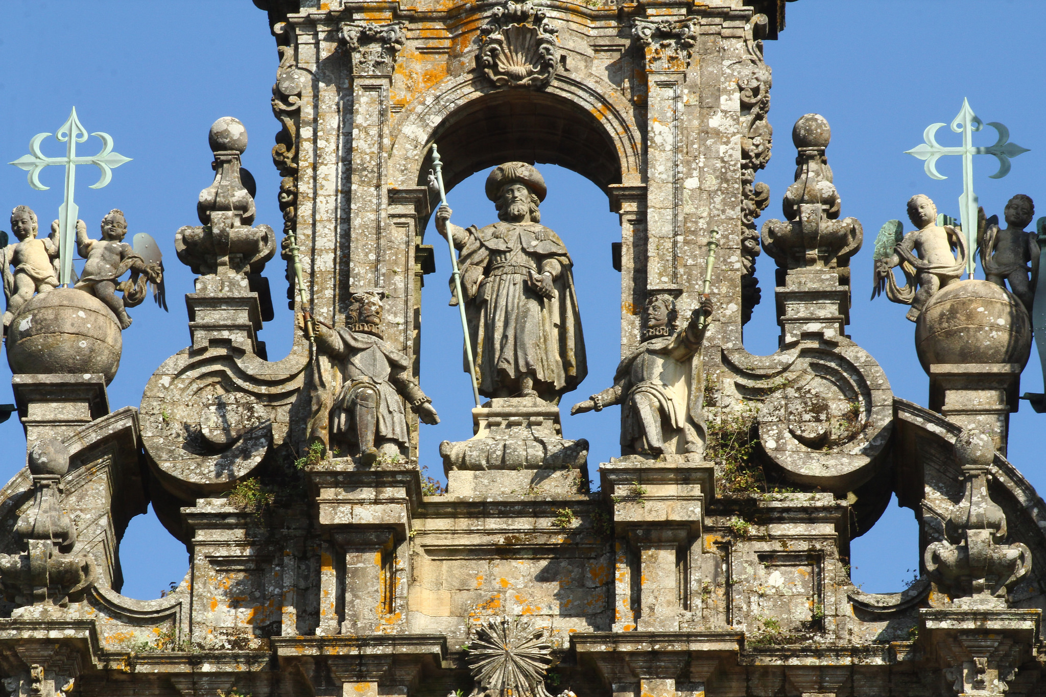
In 884, this primitive temple was rebuilt after the Battle of Clavijo, but later that church was burned and what we see today, in the 16th century. The Battle of Clavijo is one of the most mythical of the war of the Christians to expel to the Arabs of the peninsula. On the facade of the church we can see a sculpture at the top, which represents Santiago as Matamoros.
We had already seen Santiago dressed as a pilgrim in other representations, which rationally makes no sense because he would pilgrimage to his own tomb, but it is a very powerful symbology.
The apostle’s as a warrior on horseback is another of his most representative iconographies. During the middle Ages the stories of miracles of saints were current, and the apostle’s appearances in battles were one of the most widespread. During the recon quest was said that the apostle appeared and helped to “kill Moors” and in the Battle of Clavijo made one of his most stellar appearances. In fact what is known today of that battle is a historiographical revision of the XVIII that surely is quite “adorned”.
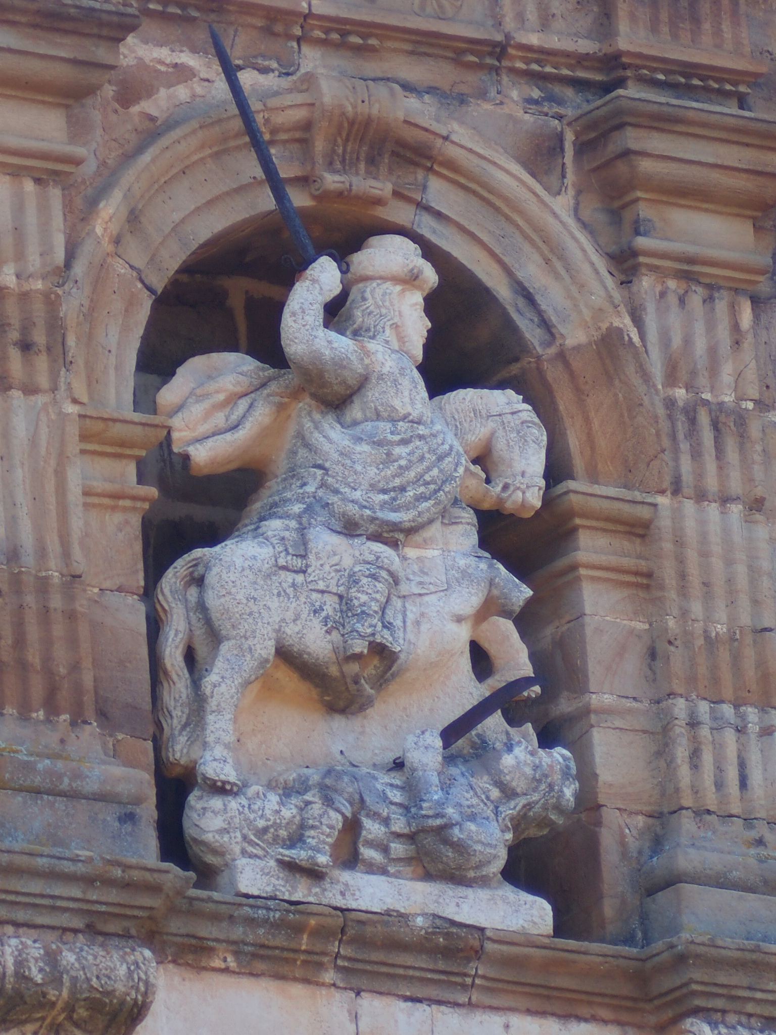
Iconography of Santiago Matamoros in León (photo courtesy Flickr by Francisco González under the following conditions)
The appearance of Santiago in battles continued being a frequent miracle with the passage of the centuries. When it was conquered America was created the iconography of Santiago Mataindios that helped to the Spanish conquerors against the natives. And, centuries later, the sons of these conquerors fought for independence, Santiago Mataespañoles was born. As we see, ¡The different military iconographies of Santiago tell much of history!
Visit to parliament and replenish forces in the market of supplies
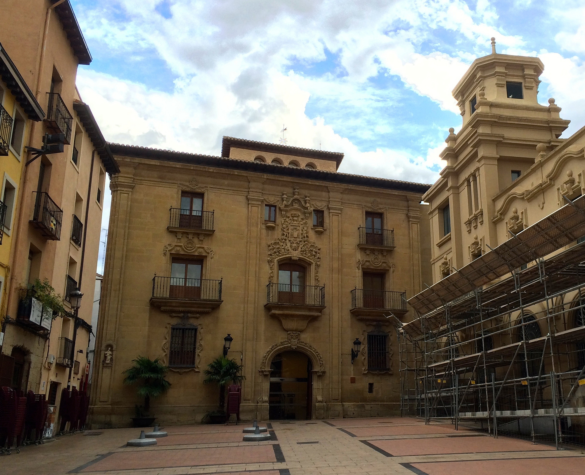
We continue along Calle Barriocepo to reach one of the most representative buildings of the city, this time civil: the parliament of La Rioja.
The building that occupies was an old convent, the one of the Merced, constructed between S. XIV and S. XVI. Since 1998, parliament has used what was once the church and the cloister which, covered with a glass dome, is where the hemicycle is. The east part of the building is the Library of La Rioja.
In addition to these two uses, the enclosure was also used as a military barracks and, from 1889 to 1978, it was a tobacco factory. In fact, in the street Portales remains today the most characteristic feature of this ancient use: a large red brick fireplace, which was left as a souvenir.
La Rioja Museum (photo provided on Flickr by Kris Arnold under the following conditions)
We continue walking along Calle de la Merced until Museo de la Rioja, and there we turn left to go to the market of Abastos, dating from the beginning of S. XX. Among its red brick walls, irons and large windows we can enjoy the best gastronomy of La Rioja, since in addition to selling the products there are also places where they cook them. If you want to lower your budget for food, it is a great place to buy something rich and eat it in a park later. Schedules can be viewed on your web site.
We finish at the Santa María Cathedral and learn about wine
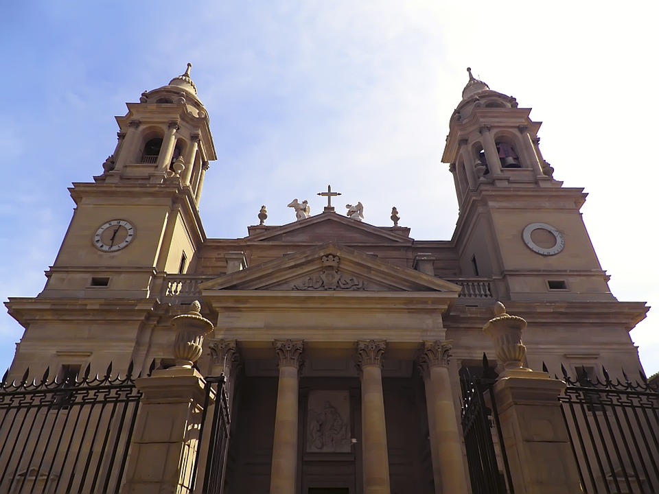
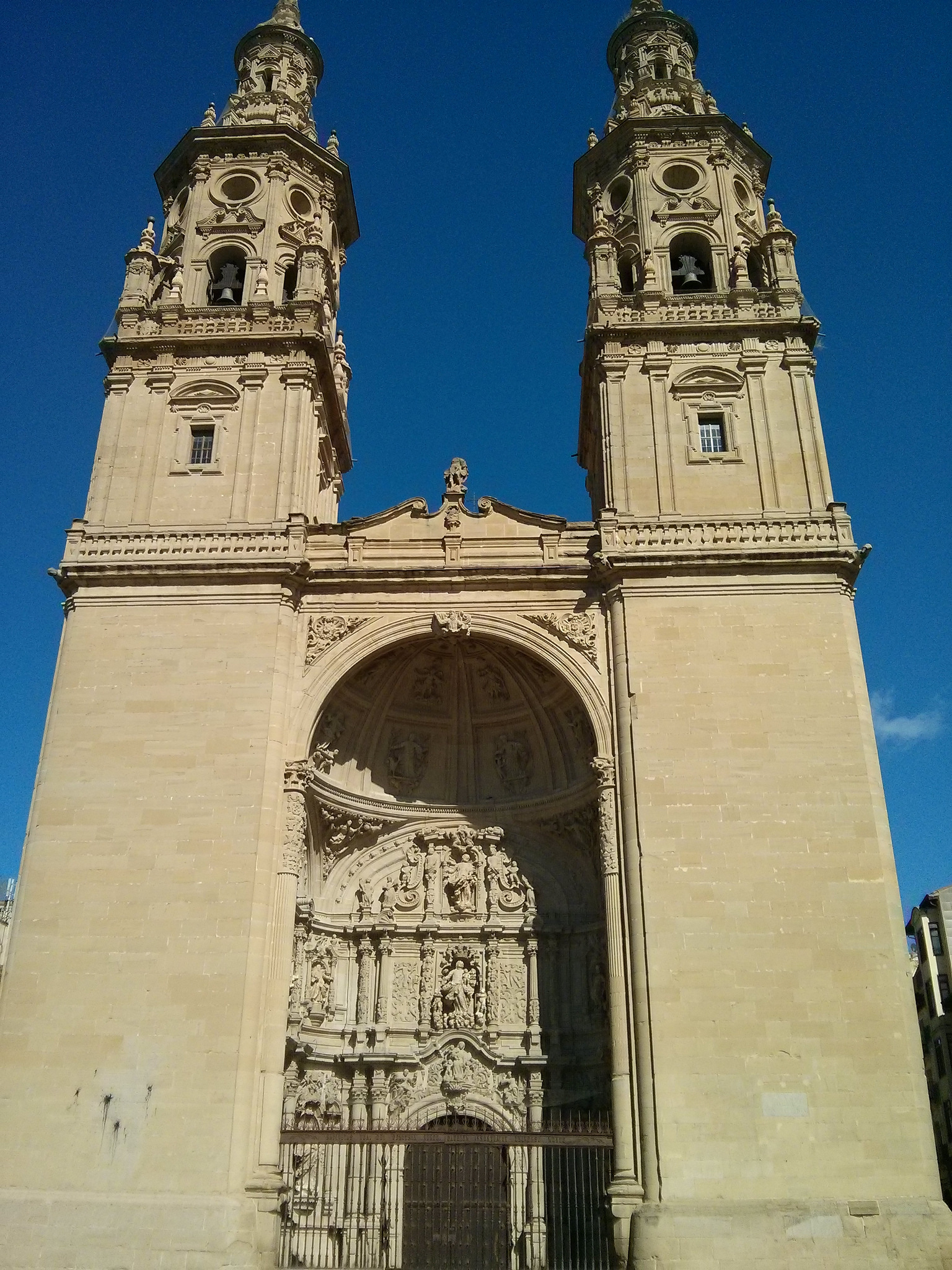
We leave the market by Sagasta Street and turning on the street Portales to the right and we arrive at the concatedral of Santa María la Redonda. Although today the name draws attention because we see nothing circular in the temple, it is given because before there was another church that was octagonal, similar to the view in Torres del Rio. When in the XV century it is declared to Logroño “city” it is decided to create a great temple, throwing the small Romanesque and beginning in 1516 what we see today.
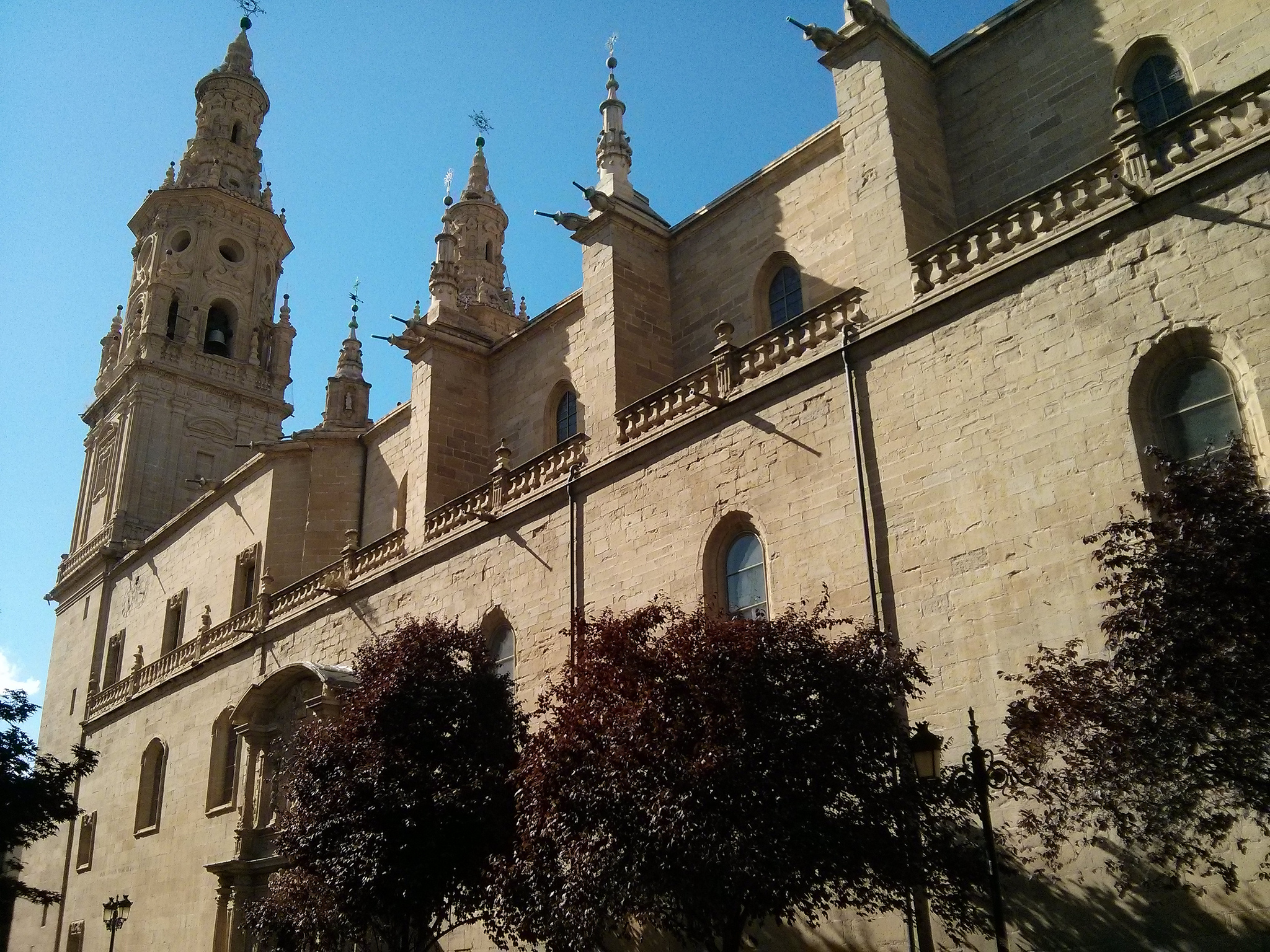
South facade of the Cathedral of Santa María la Redonda (photo courtesy of Flickr by Antonio Periago Miñarro under the following conditions)
The interior is in Elizabethan Gothic style, so named because during the end of the reign of Catholic kings were many works that are between the end of Gothic and the beginning of the Renaissance, so they have characteristics of both styles. And also it takes decorative elements Muslim and of Flanders, by the political situation of the moment. An example of eclecticism.
That is why, although the columns and arches are of Gothic style, we see how in rib vaults ribs are marked forming a kind of palm grove, with filigree, of Arab influence. In the main façade, on the other hand, we see how it is already a fully baroque style, since the whole exterior of the church was reformed in the XVIII. The two huge twin towers of the temple are another of the great symbols of the city and the door looks almost like a stone altarpiece.
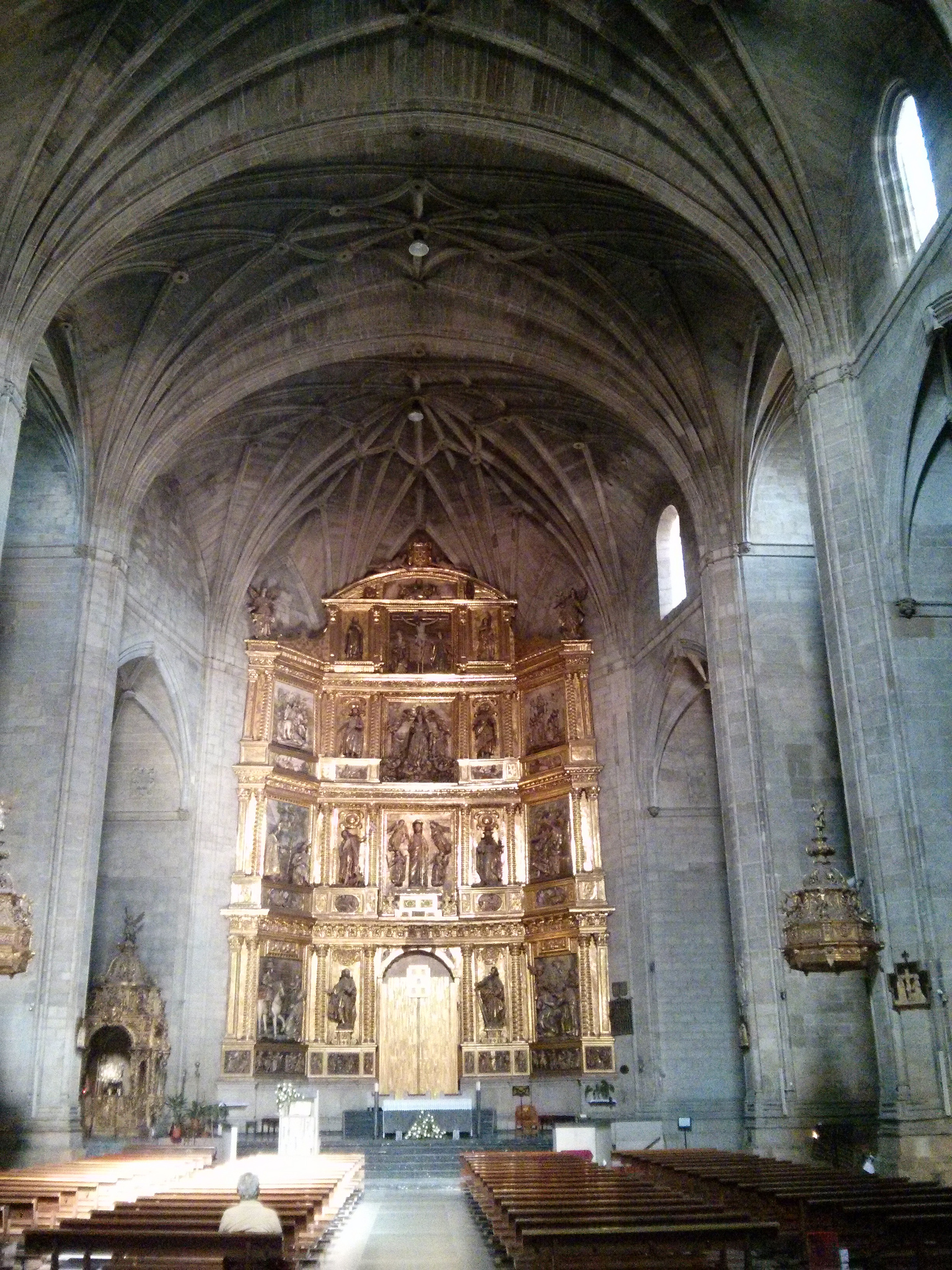
Interior of the Cathedral of Santa María la Redonda (photo courtesy Flickr by Antonio Periago Miñarro under the following conditions)
A curiosity of this church is that, being so close to the river, the land on which it sits is marshy. For this reason, it was used to cement parts of branches of vine that do not rot with the humidity and help to distribute the weight.
Facade of the Cathedral (photo courtesy Flickr by Antonio Periago Miñarro under the following conditions)
But the vine not only plays a crucial role in this temple, but as it is known in this community everything related to the world of wine is very important. La Rioja is one of the best known nationally and internationally. Since the Romans introduced their cultivation, wine has not been stopped in this area.
Proof of this are the different wineries that we can find near the core of Logroño. If you are interested in this topic, the ones that are closer to the city are the Bodegas Franco-Spanish, Ontañón and Ijalba although in this page and in this other you can find all kinds of activities related to wine in Logroño.
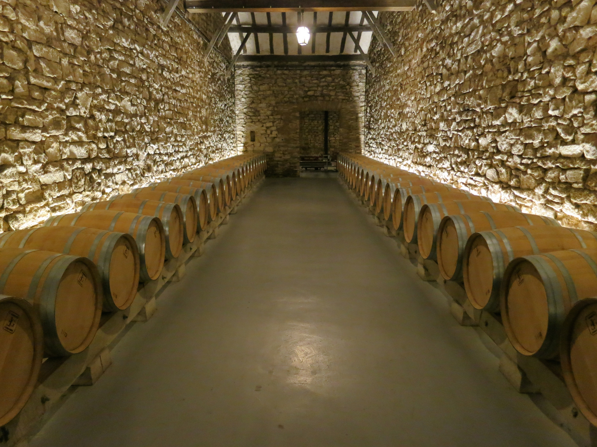
Interior of a winery in Logroño (photo provided on Flickr by Kris Arnold under the following conditions)
We rebuild forces by dining something in one of the parks or we go of pinchos
To end the day, from Tournride we give you a couple of options to have something to eat, relax and be able to face the next day. If you prefer to relax in a park snacking on something to eat, you can go to a park on the banks of the Ebro, such as the Ebro Park that we have already marked on our map.
If you prefer to taste the gastronomy of Rioja, goes de “pinchos” will be a very good option. In the southern part of the food market, on Laurel Street, you will find more than 50 shops in a lively, quiet and relaxed atmosphere. The other area that is also typical of pinchos is the area near San Juan Street, parallel to Portales Street to the south. Even so, in this page you will find all the necessary information about places of pinchos and gastronomic and oenological activities in Logroño.
In the next stage we will travel a similar distance but will demand more effort for your profile and itinerary, so enjoy before everything that Logroño can offer us!